The Cape Vincent post office opened in 1817, the earliest record of the town by name. Four smaller post offices, Millen's Bay (1837), Saint Lawrence (1848) and Rosiere (1873), opened inside today’s town and later closed.
First census: 3,044 in 18502020 census: 2,765209 years
How historic is Cape Vincent?
A
More historic than 92% of U.S. towns, on its age, its old homes and the National Register.
Founding year: the first Cape Vincent post office (Blevins & Helbock, CC0).The full story ↓
History grade
What drives Cape Vincent’s History grade
On its age, its old homes and the National Register, Cape Vincent is more historic than 92% of U.S. towns. All 3 inputs are above most U.S. towns; its National Register listings ranks highest and its share of homes from before 1940 lowest.
A
HistoryA character grade: shown, never part of Cape Vincent’s overall grade.
New York towns list more on the Register than most of the country (a typical New York town has 12.3 per 10,000 residents, the U.S. 2.4), so Cape Vincent’s 304 sits above most of its state (87% of New York towns have fewer) while its 77 historic buildings outnumber those of 88% of U.S. towns.
How sure. Graded on any two of the three inputs instead, the letter would range from A− to A. The pre-1940 share is a Census survey estimate (±5.1 points). The founding year is the first post office, not a stated founding date.
Founding year: the first post office (other dates in Quick answers). Homes: Census ACS 2020–24. National Register: National Park Service, May 2026 list; each listing counted once (boundary changes and added documentation belong to their listing), and a historic district counts its contributing buildings. How TownRatings grades history →
What stands out about Cape Vincent’s past
Read from the archive, the National Register and the record. The page puts what stands out first.
National Park Service, National Register of Historic Places. Photos from Wikimedia Commons, credited on each place’s page.
Places that used to be
Lost post offices, old corners, places now gone and burying grounds
Cape Vincent’s post office has been open since 1817. Four other post offices opened and closed inside today’s town.
Cape Vincent
1817–today
Millen's Bay
1837–1871
Saint Lawrence
1848–1934
Rosiere
1873–1957
Riverview
1886–1904
18101920today
Hamlets and corners on the map
Green Cedars Trailer ParkLazy Acres Mobile Home ParkLe Petite Ciel Mobile Home ParkMillen BayRosiereSaint LawrenceSunnybankSunset Trailer ParkWarren
Gone or out of use
School Number 11schoolSchool Number 12schoolSchool Number 13schoolSchool Number 14schoolSchool Number 16schoolSchool Number 17schoolSchool Number 3schoolSchool Number 4schoolSchool Number 5schoolSchool Number 6schoolSchool Number 7schoolSchool Number 8schoolSchool Number 9school
6cemeteries and burying grounds inside Cape Vincent
JuddRiversideSaint LawrenceSaint Vincent de PaulSaint Vincent de PaulSand Bay
US Post Offices dataset (Blevins & Helbock, CC0). Places and cemeteries from the USGS Geographic Names Information System (2021).
Help out
Start Cape Vincent’s collection
The first neighbors to add old photos shape how Cape Vincent’s history is told.
Decades since 1900 with photos
00s10s20s30s40s50s60s70s80s90s
0 of 10 decades. The empty ones are waiting for someone’s album.
The town was first explored in the 17th century by French explorers and missionaries. At that time, it was home to the Onondaga people. Modern settlement began in 1801 at Millens Bay.
During the War of 1812, Cape Vincent served as an armed camp to oppose the British forces in adjacent Kingston, Ontario.
The town was formed in 1849 from the north part of the town of Lyme. In 1895, the hamlet of Cape Vincent incorporated as a village. By that time, the region was becoming a famous tourist area due to the Thousand Islands.
In 1935, the East Charity Shoals Light was erected at the entrance to the Seaway.
Passages that mention Cape Vincent, cut from the printed page as they were published.
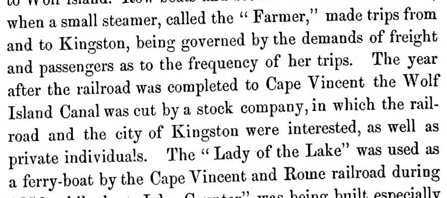
History of Jefferson County, New York1878 · page 321Read the page →
Read the text
when a small steamer, called the " Farmer," made trips from and to Kingston, being governed by the demands of freight and passengers as to the frequency of her trips. The year after the railroad was completed to Cape Vincent the Wolf Island Canal was cut by a stock company, in which the railroad and the city of Kingston were interested, as well as private individuals. The " Lady of the Lake" was used as a ferry-boat by the Cape Vincent and Rome railroad during
Text read by machine from the scan; it may contain errors.
Scans and text from the Internet Archive. Books published in 1930 or earlier, which are in the public domain.
Timeline
Cape Vincent, 1817 to 1953
Woven from the archive, old maps, post office records, the National Register and the people born here.
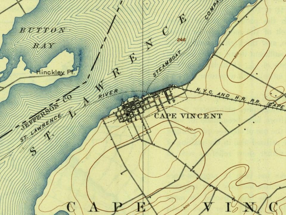
Every edition of the U.S. Geological Survey’s map of Cape Vincent. Tap a year, or press play to watch the town change.
1895Cape Vincent sheet · 1:62,500
U.S. Geological Survey historical topographic maps (public domain), via Esri’s collection of the scans. The red ring marks the center of Cape Vincent.
Every building
Cape Vincent, building by building, 1884–1909
Fire insurance maps drew every building, what it was made of and what it was used for, so insurers could price the risk of fire. Pick a year, then a sheet.
The Cape Vincent post office opened in 1817, the earliest record of the town by name (U.S. post office records).
How does Cape Vincent rank for history?
Cape Vincent is more historic than 92% of U.S. towns. The History grade combines the town’s founding era, the share of homes built before 1940 and its National Register listings. It’s a character grade, so it isn’t part of the overall grade. How it works.
What is on the National Register in Cape Vincent?
32 listings: 31 buildings, among them the Vincent LeRay House (listed 1973, the first), and 1 historic district, the Broadway Historic District, with 5 contributing buildings. 77 historic buildings in all.
How old are the homes in Cape Vincent?
23% of Cape Vincent’s homes were built before 1940 (Census estimate, ±5.1 points), against a typical 27% for a New York town; the median home was built in 1979.
Founding dates: Wikidata, Wikipedia, the U.S. post office records of Blevins & Helbock (CC0) and the Census. Homes by year built: Census ACS 2020–24. National Register of Historic Places: National Park Service (list of May 22, 2026). Old photos, postcards and papers: Wikimedia Commons, the Library of Congress and other public archives, credited on each item’s page. Maps: U.S. Geological Survey historical topographic maps (via Esri) and Sanborn fire-insurance maps (Library of Congress). History text and census tables: Wikipedia (CC BY-SA 4.0). Places that used to be: USGS Geographic Names Information System (2021).
From Wikidata (3), the National Register of Historic Places (32), Wikipedia, Wikidata and Wikipedia for famous people, U.S. Geological Survey historical maps, U.S. Census counts (via Wikipedia), the US Post Offices dataset (Blevins & Helbock), the USGS Geographic Names Information System, Sanborn fire insurance maps (Library of Congress) and old county and town histories (Internet Archive). Archive images are copied here with their credits and licenses, shown on each photo’s page. Refreshed monthly.