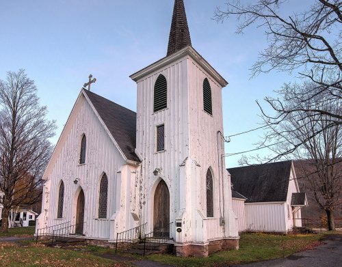
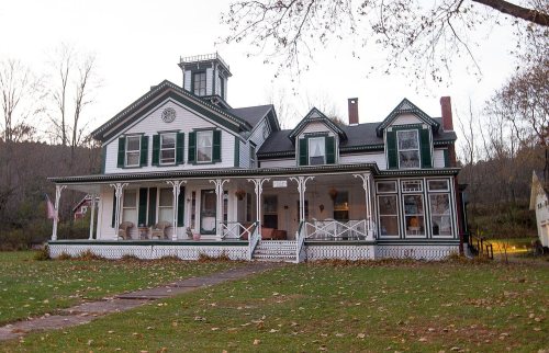
The Ashland post office opened in 1848, the earliest record of the town by name. Another post office, Scienceville (1823), opened inside today’s town and later closed.
First census: 1,290 in 18502020 census: 682178 years
Founding year: the first Ashland post office (Blevins & Helbock, CC0).The full story ↓
What stands out about Ashland’s past
Read from the archive, the National Register and the record. The page puts what stands out first.
Early settlements were abandoned during the American Revolution, but the town was re-settled in 1788. The town was created from parts of the towns of Windham and Prattsville in 1848.
When the town was still part of Windham, it was called Scienceville due to there being "some families of more than ordinary education" in the area. When Scienceville became a separate community in 1848, it was renamed Ashland after the estate of Henry Clay.
The presence of hemlock forests led to a tanning industry. Hemlock bark was an important raw material used for leather tanning, due to it being a good source of tannic acid.
The town of Ashland has been on a steady decline in population since 1850, when it had 1290 inhabitants. In 1865 there were 1080, in 1875, 935, in 1880, 899, in 1900, 647, and since that time the population has lost about 40 persons. The entire county has shown a decrease of 4 per cent in population in the past ten years, and a loss from 1850 of about 3000. The population in 1850 was 33,126. It is now just under 30,000.
Text read by machine from the scan; it may contain errors.
Aishlarvd It was not until 1S48 that the boundaries were set for the town of Ashland and portions of Prattsville and Windham were taken to form the few thousand acres that comprises the town. The principal village or hamlet is Ashland and the
Text read by machine from the scan; it may contain errors.
Scans and text from the Internet Archive. Books published in 1930 or earlier, which are in the public domain.
By decade
Ashland, decade by decade
One decade in the archive so far: the 1910s. Scroll each row; tap a photo for its story.
Nothing in the archives for these yearsWeddings on Main Street, storms, parades, school pictures, the old store. If it’s in your family album, it belongs here.
Founding dates: Wikidata, Wikipedia, the U.S. post office records of Blevins & Helbock (CC0) and the Census. Homes by year built: Census ACS 2020–24. National Register of Historic Places: National Park Service (list of May 22, 2026). Old photos, postcards and papers: Wikimedia Commons, the Library of Congress and other public archives, credited on each item’s page. Maps: U.S. Geological Survey historical topographic maps (via Esri) and Sanborn fire-insurance maps (Library of Congress). History text and census tables: Wikipedia (CC BY-SA 4.0). Places that used to be: USGS Geographic Names Information System (2021). How TownRatings grades history →
From Wikimedia Commons (3), the Library of Congress (9), the National Register of Historic Places (4), Wikipedia, Wikidata and Wikipedia for famous people, U.S. Geological Survey historical maps, U.S. Census counts (via Wikipedia), the US Post Offices dataset (Blevins & Helbock), the USGS Geographic Names Information System and old county and town histories (Internet Archive). Archive images are copied here with their credits and licenses, shown on each photo’s page. Refreshed monthly.


 1913
 1913
 1914
 1914
 1914
 1914
 1914
 1914
 2015
 2015
 2015