
Pueblo of Santa Ana, Jemez River Vicinity
Santa Ana Pueblo’s story
Santa Ana Pueblo in pictures
The archive holds 2 old photos and papers and 4 maps from 1954 on.
Explore the history →Each edition grades its towns against each other only.
A town of 1,026.
Santa Ana Pueblo’s best subject grade is an A+ for cost of living; its weakest is a C− for schools. On cost of living, just 7 of New Mexico’s 156 towns do better. Santa Ana Pueblo’s trail density is 2.1 miles per square mile, above both the New Mexico town median (1.0) and the median of U.S. towns (0.4). Santa Ana Pueblo has fewer than 2,500 residents, so it gets subject grades but no overall grade.
Where Santa Ana Pueblo beats most towns.
In a town this size, neighbors are the best guide. Ask them anything.
Each subject compared with towns across the country (schools within New Mexico), ordered by how far Santa Ana Pueblo is from typical.
How TownRatings grades towns →
The archive holds 2 old photos and papers and 4 maps from 1954 on.
Explore the history →Museums, parks, gardens and other places to visit around Santa Ana Pueblo. Close and well known come first.
 21 mi Stadium & arenaUniversity Stadium
 26 mi National MonumentBandelier National Monument248K visitors a year
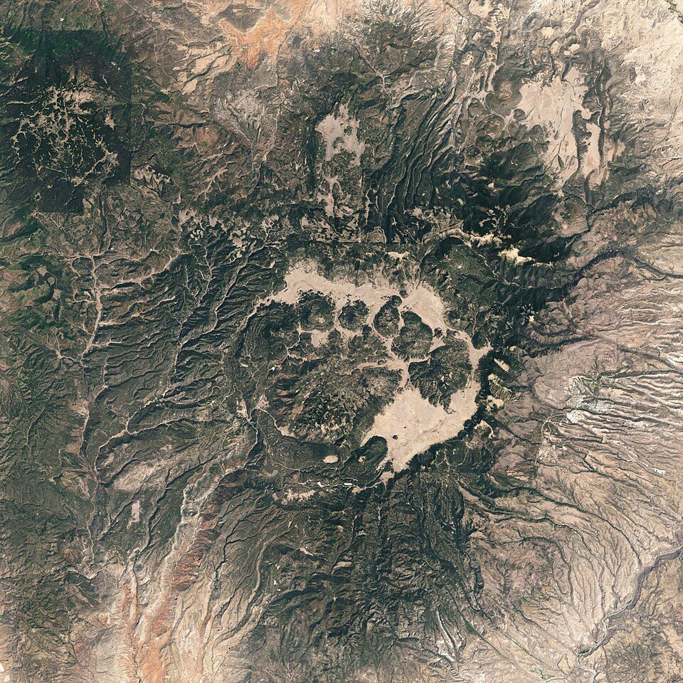 33 mi National PreserveValles Caldera National Preserve85K visitors a year
 15 mi National MonumentPetroglyph National Monument311K visitors a year
 10 mi Stadium & arenaRio Rancho Events Center
 12 mi Ski areaSandia Peak Ski Area66 runs · 1,599 ft vertical
University Stadium: Kenneth C. Zirkel, CC BY 4.0 · Bandelier National Monument: Andrew Dunn (talk · contribs), CC BY-SA 2.0 · Valles Caldera National Preserve: Jesse Allen and Robert Simmon, Public domain · Petroglyph National Monument: Unknown, Public domain · Rio Rancho Events Center: Maryabm2009, CC BY-SA 4.0 · Sandia Peak Ski Area: Skoch3, CC BY-SA 3.0
Santa Ana Pueblo is unincorporated, so Sandoval County and regional agencies provide most services.
EPA SDWIS (Oct 9, 2026) · HIFLD + EIA-861 2025 · Census 2020 ZCTAs · NCES 2024–25 · registration: vote.gov, updated Aug 27, 2026.
Ordered by what stands out in Santa Ana Pueblo.
Expected storm and flood damage is lower than in 79% of U.S. communities.
FEMA National Risk Index · OpenFEMA
Most working residents leave Santa Ana Pueblo for work: only 19% work in town. Santa Ana Pueblo’s average trip to work is 17 minutes, below both New Mexico’s towns (23 minutes) and U.S. towns (25 minutes). 5.5% of residents live below the poverty line in Santa Ana Pueblo.
| Santa Ana Pueblo | New Mexico towns | U.S. towns | |
|---|---|---|---|
| Average trip to work | 17 minutes | 23 minutes | 25 minutes |
| Below the poverty line | 5.5% | 21% | 9.6% |
| Working residents who work in town | 19% | 14% | 8% |
| Median household income | $86,000 | $55,000 | $80,000 |
Census LEHD 2023 · ACS
Santa Ana Pueblo has chilly winters and hot summers, with very little rain. Santa Ana Pueblo’s July high is 93°F.
NOAA U.S. Climate Normals, 1991–2020
Santa Ana Pueblo beats the New Mexico average on 8 of 32 CDC measures and trails it on 1. 18% of Santa Ana Pueblo adults get no exercise outside work. Only 4 of the 74 New Mexico towns we compare have a lower share of adults 18 to 64 who have no health insurance than Santa Ana Pueblo.
| Santa Ana Pueblo | New Mexico towns | U.S. towns | |
|---|---|---|---|
| Get no exercise (CDC PLACES) | 18% | 27% | 25% |
| No health insurance, 18–64 (CDC PLACES) | 5.8% | 16% | 8.1% |
| Yearly checkup (CDC PLACES) | 70% | 69% | 79% |
| Fair or poor health (CDC PLACES) | 18% | 26% | 19% |
| What stands out | Santa Ana Pueblo | NM |
|---|---|---|
| Fewer uninsured adults | 5.8% | 15.6% |
| Fewer older adults who have lost all their teeth | 8.9% | 14.2% |
| More adults with asthma | 12.6% | 9.9% |
CDC PLACES 2025 · modeled estimates for adults · CMS · HRSA
Trails & parks © OpenStreetMap contributors · Conserved land: USGS PAD-US
1 within 15 miles of the center of Santa Ana Pueblo
About 3 of every 100 Santa Ana Pueblo residents are enrolled in college, against 6 across New Mexico.
Native American settlement and federally recognized tribe in New Mexico
Santa Ana Pueblo (Eastern Keres: Tamaya [tʰɑmɑjːɑ]) is a settlement in Sandoval County, New Mexico, United States, of Native Americans who speak an eastern dialect of the Keresan languages. For statistical purposes, the United States Census Bureau has defined this community as a census-designated place (CDP). As of the 2000 census, the CDP had a total population of 479. It is part of the Albuquerque metropolitan area. The Pueblo, named Tamaya in Keres, administers a total reservation land of 73,000 acres (295 km2) in the Rio Grande valley. The pueblo celebrates an annual feast day for its patron saint, St. Anne, on July 26.
From Wikipedia, licensed CC BY-SA 4.0 · facts via Wikidata (CC0)
Short answers, built from the data on this page.
Not for the area. Cost of living, which also weighs rents, property taxes and how many households pay 30% or more of their income for housing, grades A+.


