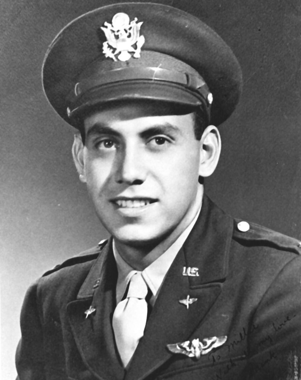
Lt. Francisco Mercado, Jr (1943), 1943
Kirtland AFB’s story
85 years in pictures
The archive holds 12 old photos and papers going back to 1943 and 5 maps from 1934 on.
- 1941Kirtland AFB is settled
Each edition grades its towns against each other only.

A town of 3,413, settled in 1941.
Kirtland AFB's standout: natural-hazard risk is low. Overall it grades B−, 8th of 72 graded towns in New Mexico. CDC estimates put its residents' health ahead of 87% of the country and it is easier to get around on foot or by transit than 90% of U.S. towns. Its weakest subject is cost of living: homes are expensive, about for a typical one and times the Albuquerque metro’s $71K median household income. Kirtland AFB’s average trip to work is 9 minutes, below both the New Mexico town median (23 minutes) and the median of U.S. towns (25 minutes). No town in New Mexico scores lower than Kirtland AFB on cost of living.
Where Kirtland AFB beats most towns.
Where Kirtland AFB’s working residents go each day. Line width shows the share.
Census LEHD 2023
Each subject compared with towns across the country (schools within New Mexico), ordered by how far Kirtland AFB is from typical.
Its grades run from A+ for hazard risk (better than 99% of comparable towns) to D− for cost of living (better than 1%), so the B− overall blends very different results.
How TownRatings grades towns →
The archive holds 12 old photos and papers going back to 1943 and 5 maps from 1934 on.
Museums, parks, gardens and other places to visit around Kirtland AFB. Close and well known come first.
 4 mi Stadium & arenaUniversity Stadium
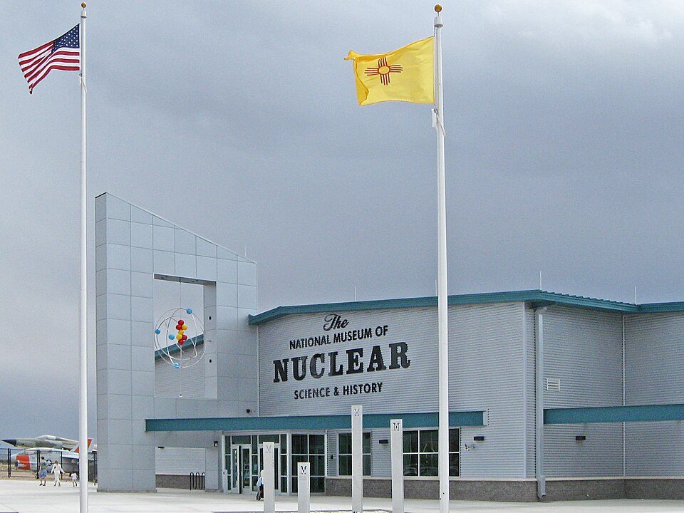 2 mi MuseumNational Museum of Nuclear Science & History
 3 mi Stadium & arenaTingley Coliseum
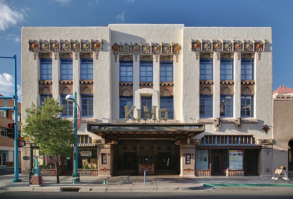 6 mi TheatreKiMo Theater
 11 mi National MonumentPetroglyph National Monument311K visitors a year
 13 mi Ski areaSandia Peak Ski Area66 runs · 1,599 ft vertical
University Stadium: Kenneth C. Zirkel, CC BY 4.0 · National Museum of Nuclear Science & History: AllenS, Public domain · Tingley Coliseum: John Phelan, CC BY 3.0 · KiMo Theater: Daniel Schwen, CC BY-SA 4.0 · Petroglyph National Monument: Unknown, Public domain · Sandia Peak Ski Area: Skoch3, CC BY-SA 3.0
Kirtland AFB is unincorporated, so Bernalillo County and regional agencies provide most services.
EPA SDWIS (Oct 9, 2026) · HIFLD + EIA-861 2025 · Census 2020 ZCTAs · NCES 2024–25 · registration: vote.gov, updated Aug 27, 2026.
Ordered by what stands out in Kirtland AFB.
Kirtland AFB carries less natural-hazard risk than nearly all of New Mexico (mostly inland flooding), has less heart disease than most of New Mexico and draws workers from Albuquerque and beyond.
Its public schools are run by the Albuquerque school district. One of its 2 schools is below, with why it’s listed.
| School | Level | Students | Letter |
|---|---|---|---|
| Sandia Base ElementaryLargest public elementary schoolGrades PK–6 | Grades PK–6 | 280 | – |
NCES · EDFacts · graded within NM on state tests and graduation
17,816 jobs are based in Kirtland AFB, 34.5 for every working resident, so most of the people who work here commute in. The average commute takes 8.7 minutes, against 23.5 across New Mexico.
Most working residents leave Kirtland AFB for work: only 13% work in town. Jobs based in Kirtland AFB grew to 17,816 in 2023, 6,526 more than in 2013. The median household income in Kirtland AFB is $85,000.
| Kirtland AFB | New Mexico towns | U.S. towns | |
|---|---|---|---|
| Below the poverty line | 13% | 21% | 9.6% |
| Median household income | $85,000 | $55,000 | $80,000 |
| Working residents who work in town | 13% | 15% | 8% |
Census LEHD 2023 · ACS
FEMA rates its natural-hazard risk lower than 100% of New Mexico towns; that rating is what its A+ for hazard risk is built on.
Kirtland AFB’s FEMA risk score is 2 of 100.
FEMA National Risk Index · OpenFEMA
Its widest gap with New Mexico is heart disease: 1.7% of its 2,688 adults have heart disease, against 7.2% statewide.
3.3% of adults have diabetes in Kirtland AFB. Only 2 of the 73 New Mexico towns we compare have a higher share of adults who have been diagnosed with depression than Kirtland AFB. 16% of adults have high blood pressure in Kirtland AFB.
| Kirtland AFB | New Mexico towns | U.S. towns | |
|---|---|---|---|
| Diabetes (CDC PLACES) | 3.3% | 14% | 12% |
| Frequent physical distress (CDC PLACES) | 8.8% | 17% | 14% |
| Binge drink (CDC PLACES) | 22% | 13% | 16% |
| High blood pressure (CDC PLACES) | 16% | 35% | 35% |
| What stands out | Kirtland AFB | NM |
|---|---|---|
| Fewer adults with heart disease | 1.7% | 7.2% |
| Fewer adults with diabetes | 3.3% | 13.2% |
| More binge drinkers | 21.9% | 13.7% |
CDC PLACES 2025 · modeled estimates for adults · CMS · HRSA
| Kirtland AFB | New Mexico towns | U.S. towns | |
|---|---|---|---|
| Miles of trail per square mile | 1.0 miles per square mile | 1.0 | 0.4 |
| Conserved land | 1.8% | 4% | 4.3% |
| Biggest places to walk | Trails | Acres |
|---|---|---|
| 1. Marquez Park | — | 4 |
| 2. Pershing Park | — | 4 |
| 3. Millenium Park | 0.2 mi | 1 |
Trails & parks © OpenStreetMap contributors · Conserved land: USGS PAD-US
Kirtland AFB has chilly winters and hot summers, with very little rain. July afternoons reach 92°, January nights drop to 22° and about 12 inches of snow falls in a winter.
NOAA U.S. Climate Normals, 1991–2020
4 within 15 miles of the center of Kirtland AFB
About 9 of every 100 Kirtland AFB residents are enrolled in college, against 6 across New Mexico.
United States Air Force base in Albuquerque, New Mexico
Kirtland Air Force Base (IATA: ABQ, ICAO: KABQ) is a United States Air Force base. It is located in the southeast quadrant of the Albuquerque, New Mexico, urban area, adjacent to the Albuquerque International Sunport. The base was named for the early Army aviator Colonel Roy C. Kirtland. The military and the international airport share the same runways, making ABQ a joint civil-military airport. Kirtland AFB is the largest installation in the Air Force Global Strike Command and sixth largest in the United States Air Force. The base occupies 51,558 acres and employs over 23,000 people, including more than 4,200 active duty and 1,000 Guard, plus 3,200 part-time Reserve personnel. Kirtland is …
From Wikipedia, licensed CC BY-SA 4.0 · facts via Wikidata (CC0)
One town shares a border with Kirtland AFB.
| Town | NM rank | Overall | Cost | Safety | Schools | Health |
|---|---|---|---|---|---|---|
| Kirtland AFB | #8 | B− | D− | — | C+ | A |
| Albuquerque | #44 | C− | C− | D− | C+ | B |
Kirtland AFB reports no FBI crime data of its own. Compare Kirtland AFB with a neighbor →
Short answers, built from the data on this page.
Kirtland AFB grades B− overall, better than 49% of U.S. towns and #8 of 72 in New Mexico. It grades A for health and C+ for schools. Cost of living is its weak spot, with a D−.


