Salem dates to 1675, and 46% of its homes were built before 1940
Among the most historic 1% of U.S. towns · #3 of 468 in New Jersey. What drives it
3 places in town are on the National Register, among them three historic districts with 408 buildings between them. Below: 12 old photos and papers, maps from 1885 on, and the census since 1810.
Founding year: Wikidata. First post office: 1792.The full story ↓
History grade
What drives Salem’s History grade
On its age, its old homes and the National Register, Salem is among the most historic 1% of U.S. towns, #3 of 468 in New Jersey. All 3 inputs put Salem near the top nationally; its share of homes from before 1940 ranks highest.
A+
HistoryA character grade: shown, never part of Salem’s overall grade.
New Jersey towns list more on the Register than most of the country (a typical New Jersey town has 3.7 per 10,000 residents, the U.S. 2.4), so Salem’s 767 sits above most of its state (97% of New Jersey towns have fewer) while its 408 historic buildings outnumber those of 96% of U.S. towns.
NoteThe founding year comes from Wikidata alone; no second source gives 1675.
How sure. Graded on any two of the three inputs instead, the letter would still be A+. The pre-1940 share is a Census survey estimate (±6.9 points).
Founding year: Wikidata (other dates in Quick answers). Homes: Census ACS 2020–24. National Register: National Park Service, May 2026 list; each listing counted once (boundary changes and added documentation belong to their listing), and a historic district counts its contributing buildings. How TownRatings grades history →
What stands out about Salem’s past
Read from the archive, the National Register and the record. The page puts what stands out first.
Salem was founded by John Fenwick, a Quaker. Fenwick had been involved in a financial dispute with Edward Byllynge, another Quaker, who had received the undivided portion of New Jersey territory that James Stuart, Duke of York had granted to Lord John Berkeley in 1664. Berkeley had sold his share to Byllynge in 1675 for 1,000 pounds, but Byllynge had become bankrupt and had the property transferred to Fenwick to hold in trust for Byllynge and his assigns. Fenwick and Byllynge subsequently disagreed over ownership and control of the property.
Passages that mention Salem, cut from the printed page as they were published.
History of the counties of Gloucester, Salem, and Cumberland, New Jersey, with biographical sketches of their prominent citizens1883 · page 98Read the page →
Read the text
The Salem Railroad was constructed from Elmer to Salem, a distance of sixteen miles, soon after the extension of the West Jersey road to Bridgeton. The route prescribed in the charter, which was passed in 1856, was " from a point in the town of Salem, or within one mile thereof, to any point on the West Jersey Railroad, at Woodbury or south thereof, which the directors may deem most eligible." The
Text read by machine from the scan; it may contain errors.
History of the counties of Gloucester, Salem, and Cumberland, New Jersey, with biographical sketches of their prominent citizens1883 · page 369Read the page →
Read the text
member. As early as 1682 he and another Friend were appointed to repair and build an addition to the meeting-house, so that it should be large enough to accommodate a Yearly Meeting. When Salem was incorporated, in 1695, he was chosen recorder. In laying out a public highway, in 1705, from Salem to Maurice River, he was one of the commissioners and surveyors, and he was likewise appointed, in 1709, to
Text read by machine from the scan; it may contain errors.
An historical account of the first settlement of Salem, in West Jersey, by John Fenwick, esq., chief proprietor of the same1839 · page 70Read the page →
Read the text
Salem iNcoRroRATEo. — In 1695, the town of Salem became incorporated, and the office of burgess was created, by which that officer was clothed with authority to hear and determine causes under forty
Text read by machine from the scan; it may contain errors.
Scans and text from the Internet Archive. Books published in 1930 or earlier, which are in the public domain.
By decade
Salem, decade by decade
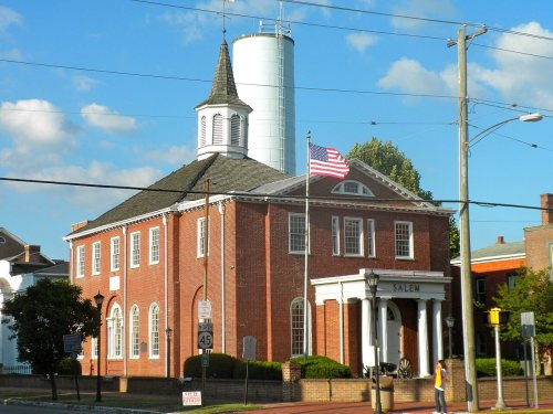
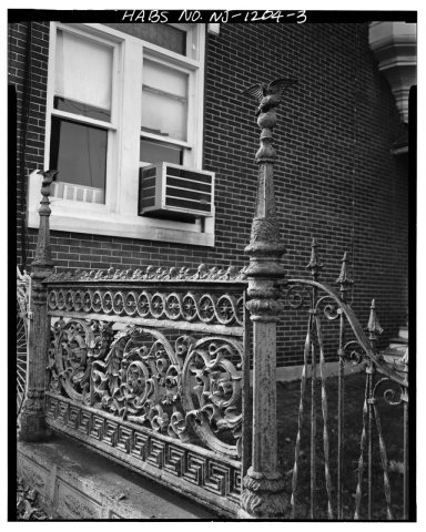
3 decades in the archive, from the 1850s to the 1930s. Scroll each row; tap a photo for its story.
Nothing in the archives for these yearsWeddings on Main Street, storms, parades, school pictures, the old store. If it’s in your family album, it belongs here.
Nothing in the archives for these yearsWeddings on Main Street, storms, parades, school pictures, the old store. If it’s in your family album, it belongs here.
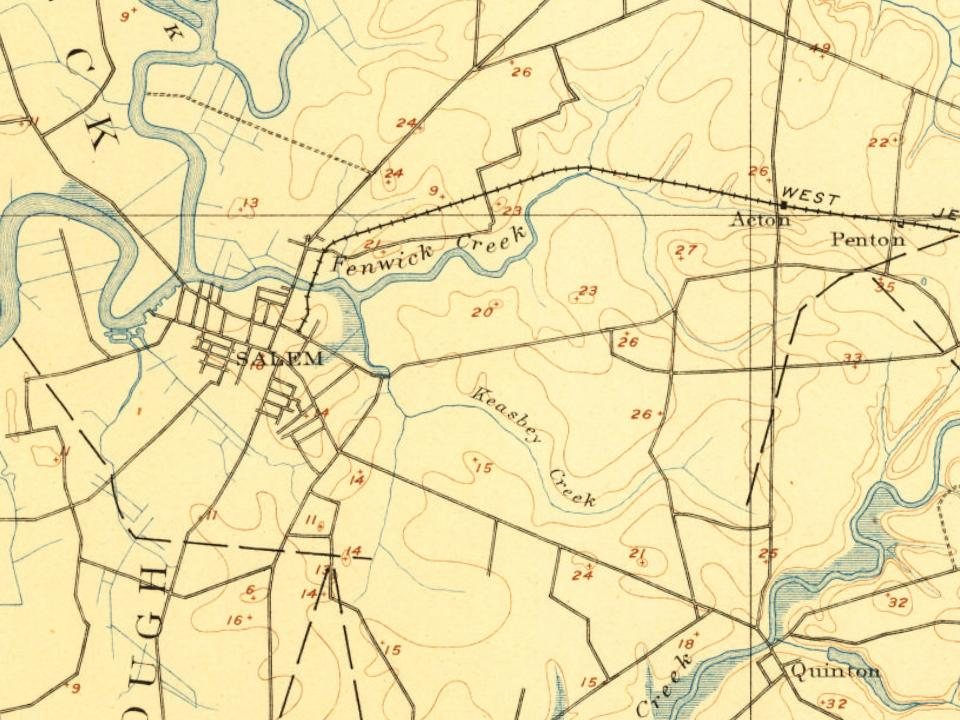
Fire insurance maps drew every building, what it was made of and what it was used for, so insurers could price the risk of fire. Pick a year, then a sheet.
In 1675, according to Wikidata. Salem’s post office opened in 1792, and the census of 1810 counted 929 people here.
How does Salem rank for history?
Salem is among the most historic 1% of U.S. towns, #3 of 468 in New Jersey. The History grade combines the town’s founding era, the share of homes built before 1940 and its National Register listings. It’s a character grade, so it isn’t part of the overall grade. How it works.
What is on the National Register in Salem?
Three places: the Market Street Historic District (listed 1975), the Broadway Historic District (1992) and the Hedge-Carpenter-Thompson Historic District (2001).
How old are the homes in Salem?
46% of Salem’s homes were built before 1940 (Census estimate, ±6.9 points), against a typical 15% for a New Jersey town; the median home was built in 1942.
Founding dates: Wikidata, Wikipedia, the U.S. post office records of Blevins & Helbock (CC0) and the Census. Homes by year built: Census ACS 2020–24. National Register of Historic Places: National Park Service (list of May 22, 2026). Old photos, postcards and papers: Wikimedia Commons, the Library of Congress and other public archives, credited on each item’s page. Maps: U.S. Geological Survey historical topographic maps (via Esri) and Sanborn fire-insurance maps (Library of Congress). History text and census tables: Wikipedia (CC BY-SA 4.0). Places that used to be: USGS Geographic Names Information System (2021).
From Wikimedia Commons (12), the National Register of Historic Places (3), Wikipedia, Wikidata and Wikipedia for famous people, U.S. Geological Survey historical maps, U.S. Census counts (via Wikipedia), the US Post Offices dataset (Blevins & Helbock), the USGS Geographic Names Information System, Sanborn fire insurance maps (Library of Congress) and old county and town histories (Internet Archive). Archive images are copied here with their credits and licenses, shown on each photo’s page. Refreshed monthly.








 1850
 1933
 1933
 1933
 1933
 1933
 1933
 1933
 1933

