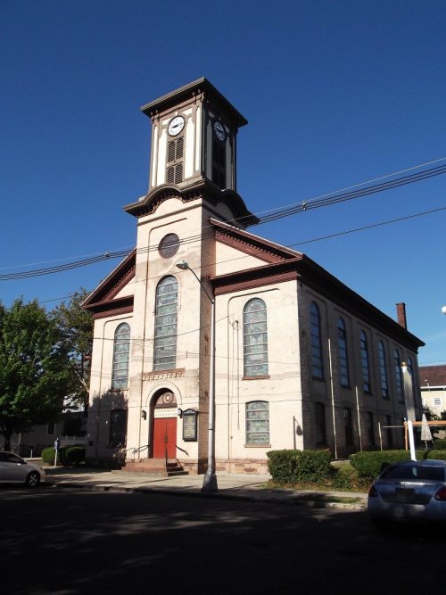
Founding year: Wikidata; Wikipedia’s history section gives the same year. First post office: 1792.The full story ↓
History grade
What drives Perth Amboy’s History grade
On its age, its old homes and the National Register, Perth Amboy is more historic than 92% of U.S. towns, #49 of 468 in New Jersey. All 3 inputs are above most U.S. towns; its age ranks highest and its National Register listings lowest.
A
HistoryA character grade: shown, never part of Perth Amboy’s overall grade.
New Jersey towns list more on the Register than most of the country (a typical New Jersey town has 3.7 per 10,000 residents, the U.S. 2.4), so Perth Amboy’s 1.4 sits near the middle of its state (38% of New Jersey towns have fewer) while its 8 listings outnumber those of 74% of U.S. towns.
How sure. Graded on any two of the three inputs instead, the letter would range from A− to A+. The pre-1940 share is a Census survey estimate (±3.7 points). Two sources give 1683.
Founding year: Wikidata (other dates in Quick answers). Homes: Census ACS 2020–24. National Register: National Park Service, May 2026 list; each listing counted once (boundary changes and added documentation belong to their listing), and a historic district counts its contributing buildings. How TownRatings grades history →
What stands out about Perth Amboy’s past
Read from the archive, the National Register and the record. The page puts what stands out first.
Lost post offices, old corners, places now gone and burying grounds
Perth Amboy’s post office has been open since 1842. Two other post offices opened and closed inside today’s town.
Amboy
1792–1842
Perth Amboy
1842–today
Maurer
1892–1920
17901910today
Hamlets and corners on the map
BarberHarbor TerraceJohn J Delaney HomesMaurerWilliam Dunlap Homes
Gone or out of use
Ceskoslovensky Catholic ChurchchurchGrade School Number 9schoolHoly Trinity SchoolschoolImmaculate Heart of Our Lady of Fatima ChurchchurchOur Saviours Lutheran ChurchchurchPerth Amboy Grade School Number 8schoolPerth Amboy Public School Number 11schoolPier Number 4localePublic School Number 5schoolSaint Johns Greek Catholic SchoolschoolSaint Marys LyceumschoolSaint Michael's Greek Catholic ChurchchurchSaint Michaels SchoolschoolSecond Baptist ChurchchurchSlovac Presbyterian ChurchchurchUkrainian Catholic Church of the Assumption of the Holy VirginchurchWesley Methodist Churchchurch
6cemeteries and burying grounds inside Perth Amboy
AlpineCongregation Beth MordecaiCongregation Shari TephaloSaint John the Baptist Orthodox ChurchSaint Mary'sSaint Nicholas
US Post Offices dataset (Blevins & Helbock, CC0). Places and cemeteries from the USGS Geographic Names Information System (2021).
The Lenape Native Americans called the point on which the city is built "Ompoge", meaning "level ground" or "standing or upright". When settled in 1683, the new city was dubbed "New Perth" in honor of James Drummond, Earl of Perth, one of the 12 associates of a company of Scottish proprietors; Drummond has been honored with a statue located outside of city hall. The Algonquian language name persisted, corrupted to Ambo, or Point Amboy, and eventually a combination of the native and colonial names emerged, also appearing in South Amboy.
Passages that mention Perth Amboy, cut from the printed page as they were published.
History of Middlesex County, New Jersey, 1664-19201921 · page 410Read the page →
Read the text
Perth Amboy, with stations at Woodbridge, Avenel and Spa Sjiring. Before that time the mail was carried from Rahway to Perth Amboy via Woodbridge, by wagon, sleigh or horseback ; and the writer remembers seeing the genial face of former Sheriff Convery, of Perth Amboy, who for several years was the mail carrier, appearing in the Woodbridge postofifice, his coat covered with snow, or drenched with rain, after a three and a half mile drive. The postoffice was successively located in the old building on the corner of Rahway avenue and Green street ;
Text read by machine from the scan; it may contain errors.
History of Middlesex County, New Jersey, 1664-19201921Read the page →
Read the text
building which did duty as a church until the present handsome edifice was built in 1887. The former church has been used continuously as a parish school since that time. Father Quinn was relieved of the Woodbridge mission in 1863, and it was attached to the Perth Amboy parish and ministered to by Father Cornell until 1865, when the latter left Perth Amboy and Father Quinn was again placed in charge of Perth Amboy and Woodbridge ; he also established the Catholic cemetery in the township. In 1871 Rev. Peter L. Connolly, parish priest of Perth
Text read by machine from the scan; it may contain errors.
Contributions to the early history of Perth Amboy and adjoining country1856 · page 50Read the page →
Read the text
cessful, tho' their request is not to be granted of right, but grace ; therefore humbly pray for our royal grant by letters patent, under our great seal of our said province of New Jersey, to incorporate the freeholders, inhabitants of the said town of Perth Amboy, into a Body Corporate and politic, with perpetual succession by what name our said governor shall think fit; as also to grant such immunities and privileges as may be thought requisite for the well ordering and ruling thereof, &c. "We, being willing to promote all trade, industry, rule, and good order amongst
Text read by machine from the scan; it may contain errors.
Scans and text from the Internet Archive. Books published in 1930 or earlier, which are in the public domain.
By decade
Perth Amboy, decade by decade
One decade in the archive so far: the 1920s. Scroll each row; tap a photo for its story.
Nothing in the archives for these yearsWeddings on Main Street, storms, parades, school pictures, the old store. If it’s in your family album, it belongs here.
Every edition of the U.S. Geological Survey’s map of Perth Amboy. Tap a year, or press play to watch the town change.
1947Perth Amboy sheet · 1:24,000
U.S. Geological Survey historical topographic maps (public domain), via Esri’s collection of the scans. The red ring marks the center of Perth Amboy.
Every building
Perth Amboy, building by building, 1891–1914
Fire insurance maps drew every building, what it was made of and what it was used for, so insurers could price the risk of fire. Pick a year, then a sheet.
In 1683, according to Wikidata and Wikipedia’s history of the town. Perth Amboy’s post office opened in 1792, and the first U.S. census counted 582 people here in 1790.
How does Perth Amboy rank for history?
Perth Amboy is more historic than 92% of U.S. towns, #49 of 468 in New Jersey. The History grade combines the town’s founding era, the share of homes built before 1940 and its National Register listings. It’s a character grade, so it isn’t part of the overall grade. How it works.
What is on the National Register in Perth Amboy?
8 listings: 7 buildings, among them the Proprietary House (listed 1971, the first), and 1 structure.
How old are the homes in Perth Amboy?
31% of Perth Amboy’s homes were built before 1940 (Census estimate, ±3.7 points), against a typical 15% for a New Jersey town; the median home was built in 1959.
Founding dates: Wikidata, Wikipedia, the U.S. post office records of Blevins & Helbock (CC0) and the Census. Homes by year built: Census ACS 2020–24. National Register of Historic Places: National Park Service (list of May 22, 2026). Old photos, postcards and papers: Wikimedia Commons, the Library of Congress and other public archives, credited on each item’s page. Maps: U.S. Geological Survey historical topographic maps (via Esri) and Sanborn fire-insurance maps (Library of Congress). History text and census tables: Wikipedia (CC BY-SA 4.0). Places that used to be: USGS Geographic Names Information System (2021).
From the Library of Congress (3), Wikidata (7), the National Register of Historic Places (8), Wikipedia, Wikidata and Wikipedia for famous people, U.S. Geological Survey historical maps, U.S. Census counts (via Wikipedia), the US Post Offices dataset (Blevins & Helbock), the USGS Geographic Names Information System, Sanborn fire insurance maps (Library of Congress) and old county and town histories (Internet Archive). Archive images are copied here with their credits and licenses, shown on each photo’s page. Refreshed monthly.


 Date?
 Date?