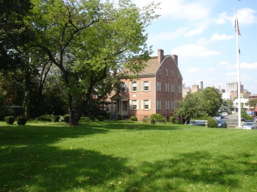
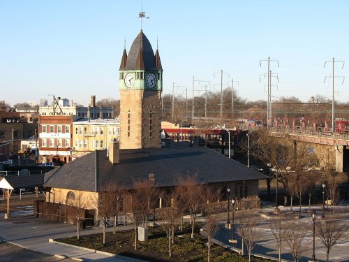
Elizabeth dates to 1665, and 27% of its homes were built before 1940
More historic than 96% of U.S. towns · #24 of 468 in New Jersey. What drives it
10 places in town are on the National Register, among them the Boxwood Hall, a National Historic Landmark, and a historic district with 115 buildings. Below: 5 old photos and papers, maps from 1889 on, and the census since 1810.
Founding year: Wikidata. First post office: 1776.The full story ↓
History grade
What drives Elizabeth’s History grade
On its age, its old homes and the National Register, Elizabeth is more historic than 96% of U.S. towns, #24 of 468 in New Jersey. All 3 inputs are above most U.S. towns; its age ranks highest and its National Register listings lowest.
A+
HistoryA character grade: shown, never part of Elizabeth’s overall grade.
Among the 400 U.S. cities of 100,000 or more, Elizabeth ranks #38 on History.
New Jersey towns list more on the Register than most of the country (a typical New Jersey town has 3.7 per 10,000 residents, the U.S. 2.4), so Elizabeth’s 9.6 sits above most of its state (68% of New Jersey towns have fewer) while its 132 historic buildings outnumber those of 91% of U.S. towns.
NoteThe founding year comes from Wikidata alone; no second source gives 1665.
How sure. Graded on any two of the three inputs instead, the letter would range from A to A+. The pre-1940 share (±2.1 points) is firm at this size.
Founding year: Wikidata (other dates in Quick answers). Homes: Census ACS 2020–24. National Register: National Park Service, May 2026 list; each listing counted once (boundary changes and added documentation belong to their listing), and a historic district counts its contributing buildings. How TownRatings grades history →
What stands out about Elizabeth’s past
Read from the archive, the National Register and the record. The page puts what stands out first.
Elizabeth, originally called "Elizabethtown" and part of the Elizabethtown Tract, was founded in 1664 by English settlers. The town was not named for Queen Elizabeth I as many people may assume, but rather for Elizabeth, wife of Sir George Carteret, one of the two original Proprietors of the colony of New Jersey. She was the daughter of Philippe de Carteret II, 3rd Seigneur de Sark and Anne Dowse. The town served as the first capital of New Jersey.
Passages that mention Elizabeth, cut from the printed page as they were published.
A bill in the Chancery of New-Jersey, at the suit of John Earl of Stair, and others, proprietors of the Eastern-Division of New-Jersey1747Read the page →
Read the text
delivered it as a Part, in Lieu of the Whole; your Orators fay, that in that Point his Deſition is contradictory to an Entry in the Town Book of Elizabeth Toun, which your 35 Orators have lately come to the Knowledge of; for that in the Hands of ſome of the Aſſociates of Elizabeth Town, was ſome Years ago ſeen a Certificate in the Hand-writing of
Text read by machine from the scan; it may contain errors.
History of Port Elizabeth, Cumberland County, New Jersey1885Read the page →
Read the text
across the river to Port Elizabeth, was laid in the usual way in 1810, a short distance north of the former one. The road from Port Elizabeth to Tuckahoe was laid and opened in 1794. The road from Port Elizabeth to Millviile as now used was laid out and opened, after a long contest, in 18 18. The road from Broadway, leading by the Eagle Glass-Works, was regularly laid out in 1800, July I.
Text read by machine from the scan; it may contain errors.
History of Port Elizabeth, Cumberland County, New Jersey1885Read the page →
Read the text
for the collection of duties on imports, and the eastern side of the Delaware, from above Camden to Cape May, was made the district of Bridgeton, with Bridgeton as the port of entry, and Salem and Port Elizabeth as ports of delivery. Port Elizabeth was considered a fine location for business, particularly in wood and lumber; consequently a number of enterprising young men of business saw the advantages of the place, purchased lots, and built dwellings, storehouses, etc. Among these were James
Text read by machine from the scan; it may contain errors.
History of Elizabeth, New Jersey1868 · page 436Read the page →
Read the text
As soon as the troops landed (says a correspondent), they paraded the north shore, and on Wednesday morning [3d] made their appearance near Elizabeth-Town point; but the country being soon alarmed, they retreated, took up the floor of the drawbridge in the salt meadows, and immediately threw up some works. Their near approach to Elizabeth-Town point greatly alarmed the inhabitants of Essex county, and particularly the people of Elizabeth-Town and Newark ; but they are now in a condition to receive them whenever they may think proper to approach.
Text read by machine from the scan; it may contain errors.
Scans and text from the Internet Archive. Books published in 1930 or earlier, which are in the public domain.
By decade
Elizabeth, decade by decade
5 decades in the archive, from the 1750s to the 1880s. Scroll each row; tap a photo for its story.
Nothing in the archives for these yearsWeddings on Main Street, storms, parades, school pictures, the old store. If it’s in your family album, it belongs here.
Every edition of the U.S. Geological Survey’s map of Elizabeth. Tap a year, or press play to watch the town change.
1947Elizabeth sheet · 1:24,000
U.S. Geological Survey historical topographic maps (public domain), via Esri’s collection of the scans. The red ring marks the center of Elizabeth.
Every building
Elizabeth, building by building, 1889–1922
Fire insurance maps drew every building, what it was made of and what it was used for, so insurers could price the risk of fire. Pick a year, then a sheet.
Boudinot SchoolschoolJanet Memorial Elizabeth Orphan AsylumbuildingSacred Heart SchoolschoolSaint Michaels Elementary SchoolschoolThomas Jefferson High SchoolschoolVail Deane Girls Schoolschool
3cemeteries and burying grounds inside Elizabeth
B'Nai JeshuronRosemont Memorial ParkSaint Mary of the Assumption
US Post Offices dataset (Blevins & Helbock, CC0). Places and cemeteries from the USGS Geographic Names Information System (2021).
Help out
Finish Elizabeth’s story
Most archives stop around 1920. The photos from after that are in family albums, not libraries.
Decades since 1900 with photos
00s10s20s30s40s50s60s70s80s90s
0 of 10 decades. The empty ones are waiting for someone’s album.
In 1665, according to Wikidata. Elizabeth’s post office opened in 1776, and the census of 1810 counted 2,977 people here.
How does Elizabeth rank for history?
Elizabeth is more historic than 96% of U.S. towns, #24 of 468 in New Jersey. The History grade combines the town’s founding era, the share of homes built before 1940 and its National Register listings. It’s a character grade, so it isn’t part of the overall grade. How it works.
What is on the National Register in Elizabeth?
10 listings: 9 buildings, among them the Boxwood Hall (a National Historic Landmark since 1972), and 1 historic district, the Mid-Town Historic District, with 115 contributing buildings. 132 historic buildings in all.
How old are the homes in Elizabeth?
27% of Elizabeth’s homes were built before 1940 (Census estimate, ±2.1 points), against a typical 15% for a New Jersey town; the median home was built in 1957.
Founding dates: Wikidata, Wikipedia, the U.S. post office records of Blevins & Helbock (CC0) and the Census. Homes by year built: Census ACS 2020–24. National Register of Historic Places: National Park Service (list of May 22, 2026). Old photos, postcards and papers: Wikimedia Commons, the Library of Congress and other public archives, credited on each item’s page. Maps: U.S. Geological Survey historical topographic maps (via Esri) and Sanborn fire-insurance maps (Library of Congress). History text and census tables: Wikipedia (CC BY-SA 4.0). Places that used to be: USGS Geographic Names Information System (2021).
From Wikimedia Commons (5), the National Register of Historic Places (10), Wikipedia, Wikidata and Wikipedia for famous people, U.S. Geological Survey historical maps, U.S. Census counts (via Wikipedia), the US Post Offices dataset (Blevins & Helbock), the USGS Geographic Names Information System, Sanborn fire insurance maps (Library of Congress) and old county and town histories (Internet Archive). Archive images are copied here with their credits and licenses, shown on each photo’s page. Refreshed monthly.


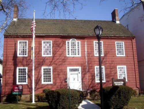 ★ Landmark