Guest, Sign inJoin

Post to Cherry Hill Township

We’ll email a one-tap link to publish your post. No password, and nothing is public until you click it.
Already a member? Sign in
B−History
History · Cherry Hill Township

Cherry Hill Township dates to 1844, and 5 of its places are on the National Register

More historic than 54% of U.S. towns · #286 of 468 in New Jersey. What drives it

Most of Cherry Hill Township was built recently: 4% of its homes predate 1940 and the median home dates from 1968. Below: maps from 1888 on and the census since 1850.

1844founded
5on the National Register
4%homes built before 1940
25famous people
Quick answers

How Cherry Hill Township began

When was Cherry Hill Township founded?

1844

Cherry Hill Township dates its founding to 1844 (Wikidata and Wikipedia’s history agree). The census first counted it in 1850.

First census: 2,577 in 18502020 census: 74,553182 years

How historic is Cherry Hill Township?

B−

More historic than 54% of U.S. towns, on its age, its old homes and the National Register.

What drives the grade ↓
Founding year: Wikidata; Wikipedia’s history section gives the same year. First post office: 1852.The full story ↓
History grade

What drives Cherry Hill Township’s History grade

On its age, its old homes and the National Register, Cherry Hill Township is more historic than 54% of U.S. towns, #286 of 468 in New Jersey. Its age holds the grade up; its share of homes from before 1940 pulls it down.

B−
HistoryA character grade: shown, never part of Cherry Hill Township’s overall grade.
All U.S. towns we grade (21,289)Ahead of 54%
NewerOlder
New Jersey towns of 2,500+ (468)Ahead of 39%

New Jersey towns list more on the Register than most of the country (a typical New Jersey town has 3.7 per 10,000 residents, the U.S. 2.4), so Cherry Hill Township’s 1.0 sits below most of its state (33% of New Jersey towns have fewer) while its 8 historic buildings outnumber those of 74% of U.S. towns.

How sure. Graded on any two of the three inputs instead, the letter would range from C to B+. The pre-1940 share (±0.8 points) is firm at this size. Two sources give 1844.

Founding year: Wikidata (other dates in Quick answers). Homes: Census ACS 2020–24. National Register: National Park Service, May 2026 list; each listing counted once (boundary changes and added documentation belong to their listing), and a historic district counts its contributing buildings. How TownRatings grades history →

What stands out about Cherry Hill Township’s past

Read from the archive, the National Register and the record. The page puts what stands out first.

★ What stands out · Places that used to be

Lost post offices, old corners, places now gone and burying grounds

Four other post offices opened and closed inside today’s town.

Ellisburg
1852–1900
Bethel
1868–1869
Ashland
1884–1966
Erlton
1917–1949
Cherry Hill
1965–today
18501940today
Hamlets and corners on the map
AshlandBarclay FarmBrookfieldCandlewyckCharleston EastCherry DownsCherry HillCherry Hill EstatesCherry Hill MallCherry ValleyColestownColumbia LakesColwickDeer ParkDeerwoodsDowns FarmsEllisburgErltonFox Hollow WoodsGolden TriangleGreenhavenGreentreeHaddon TowneHerwood
Gone or out of use
A M Rodgers Construction Companyairport
3cemeteries and burying grounds inside Cherry Hill Township
CalvaryColestownLocustwood

US Post Offices dataset (Blevins & Helbock, CC0). Places and cemeteries from the USGS Geographic Names Information System (2021).

Help out

Start Cherry Hill Township’s collection

The first neighbors to add old photos shape how Cherry Hill Township’s history is told.

Decades since 1900 with photos
00s10s20s30s40s50s60s70s80s90s
0 of 10 decades. The empty ones are waiting for someone’s album.
People over time

Cherry Hill Township, census by census

020,00040,00060,00080,00018501900195020002,577 in 1850Low: 1,457

Lost a third of its people between 1850 and 1890, then grew more than tenfold.

18 censuses, 1850–2020.

U.S. Census Bureau decennial counts, from the census table on Cherry Hill Township’s Wikipedia page.

The story

How Cherry Hill Township came to be

From Wikipedia’s history of Cherry Hill Township.

Read it all →

The area now known as Cherry Hill was originally settled by the Lenni-Lenape Native Americans before being displaced by the first settlers from England, namely Quaker followers of William Penn who arrived in the late 17th century.

Text from Wikipedia, licensed CC BY-SA 4.0.

Timeline

Cherry Hill Township, 1844 to 2020

Woven from the archive, old maps, post office records, the National Register and the people born here.

  1. 19th century
  2. 1844
    FoundingCherry Hill Township is established
  3. 1852Post officeThe Ellisburg post office opens
  4. 1868Post officeThe Bethel post office opens
  5. 1869Post officeThe Bethel post office closes
  6. 1884Post officeThe Ashland post office opens
  7. 1888On the mapFirst mapped by the U.S. Geological Survey
  8. 20th century
  9. 1900Post officeThe Ellisburg post office closes
  10. 1966Post officeThe Ashland post office closes
  11. 1976Born hereAli Larter is born here
  12. 1978Born hereMike Bibby is born here
  13. 1982Born hereLauren Cohan is born here
  14. 1985Born hereCristin Milioti is born here
  15. 21st century
  16. 2020CensusPopulation peaks at 74,553
By decade

Cherry Hill Township, decade by decade

Today47 recent
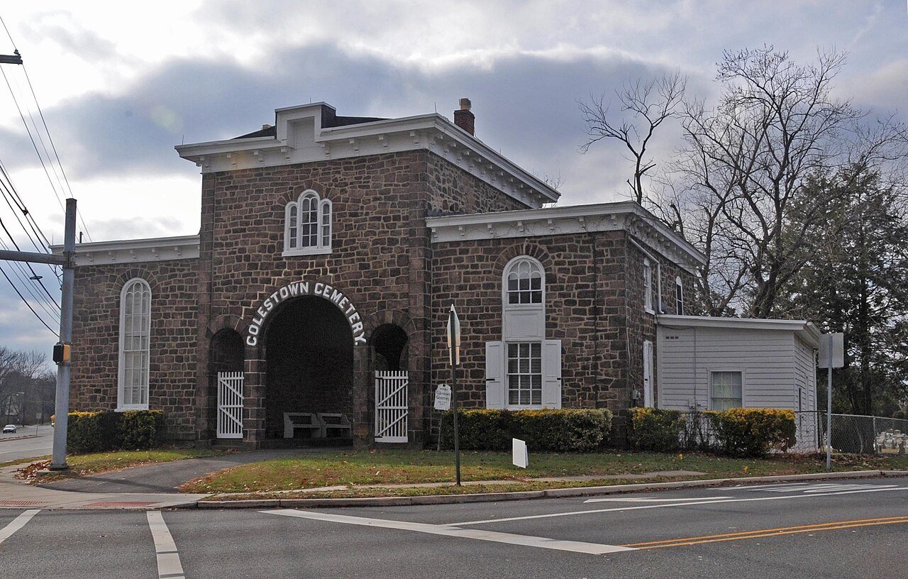
Cherry Hill, NJ municipal building, Sept. 20252025Cherry Hill, NJ municipal building, Sept. 2025Cherry Hill, NJ municipal building, Nov. 20252025Cherry Hill, NJ municipal building, Nov. 2025Cherry Hill, NJ World War II memorial, Nov. 20252025Cherry Hill, NJ World War II memorial, Nov. 2025Cherry Hill NJ water tower from Garden State Pavilions2025Cherry Hill NJ water tower from Garden State PavilionsCherry Hill NJ from airplane approaching PHL2025Cherry Hill NJ from airplane approaching PHLCherry Hill High School West front, Nov. 20252025Cherry Hill High School West front, Nov. 2025Carman Tilelli Community Center, Cherry Hill, NJ, Sept. 20252025Carman Tilelli Community Center, Cherry Hill, NJ, Sep…20221222POLITZCH202220221222POLITZCH2021-09-07 13 11 14 Green apple on a tree next to New Jersey State Route 38 (Kaighn Avenue) in Cherry Hill Township, Ca…20212021-09-07 13 11 14 Green apple on a tree next to New…20200205-720COOPERLANDINGRD202020200205-720COOPERLANDINGRDWhat a loser2019What a loserPolitzCherryHill2018PolitzCherryHillNJ 70 in Cherry Hill - Aerial2016NJ 70 in Cherry Hill - AerialLatincasionmenu2016LatincasionmenuOnce a working mill and farm and a stop on the Underground Railroad, today Croft Farm is a vibrant Arts Center and publ…2015Once a working mill and farm and a stop on the Underg…Once a working mill and farm and a stop on the Underground Railroad, today Croft Farm is a vibrant Arts Center and publ…2015Once a working mill and farm and a stop on the Underg…Mayor Chuck Cahn, Mary Maiatico, AnnaMarie Marino, Margaret McDaniels at Barclay Farmstead, a historical oasis in the h…2015Mayor Chuck Cahn, Mary Maiatico, AnnaMarie Marino, Ma…Mary Malatico, AnnaMarie Marino, Margaret McDaniels at Barclay Farmstead, a historical oasis in the heart of bustling C…2015Mary Malatico, AnnaMarie Marino, Margaret McDaniels a…Mary Malatico, Anna Marie Marino, Margaret McDaniels at Barclay Farmstead, a historical oasis in the heart of bustling …2015Mary Malatico, Anna Marie Marino, Margaret McDaniels …Tom Jarvis drives a tractor at Springdale Farm which is owned and operated by the Jarvis family since 1949. Cherry Hill…2015Tom Jarvis drives a tractor at Springdale Farm which …Scarborough Covered Bridge, celebrated 50 years in 2009.It was building by Barclay Farm developer Bob Scarborough near …2015Scarborough Covered Bridge, celebrated 50 years in 20…A reinactor works near loom at Barclay Farmstead, a historical oasis in the heart of bustling Cherry Hill, New Jersey2015A reinactor works near loom at Barclay Farmstead, a h…Barclay Farmstead, a historical oasis in the heart of bustling Cherry Hill, New Jersey2015Barclay Farmstead, a historical oasis in the heart of…Barclay Farmstead, a historical oasis in the heart of bustling Cherry Hill, New Jersey2015Barclay Farmstead, a historical oasis in the heart of…Sonia Frantz and her son Johan Frantz look at books in the Cherry Hill Library2015Sonia Frantz and her son Johan Frantz look at books i…Cherry Hill Public Library2015Cherry Hill Public LibraryCherry Hill Public Library2015Cherry Hill Public LibraryCherry Hill Public Library2015Cherry Hill Public LibraryCherry Hill Mall2015Cherry Hill MallCherry Hill Mall2015Cherry Hill MallAbraham Browning2014Abraham BrowningRohrer Campus, Cherry Hill, NJ, Main Building2012Rohrer Campus, Cherry Hill, NJ, Main BuildingColestown Gatehouse, Cherry Hill, NJ 080342012Colestown Gatehouse, Cherry Hill, NJ 08034TBSmaindoor2011TBSmaindoorPonziosdiner2011PonziosdinerMkorshalomfront2011MkorshalomfrontChwestsign2011ChwestsignCherryhillparksign2011CherryhillparksignCensus Bureau map of2011Census Bureau map ofMapA totem by david ascalon ascalon studio2009A totem by david ascalon ascalon studioTotem par David Ascalon2006Totem par David AscalonLeaf on Grass, Cherry Hill, NJ 20042006Leaf on Grass, Cherry Hill, NJ 2004Erlton ellisburg cdp nj 0072005Erlton ellisburg cdp nj 007Cherry hill mall cdp nj 0072005Cherry hill mall cdp nj 007Barclay kingston cdp nj 0072005Barclay kingston cdp nj 007Ashland cdp nj 0072005Ashland cdp nj 007Map of Camden County highlighting Cherry Hill Township2004Map of Camden County highlighting Cherry Hill TownshipMap
On the map

Cherry Hill Township on the map, 1888 to 1995

Every edition of the U.S. Geological Survey’s map of Cherry Hill Township. Tap a year, or press play to watch the town change.

Cherry Hill Township on the 1888 USGS mapCherry Hill Township on the 1894 USGS mapCherry Hill Township on the 1942 USGS mapCherry Hill Township on the 1953 USGS mapCherry Hill Township on the 1966 USGS mapCherry Hill Township on the 1981 USGS mapCherry Hill Township on the 1995 USGS map1888Mount Holly sheet · 1:62,500

U.S. Geological Survey historical topographic maps (public domain), via Esri’s collection of the scans. The red ring marks the center of Cherry Hill Township.

On the National Register

5 historic places in Cherry Hill Township

The country’s official list of buildings and places worth saving.

places listed
5
National Historic Landmarks
0
none yet
historic buildings protected
8
each building in a district counts
first listed
1973
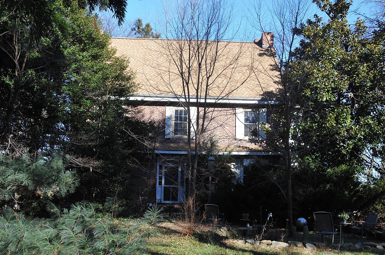
Samuel Coles House
All 5 listings

National Park Service, National Register of Historic Places. Photos from Wikimedia Commons, credited on each place’s page.

Famous people

25 famous people were born in Cherry Hill Township

Writers, athletes, leaders and more, ranked by how widely they’re known.

See all →
Stories next door

History across the town line

Each neighbor’s History grade, on the same three inputs.

Questions about Cherry Hill Township’s history

What year was Cherry Hill Township founded?

In 1844, according to Wikidata and Wikipedia’s history of the town. Cherry Hill Township’s post office opened in 1852, and the census of 1850 counted 2,577 people here.

How does Cherry Hill Township rank for history?

Cherry Hill Township is more historic than 54% of U.S. towns, #286 of 468 in New Jersey. The History grade combines the town’s founding era, the share of homes built before 1940 and its National Register listings. It’s a character grade, so it isn’t part of the overall grade. How it works.

What is on the National Register in Cherry Hill Township?

5 listings: 4 buildings, among them the Samuel Coles House (listed 1973, the first), and 1 structure. 8 historic buildings in all.

How old are the homes in Cherry Hill Township?

4% of Cherry Hill Township’s homes were built before 1940 (Census estimate), against a typical 15% for a New Jersey town; the median home was built in 1968.

Memory lane

What the archives can’t tell you, neighbors can.

Town Square →
Start a conversation
Sources

Where this page comes from

Founding dates: Wikidata, Wikipedia, the U.S. post office records of Blevins & Helbock (CC0) and the Census. Homes by year built: Census ACS 2020–24. National Register of Historic Places: National Park Service (list of May 22, 2026). Old photos, postcards and papers: Wikimedia Commons, the Library of Congress and other public archives, credited on each item’s page. Maps: U.S. Geological Survey historical topographic maps (via Esri) and Sanborn fire-insurance maps (Library of Congress). History text and census tables: Wikipedia (CC BY-SA 4.0). Places that used to be: USGS Geographic Names Information System (2021).

From Wikimedia Commons (31), the Library of Congress (16), the National Register of Historic Places (5), Wikipedia, Wikidata and Wikipedia for famous people, U.S. Geological Survey historical maps, U.S. Census counts (via Wikipedia), the US Post Offices dataset (Blevins & Helbock) and the USGS Geographic Names Information System. Archive images are copied here with their credits and licenses, shown on each photo’s page. Refreshed monthly.