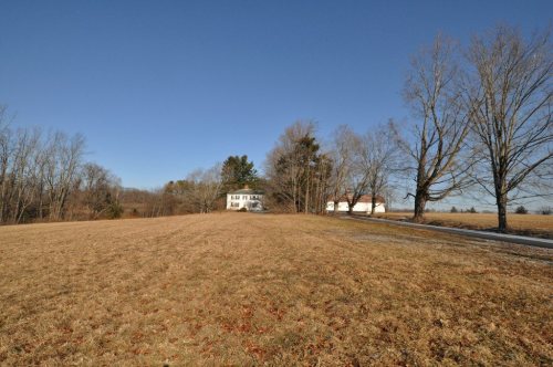
Goffstown dates to 1761, and 12% of its homes were built before 1940
More historic than 85% of U.S. towns · #55 of 126 in New Hampshire. What drives it
8 places in town are on the National Register, among them a historic district with 23 buildings. Below: 4 old photos and papers, maps from 1892 on, and the census since 1790.
Founding year: Wikidata; Wikipedia’s history section gives the same year. First post office: 1813.The full story ↓
History grade
What drives Goffstown’s History grade
On its age, its old homes and the National Register, Goffstown is more historic than 85% of U.S. towns, #55 of 126 in New Hampshire. All 3 inputs are above most U.S. towns; its age ranks highest and its share of homes from before 1940 lowest.
A
HistoryA character grade: shown, never part of Goffstown’s overall grade.
New Hampshire towns list more on the Register than most of the country (a typical New Hampshire town has 9.5 per 10,000 residents, the U.S. 2.4), so Goffstown’s 16.7 sits near the middle of its state (59% of New Hampshire towns have fewer) while its 31 historic buildings outnumber those of 82% of U.S. towns.
How sure. Graded on any two of the three inputs instead, the letter would range from B+ to A. The pre-1940 share is a Census survey estimate (±3.3 points). Two sources give 1761.
Founding year: Wikidata (other dates in Quick answers). Homes: Census ACS 2020–24. National Register: National Park Service, May 2026 list; each listing counted once (boundary changes and added documentation belong to their listing), and a historic district counts its contributing buildings. How TownRatings grades history →
What stands out about Goffstown’s past
Read from the archive, the National Register and the record. The page puts what stands out first.
Prior to the arrival of English colonists, the area had seasonally been inhabited for thousands of years by succeeding cultures of Native Americans; its waterways had numerous fish, and the area had game.
The town was first granted as "Narragansett No. 4" in 1734 by New Hampshire and Massachusetts colonial Governor Jonathan Belcher as a Massachusetts township (the area then being disputed between the two provinces). It was one of seven townships intended for soldiers (or their heirs) who had fought in the "Narragansett War" of 1675, also known as King Philip's War. In 1735, however, some grantees "found it so poor and barren as to be altogether incapable of making settlements," and were instead granted a tract in Greenwich, Massachusetts.
Passages that mention Goffstown, cut from the printed page as they were published.
History of the town of Amherst, Hillsborough County, New Hampshire1883 · page 25Read the page →
Read the text
Buxton, Maine: No. 2, as Westminster, Mass ; Xo. 3 comprised parts of the present towns of Amherst, Merrimack, Milford, and Mont Vernon, New Hampshire; No. 4 included the present town of Goffstown, and a part of the city of Manchester; hut as the grantees reported that " they found the land so poor and barren as to be altogether uncapable of making a settlement!" it was abandoned, and another township, at a place called Quabbin, now Greenwich, Mass.,
Text read by machine from the scan; it may contain errors.
History of Hillsborough County, New Hampshire1885 · page 319Read the page →
Read the text
The town of Goffstown lies in the northeastern part of the founty, and is bounded as follows: North by Merrimack County, east by Merrimack County and Manchester, south by Bedford, and west by Weare and New Boston.
Text read by machine from the scan; it may contain errors.
History of Hillsborough County, New Hampshire1885 · page 338Read the page →
Read the text
hail existed tor several years in this town a branch of the Bai>tist Church at Hopkinton ; but in that year an independent church was formed, including in its meml)ership residents of Goffstown, Bow and Dunbarton. This organization was maintained until March 18, 1820, when it was dissolved, and upon the same day the present church was organized with a membership of thirty-four, including several persons
Text read by machine from the scan; it may contain errors.
History of the town of Amherst, Hillsborough County, New Hampshire1883 · page 350Read the page →
Read the text
At a session of the superior court held at Hopkinton, 21 April, 1821, Daniel Davis Farmer, of Goffstown, was arraigned for the murder of Widow Anna Ayer, of Goffstown, on the sixth day of the same month.
Text read by machine from the scan; it may contain errors.
Scans and text from the Internet Archive. Books published in 1930 or earlier, which are in the public domain.
Timeline
Goffstown, 1761 to 2020
Woven from the archive, old maps, post office records, the National Register and the people born here.
Nothing in the archives for these yearsWeddings on Main Street, storms, parades, school pictures, the old store. If it’s in your family album, it belongs here.
Nothing in the archives for these yearsWeddings on Main Street, storms, parades, school pictures, the old store. If it’s in your family album, it belongs here.
Every edition of the U.S. Geological Survey’s map of Goffstown. Tap a year, or press play to watch the town change.
1927Concord sheet · 1:62,500
U.S. Geological Survey historical topographic maps (public domain), via Esri’s collection of the scans. The red ring marks the center of Goffstown.
Every building
Goffstown, building by building, 1892–1921
Fire insurance maps drew every building, what it was made of and what it was used for, so insurers could price the risk of fire. Pick a year, then a sheet.
In 1761, according to Wikidata and Wikipedia’s history of the town. Goffstown’s post office opened in 1813, and the first U.S. census counted 1,275 people here in 1790.
How does Goffstown rank for history?
Goffstown is more historic than 85% of U.S. towns, #55 of 126 in New Hampshire. The History grade combines the town’s founding era, the share of homes built before 1940 and its National Register listings. It’s a character grade, so it isn’t part of the overall grade. How it works.
What is on the National Register in Goffstown?
8 listings: 6 buildings, 1 historic district, the Goffstown Main Street Historic District, with 23 contributing buildings, and 1 structure. 31 historic buildings in all.
How old are the homes in Goffstown?
12% of Goffstown’s homes were built before 1940 (Census estimate, ±3.3 points), against a typical 17% for a New Hampshire town; the median home was built in 1982.
Founding dates: Wikidata, Wikipedia, the U.S. post office records of Blevins & Helbock (CC0) and the Census. Homes by year built: Census ACS 2020–24. National Register of Historic Places: National Park Service (list of May 22, 2026). Old photos, postcards and papers: Wikimedia Commons, the Library of Congress and other public archives, credited on each item’s page. Maps: U.S. Geological Survey historical topographic maps (via Esri) and Sanborn fire-insurance maps (Library of Congress). History text and census tables: Wikipedia (CC BY-SA 4.0). Places that used to be: USGS Geographic Names Information System (2021).
From Wikimedia Commons (23), Wikidata (1), the National Register of Historic Places (8), Wikipedia, Wikidata and Wikipedia for famous people, U.S. Geological Survey historical maps, U.S. Census counts (via Wikipedia), the US Post Offices dataset (Blevins & Helbock), the USGS Geographic Names Information System, Sanborn fire insurance maps (Library of Congress) and old county and town histories (Internet Archive). Archive images are copied here with their credits and licenses, shown on each photo’s page. Refreshed monthly.


 Date?
 2026
 2024
 2019
 2018
 2014
 2014
 2014
 2014
 2014
 2014
 2013
 2013
 2012
 2008
 2008
 2008
 2008
 2008
 2008