Guest, Sign inJoin

Post to Fayetteville

We’ll email a one-tap link to publish your post. No password, and nothing is public until you click it.
Already a member? Sign in
B+History
History · Fayetteville

Fayetteville dates to 1762, and 56 of its places are on the National Register

More historic than 72% of U.S. towns · #73 of 290 in North Carolina. What drives it

Most of Fayetteville was built recently: 2% of its homes predate 1940 and the median home dates from 1984. 56 places in town are on the National Register, among them the Market House, a National Historic Landmark, and seven historic districts with 206 buildings between them. Below: 8 old photos and papers, maps from 1885 on, and the census since 1790.

1762founded
56on the National Register
2%homes built before 1940
8old photos & papers
36famous people
From Fayetteville’s archive · credits on each photo
Quick answers

How Fayetteville began

When was Fayetteville founded?

1762

Fayetteville dates its founding to 1762 (Wikidata). It appears in the first U.S. census, 1790.

First census: 1,536 in 17902020 census: 208,501264 years

How historic is Fayetteville?

B+

More historic than 72% of U.S. towns, on its age, its old homes and the National Register.

What drives the grade ↓
Founding year: Wikidata. First post office: 1792.The full story ↓
History grade

What drives Fayetteville’s History grade

On its age, its old homes and the National Register, Fayetteville is more historic than 72% of U.S. towns, #73 of 290 in North Carolina. Its age holds the grade up; its share of homes from before 1940 pulls it down.

B+
HistoryA character grade: shown, never part of Fayetteville’s overall grade.
All U.S. towns we grade (21,289)Ahead of 72%
NewerOlder
North Carolina towns of 2,500+ (290)Ahead of 75%

Among the 400 U.S. cities of 100,000 or more, Fayetteville ranks #161 on History.

North Carolina towns list more on the Register than most of the country (a typical North Carolina town has 12.5 per 10,000 residents, the U.S. 2.4), so Fayetteville’s 13.2 sits near the middle of its state (56% of North Carolina towns have fewer) while its 278 historic buildings outnumber those of 95% of U.S. towns.

Newer cities are common at Fayetteville’s size: in the typical U.S. city of 100,000 or more, 5% of homes predate 1940.

NoteThe founding year comes from Wikidata alone; no second source gives 1762.
How sure. Graded on any two of the three inputs instead, the letter would range from C+ to A+. The pre-1940 share (±0.2 points) is firm at this size.

Founding year: Wikidata (other dates in Quick answers). Homes: Census ACS 2020–24. National Register: National Park Service, May 2026 list; each listing counted once (boundary changes and added documentation belong to their listing), and a historic district counts its contributing buildings. How TownRatings grades history →

What stands out about Fayetteville’s past

Read from the archive, the National Register and the record. The page puts what stands out first.

★ What stands out · On the National Register

56 listings protect 278 historic buildings

The country’s official list of buildings and places worth saving. One is a National Historic Landmark, the highest tier. Boundary changes and added documentation are counted with their listing.

places listed
56
National Historic Landmark
1
Market House
historic buildings protected
278
each building in a district counts
first listed
1970
Market House
BuildingsDistricts★ landmark

Architectural styles listings

Greek Revival10
Colonial Revival10
Federal9
Italianate5
Classical Revival5
Queen Anne4
All 56 listings
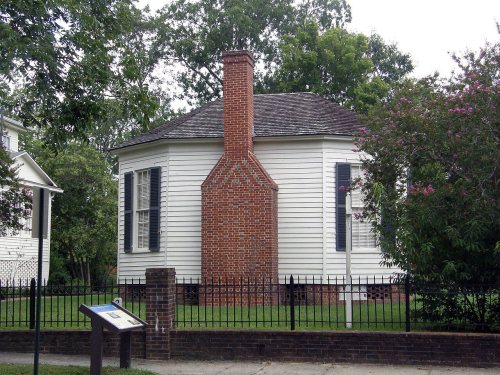
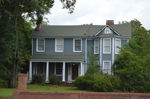
St. John's Episcopal ChurchBuilding · listed 1974Sedberry-Holmes HouseBuilding · listed 1975First Presbyterian ChurchBuilding · listed 1976Cumberland County CourthouseBuilding · listed 1979St. Joseph's Episcopal ChurchBuilding · listed 1982Atlantic Coast Line Railroad StationBuilding · listed 1982Barge's TavernBuilding · listed 1983Camp Ground Methodist ChurchBuilding · listed 1983Cape Fear and Yadkin Valley Railway Passenger DepotBuilding · listed 1983Edgar Allan Poe HouseBuilding · listed 1983Evans Metropolitan AME Zion ChurchBuilding · listed 1983Fayetteville Mutual Insurance Company BuildingBuilding · listed 1983First Baptist ChurchBuilding · listed 1983Hay Street Methodist ChurchBuilding · listed 1983Henry McLean HouseBuilding · listed 1983Holt-Harrison HouseBuilding · listed 1983John Davis HouseBuilding · listed 1983John E. Patterson HouseBuilding · listed 1983M & O Chevrolet CompanyBuilding · listed 1983Market House Square DistrictDistrict · listed 1983McCall HouseBuilding · listed 1983Phoenix Masonic Lodge No. 8Building · listed 1983Prince Charles HotelBuilding · listed 1983Strange, Robert, Country HouseBuilding · listed 1983Taylor-Utley HouseBuilding · listed 1983U.S. Post OfficeBuilding · listed 1983Waddill's StoreBuilding · listed 1983William McDiarmid HouseBuilding · listed 1983Haymount DistrictDistrict · listed 1983Orange Street SchoolBuilding · listed 1987Cross Creek Cemetery Number OneDistrict · listed 1998North Durham County Prison Camp (Former)Building · listed 1998Fayetteville Downtown Historic DistrictDistrict · listed 1999Frank H. Stedman HouseBuilding · listed 2002BrownleaBuilding · listed 2003Massey Hill High SchoolBuilding · listed 2004Seventy-First Consolidated SchoolBuilding · listed 2004Capitol, TheBuilding · listed 2005Haymount Historic DistrictDistrict · listed 2007Dr. William C. Verdery HouseBuilding · listed 2007Fayetteville Veterans Administration Hospital Historic DistrictDistrict · listed 2012Dr. Ezekiel Ezra Smith HouseBuilding · listed 2015Long Street ChurchBuilding · listed 1974WestlawnBuilding · listed 1980Carolina TheaterBuilding · listed 1983Fayetteville Ice and Manufacturing Company:Plant and Engineer's HouseBuilding · listed 1983Gully MillBuilding · listed 1983John A. Oates HouseBuilding · listed 1983

National Park Service, National Register of Historic Places. Photos from Wikimedia Commons, credited on each place’s page.

Places that used to be

Lost post offices, old corners, places now gone and burying grounds

Fayetteville’s post office has been open since 1792. Two other post offices opened and closed inside today’s town.

Fayetteville
1792–today
Cumberland
1886–today
Lakedale
1916–1951
Fort Bragg
1922–1941
17901910today
Hamlets and corners on the map
Anzio AcresArran HillsArran LakesArran Lakes NorthArran Lakes WestAscot IIBastogne GablesBeaver CreekBizza RidgeBluesprings WoodsBones FordBonnie DooneBordeauxBorden HeightsBougainvilleBrentwoodBridle CreekBroad AcresBroadellCade HillCambridgeCasablancaCherbourgChestnut Hills
Gone or out of use
Beard AirportairportFayetteville VAH AirportairportSaint James Inn Airportairport
2cemeteries and burying grounds inside Fayetteville
Cross CreekLafayette Memorial

US Post Offices dataset (Blevins & Helbock, CC0). Places and cemeteries from the USGS Geographic Names Information System (2021).

The story

How Fayetteville came to be

From Wikipedia’s history of Fayetteville.

Read it all →

Merchants in Wilmington wanted a town on the Cape Fear River to secure trade with the frontier country. They were afraid people would use the Pee Dee River and transport their goods to Charleston, South Carolina. The merchants bought land from Newberry in Cross Creek. Campbelton became a place where poor whites and free blacks lived and gained a reputation for lawlessness.

Text from Wikipedia, licensed CC BY-SA 4.0.

Timeline

Fayetteville, 1762 to 1973

Woven from the archive, old maps, post office records, the National Register and the people born here.

  1. 18th century
  2. 1762
    FoundingFayetteville is established
  3. 1792Post officeThe Fayetteville post office opens
  4. 19th century
  5. 1814In the archiveLa fayette ville
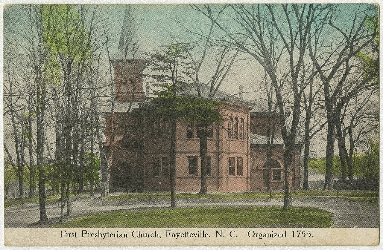
  6. 1816BuiltFirst Presbyterian Church is built
  7. 1825In the archiveFayetteville NC 1825
  8. 1827Born hereHiram Rhodes Revels is born here
  9. 1861In the archiveLetter from J.J. Prather to his nephew (April 29, 1861) (a5a12056-6024-49cb-8783-d52e51f6…
  10. 1875BuiltHenry McLean House is built
  11. 1886Post officeThe Cumberland post office opens
  12. 20th century
  13. 1911BuiltAtlantic Coast Line Railroad Station is built
  14. 1911In the archiveGrape harvest in Fayetteville, 1911
  15. 1916Post officeThe Lakedale post office opens
  16. 1923In the archiveFayetteville NC Presby PHS1047
  17. 1937BuiltM & O Chevrolet Company is built
  18. 1948On the mapFirst mapped by the U.S. Geological Survey
  19. 1951Post officeThe Lakedale post office closes
  20. 1953Born hereEllen S. Baker is born here
  21. 1973LandmarkMarket House named a National Historic Landmark
By decade

Fayetteville, decade by decade

5 decades in the archive, from the 1810s to the 1920s. Scroll each row; tap a photo for its story.

On the map

Fayetteville on the map, 1948 to 1997

Every edition of the U.S. Geological Survey’s map of Fayetteville. Tap a year, or press play to watch the town change.

Fayetteville on the 1948 USGS mapFayetteville on the 1950 USGS mapFayetteville on the 1971 USGS mapFayetteville on the 1982 USGS mapFayetteville on the 1997 USGS map1948Fayetteville sheet · 1:62,500

U.S. Geological Survey historical topographic maps (public domain), via Esri’s collection of the scans. The red ring marks the center of Fayetteville.

Every building

Fayetteville, building by building, 1885–1923

Fire insurance maps drew every building, what it was made of and what it was used for, so insurers could price the risk of fire. Pick a year, then a sheet.

Fayetteville fire insurance map, 1885, sheet 11885Sheet 1 of 2
Edition
BrickWoodStone

Sanborn Map Company, via the Library of Congress. Editions published in 1930 or earlier, which are in the public domain.

Then & now

Stand where they stood

No then-and-now pairs yet. Take a photo from the same spot as an old one and they appear here side by side.

Grape harvest in Fayetteville, 1911
Retake this viewGrape harvest in Fayetteville, 1911, 1911

Find the spot, match the angle, and add your photo. It becomes the first then-and-now pair on Fayetteville’s page.

Retake this view · +15
People over time

Fayetteville, census by census

020,00040,00060,00080,000100,000120,000140,000160,000180,000200,000220,00018001850190019502000208,501

Grew from 1,536 people in 1790 to 208,501 in 2020, more than tenfold.

22 censuses, 1790–2020.

U.S. Census Bureau decennial counts, from the census table on Fayetteville’s Wikipedia page.

Famous people

36 famous people were born in Fayetteville

Writers, athletes, leaders and more, ranked by how widely they’re known.

See all →
Help out

Finish Fayetteville’s story

Most archives stop around 1920. The photos from after that are in family albums, not libraries.

Decades since 1900 with photos
00s10s20s30s40s50s60s70s80s90s
2 of 10 decades. The empty ones are waiting for someone’s album.
Stories next door

History across the town line

Each neighbor’s History grade, on the same three inputs.

Questions about Fayetteville’s history

What year was Fayetteville founded?

In 1762, according to Wikidata. Fayetteville’s post office opened in 1792, and the first U.S. census counted 1,536 people here in 1790.

How does Fayetteville rank for history?

Fayetteville is more historic than 72% of U.S. towns, #73 of 290 in North Carolina. The History grade combines the town’s founding era, the share of homes built before 1940 and its National Register listings. It’s a character grade, so it isn’t part of the overall grade. How it works.

What is on the National Register in Fayetteville?

56 listings: 49 buildings, among them the Market House (a National Historic Landmark since 1973), and 7 historic districts with 206 contributing buildings. 278 historic buildings in all.

How old are the homes in Fayetteville?

2% of Fayetteville’s homes were built before 1940 (Census estimate), against a typical 4.1% for a North Carolina town; the median home was built in 1984.

Memory lane

What the archives can’t tell you, neighbors can.

Town Square →
Start a conversation
Sources

Where this page comes from

Founding dates: Wikidata, Wikipedia, the U.S. post office records of Blevins & Helbock (CC0) and the Census. Homes by year built: Census ACS 2020–24. National Register of Historic Places: National Park Service (list of May 22, 2026). Old photos, postcards and papers: Wikimedia Commons, the Library of Congress and other public archives, credited on each item’s page. Maps: U.S. Geological Survey historical topographic maps (via Esri) and Sanborn fire-insurance maps (Library of Congress). History text and census tables: Wikipedia (CC BY-SA 4.0). Places that used to be: USGS Geographic Names Information System (2021).

From Wikimedia Commons (6), the Library of Congress (2), Wikidata (4), the National Register of Historic Places (56), Wikipedia, Wikidata and Wikipedia for famous people, U.S. Geological Survey historical maps, U.S. Census counts (via Wikipedia), the US Post Offices dataset (Blevins & Helbock), the USGS Geographic Names Information System and Sanborn fire insurance maps (Library of Congress). Archive images are copied here with their credits and licenses, shown on each photo’s page. Refreshed monthly.