Lee's Summit’s post office opened in 1865, and 20 of its places are on the National Register
More historic than 51% of U.S. towns · #116 of 247 in Missouri. What drives it
Most of Lee's Summit was built recently: 3% of its homes predate 1940 and the median home dates from 1994. 20 places in town are on the National Register, among them ten historic districts with 373 buildings between them. Below: maps from 1893 on and the census since 1880.
The Lee's Summit post office opened in 1865, the earliest record of the town by name. Two smaller post offices, Jackson Court House (1827) and Strother (1866), opened inside today’s city and later closed.
First census: 693 in 18802020 census: 101,108161 years
How historic is Lee's Summit?
B−
More historic than 51% of U.S. towns, on its age, its old homes and the National Register.
Founding year: the first Lee's Summit post office (Blevins & Helbock, CC0).The full story ↓
History grade
What drives Lee's Summit’s History grade
On its age, its old homes and the National Register, Lee's Summit is more historic than 51% of U.S. towns, #116 of 247 in Missouri. Its National Register listings hold the grade up; its share of homes from before 1940 pulls it down.
B−
HistoryA character grade: shown, never part of Lee's Summit’s overall grade.
Among the 400 U.S. cities of 100,000 or more, Lee's Summit ranks #235 on History.
Missouri towns list about as much on the Register as the country (a typical Missouri town has 2.4 per 10,000 residents, the U.S. 2.4), so Lee's Summit’s 39.0 sits above most of its state (86% of Missouri towns have fewer) while its 404 historic buildings outnumber those of 96% of U.S. towns.
Newer cities are common at Lee's Summit’s size: in the typical U.S. city of 100,000 or more, 5% of homes predate 1940.
How sure. Graded on any two of the three inputs instead, the letter would range from C− to B+. The pre-1940 share (±1.3 points) is firm at this size. The founding year is the first post office, not a stated founding date.
Founding year: the first post office (other dates in Quick answers). Homes: Census ACS 2020–24. National Register: National Park Service, May 2026 list; each listing counted once (boundary changes and added documentation belong to their listing), and a historic district counts its contributing buildings. How TownRatings grades history →
What stands out about Lee's Summit’s past
Read from the archive, the National Register and the record. The page puts what stands out first.
The region encompassing present-day Lee’s Summit has been inhabited by humans for at least 10,000 years. Archaeological evidence suggests continuous human occupation within the present-day boundaries of Lee’s Summit dating back roughly 9,000 years. For example, archaeologists have discovered stone arrowheads characteristic of the Dalton tradition in Lee's Summit, indicating that humans occupied the area at least 9,000 years ago. At another site in the city, arrowheads and ceramics characteristic of the Kansas City Hopewell culture were discovered, indicating that humans had temporary campsites in the area roughly 2,000 years ago. Stone tools and organic remains suggest that temporary campsites in what is now Lee's Summit were used to hunt for deer, bison, and other small mammals, roughly 700 years ago.
Passages that mention Lee's Summit, cut from the printed page as they were published.
The History of Jackson county, Missouri, containing a history of the county, its cities, towns, etc., biographical sketches of its citizens, Jackson county in the late war... history of Missouri, map of Jackson county ..1881 · page 951Read the page →
Read the text
plants, collecting, etc. He continued in this business until the year 1872, when he became engaged in the wholesale nursery business for Mr. Balis, of Lee's Summit, and continued with him for one year, when he went into the boot and shoe business at Lee's Summit, and continued this business for one year when he traded his interest in the store for a farm near the town of Lee's Summit. Has now a nice hedge nursery near Lee's Summit, of about twelve acres. He was married on the 22nd of August, 1872, to Miss Mary A, Cass, of Jackson County.
Text read by machine from the scan; it may contain errors.
The History of Jackson county, Missouri, containing a history of the county, its cities, towns, etc., biographical sketches of its citizens, Jackson county in the late war... history of Missouri, map of Jackson county ..1881 · page 952Read the page →
Read the text
He was finally released on abondof $25,000. Then took his family, and removed to Kentucky, where his wife died. Afterward returned to this county, and engaged in farming. In 1865 he laid out ttie town of Lee's Summit, the original plat containing seventy acres. Two years afterward, he made his first addition, containing eighty acres more. In order to secure the depot at this place, he gave the railroad half of four blocks and grounds for the depot site. He has also given lots to churches, and donated two acres for a cemetery. The town was called by a different name at first, but it was afterward changed to its presen name.
Text read by machine from the scan; it may contain errors.
Scans and text from the Internet Archive. Books published in 1930 or earlier, which are in the public domain.
Timeline
Lee's Summit, 1827 to 1999
Woven from the archive, old maps, post office records, the National Register and the people born here.
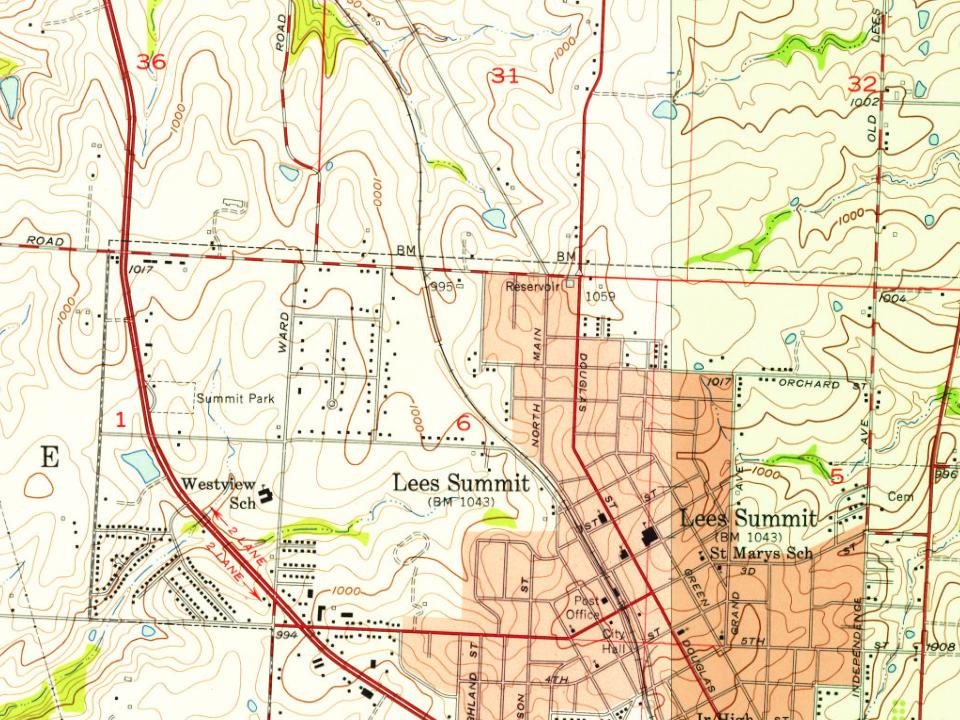
Every edition of the U.S. Geological Survey’s map of Lee's Summit. Tap a year, or press play to watch the town change.
1934Lees Summit sheet · 1:24,000
U.S. Geological Survey historical topographic maps (public domain), via Esri’s collection of the scans. The red ring marks the center of Lee's Summit.
Every building
Lee's Summit, building by building, 1893–1927
Fire insurance maps drew every building, what it was made of and what it was used for, so insurers could price the risk of fire. Pick a year, then a sheet.
1893Sheet 1 of 1
Edition
Sheets
BrickWoodStone
Sanborn Map Company, via the Library of Congress. Editions published in 1930 or earlier, which are in the public domain.
People over time
Lee's Summit, census by census
Grew from 693 people in 1880 to 101,108 in 2020, more than tenfold.
15 censuses, 1880–2020.
U.S. Census Bureau decennial counts, from the census table on Lee's Summit’s Wikipedia page.
Famous people
20 famous people were born in Lee's Summit
Writers, athletes, leaders and more, ranked by how widely they’re known.
Lost post offices, old corners, places now gone and burying grounds
Two other post offices opened and closed inside today’s town.
Jackson Court House
1827–1827
Lees Summit
1865–today
Strother
1866–1868
18201920today
Hamlets and corners on the map
Lees SummitLongviewSouth Lee
Gone or out of use
Colburn SchoolschoolDelta SchoolschoolHigh Mound SchoolschoolLone Oak SchoolschoolMaple Grove SchoolschoolRadio Control Flying FieldairportTennison Schoolschool
1cemetery inside Lee's Summit
Lee's Summit
US Post Offices dataset (Blevins & Helbock, CC0). Places and cemeteries from the USGS Geographic Names Information System (2021).
Stories next door
History across the town line
Each neighbor’s History grade, on the same three inputs.
The Lee's Summit post office opened in 1865, the earliest record of the town by name (U.S. post office records).
How does Lee's Summit rank for history?
Lee's Summit is more historic than 51% of U.S. towns, #116 of 247 in Missouri. The History grade combines the town’s founding era, the share of homes built before 1940 and its National Register listings. It’s a character grade, so it isn’t part of the overall grade. How it works.
What is on the National Register in Lee's Summit?
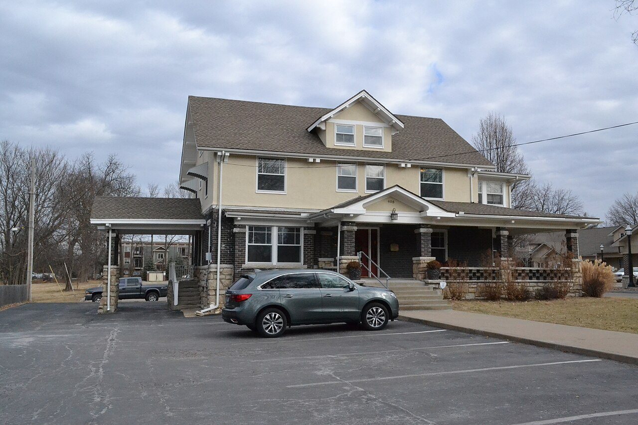
20 listings: 7 buildings, among them the Saint Paul's Episcopal Church (listed 1985, the first), and 13 historic districts with 373 contributing buildings. 404 historic buildings in all.
How old are the homes in Lee's Summit?
3% of Lee's Summit’s homes were built before 1940 (Census estimate, ±1.3 points), against a typical 8.4% for a Missouri town; the median home was built in 1994.
Founding dates: Wikidata, Wikipedia, the U.S. post office records of Blevins & Helbock (CC0) and the Census. Homes by year built: Census ACS 2020–24. National Register of Historic Places: National Park Service (list of May 22, 2026). Old photos, postcards and papers: Wikimedia Commons, the Library of Congress and other public archives, credited on each item’s page. Maps: U.S. Geological Survey historical topographic maps (via Esri) and Sanborn fire-insurance maps (Library of Congress). History text and census tables: Wikipedia (CC BY-SA 4.0). Places that used to be: USGS Geographic Names Information System (2021).
From Wikimedia Commons (12), the National Register of Historic Places (20), Wikipedia, Wikidata and Wikipedia for famous people, U.S. Geological Survey historical maps, U.S. Census counts (via Wikipedia), the US Post Offices dataset (Blevins & Helbock), the USGS Geographic Names Information System, Sanborn fire insurance maps (Library of Congress) and old county and town histories (Internet Archive). Archive images are copied here with their credits and licenses, shown on each photo’s page. Refreshed monthly.









 2018
 2014
 2013
 2013
 2013
 2013
 2013
 2013
 2013
 2011
 2010
 2006