Guest, Sign inJoin

Post to West St. Paul

We’ll email a one-tap link to publish your post. No password, and nothing is public until you click it.
Already a member? Sign in
West St. Paul, MN
Minnesota›Dakota County

West St. PaulMN

A town of 21,950, settled in 1857.

Trash & recycling
4 bordering townsMap →
Photo: DanNowicki · CC BY-SA 4.0
Photo of West St. Paul

West St. Paul, MN · Photo: DanNowicki · CC BY-SA 4.0 · Source ↗

Is West St. Paul a good place to live?

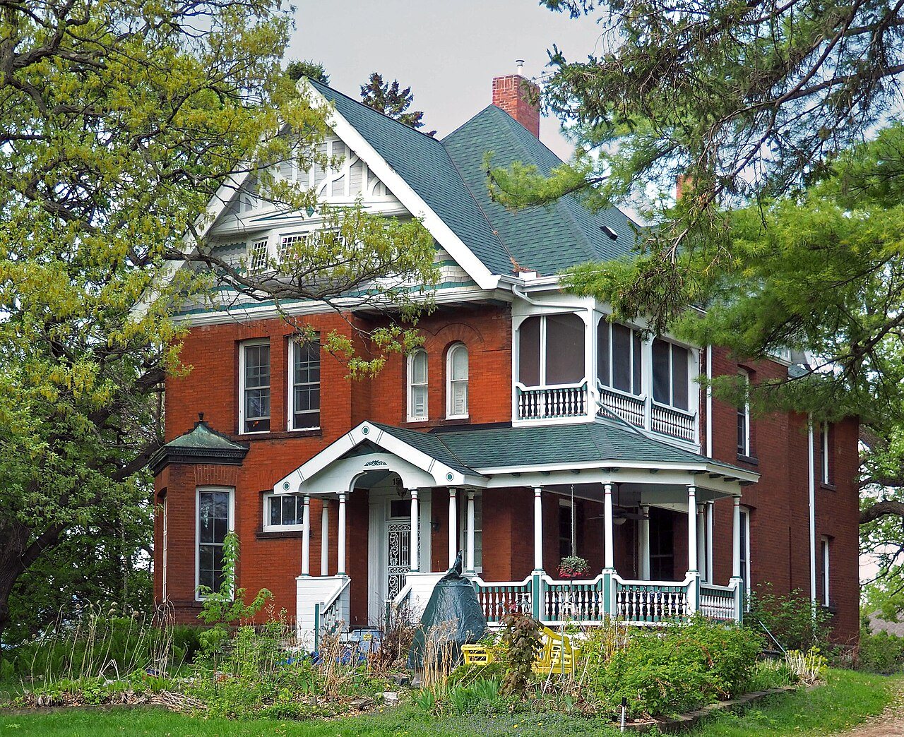
West St. Paul grades B− overall, 217th among Minnesota's 271 graded towns, with clear strengths and some subjects that lag. It is easier to get around on foot or by transit than 90% of U.S. towns and natural-hazard risk is low. On the other side, its police reported 59 violent crimes reported to the FBI in 2025, a higher rate per resident than 90% of U.S. towns. West St. Paul’s property crime rate is 37.6 per 1,000 residents, above both the Minnesota town median (8.6) and the median of U.S. towns (9.9). Among 274 Minnesota towns, just 4 have a higher January low than West St. Paul. George W. Wentworth House is on the National Register of Historic Places.

What makes West St. Paul stand out

Where West St. Paul beats most towns, and one thing worth knowing.

How West St. Paul grades

Each subject compared with towns across the country (schools within Minnesota), ordered by how far West St. Paul is from typical.

How grading works
Character Graded, but not part of the overall grade.
Described, not graded Taste, not quality: snow or an older crowd is neither good nor bad.

How TownRatings grades towns →

George W. Wentworth House
George W. Wentworth House · National Register of Historic Places
West St. Paul’s story

169 years in pictures

Census counts: 1,596 in 1890, 20,615 in 2020. The archive holds 6 old photos and papers going back to 1874 and 6 maps from 1896 on.

1 place on the National Register of Historic Places.

  • 1857West St. Paul is settled
Explore the history →
Nearby attractions

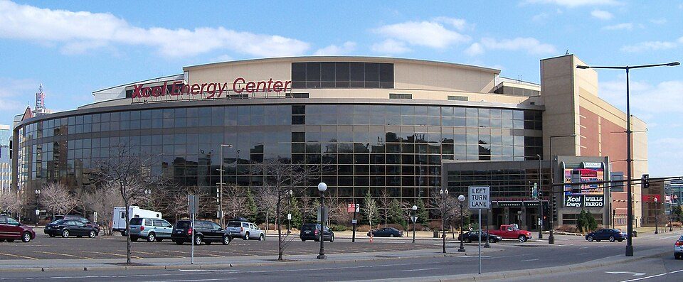
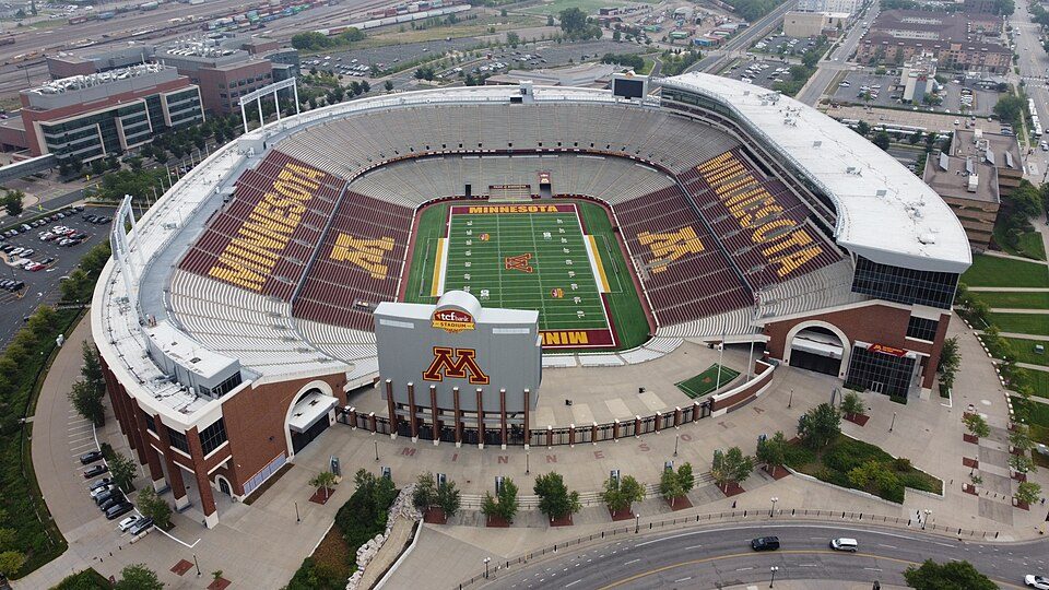
U.S. Bank Stadium and 70 more within 40 miles

Museums, parks, gardens and other places to visit around West St. Paul. Close and well known come first.

All 74 attractions →
Sources: National Park Service · ski areas © OpenSkiMap / OpenStreetMap contributors · Wikidata · Wikipedia readership · photos via Wikimedia Commons
Photo credits

U.S. Bank Stadium: Darb02, CC BY-SA 4.0 · Grand Casino Arena: AlexiusHoratius, CC BY-SA 3.0 · Huntington Bank Stadium: Lectrician2, CC BY-SA 4.0 · Target Field: Lectrician2, CC BY-SA 4.0 · Fort Snelling: en:User:The Statue With The Dictionary, CC BY-SA 3.0 · Allianz Field: Andy Witchger, CC BY 2.0

Getting set up

Moving to West St. Paul: who provides what

Who provides power, water and the rest in West St. Paul, and how to reach them.

The full setup list →
PowerXcel Energy17.1¢/kWh · EIA 2025HIFLD · EIA
WaterSaint Paul Regional Water Services1 health-based violation in 5 years · EPAEPA
Internet7 providers100% of addresses get 100/20 MbpsFCC
Trash & dumpHire your ownNo town pickup: you hire a private haulerTown site
SchoolsWest St. Paul-Mendota Heights-EaganWhich school depends on your addressNCES
Register to voteOnlineIn Minnesota you can register online until 21 days before Election Day, in person up to and including Election Day, or by mail (received 21 days before).vote.gov
Who runs elections hereDakota County ElectionsDakota County; contacts on the Handbook page.FVAP, Aug 2015
ZIP code5511855118 100%Census 2020

EPA SDWIS (Oct 9, 2026) · HIFLD + EIA-861 2025 · Census 2020 ZCTAs · NCES 2024–25 · registration: vote.gov, updated Nov 18, 2024.

The data

Ordered by what stands out in West St. Paul.

West St. Paul is healthier than towns with similar incomes and gets more snow than most of the country, though not than most of Minnesota; it also reports property crime at about twice the Minnesota rate.

OutdoorsA−

4.8% of the land in West St. Paul is protected from building

The trail network density in West St. Paul is 1.2 miles per square mile. In 13 parks and preserves, walkers have 5.9 miles of trail. Dodge Nature Center, at 156 acres with 2.9 miles of trail, is the biggest park or preserve.

#35for trails in MN
West St. PaulMinnesota townsU.S. towns
Miles of trail per square mile1.2 miles per square mile0.50.4
Conserved land4.8%4.6%4.3%
4.8%
conserved · 153 of 3,194 acres
5.9 mi
of trails · 1.2 per sq mi
Biggest places to walkTrailsAcres
1. Dodge Nature Center2.9 mi156
2. Thompson County Park1.6 mi58
3. Harmon Park0.9 mi19

Trails & parks © OpenStreetMap contributors · Conserved land: USGS PAD-US

SchoolsB

West St. Paul’s public schools outperform 60% of Minnesota districts

Its public schools are run by the West St. Paul-Mendota Heights-Eagan school district. Two of its 16 schools are below, each with the reason it’s listed. Public school enrollment locally: 783 students across 2 schools.

60%of MN districts it outscoresBSchool Grade
SchoolLevelStudentsLetter
Heritage E-STEM Magnet SchoolLargest public middle schoolGrades 5–8Grades 5–8761C+
Academic Arts High SchoolLargest public high schoolGrades 9–12Grades 9–1278–

NCES · EDFacts · graded within MN on state tests and graduation

SafetyD

West St. Paul’s grade for safety is a D

Property crime runs at 37.6 per 1,000 residents, about twice the Minnesota rate, most of it theft.

For West St. Paul, the violent offense rate is 2.6 per 1,000 residents.

10%of U.S. towns report more crimeDSafety Grade

Violent crime per 1,000 residents

West St. Paul2.6
Minnesota2.3
U.S.3.3

Property crime per 1,000 residents

West St. Paul37.6
Minnesota14.3
U.S.15.5
10th
percentile among U.S. towns we grade
4th
percentile among MN towns
59
violent crimes reported in 2025
838
property crimes reported in 2025

FBI crime data, 2025 · crimes reported to police

Natural hazardsHazard risk grade A

Natural hazards: very low risk in West St. Paul, mostly tornadoes

Households in West St. Paul have drawn federal disaster aid once, in 2012. FEMA expects less storm and flood damage here than in 85% of U.S. communities. Expected losses in West St. Paul break down as 30% from tornadoes and 28% from inland flooding. Since 1997, West St. Paul has seen 4 flood insurance claims paid out.

15risk score of 100
FEMA risk score
15Very low riskLowerHigher
TornadoesInland floodingStrong wind
4
paid flood claims since 1997
1
federal disasters paid out here

FEMA disaster declarations and aid · FEMA flood insurance claims · FEMA National Risk Index · OpenFEMA

HealthB+

On CDC estimates, West St. Paul is healthier than two in three U.S. towns

Against the 10,383 U.S. towns with household incomes like West St. Paul’s, it is healthier than 84%, so its B+ isn’t only a matter of income. Within Minnesota it is less healthy than 66% of the 271 graded towns: Minnesota sets a high bar.

Among adults in West St. Paul, 30% sleep under 7 hours. Two figures for adults here: 27% get no exercise outside work, 15% report frequent mental distress.

66%healthier than U.S. townsB+Health Grade
West St. PaulMinnesota townsU.S. towns
Sleep under 7 hours (CDC PLACES)30%30%36%
Get no exercise (CDC PLACES)27%23%25%
No health insurance, 18–64 (CDC PLACES)10%7.3%8.1%
Frequent mental distress (CDC PLACES)15%16%17%
32 measures vs. Minnesota
0 better28 too close to call4 worse
What stands outWest St. PaulMN
More uninsured adults10.4%7.5%
More adults who get no exercise26.9%22.3%
More adults facing a utility shut-off6.8%5.7%
Allina United Hospital
3 mi away · emergency room
None
primary care, dental or mental-health shortage
34th
percentile among MN towns

CDC PLACES 2025 · modeled estimates for adults · CMS · HRSA

Climate

Snowy winters and pleasant summers: that is West St. Paul’s year

The U Of Mn St Paul weather station, 8 miles away, records that 40 inches of snow fall in a normal winter: more than most of the country, but less than 83% of Minnesota places with climate records. January nights average 7.3°: colder than most of the country, but milder than 98% of Minnesota places with climate records; July afternoons average 82°.

The typical July afternoon high for West St. Paul comes to 82°F.

40″snow a winter

Typical low → high °F

Winter11–26°
Spring36–55°
Summer61–80°
Fall39–57°
Oct 12
typical first frost
Apr 26
typical last frost
+1.4°
vs. the 20th-century average

NOAA U.S. Climate Normals, 1991–2020

Work & commuteJobs & income grade B

West St. Paul has 0.8 jobs per working resident, so most workers leave town for work

In West St. Paul, the middle household income is $68,000. Commuting out is the norm here: 8% of working residents work locally. For workers locally, the share who work from home is 20%. The top destinations are St. Paul (20%), Minneapolis (13%) and Eagan (6%).

8%work in town
West St. PaulMinnesota townsU.S. towns
Work from home20%14%11%
Median household income$68,000$91,000$80,000
Average trip to work22 minutes23 minutes25 minutes
Below the poverty line8.9%7%9.6%

Where working residents work

In West St. Paul8%
St. Paul20%
Minneapolis13%
Eagan6%
Bloomington4%
9 mi
median commute distance
7,537
jobs based in West St. Paul
Balanced
jobs vs. working residents
A
Walkability grade: more walkable than 90% of U.S. towns

Census LEHD 2023 · ACS

HousingCost of living grade B−

Homes in West St. Paul are worth about $318K, by Zillow’s estimate

Typical home values rose 2.4% in the year to September 2026. In West St. Paul, 57% of households live in a home they own. On the market locally: a median 23 days to sell.

$318KZillow home value
West St. PaulMinnesota townsU.S. towns
Households that own their home57%75%73%
Median rent$1,282 a month$1,192 a month$1,185 a month

Typical home value

West St. Paul$318K
Minnesota$349K
Market temperature
Seller’s marketA strong seller's marketBuyer’sSeller’s
23
days on market
100.8%
sale-to-list price
+2.4%
value change, 1 year
19
homes sold in May

Census ACS, 2020–24 · Zillow Home Value Index · Redfin Data Center

Who lives here

An age mix much like Minnesota’s

No broad age group is more than 4 points off the Minnesota average. West St. Paul: 20% of residents are under 18. Population is up 6.5% locally since 2020, to 21,950 by the Census Bureau’s 2025 estimate. College graduates make up just over a third of adults 25 and older, against 39% across Minnesota.

39.8median age · MN 38.8
West St. PaulMinnesota townsU.S. towns
Under 1820%23%22%
Aged 65 or older21%17%18%
Bachelor’s degree or more, 25+35%33%29%
West St. PaulMinnesotaUnited States

Ages · share of residents

Education · adults 25 and older

No diploma8%
High school25%
Some college22%
Associate’s10%
Bachelor’s24%
Graduate12%

Women and men · all residents

54% women, 46% men

About 85 men for every 100 women (the survey’s margin: ±2.2 points). Across Minnesota, 49.9% of residents are women.

Ages and education in West St. Paul
West St. PaulMNU.S.
Under 1010.4%12.1%11.6%
10 to 179.2%10.7%10.3%
18 to 248.9%8.8%9.1%
25 to 3416.1%13%13.7%
35 to 4413%13.5%13.2%
45 to 5411.2%11.6%12.2%
55 to 6410.7%12.9%12.7%
65 to 7411.4%10.2%10.2%
75 and older9.1%7%7%
No diploma7.5%6.1%10.4%
High school24.5%23.3%26%
Some college22.1%19.5%19.1%
Associate’s10.4%11.8%8.8%
Bachelor’s23.5%25.6%21.6%
Graduate11.9%13.8%14.1%

Census population estimates, 2025 · U.S. Census Bureau · ACS 2020-2024 5-year estimates

Keep exploring

Everything we know about West St. Paul

20pages on West St. Paul
After high school

Colleges nearby

26 within 15 miles of the center of West St. Paul

Famous people from West St. Paul

8 notable people were born in West St. Paul.

See all 8 →

About West St. Paul

City in Minnesota, United States

Official town website ↗

West St. Paul is a city in Dakota County, Minnesota, United States. The population was 20,615 at the 2020 census. It is immediately south of Saint Paul and immediately west of South St. Paul.

From Wikipedia, licensed CC BY-SA 4.0 · facts via Wikidata (CC0)

Area
5.0 sq mi
Elevation
1,027 ft
Area code
651

West St. Paul’s neighbors

4 towns share a border with West St. Paul.

Explore the map →
How the neighbors grade
TownMN rankOverallCostSafetySchoolsHealth
West St. Paul#217B−B−DBB+
South St. Paul#206BBC+CB+
Inver Grove Heights#89AC+C+B+A
St. Paul#259CC+DC−B+
Sunfish Lake——————

Sunfish Lake isn’t graded (fewer than 1,000 residents, or not enough data). Compare West St. Paul with a neighbor →

Questions about West St. Paul

Short answers, built from the data on this page.

Is West St. Paul, MN a good place to live?

West St. Paul grades B− overall, better than 50% of U.S. towns and #217 of 271 in Minnesota. It grades B+ for health, D for safety and B for schools. Safety is its weak spot, with a D.

Is West St. Paul, MN expensive?

That is 3.2 years of the area's median household income ($99,833 across the Minneapolis-St. Paul-Bloomington, MN-WI metro area). Cost of living, which also weighs rents, property taxes and how many households pay 30% or more of their income for housing, grades B−.

What is West St. Paul, MN known for?

8 notable people were born here, including Harold Stassen and Paul Johnson.