More historic than 74% of U.S. towns · #94 of 143 in Maine. What drives it
3 places in town are on the National Register, among them a historic district with 5 buildings. Below: 4 old photos and papers, maps from 1892 on, and the census since 1800.
On its age, its old homes and the National Register, Readfield is more historic than 74% of U.S. towns, #94 of 143 in Maine. All 2 inputs are above most U.S. towns; its National Register listings ranks highest and its share of homes from before 1940 lowest.
B+
HistoryA character grade: shown, never part of Readfield’s overall grade.
Maine towns list more on the Register than most of the country (a typical Maine town has 15.9 per 10,000 residents, the U.S. 2.4), so Readfield’s 26.4 sits near the middle of its state (65% of Maine towns have fewer) while its 7 historic buildings outnumber those of 73% of U.S. towns.
How sure. Graded on two of the three inputs, so a change in either one moves the letter more than it would with three. The pre-1940 share is a Census survey estimate (±6.9 points).
Founding year: our sources. Homes: Census ACS 2020–24. National Register: National Park Service, May 2026 list; each listing counted once (boundary changes and added documentation belong to their listing), and a historic district counts its contributing buildings. How TownRatings grades history →
What stands out about Readfield’s past
Read from the archive, the National Register and the record. The page puts what stands out first.
Lost half of its people between 1840 and 1930, then more than doubled.
23 censuses, 1800–2020.
U.S. Census Bureau decennial counts, from the census table on Readfield’s Wikipedia page.
On the map
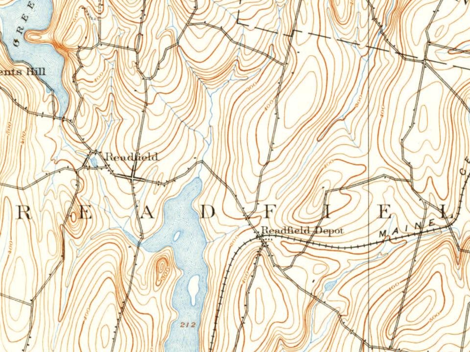
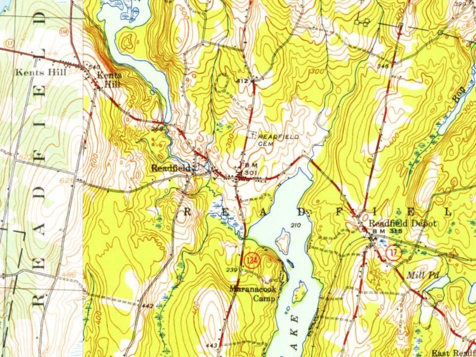
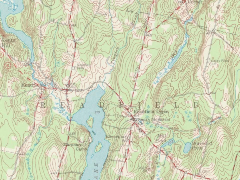
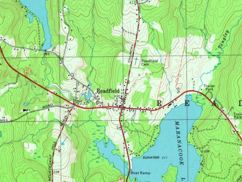
Readfield on the map, 1892 to 2000
Every edition of the U.S. Geological Survey’s map of Readfield. Tap a year, or press play to watch the town change.
1892Augusta sheet · 1:62,500
U.S. Geological Survey historical topographic maps (public domain), via Esri’s collection of the scans. The red ring marks the center of Readfield.
The story so far
Readfield, in brief
Wikipedia doesn’t have a history of Readfield yet. The photos, dates and memories neighbors add here are how it gets written.
Readfield ( REED-field) is a town in Kennebec County, Maine, United States. The population was 2,597 at the 2020 census. Readfield is home to the Kents Hill School, a preparatory school, Maranacook Community Schools, public schools for the district, a few summer camps, and the annual Readfield Heritage Days. A popular recreation spot in central Maine, the town contains nine lakes and ponds, including Maranacook Lake, and is part of the Winthrop Lakes Region. The town of Readfield was previously named Pond Town. Readfield is included in the Augusta, Maine micropolitan and included in the Lewiston-Auburn, Maine metropolitan New England City and Town Area.
Its population held steady between the last two censuses: 2,598 in 2010, 2,597 in 2020.
Intro from Wikipedia. Population: U.S. Census Bureau.
From the old history books
What they wrote about Readfield, 1892–1898
Passages that mention Readfield, cut from the printed page as they were published.
Illustrated history of Kennebec County, Maine1892 · page 898Read the page →
Read the text
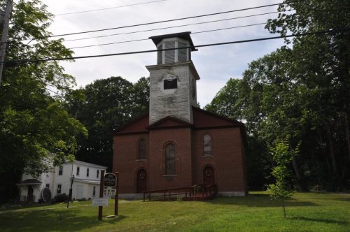
Churches. — The large brick meeting house at Readfield Corner was probably built in 1827. An extract from the first page of its records reads: " The undersigned, owners and proprietors of the Meeting house recently erected at Readfield Corners, hereby represent that they are desirous of becoming a legal corporation by the name and style of the Readfield Union Meeting House Company."
Text read by machine from the scan; it may contain errors.
Illustrated history of Kennebec County, Maine1892 · page 899Read the page →
Read the text
at the .school house in District No. 5, until April 20, 1839, on which date a meeting was held in the Union meeting house, the last entry in the records of which reads: " I have returned into the clerk's office of the town of Readfield a list of the members belonging to said society, being one hundred and twenty. L. Myrick Morrell, Clerk." All of the names are copied in the records, and no women's names appear in the list.
Text read by machine from the scan; it may contain errors.
History of the town of Wayne, Kennebec County, Maine, from its settlement to 18981898Read the page →
Read the text
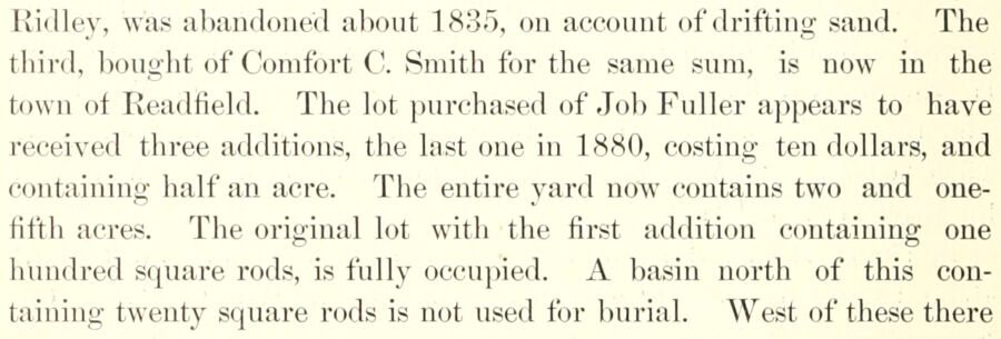
Ridley, was aJ)andoned about 1835, on account of drifting sand. The third, bought of Comfort C'. Smith for the same sum, is now in the town of Readfield. The lot })urchased of Job Fuller appears to have received three additions, the last one in 1880, costing ten dollars, and containing half an acre. The entire yjvrd now contains two and onefifth acres. The original lot with the first addition containing one hundred square rods, is fully occupied. A basin north of this containing twenty square rods is not used for burial. West of these there
Text read by machine from the scan; it may contain errors.
Scans and text from the Internet Archive. Books published in 1930 or earlier, which are in the public domain.
Timeline
Readfield, 1794 to 2010
Woven from the archive, old maps, post office records, the National Register and the people born here.
Nothing in the archives for these yearsWeddings on Main Street, storms, parades, school pictures, the old store. If it’s in your family album, it belongs here.
Readfield is more historic than 74% of U.S. towns, #94 of 143 in Maine. The History grade combines the town’s founding era, the share of homes built before 1940 and its National Register listings. It’s a character grade, so it isn’t part of the overall grade. How it works.
What is on the National Register in Readfield?
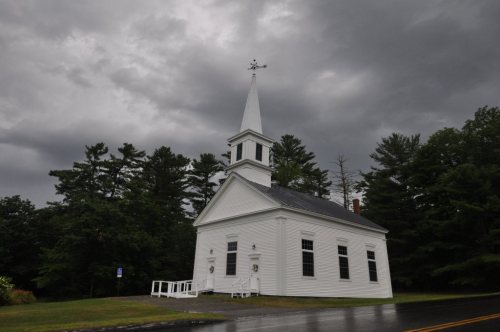
Three places: the Kent's Hill School Historic District (listed 1979), the Readfield Union Meeting House (1982) and the Lee, Jesse, Church (1984).
How old are the homes in Readfield?
15% of Readfield’s homes were built before 1940 (Census estimate, ±6.9 points), against a typical 19% for a Maine town; the median home was built in 1979.
Founding dates: Wikidata, Wikipedia, the U.S. post office records of Blevins & Helbock (CC0) and the Census. Homes by year built: Census ACS 2020–24. National Register of Historic Places: National Park Service (list of May 22, 2026). Old photos, postcards and papers: Wikimedia Commons, the Library of Congress and other public archives, credited on each item’s page. Maps: U.S. Geological Survey historical topographic maps (via Esri) and Sanborn fire-insurance maps (Library of Congress). History text and census tables: Wikipedia (CC BY-SA 4.0). Places that used to be: USGS Geographic Names Information System (2021).
From Wikimedia Commons (10), Wikidata (1), the National Register of Historic Places (3), Wikidata and Wikipedia for famous people, U.S. Geological Survey historical maps, U.S. Census counts (via Wikipedia), the US Post Offices dataset (Blevins & Helbock), the USGS Geographic Names Information System and old county and town histories (Internet Archive). Archive images are copied here with their credits and licenses, shown on each photo’s page. Refreshed monthly.
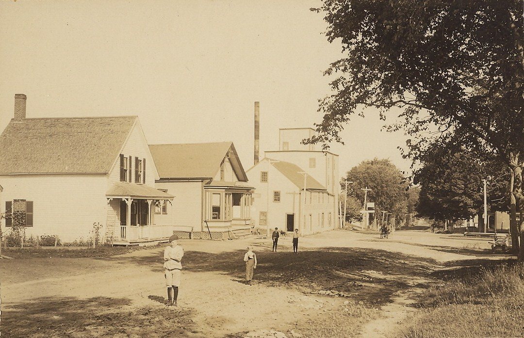
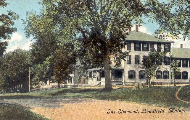







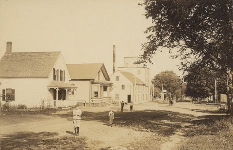
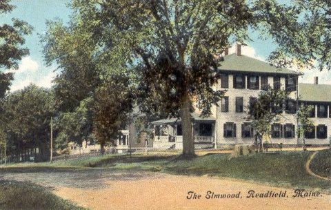
 c. 1912
 c. 1912
 2022
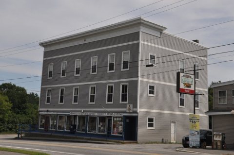 2022
 2022
 2022
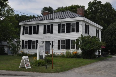 2022
 2014