North Haven dates to 1846, and 53% of its homes were built before 1940
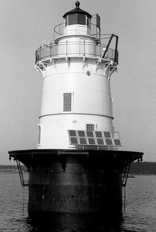
Its Register listings are the Goose Rocks Light Station and the Wharf House. Below: 1 old photo or paper, maps from 1904 on, and the census since 1850.
English explorer Martin Pring from Bristol, England, explored the area in 1603 at age 23, commanding the ships Speedwell and Explorer in an expedition to assess the commercial potential of the northern Virginia territory. Pring named the islands "Fox Islands" after the indigenous silver-gray foxes he observed, a name that survives in the Fox Islands Thoroughfare, the strait separating North Haven and Vinalhaven that provides passage for boats crossing Penobscot Bay.
Nothing in the archives for these yearsWeddings on Main Street, storms, parades, school pictures, the old store. If it’s in your family album, it belongs here.
Founding dates: Wikidata, Wikipedia, the U.S. post office records of Blevins & Helbock (CC0) and the Census. Homes by year built: Census ACS 2020–24. National Register of Historic Places: National Park Service (list of May 22, 2026). Old photos, postcards and papers: Wikimedia Commons, the Library of Congress and other public archives, credited on each item’s page. Maps: U.S. Geological Survey historical topographic maps (via Esri) and Sanborn fire-insurance maps (Library of Congress). History text and census tables: Wikipedia (CC BY-SA 4.0). Places that used to be: USGS Geographic Names Information System (2021). How TownRatings grades history →
From Wikimedia Commons (4), Wikidata (1), the National Register of Historic Places (2), Wikipedia, Wikidata and Wikipedia for famous people, U.S. Geological Survey historical maps, U.S. Census counts (via Wikipedia), the US Post Offices dataset (Blevins & Helbock) and the USGS Geographic Names Information System. Archive images are copied here with their credits and licenses, shown on each photo’s page. Refreshed monthly.



 2008
 2005
 2005

