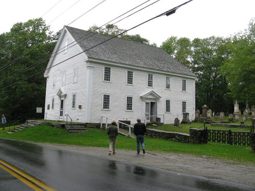
Founding year: Wikidata. First post office: 1801.The full story ↓
History grade
What drives Bristol’s History grade
On its age, its old homes and the National Register, Bristol is more historic than 95% of U.S. towns, #24 of 143 in Maine. All 3 inputs are above most U.S. towns; its age ranks highest and its National Register listings lowest.
A+
HistoryA character grade: shown, never part of Bristol’s overall grade.
Maine towns list more on the Register than most of the country (a typical Maine town has 15.9 per 10,000 residents, the U.S. 2.4), so Bristol’s 20.6 sits near the middle of its state (59% of Maine towns have fewer) while its 6 listings outnumber those of 72% of U.S. towns.
NoteThe founding year comes from Wikidata alone; no second source gives 1765.
How sure. Graded on any two of the three inputs instead, the letter would range from A to A+. The pre-1940 share is a Census survey estimate (±7.8 points).
Founding year: Wikidata (other dates in Quick answers). Homes: Census ACS 2020–24. National Register: National Park Service, May 2026 list; each listing counted once (boundary changes and added documentation belong to their listing), and a historic district counts its contributing buildings. How TownRatings grades history →
What stands out about Bristol’s past
Read from the archive, the National Register and the record. The page puts what stands out first.
Once territory of the Wawenock (or Walinakiak, meaning "People of the Bay") Abenaki Indians, early Bristol was one of the most important and embattled frontier settlements in the province. Beginning with seasonal fishing, as early as 1625 the English established at Pemaquid Point a year-round trading post for fur trading. In 1631, the area was granted as the Pemaquid Patent by the Plymouth Council to Robert Aldsworth and Gyles Elbridge, merchants from Bristol, England.
In 1632, Pemaquid was raided and plundered by the pirate Dixie Bull.
The Great Colonial Hurricane on August 15, 1635 sank the galleon Angel Gabriel while it was anchored off the settlement, drowning some crew and passengers.
The meeting house question in tha mother town of Bristol, after more than six years of earnest discussion, was settled. It was a question of whether to build one meeting house for the whole to'<7n or divide the to>7n into three parishes and that a meeting house should be erect -id in each. This was about 1772. The three parish-
Text read by machine from the scan; it may contain errors.
A history of the towns of Bristol and Bremen in the state of Maine, including the Pemaquid settlement1873 · page 391Read the page →
Read the text
History of Bristol and Bremen. 391 of Maine, and soon came into notice as a public man. He took an active part in the preliminary steps to secure the incorporation of the town of Bristol, in 1765, and in 1769 was elected on the board of selectmen. Subsequently he was elected to a place on this board, or the board of assessors every year, except iu 1772 and 1781, until and including 1801. At the annual townmeeting in 1802, bis name was omitted from the list and that
Text read by machine from the scan; it may contain errors.
A history of the towns of Bristol and Bremen in the state of Maine, including the Pemaquid settlement1873 · page 513Read the page →
Read the text
Goudy and Rufus K. Sewall, their associates and successors are hereby created a body corporate and politic, by the name of the Pemaquid Monument Association, for the purpose of erecting and maintaining in the town of Bristol, upon, or near the site of the ruins of Fort William Henry, at Pemaquid Harbor, an appropriate monument, commemorative of the early European settlement, or settlements, in that locality; and may sue and. be sued, plead and be impleaded, have a common seal, which it may alter at pleasure, and shall have all the privileges and powers and be sub-
Text read by machine from the scan; it may contain errors.
Scans and text from the Internet Archive. Books published in 1930 or earlier, which are in the public domain.
By decade
Bristol, decade by decade
4 decades in the archive, from the 1880s to the 1980s. Scroll each row; tap a photo for its story.
Nothing in the archives for these yearsWeddings on Main Street, storms, parades, school pictures, the old store. If it’s in your family album, it belongs here.
Nothing in the archives for these yearsWeddings on Main Street, storms, parades, school pictures, the old store. If it’s in your family album, it belongs here.
In 1765, according to Wikidata. Bristol’s post office opened in 1801, and the first U.S. census counted 516 people here in 1790.
How does Bristol rank for history?
Bristol is more historic than 95% of U.S. towns, #24 of 143 in Maine. The History grade combines the town’s founding era, the share of homes built before 1940 and its National Register listings. It’s a character grade, so it isn’t part of the overall grade. How it works.
What is on the National Register in Bristol?
6 listings: 4 buildings and 2 structures.
How old are the homes in Bristol?
35% of Bristol’s homes were built before 1940 (Census estimate, ±7.8 points), against a typical 19% for a Maine town; the median home was built in 1968.
Founding dates: Wikidata, Wikipedia, the U.S. post office records of Blevins & Helbock (CC0) and the Census. Homes by year built: Census ACS 2020–24. National Register of Historic Places: National Park Service (list of May 22, 2026). Old photos, postcards and papers: Wikimedia Commons, the Library of Congress and other public archives, credited on each item’s page. Maps: U.S. Geological Survey historical topographic maps (via Esri) and Sanborn fire-insurance maps (Library of Congress). History text and census tables: Wikipedia (CC BY-SA 4.0). Places that used to be: USGS Geographic Names Information System (2021).
From Wikimedia Commons (15), the Library of Congress (1), Wikidata (2), the National Register of Historic Places (6), Wikipedia, Wikidata and Wikipedia for famous people, U.S. Geological Survey historical maps, U.S. Census counts (via Wikipedia), the US Post Offices dataset (Blevins & Helbock), the USGS Geographic Names Information System and old county and town histories (Internet Archive). Archive images are copied here with their credits and licenses, shown on each photo’s page. Refreshed monthly.


 1909
 1909
 c. 1930
 c. 1930
 1936
 1936
 1980
 2013
 2013
 2012
 2012
 2012
 2012