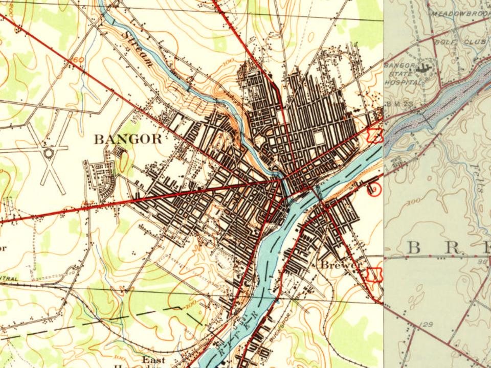
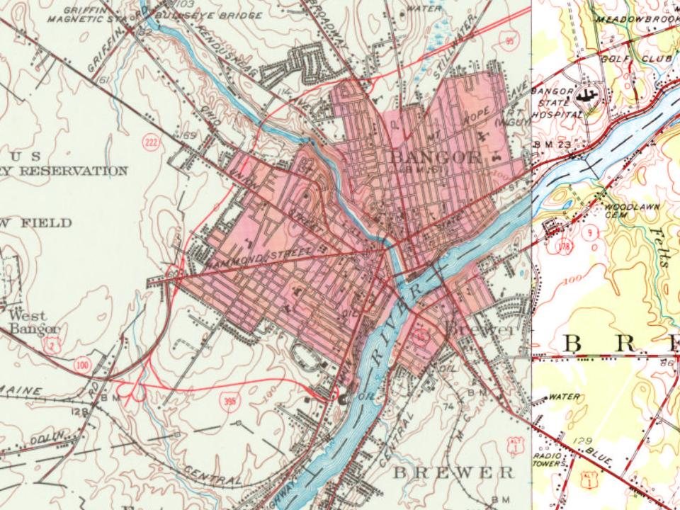
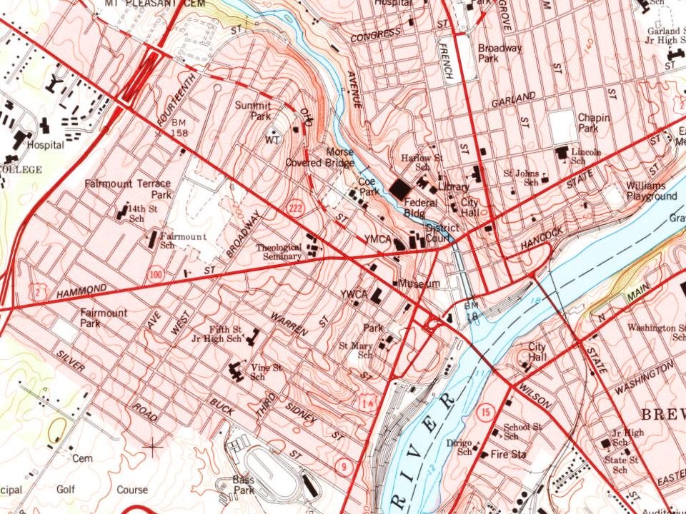
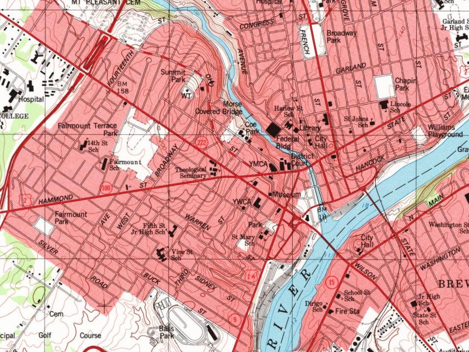
More historic than 98% of U.S. towns · #11 of 143 in Maine. What drives it
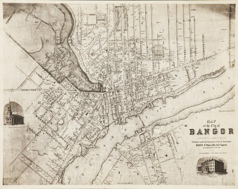
38 places in town are on the National Register, among them six historic districts with 117 buildings between them. Below: 9 old photos and papers, maps from 1884 on, and the census since 1800.
On its age, its old homes and the National Register, Bangor is more historic than 98% of U.S. towns, #11 of 143 in Maine. All 2 inputs are above most U.S. towns; its share of homes from before 1940 ranks highest and its National Register listings lowest.
A+
HistoryA character grade: shown, never part of Bangor’s overall grade.
Maine towns list more on the Register than most of the country (a typical Maine town has 15.9 per 10,000 residents, the U.S. 2.4), so Bangor’s 47.3 sits above most of its state (74% of Maine towns have fewer) while its 151 historic buildings outnumber those of 92% of U.S. towns.
How sure. Graded on two of the three inputs, so a change in either one moves the letter more than it would with three. The pre-1940 share is a Census survey estimate (±3.7 points).
Founding year: our sources. Homes: Census ACS 2020–24. National Register: National Park Service, May 2026 list; each listing counted once (boundary changes and added documentation belong to their listing), and a historic district counts its contributing buildings. How TownRatings grades history →
What stands out about Bangor’s past
Read from the archive, the National Register and the record. The page puts what stands out first.
National Park Service, National Register of Historic Places. Photos from Wikimedia Commons, credited on each place’s page.
Places that used to be
Lost post offices, old corners, places now gone and burying grounds
Bangor’s post office has been open since 1800. Five other post offices opened and closed inside today’s town.
Bangor
1800–today
North Bangor
1836–1853
Six Mile Falls
1848–1895
West Bangor
1854–1900
North Bangor
1858–1901
East Bangor
1868–1900
18001910today
Hamlets and corners on the map
Birch Hill Mobile Home ParkEast BangorMartells Mobile Home CourtNorth BangorRainbow Home Court Mobile Home ParkSix Mile FallsStillwater AvenueWest Bangor
Gone or out of use
Bangor Theological SeminaryschoolDevils Half-AcrelocaleDow Air Force BasemilitaryDow FieldairportNorth Bangor Stationlocale
7cemeteries and burying grounds inside Bangor
Beth AbrahamCongregation Beth IsraelMaple GroveMount HopeMount Pleasant CatholicOak GrovePine Grove
US Post Offices dataset (Blevins & Helbock, CC0). Places and cemeteries from the USGS Geographic Names Information System (2021).
Every building
Bangor, building by building, 1884–1914
Fire insurance maps drew every building, what it was made of and what it was used for, so insurers could price the risk of fire. Pick a year, then a sheet.
The Penobscot people have inhabited the area around present-day Bangor for at least 11,000 years and continue to occupy tribal land on the nearby Penobscot Indian Island Reservation. The Penobscot traditionally call the Bangor area kkάtaskkik, meaning "at/on the water parsnip ground," which European colonists rendered in English as Kenduskeag. The Penobscot practiced some agriculture but relied more heavily on hunting and gathering than indigenous peoples in warmer southern New England.
He was an Executive Councillor in 1837. Alderman of Bangor, and held other official positions. In 1854 he moved to the town of Veazie. which was formerly a part of Bangor, but was incorporated into a town 1853. ami named for him. He died March 12. 18G8.
Text read by machine from the scan; it may contain errors.
Scans and text from the Internet Archive. Books published in 1930 or earlier, which are in the public domain.
Timeline
Bangor, 1800 to 1972
Woven from the archive, old maps, post office records, the National Register and the people born here.
Bangor is more historic than 98% of U.S. towns, #11 of 143 in Maine. The History grade combines the town’s founding era, the share of homes built before 1940 and its National Register listings. It’s a character grade, so it isn’t part of the overall grade. How it works.
What is on the National Register in Bangor?
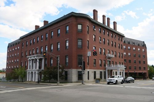
38 listings: 30 buildings, among them the Bangor House (listed 1972, the first), 6 historic districts with 117 contributing buildings, 1 structure, and 1 object. 151 historic buildings in all.
How old are the homes in Bangor?
41% of Bangor’s homes were built before 1940 (Census estimate, ±3.7 points), against a typical 19% for a Maine town; the median home was built in 1954.
Founding dates: Wikidata, Wikipedia, the U.S. post office records of Blevins & Helbock (CC0) and the Census. Homes by year built: Census ACS 2020–24. National Register of Historic Places: National Park Service (list of May 22, 2026). Old photos, postcards and papers: Wikimedia Commons, the Library of Congress and other public archives, credited on each item’s page. Maps: U.S. Geological Survey historical topographic maps (via Esri) and Sanborn fire-insurance maps (Library of Congress). History text and census tables: Wikipedia (CC BY-SA 4.0). Places that used to be: USGS Geographic Names Information System (2021).
From Wikimedia Commons (7), the Library of Congress (2), Wikidata (9), the National Register of Historic Places (38), Wikipedia, Wikidata and Wikipedia for famous people, U.S. Geological Survey historical maps, U.S. Census counts (via Wikipedia), the US Post Offices dataset (Blevins & Helbock), the USGS Geographic Names Information System, Sanborn fire insurance maps (Library of Congress) and old county and town histories (Internet Archive). Archive images are copied here with their credits and licenses, shown on each photo’s page. Refreshed monthly.






 1835
 1839
 1840s
 1840s
 1854