Brewer dates to 1777, and 30% of its homes were built before 1940
More historic than 80% of U.S. towns · #79 of 143 in Maine. What drives it
Its Register listings are the Sargent, Daniel House, the Brewer High School and the Penobscot Salmon Club and Pool. Below: 4 old photos and papers, maps from 1902 on, and the census since 1820.
On its age, its old homes and the National Register, Brewer is more historic than 80% of U.S. towns, #79 of 143 in Maine. Its share of homes from before 1940 holds the grade up; its National Register listings pull it down.
A−
HistoryA character grade: shown, never part of Brewer’s overall grade.
Maine towns list more on the Register than most of the country (a typical Maine town has 15.9 per 10,000 residents, the U.S. 2.4), so Brewer’s 3.1 sits below most of its state (23% of Maine towns have fewer) while its 3 listings outnumber those of 65% of U.S. towns.
NoteThe founding year comes from Wikidata alone; no second source gives 1777.
How sure. Graded on any two of the three inputs instead, the letter would range from B to A. The pre-1940 share is a Census survey estimate (±4.6 points).
Founding year: Wikidata (other dates in Quick answers). Homes: Census ACS 2020–24. National Register: National Park Service, May 2026 list; each listing counted once (boundary changes and added documentation belong to their listing), and a historic district counts its contributing buildings. How TownRatings grades history →
What stands out about Brewer’s past
Read from the archive, the National Register and the record. The page puts what stands out first.
Wikipedia doesn’t have a history of Brewer yet. The photos, dates and memories neighbors add here are how it gets written.
Brewer is a city in Penobscot County, Maine, United States. It is part of the Bangor metropolitan area. The city is named after its first settler, Colonel John Brewer. The population was 9,672 at the 2020 census. Brewer is the sister city of Bangor. The two are at the head of navigation on opposite sides of the Penobscot River estuary and are connected by three bridges. Brewer and Bangor were originally both part of Condeskeag Plantation, though the Brewer part was also called "New Worcester" after John Brewer's birthplace. In 1788, Orrington, Maine was incorporated with Brewer/New Worcester as its major village. The other half of Kenduskeag incorporated in 1791 as Bangor. Finally, in...
Brewer was established in 1777. Between the 2010 and 2020 censuses its population grew from 9,482 to 9,672 (+2%).
Intro from Wikipedia. Population: U.S. Census Bureau.
From the old history books
What they wrote about Brewer in 1882
Passages that mention Brewer, cut from the printed page as they were published.
History of Penobscot County, Maine1882 · page 468Read the page →
Read the text
The first settlement upon the soil of old Orrington was made by Colonel John Brewer, in June, 1770, at the mouth of the Segeunkedunk Stream, where now is Brewer Village, within the limits of the town of Brewer. The Wstory of that settlement, therefore, is properly a part of the history of that town, in which Colonel Brewer and his beginnings in the Penobscot Valley will be found noticed at some length.
Text read by machine from the scan; it may contain errors.
History of Penobscot County, Maine1882 · page 468Read the page →
Read the text
The first settlement upon the soil of old Orrington was made by Colonel John Brewer, in June, 1770, at the mouth of the Segeunkedunk Stream, where now is Brewer Vill.ige, within the limits of the town of Brewer. The history of that settlement, therefore, is properly a part of the history of that town, in which Colonel Brewer and his beginnings in the Penobscot Valley will be found noticed at some length.
Text read by machine from the scan; it may contain errors.
History of Penobscot County, Maine1882 · page 258Read the page →
Read the text
about half-way across the southwest part of the townconnect the highways that traverse its breadth. These are four in number, lying generally not more than a mile apart. One runs from Brewer Village into Holden, with a branch just out of the village running into Orrington, Another strikes from Brewer post-office, with three branches connecting with the wagon bridge over the Penobscot, and points a little above and below it, straight
Text read by machine from the scan; it may contain errors.
History of Penobscot County, Maine1882 · page 205Read the page →
Read the text
Massachusetts, but got the spirit of emigration to Maine, and in the summer of 1811 made his way to Orrington, where he established liimself; but in the following year he found himself in Brewer, without having removed at all. In 1812 the town of Brewer was incorporated (taken from Orringlon), and Judge Perham was near ilie southern boundary of the town, in the village at the mouth of the Segeunkedunk Stream, where he had a
Text read by machine from the scan; it may contain errors.
Scans and text from the Internet Archive. Books published in 1930 or earlier, which are in the public domain.
By decade
Brewer, decade by decade
3 decades in the archive, from the 1840s to the 1980s. Scroll each row; tap a photo for its story.
Nothing in the archives for these yearsWeddings on Main Street, storms, parades, school pictures, the old store. If it’s in your family album, it belongs here.
Nothing in the archives for these yearsWeddings on Main Street, storms, parades, school pictures, the old store. If it’s in your family album, it belongs here.
In 1777, according to Wikidata. Brewer’s post office opened in 1812, and the census of 1820 counted 744 people here.
How does Brewer rank for history?
Brewer is more historic than 80% of U.S. towns, #79 of 143 in Maine. The History grade combines the town’s founding era, the share of homes built before 1940 and its National Register listings. It’s a character grade, so it isn’t part of the overall grade. How it works.
What is on the National Register in Brewer?
Three places: the Sargent, Daniel House (listed 1982), the Brewer High School (2014) and the Penobscot Salmon Club and Pool (1976).
How old are the homes in Brewer?
30% of Brewer’s homes were built before 1940 (Census estimate, ±4.6 points), against a typical 19% for a Maine town; the median home was built in 1959.
Founding dates: Wikidata, Wikipedia, the U.S. post office records of Blevins & Helbock (CC0) and the Census. Homes by year built: Census ACS 2020–24. National Register of Historic Places: National Park Service (list of May 22, 2026). Old photos, postcards and papers: Wikimedia Commons, the Library of Congress and other public archives, credited on each item’s page. Maps: U.S. Geological Survey historical topographic maps (via Esri) and Sanborn fire-insurance maps (Library of Congress). History text and census tables: Wikipedia (CC BY-SA 4.0). Places that used to be: USGS Geographic Names Information System (2021).
From Wikimedia Commons (17), Wikidata (1), the National Register of Historic Places (3), Wikidata and Wikipedia for famous people, U.S. Geological Survey historical maps, U.S. Census counts (via Wikipedia), the US Post Offices dataset (Blevins & Helbock), the USGS Geographic Names Information System and old county and town histories (Internet Archive). Archive images are copied here with their credits and licenses, shown on each photo’s page. Refreshed monthly.


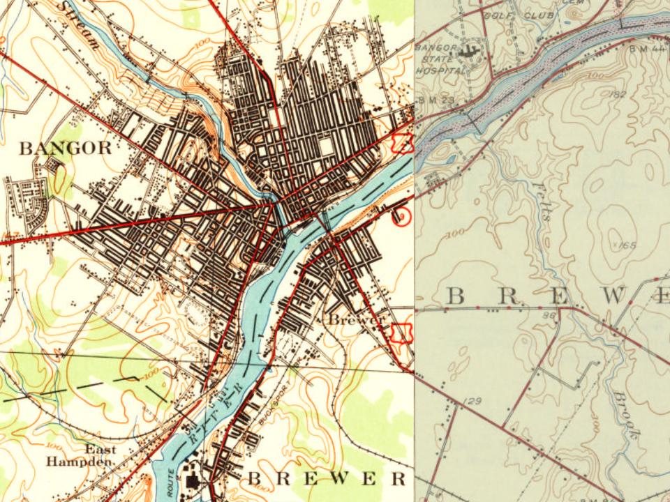
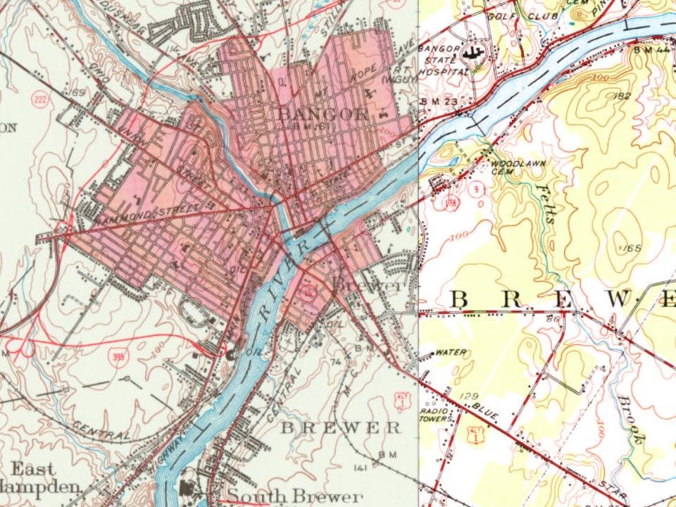

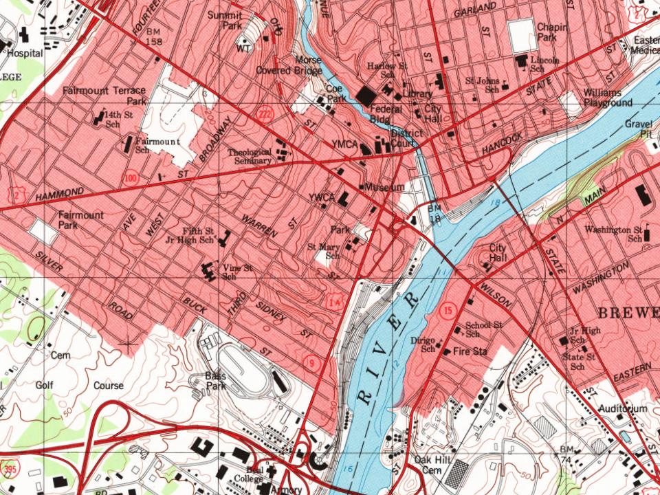


 1915
 2016
 2016
 2016
 2016
 2016
 2016
 2014
 2014
 2014
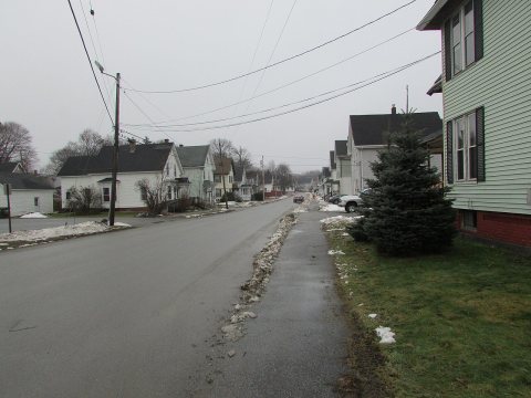 2014
 2012
 2009
 2007

