Orono dates to 1774, and 19% of its homes were built before 1940
More historic than 94% of U.S. towns · #29 of 143 in Maine. What drives it
11 places in town are on the National Register, among them three historic districts with 54 buildings between them. Below: 13 old photos and papers, maps from 1889 on, and the census since 1810.
On its age, its old homes and the National Register, Orono is more historic than 94% of U.S. towns, #29 of 143 in Maine. All 3 inputs are above most U.S. towns; its age ranks highest and its share of homes from before 1940 lowest.
A
HistoryA character grade: shown, never part of Orono’s overall grade.
Maine towns list more on the Register than most of the country (a typical Maine town has 15.9 per 10,000 residents, the U.S. 2.4), so Orono’s 52.1 sits above most of its state (76% of Maine towns have fewer) while its 62 historic buildings outnumber those of 86% of U.S. towns.
NoteThe founding year comes from Wikidata alone; no second source gives 1774.
How sure. Graded on any two of the three inputs instead, the letter would range from A− to A+. The pre-1940 share is a Census survey estimate (±4.1 points).
Founding year: Wikidata (other dates in Quick answers). Homes: Census ACS 2020–24. National Register: National Park Service, May 2026 list; each listing counted once (boundary changes and added documentation belong to their listing), and a historic district counts its contributing buildings. How TownRatings grades history →
What stands out about Orono’s past
Read from the archive, the National Register and the record. The page puts what stands out first.
Fire insurance maps drew every building, what it was made of and what it was used for, so insurers could price the risk of fire. Pick a year, then a sheet.
National Park Service, National Register of Historic Places. Photos from Wikimedia Commons, credited on each place’s page.
The story so far
Orono, in brief
Wikipedia doesn’t have a history of Orono yet. The photos, dates and memories neighbors add here are how it gets written.
Orono ( ORR-ə-noh) is a town in Penobscot County, Maine, United States. Located on the Penobscot and Stillwater rivers, it was first settled by American colonists in 1774. They named it in honor of Chief Joseph Orono, a sachem of the indigenous Penobscot nation who long occupied this territory. In the 19th century, the town became a center of the lumber industry. Sawmills on the rivers were powered by the water, and logs were floated downriver on the Penobscot for shipping and export from coastal ports. Orono was home to a large pulp and paper mill. A defunct railroad spur extending from downtown to the Stillwater Community of Old Town is now the Stillwater River Trail. There has been a bri…
Orono was established in 1774. Between the 2010 and 2020 censuses its population grew from 10,362 to 11,183 (+8%).
Intro from Wikipedia. Population: U.S. Census Bureau.
From the old history books
What they wrote about Orono in 1874
Passages that mention Orono, cut from the printed page as they were published.
Centennial celebration, and dedication of town hall, Orono, Maine, March 3, 18741874Read the page →
Read the text
acres of land with a double saw-mill, on the point of the island on the Stillwater branch of the Penobscot river; there were then but a very few houses in Orono, and, indeed, not more than ten on both sides of the Kenduskeag stream, where the dense part of the city of Bangor is now built, and the roads were such that it was difficult to go from Bangor to Oldtown (in Orono), even on horse-back. In about
Text read by machine from the scan; it may contain errors.
Centennial celebration, and dedication of town hall, Orono, Maine, March 3, 18741874Read the page →
Read the text
The act of division and incorporation was passed March 16, 1840. At the census taken in the following June, the population of Orono was 1521, of Oldtown, 2345 — or 38GG in both towns. In the division more than two-thirds of the territory was set off to Oldtown, leaving Orono one of the smallest towns in area in the State. The progress of Oldtown has been, as the enterprise and intelligence of its people
Text read by machine from the scan; it may contain errors.
Scans and text from the Internet Archive. Books published in 1930 or earlier, which are in the public domain.
Timeline
Orono, 1774 to 1932
Woven from the archive, old maps, post office records, the National Register and the people born here.
Nothing in the archives for these yearsWeddings on Main Street, storms, parades, school pictures, the old store. If it’s in your family album, it belongs here.
In 1774, according to Wikidata. Orono’s post office opened in 1819, and the census of 1810 counted 351 people here.
How does Orono rank for history?
Orono is more historic than 94% of U.S. towns, #29 of 143 in Maine. The History grade combines the town’s founding era, the share of homes built before 1940 and its National Register listings. It’s a character grade, so it isn’t part of the overall grade. How it works.
What is on the National Register in Orono?
11 listings: 8 buildings, among them the Gov. Israel Washburn House (listed 1973, the first), and 3 historic districts, the University of Maine at Orono Historic District, the University of Maine Historic District Boundary Increase and the Orono Main Street Historic District, with 54 contributing buildings. 62 historic buildings in all.
How old are the homes in Orono?
19% of Orono’s homes were built before 1940 (Census estimate, ±4.1 points), against a typical 19% for a Maine town; the median home was built in 1977.
Founding dates: Wikidata, Wikipedia, the U.S. post office records of Blevins & Helbock (CC0) and the Census. Homes by year built: Census ACS 2020–24. National Register of Historic Places: National Park Service (list of May 22, 2026). Old photos, postcards and papers: Wikimedia Commons, the Library of Congress and other public archives, credited on each item’s page. Maps: U.S. Geological Survey historical topographic maps (via Esri) and Sanborn fire-insurance maps (Library of Congress). History text and census tables: Wikipedia (CC BY-SA 4.0). Places that used to be: USGS Geographic Names Information System (2021).
From Wikimedia Commons (28), the Library of Congress (9), Wikidata (4), the National Register of Historic Places (11), Wikidata and Wikipedia for famous people, U.S. Geological Survey historical maps, U.S. Census counts (via Wikipedia), the US Post Offices dataset (Blevins & Helbock), the USGS Geographic Names Information System, Sanborn fire insurance maps (Library of Congress) and old county and town histories (Internet Archive). Archive images are copied here with their credits and licenses, shown on each photo’s page. Refreshed monthly.


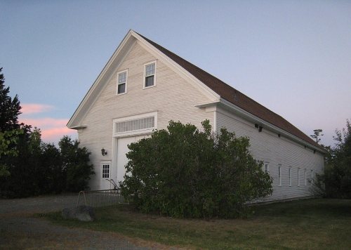


 1909
 1909
 1909
 1909
 1917
 1917
 1917
 1917
 c. 1930
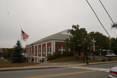 Date?
 2026
 2017
 2017
 2017
 2017
 2017
 2017
 2017
 2017
 2016
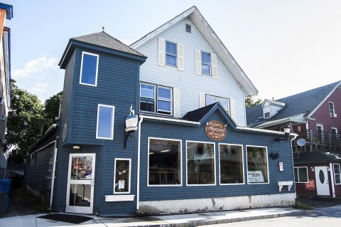 2015
 2015
 2015
 2015
 2015
 2013
 2013
 2010
 2010
 2010
 2010
 2010
 2007
 2005

