Bethesda’s post office opened in 1852, and 9 of its places are on the National Register
More historic than 46% of U.S. towns · #104 of 261 in Maryland. What drives it
Most of Bethesda was built recently: 8% of its homes predate 1940 and the median home dates from 1970. Below: 6 old photos and papers, maps from 1900 on, and the census since 1960.
The Bethesda post office opened in 1852, the earliest record of the town by name. Two smaller post offices, Concord (1855) and Beane (1886), opened inside today’s town and later closed.
First census: 56,527 in 19602020 census: 68,056174 years
How did Bethesda get its name?
It takes its name from a local church, the Bethesda Meeting House (1820, rebuilt 1849), which in turn took its name from Jerusalem's Pool of Bethesda.
How historic is Bethesda?
B−
More historic than 46% of U.S. towns, on its age, its old homes and the National Register.
On its age, its old homes and the National Register, Bethesda is more historic than 46% of U.S. towns, #104 of 261 in Maryland. Its National Register listings hold the grade up; its age pulls it down.
B−
HistoryA character grade: shown, never part of Bethesda’s overall grade.
Few Maryland towns list much on the Register (a typical Maryland town has 0.9 per 10,000 residents, the U.S. 2.4), so Bethesda’s 1.3 sits near the middle of its state (51% of Maryland towns have fewer) while its 9 listings outnumber those of 75% of U.S. towns.
How sure. Graded on any two of the three inputs instead, the letter would range from C to B−. The pre-1940 share (±1.2 points) is firm at this size. The founding year is the first post office, not a stated founding date.
Founding year: the first post office (other dates in Quick answers). Homes: Census ACS 2020–24. National Register: National Park Service, May 2026 list; each listing counted once (boundary changes and added documentation belong to their listing), and a historic district counts its contributing buildings. How TownRatings grades history →
What stands out about Bethesda’s past
Read from the archive, the National Register and the record. The page puts what stands out first.
Lost post offices, old corners and places now gone
Bethesda had its own post office from 1852 to 1852. Three other post offices opened and closed inside today’s town.
Bethesda
1852–1852
Concord
1855–1859
Bethesda
1871–1925
Beane
1886–1905
Bethesda
1981–today
18501940today
Hamlets and corners on the map
Alta VistaAlta Vista TerraceAshburtonBannockburnBannockburn EstatesBannockburn HeightsBattery ParkBradley HillsBradley Hills GroveBradley WoodsBradmoorBrookdaleChevy Chase TerraceCohassetCrestviewDrummondEdgemoorEdgewoodEnglish VillageFairway HillsGlen CoveGlen Mar ParkGlenbrook KnollGlenwood
Gone or out of use
Alta Vista Elementary SchoolschoolArlington Road Station Post Officepost officeAyrlawn Elementary SchoolschoolWhittier Woods Elementary SchoolschoolWoodmont Country Clublocale
US Post Offices dataset (Blevins & Helbock, CC0). Places and cemeteries from the USGS Geographic Names Information System (2021).
On the map
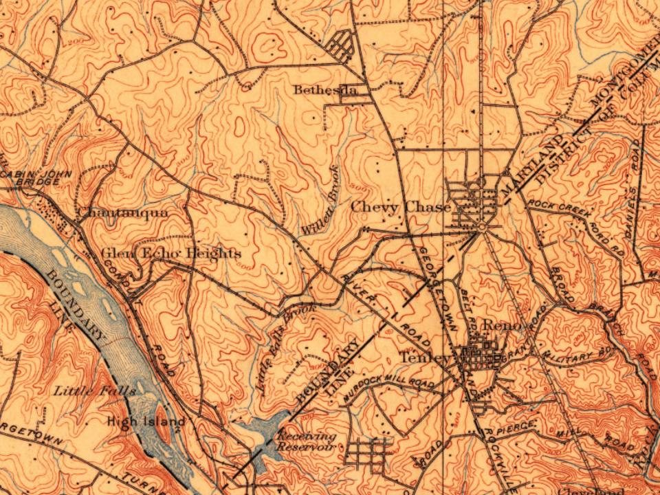
Bethesda on the map, 1900 to 1980
Every edition of the U.S. Geological Survey’s map of Bethesda. Tap a year, or press play to watch the town change.
1900Washington sheet · 1:62,500
U.S. Geological Survey historical topographic maps (public domain), via Esri’s collection of the scans. The red ring marks the center of Bethesda.
Famous people
52 famous people were born in Bethesda
Writers, athletes, leaders and more, ranked by how widely they’re known.
Bethesda is located in the traditional territory of the indigenous Native Piscataway and Nacotchtank at the time of European colonization. Fur trader Henry Fleet became the first European to visit the area, reaching it by sailing up the Potomac River. He stayed with the Piscataway tribe from 1623 to 1627, either as a guest or prisoner (historical accounts differ). Fleet eventually secured funding for another expedition to the region and was later granted proprietary rights to 2,000 acres of land in the nascent colony and became a member of Maryland's colonial legislature. Raids from the Senecas and Susquehannock resulted in the creation of the Maryland division of Rangers in 1694 to patrol the frontier.
Passages that mention Bethesda, cut from the printed page as they were published.
The history of Montgomery county, Maryland, from its earliest settlement in 1650 to 1879 ..1879 · page 32Read the page →
Read the text
twenty-four acres. Tliis land extends from near the Potomac and below Edmund Brooke's farm, a south-easterly and easterly direction across the Georgetown Turnpike, north of Tenallytown. and up the pike, north-westerly, near to Bethesda post office, and contains many rich and valuable farms; Allison Sailor's lands, and the farms of Richard Williams, Henry v Loughborough, and others. The river road passes through from Rider's farm to near Tenallytown. Adjoining, and on the
Text read by machine from the scan; it may contain errors.
Scans and text from the Internet Archive. Books published in 1930 or earlier, which are in the public domain.
Timeline
Bethesda, 1852 to 1977
Woven from the archive, old maps, post office records, the National Register and the people born here.
Nothing in the archives for these yearsWeddings on Main Street, storms, parades, school pictures, the old store. If it’s in your family album, it belongs here.
The Bethesda post office opened in 1852, the earliest record of the town by name (U.S. post office records).
How does Bethesda rank for history?
Bethesda is more historic than 46% of U.S. towns, #104 of 261 in Maryland. The History grade combines the town’s founding era, the share of homes built before 1940 and its National Register listings. It’s a character grade, so it isn’t part of the overall grade. How it works.
What is on the National Register in Bethesda?
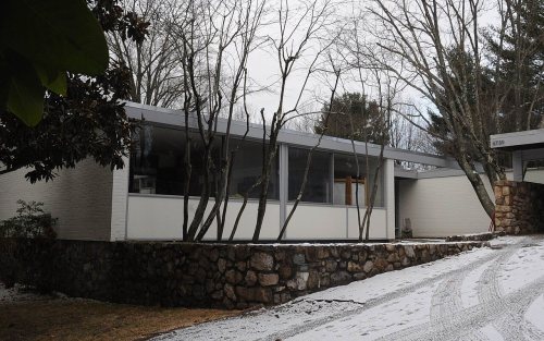
9 listings: 8 buildings, among them the Milton (listed 1975, the first).
How old are the homes in Bethesda?
8% of Bethesda’s homes were built before 1940 (Census estimate, ±1.2 points), against a typical 3.3% for a Maryland town; the median home was built in 1970.
Founding dates: Wikidata, Wikipedia, the U.S. post office records of Blevins & Helbock (CC0) and the Census. Homes by year built: Census ACS 2020–24. National Register of Historic Places: National Park Service (list of May 22, 2026). Old photos, postcards and papers: Wikimedia Commons, the Library of Congress and other public archives, credited on each item’s page. Maps: U.S. Geological Survey historical topographic maps (via Esri) and Sanborn fire-insurance maps (Library of Congress). History text and census tables: Wikipedia (CC BY-SA 4.0). Places that used to be: USGS Geographic Names Information System (2021).
From the Library of Congress (6), the National Register of Historic Places (8), Wikipedia, Wikidata and Wikipedia for famous people, U.S. Geological Survey historical maps, U.S. Census counts (via Wikipedia), the US Post Offices dataset (Blevins & Helbock), the USGS Geographic Names Information System and old county and town histories (Internet Archive). Archive images are copied here with their credits and licenses, shown on each photo’s page. Refreshed monthly.









 1910
 1910
 1910
 1910
 1916


