174 years in pictures
Census counts: 56,527 in 1960, 68,056 in 2020. The archive holds 6 old photos and papers going back to 1910 and 6 maps from 1900 on.
8 places on the National Register of Historic Places.
- 1852Bethesda is settled
Each edition grades its towns against each other only.

The city, settled in 1852, counts 69,397 residents.
A good place to live, if you can afford it. Health is its strong suit (A+). Bethesda grades A overall and ranks 37th of 259 in Maryland. Nationally, it does better than 93% of U.S. towns. Add incomes to its strengths (A+): the median household earns $192K. The trade-off is cost of living (D): the typical home is worth about $1.1 million, 8.9 years of the Washington metro’s $127K median household income. The city has 8 places on the National Register of Historic Places, among them Milton and Bethesda Meetinghouse. 87% of adults 25 and older hold a bachelor’s degree or more locally, against 42% in Maryland’s towns and 29% across U.S. towns.
Figures: health, CDC PLACES · incomes, Census ACS, 2020–24 · home values, Zillow · National Register of Historic Places.
Where Bethesda beats most towns.
| Widest gap | Bethesda | MD |
|---|---|---|
| Fewer older adults who have lost all their teeth | 3.1% | 9.9% |
Census counts: 56,527 in 1960, 68,056 in 2020. The archive holds 6 old photos and papers going back to 1910 and 6 maps from 1900 on.
8 places on the National Register of Historic Places.
Each subject compared with towns across the country (schools within Maryland), ordered by how far Bethesda is from typical.
How TownRatings grades towns →
Museums, parks, gardens and other places to visit around Bethesda. Close and well known come first.
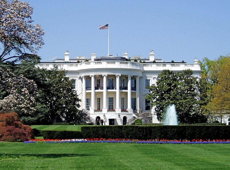
Big draw8 mi National park siteWhite House311K visitors a year
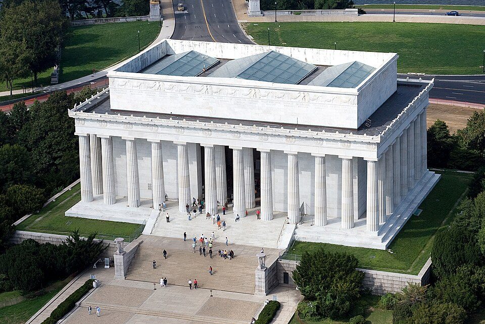
Big draw8 mi National MemorialWashington Monument204K visitors a year
Big draw8 mi LandmarkArlington National Cemetery
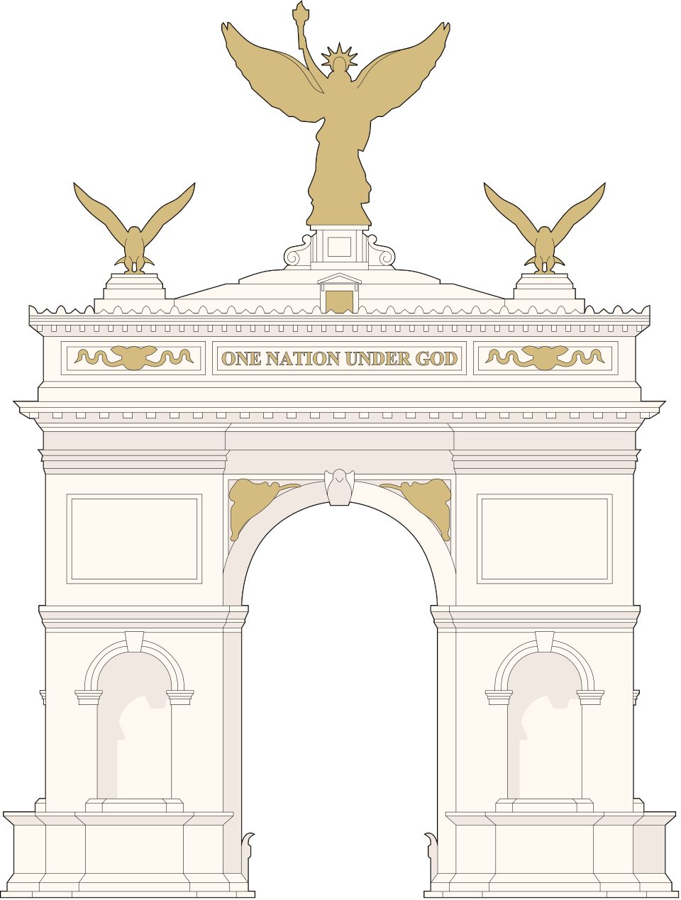
Big draw8 mi LandmarkUnited States Triumphal Arch
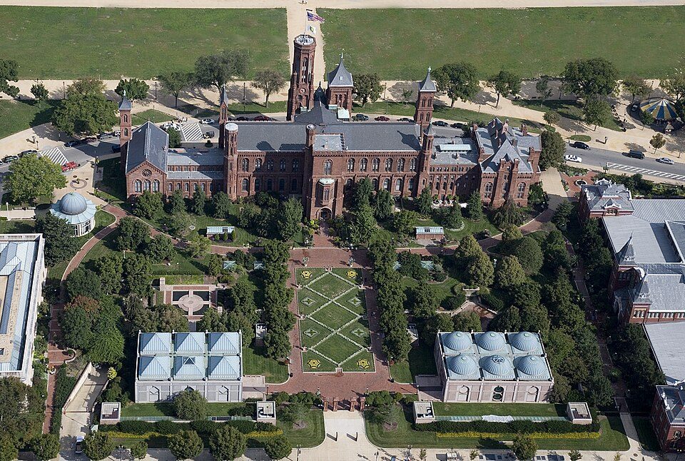
Big draw8 mi MuseumSmithsonian Institution30.0M visitors a year
Big draw8 mi National MemorialLincoln Memorial7.7M visitors a yearWhite House: This image or media was taken or created by Matt H. Wade. To see his entire port, CC BY-SA 3.0 · Washington Monument: Oren Rozen, CC BY-SA 4.0 · Arlington National Cemetery: Protoant, Public domain · United States Triumphal Arch: Hstoops, CC0 · Smithsonian Institution: Highsmith, Carol M., 1946-, photographer, Public domain · Lincoln Memorial: Aerial_view_of_Lincoln_Memorial_-_east_side.jpg: Carol M. Highsmith derivative w, Public domain
Bethesda is unincorporated, so Montgomery County and regional agencies provide most services.
EPA SDWIS (Oct 9, 2026) · HIFLD + EIA-861 2025 · Census 2020 ZCTAs · NCES 2024–25 · registration: vote.gov, updated Mar 11, 2026.
Ordered by what stands out in Bethesda.
Bethesda is the healthiest town in Maryland, has more 90° days than almost anywhere else in Maryland and draws workers from Washington and beyond.
At 8.9 years of the Washington metro’s $127K median household income, the typical home (about $1.13M) costs more against local pay than in 98% of Maryland towns; that ratio is one input to that grade.
Homes in Bethesda are typically worth about $1,126,000, up 1.3% in a year, more than twice the Maryland typical home. The going rate for rent for Bethesda comes to $2,469 a month. Bethesda: 64% of households live in a home they own.
| Bethesda | Maryland towns | U.S. towns | |
|---|---|---|---|
| Median rent | $2,469 a month | $1,809 a month | $1,185 a month |
| Households that own their home | 64% | 74% | 73% |
| Renters paying 30%+ of income on rent | 46% | 51% | 48% |
Census ACS, 2020–24 · Zillow Home Value Index · Redfin Data Center
Below: Three of its 27 schools, each with why it was picked. Public schools: the Montgomery County Public Schools.
| School | Level | Students | Letter |
|---|---|---|---|
| Thomas W. Pyle MiddleLargest public middle schoolGrades 6–8 | Grades 6–8 | 1,259 | A |
| Bethesda-Chevy Chase HighLargest public high schoolGrades 9–12 | Grades 9–12 | 2,377 | A+ |
| Walt Whitman HighTop results in townGrades 9–12 | Grades 9–12 | 2,056 | A+ |
NCES · EDFacts · graded within MD on state tests and graduation
It is the healthiest of the 261 Maryland towns we grade on the CDC estimates behind the Health Grade. Its widest gap with Maryland is tooth loss: 3.1% of those 65+ have lost all their teeth, against 9.9% statewide.
Only 3 of the 261 Maryland towns we compare have a lower share of adults who get no exercise outside work than Bethesda. Among adults locally, 29% feel lonely. Against the Maryland average, Bethesda comes out ahead on 25 CDC measures out of 32, and behind on 2.
| Bethesda | Maryland towns | U.S. towns | |
|---|---|---|---|
| Obesity (CDC PLACES) | 22% | 36% | 35% |
| Frequent mental distress (CDC PLACES) | 10% | 15% | 17% |
| Sleep under 7 hours (CDC PLACES) | 28% | 38% | 36% |
| Smoke cigarettes (CDC PLACES) | 4.6% | 11% | 14% |
| What stands out | Bethesda | MD |
|---|---|---|
| Fewer older adults who have lost all their teeth | 3.1% | 9.9% |
| Fewer adults facing food insecurity | 5.5% | 15.4% |
| More adults who have had cancer | 9.3% | 7.6% |
CDC PLACES 2025 · modeled estimates for adults · CMS · HRSA
73,370 jobs are based in Bethesda, 2.7 for every working resident, so most of the people who work here commute in. 28% of working residents cross a state line to work, Arlington among the top destinations.
In Bethesda, 16% of working residents work locally. The top destinations are Washington (29%), Rockville (4%) and North Bethesda (4%). The town’s average trip to work is 28 minutes. The median commute is under 8 miles.
| Bethesda | Maryland towns | U.S. towns | |
|---|---|---|---|
| Work from home | 38% | 18% | 11% |
| Median household income | $192,000 | $113,000 | $80,000 |
| Working residents who work in town | 16% | 3.1% | 8% |
| Below the poverty line | 4.3% | 7% | 9.6% |
Census LEHD 2023 · ACS
Since 1979, 55 flood insurance claims have been paid out in Bethesda. On expected storm and flood damage, Bethesda sits below 95% of U.S. communities. FEMA puts 59% of the town’s expected hazard losses down to inland flooding, and 10% to hurricanes. Households locally have drawn federal disaster aid once, in 2003.
FEMA flood insurance claims · FEMA National Risk Index · OpenFEMA
In 32 parks and preserves, walkers have 6.4 miles of trail. The biggest place to walk is Little Falls Stream Valley Park, 146 acres with 1.2 miles of trail.
| Bethesda | Maryland towns | U.S. towns | |
|---|---|---|---|
| Conserved land | 6% | 9.5% | 4.3% |
| Miles of trail per square mile | 0.5 miles per square mile | 0.6 | 0.4 |
| Biggest places to walk | Trails | Acres |
|---|---|---|
| 1. Little Falls Stream Valley Park | 1.2 mi | 146 |
| 2. McCrillis Gardens Special Park | 0.8 mi | 5 |
| 3. Whittier Woods Local Park | 0.3 mi | 8 |
Trails & parks © OpenStreetMap contributors · Conserved land: USGS PAD-US
The Dalecarlia Rsvr weather station records that about 44 days a year reach 90°, the #2 highest of 536 Maryland places with climate records.
Summer afternoons peak near 87° in July, and January nights bottom out around 26°; snowfall runs to about 6 inches a winter. Bethesda has chilly winters and warm summers.
NOAA U.S. Climate Normals, 1991–2020
35 within 15 miles of the center of Bethesda
About 6 of every 100 Bethesda residents are enrolled in college, about the same as Maryland.
60,858 counted in 2010 and 68,056 in 2020.
U.S. Census 2010 & 2020 counts
8 places in Bethesda on the National Register of Historic Places.
52 notable people were born in Bethesda.


Census-designated place in Maryland, United States
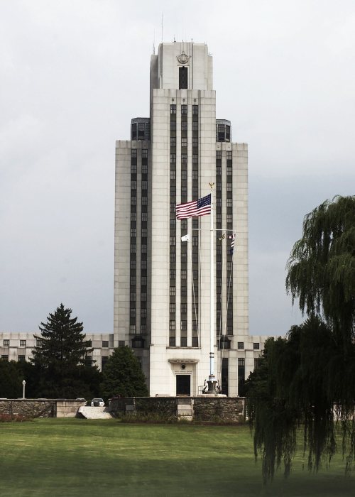
Bethesda () is an unincorporated, census-designated place in southern Montgomery County, Maryland, United States. Located just northwest of Washington, D.C., it is a major business and government center of the Washington metropolitan region and a national center for medical research. According to the 2020 census, the community had a population of 68,056.
From Wikipedia, licensed CC BY-SA 4.0 · facts via Wikidata (CC0)
10 towns share a border with Bethesda.
| Town | MD rank | Overall | Cost | Safety | Schools | Health |
|---|---|---|---|---|---|---|
| Bethesda | #37 | A | D | — | B+ | A+ |
| South Kensington | #47 | A | D | — | B+ | A+ |
| Brookmont | #17 | A+ | C− | — | B+ | A+ |
| Chevy Chase | #44 | A | D− | — | B+ | A+ |
| North Bethesda | #34 | A | D | — | B+ | A+ |
| Potomac | #40 | A | D | — | B+ | A+ |
| Somerset | — | — | C− | — | B+ | A+ |
| Chevy Chase | #25 | A+ | D | — | B+ | A+ |
Somerset has fewer than 2,500 residents, so it gets subject grades but no overall grade. Bethesda, South Kensington, Brookmont, Chevy Chase, North Bethesda, Potomac, Somerset and Chevy Chase report no FBI crime data of their own. Compare Bethesda with a neighbor →
Short answers, built from the data on this page.
Yes, by almost any measure. Bethesda grades A overall, better than 93% of U.S. towns and #37 of 259 in Maryland. It grades A+ for health and B+ for schools. Cost of living is its weak spot, with a D.
Yes. Cost of living, which also weighs rents, property taxes and how many households pay 30% or more of their income for housing, grades D.
52 notable people were born here, including Richard Schiff and Daniel Stern.