Potomac’s post office opened in 1830, and 4 of its places are on the National Register
More historic than 64% of U.S. towns · #58 of 261 in Maryland. What drives it
Most of Potomac was built recently: 0.5% of its homes predate 1940 and the median home dates from 1977. 4 places in town are on the National Register, among them a historic district with 287 buildings. Below: 4 old photos and papers, maps from 1908 on, and the census since 1980.
The Potomac post office opened in 1830, the earliest record of the town by name. Seven smaller post offices, Georgetown (1776), Section Eight (1830) and Greatfalls (1857), opened inside today’s town and later closed.
First census: 40,401 in 19802020 census: 47,018196 years
How historic is Potomac?
B
More historic than 64% of U.S. towns, on its age, its old homes and the National Register.
Founding year: the first Potomac post office (Blevins & Helbock, CC0).The full story ↓
History grade
What drives Potomac’s History grade
On its age, its old homes and the National Register, Potomac is more historic than 64% of U.S. towns, #58 of 261 in Maryland. Its National Register listings hold the grade up; its share of homes from before 1940 pulls it down.
B
HistoryA character grade: shown, never part of Potomac’s overall grade.
Few Maryland towns list much on the Register (a typical Maryland town has 0.9 per 10,000 residents, the U.S. 2.4), so Potomac’s 63.6 sits above most of its state (82% of Maryland towns have fewer) while its 292 historic buildings outnumber those of 95% of U.S. towns.
How sure. Graded on any two of the three inputs instead, the letter would range from C+ to A. The pre-1940 share (±0.3 points) is firm at this size. The founding year is the first post office, not a stated founding date.
Founding year: the first post office (other dates in Quick answers). Homes: Census ACS 2020–24. National Register: National Park Service, May 2026 list; each listing counted once (boundary changes and added documentation belong to their listing), and a historic district counts its contributing buildings. How TownRatings grades history →
What stands out about Potomac’s past
Read from the archive, the National Register and the record. The page puts what stands out first.
Captain John ChurchchurchEvergreen ChurchchurchGeorgetown Hill Elementary SchoolschoolMaryland MinemineMount Glory ChurchchurchScotland SchoolschoolStoneyhurst Quarry Number 1mineStoneyhurst Quarry Number 3mineToms Run QuarrymineWest Bethesda Post Officepost office
1cemetery inside Potomac
Saint Gabriel
US Post Offices dataset (Blevins & Helbock, CC0). Places and cemeteries from the USGS Geographic Names Information System (2021).
Help out
Start Potomac’s collection
The first neighbors to add old photos shape how Potomac’s history is told.
Decades since 1900 with photos
00s10s20s30s40s50s60s70s80s90s
3 of 10 decades. The empty ones are waiting for someone’s album.
The land that is now Potomac was first settled by Edward Offutt in 1714 after he was granted a 600-acre (2.4 km2) land grant of a region known as Clewerwell by Lord Baltimore. His grant of land was by the Tehogee Indian Trail, an Indian trade route built by the Canaze Native American nation in 1716. Throughout the 18th century, what became known as "Offutts Crossroads" was a small, rural community which served planters and travelers. In the 19th century, a few small dwellings had been built along with a tavern established in 1820. By the time of the Civil War, the community contained two general stores, a blacksmith shop, and a post office which served a community of 100.
Passages that mention Potomac, cut from the printed page as they were published.
A History of the Army of the Potomac1893 · page 120Read the page →
Read the text
down, over which a whole army could cross. The corps remained there for some time. The railroad bridge was rebuilt, and the railroad to Brooks' station, at Aquia Creek, on the Potomac, was repaired and put in running order. While at Fredericksburg, on the Fourth of July, an amusing incident occurred in the 2d Wisconsin. The boys had resolved to have some fun. They organized a plan to capture the officers' coats, which were to be donned by a
Text read by machine from the scan; it may contain errors.
A History of the Army of the Potomac1893 · page 614Read the page →
Read the text
same plan as that of the Wilderness. But for the accident of Merritt being ordered to relieve Sheridan in his work of holding the bridges over the Po River, the Army of the Potomac would have marched unopposed into Spottsylvania, where Lee would have been crowded off to the right, placing the Army of the Potomac between Lee and Richmond.
Text read by machine from the scan; it may contain errors.
Scans and text from the Internet Archive. Books published in 1930 or earlier, which are in the public domain.
Timeline
Potomac, 1776 to 1980
Woven from the archive, old maps, post office records, the National Register and the people born here.
Nothing in the archives for these yearsWeddings on Main Street, storms, parades, school pictures, the old store. If it’s in your family album, it belongs here.
Nothing in the archives for these yearsWeddings on Main Street, storms, parades, school pictures, the old store. If it’s in your family album, it belongs here.
The Potomac post office opened in 1830, the earliest record of the town by name (U.S. post office records).
How does Potomac rank for history?
Potomac is more historic than 64% of U.S. towns, #58 of 261 in Maryland. The History grade combines the town’s founding era, the share of homes built before 1940 and its National Register listings. It’s a character grade, so it isn’t part of the overall grade. How it works.
What is on the National Register in Potomac?
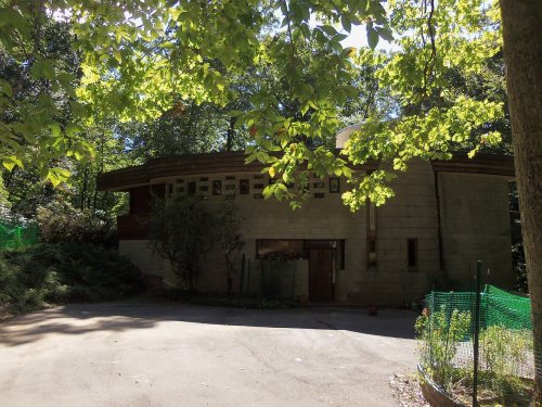
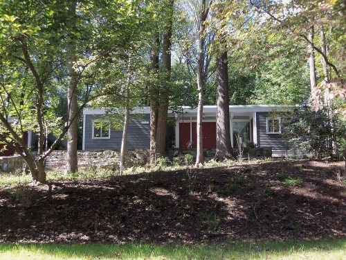
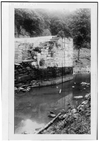
4 listings: 2 buildings, among them the Taylor, David W., Model Basin (listed 1985, the first), and 1 historic district, the Carderock Springs Historic District, with 287 contributing buildings. 292 historic buildings in all.
How old are the homes in Potomac?
0.5% of Potomac’s homes were built before 1940 (Census estimate), against a typical 3.3% for a Maryland town; the median home was built in 1977.
Founding dates: Wikidata, Wikipedia, the U.S. post office records of Blevins & Helbock (CC0) and the Census. Homes by year built: Census ACS 2020–24. National Register of Historic Places: National Park Service (list of May 22, 2026). Old photos, postcards and papers: Wikimedia Commons, the Library of Congress and other public archives, credited on each item’s page. Maps: U.S. Geological Survey historical topographic maps (via Esri) and Sanborn fire-insurance maps (Library of Congress). History text and census tables: Wikipedia (CC BY-SA 4.0). Places that used to be: USGS Geographic Names Information System (2021).
From Wikimedia Commons (12), the National Register of Historic Places (3), Wikipedia, Wikidata and Wikipedia for famous people, U.S. Geological Survey historical maps, U.S. Census counts (via Wikipedia), the US Post Offices dataset (Blevins & Helbock), the USGS Geographic Names Information System and old county and town histories (Internet Archive). Archive images are copied here with their credits and licenses, shown on each photo’s page. Refreshed monthly.






 2006
 2006
 2006
 2006
 2006
 2006
 2005
 2004


