Weston dates to 1642, and 23% of its homes were built before 1940
More historic than 98% of U.S. towns · #46 of 283 in Massachusetts. What drives it
13 places in town are on the National Register, among them six historic districts with 334 buildings between them. Below: 12 old photos and papers, maps from 1886 on, and the census since 1790.
Founding year: Wikidata. First post office: 1812.The full story ↓
History grade
What drives Weston’s History grade
On its age, its old homes and the National Register, Weston is more historic than 98% of U.S. towns, #46 of 283 in Massachusetts. All 3 inputs are above most U.S. towns; its age ranks highest and its share of homes from before 1940 lowest.
A+
HistoryA character grade: shown, never part of Weston’s overall grade.
Massachusetts towns list more on the Register than most of the country (a typical Massachusetts town has 46.0 per 10,000 residents, the U.S. 2.4), so Weston’s 370 sits above most of its state (88% of Massachusetts towns have fewer) while its 429 historic buildings outnumber those of 97% of U.S. towns.
NoteThe founding year comes from Wikidata alone; no second source gives 1642.
How sure. Graded on any two of the three inputs instead, the letter would range from A to A+. The pre-1940 share is a Census survey estimate (±5.0 points).
Founding year: Wikidata (other dates in Quick answers). Homes: Census ACS 2020–24. National Register: National Park Service, May 2026 list; each listing counted once (boundary changes and added documentation belong to their listing), and a historic district counts its contributing buildings. How TownRatings grades history →
What stands out about Weston’s past
Read from the archive, the National Register and the record. The page puts what stands out first.
The description of Weston's history here is pulled directly from the 2017 Weston Open Space and Recreation Plan.
Weston was originally part of the Watertown settlement of 1630, but until the end of the century, the land was used mainly for grazing cattle. In 1698, "The Farms" was set off as a separate precinct with its own meetinghouse; and in 1712–1713, the "Farmers' Precinct" was incorporated as a separate town, Weston.
Passages that mention Weston, cut from the printed page as they were published.
History of the town of Weston, Massachusetts, 1630-18901913 · page 4Read the page →
Read the text
once, — in fact, not until after a period of three years. Justice Sewall, who presided over the conference, states in his Diary that so great was the contention that he had to pray hard to keep the contending parties from coming to blows. Weston became a separate precinct in 1698; but on January 1, 1697, they were exempted from ministerial rates in Watertown, though not in legal form until a year later. After the incorporation of Weston in 1712 (up to which period it had been called the "westerly,"
Text read by machine from the scan; it may contain errors.
History of the town of Weston, Massachusetts, 1630-18901913 · page 28Read the page →
Read the text
Whereas by an order of the Great and General Court of the Province of the Massachusetts Bay, passed the 26th day of April last, a number of the Inhabitants of Weston with others, inhabitants of Concord and Lexington, are set off to be a precinct and thereby the remaining part of the said town of Weston is an entire parish. Therefore we are to request that your honor would issue a warrant for calling the first precinct meeting in the first precinct of Weston to choose precinct officers as the law directs.
Text read by machine from the scan; it may contain errors.
Genealogies of the families and descendants of the early settlers of Watertown, Massachusetts, including Waltham and Weston1860 · page 991Read the page →
Read the text
§ 41. The present boundaries of Weston, on the north and east, do not correspond with those described, when it was set off as a precinct. Beaver Pond, there mentioned, is in Lincoln, and the pine, where the bounds of Cambridge (Lex.), Watertown, and Concord meet, was not far north of the centre of Lincoln, which was incorporated as a precinct, April 24, 1746, and as a town, April 19, 1754, and which was made up of land taken from the northern part of Weston, the southern part of Concord, and the western part of Lexington. Nor does Stony Brook continue to be the entire boundary between Weston and Waltham." This line of boundary, after
Text read by machine from the scan; it may contain errors.
Scans and text from the Internet Archive. Books published in 1930 or earlier, which are in the public domain.
By decade
Weston, decade by decade
One decade in the archive so far: the 1900s. Scroll each row; tap a photo for its story.
Nothing in the archives for these yearsWeddings on Main Street, storms, parades, school pictures, the old store. If it’s in your family album, it belongs here.
In 1642, according to Wikidata. Weston’s post office opened in 1812, and the first U.S. census counted 1,010 people here in 1790.
How does Weston rank for history?
Weston is more historic than 98% of U.S. towns, #46 of 283 in Massachusetts. The History grade combines the town’s founding era, the share of homes built before 1940 and its National Register listings. It’s a character grade, so it isn’t part of the overall grade. How it works.
What is on the National Register in Weston?
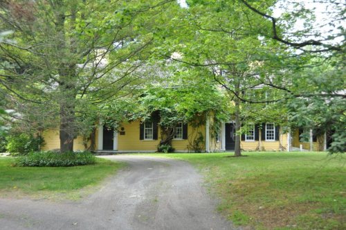
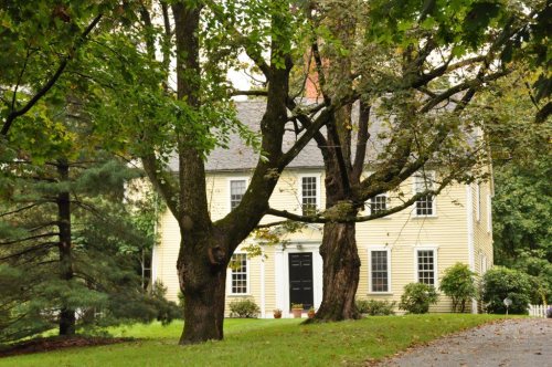
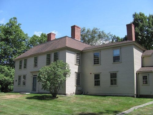
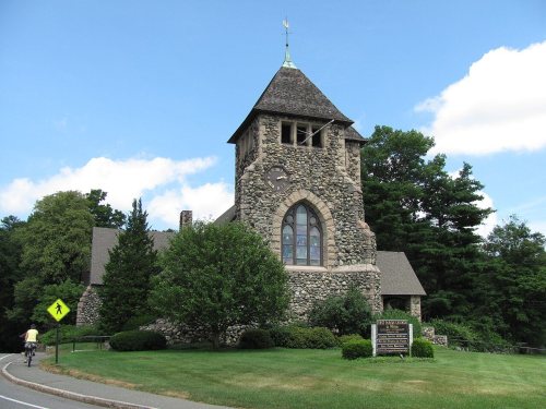
13 listings: 7 buildings, among them the Golden Ball Tavern (listed 1972, the first), and 6 historic districts with 334 contributing buildings. 429 historic buildings in all.
How old are the homes in Weston?
23% of Weston’s homes were built before 1940 (Census estimate, ±5.0 points), against a typical 21% for a Massachusetts town; the median home was built in 1964.
Founding dates: Wikidata, Wikipedia, the U.S. post office records of Blevins & Helbock (CC0) and the Census. Homes by year built: Census ACS 2020–24. National Register of Historic Places: National Park Service (list of May 22, 2026). Old photos, postcards and papers: Wikimedia Commons, the Library of Congress and other public archives, credited on each item’s page. Maps: U.S. Geological Survey historical topographic maps (via Esri) and Sanborn fire-insurance maps (Library of Congress). History text and census tables: Wikipedia (CC BY-SA 4.0). Places that used to be: USGS Geographic Names Information System (2021).
From Wikimedia Commons (12), Wikidata (6), the National Register of Historic Places (13), Wikipedia, Wikidata and Wikipedia for famous people, U.S. Geological Survey historical maps, U.S. Census counts (via Wikipedia), the US Post Offices dataset (Blevins & Helbock), the USGS Geographic Names Information System, Sanborn fire insurance maps (Library of Congress) and old county and town histories (Internet Archive). Archive images are copied here with their credits and licenses, shown on each photo’s page. Refreshed monthly.









 1901
 1901
 1901
 1901
 1901
 1901
 1901
 1901
 1901
 1901
 1901

