309 years in pictures
Census counts: 773 in 1790, 10,066 in 2020. The archive holds 24 old photos and papers going back to 1845 and 7 maps from 1887 on.
6 places on the National Register of Historic Places.
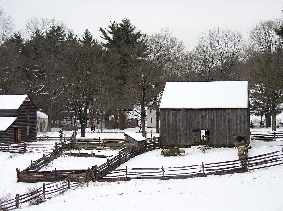
- 1717Ware is settled
Each edition grades its towns against each other only.

Ware grades D overall, 267th of 282 graded towns in Massachusetts, mostly because of schools. Its schools rank behind 89% of the state's. One bright spot: it has 23 miles of trail and 26% conserved land. History is its standout character grade: an A+, better than 98% of U.S. towns, with 6 places on the National Register. Ware’s level of violent crime is 6.1 per 1,000 residents, against 1.4 in Massachusetts’ towns and 1.6 across U.S. towns. On incomes, just 12 of Massachusetts’ 325 towns do worse. Quabbin Reservoir Reservation, at 7,964 acres with 6.1 miles of trail, is the biggest park or preserve.
Where Ware beats most towns.
Census counts: 773 in 1790, 10,066 in 2020. The archive holds 24 old photos and papers going back to 1845 and 7 maps from 1887 on.
6 places on the National Register of Historic Places.
Each subject compared with towns across the country (schools within Massachusetts), ordered by how far Ware is from typical.
How TownRatings grades towns →
Museums, parks, gardens and other places to visit around Ware. Close and well known come first.
Big draw28 mi LakeLake Chaubunagungamaug
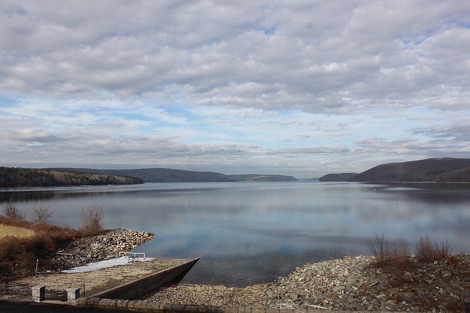
6 mi LakeQuabbin Reservoir
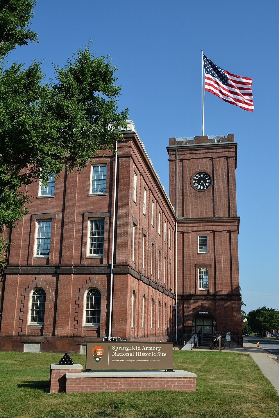
19 mi National Historic SiteSpringfield Armory National Historic Site14K visitors a year
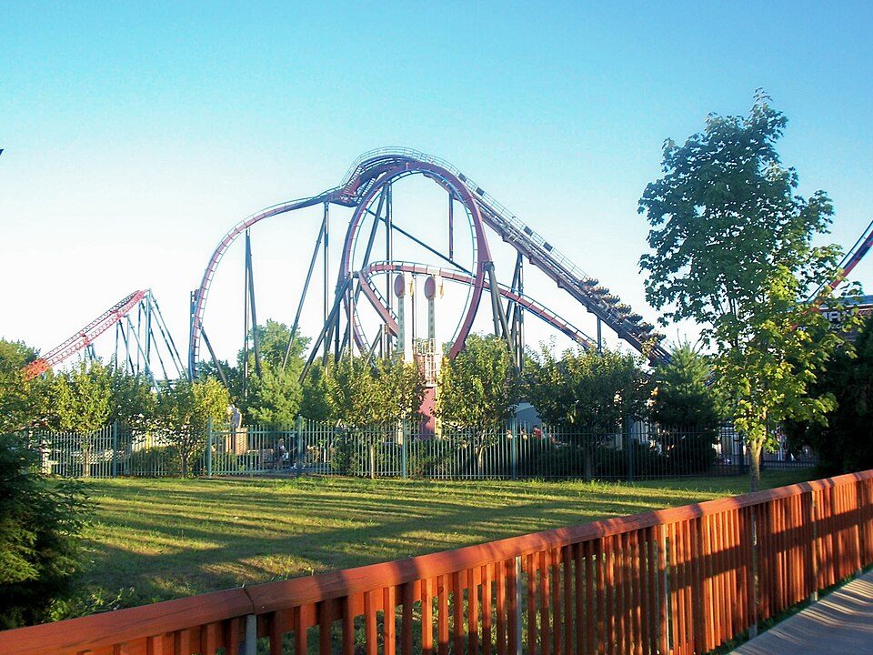
24 mi Theme parkSix Flags New England
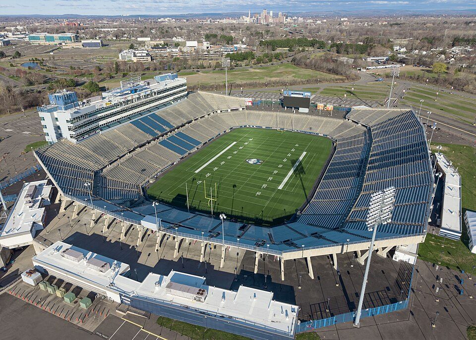
40 mi Stadium & arenaPratt & Whitney Stadium
15 mi MuseumOld Sturbridge VillageLake Chaubunagungamaug: Bree from Worcester, MA, USA, CC BY-SA 2.0 · Quabbin Reservoir: engineerchange, CC BY 2.0 · Springfield Armory National Historic Site: National Park Service, Public domain · Six Flags New England: Canadaolympic989, Public domain · Pratt & Whitney Stadium: Quintin Soloviev, CC BY 4.0 · Old Sturbridge Village: Wgmleslie at en.wikipedia, CC BY-SA 2.5
Who provides power, water and the rest in Ware, and how to reach them.
EPA SDWIS (Oct 9, 2026) · HIFLD + EIA-861 2025 · Census 2020 ZCTAs · NCES 2024–25 · registration: vote.gov, updated Nov 18, 2024.
Ordered by what stands out in Ware.
Ware reports violent crime at about twice the Massachusetts rate, but it has many renters stretched by housing costs.
Its public schools are run by the Ware school district. Two of its 3 schools are below, each with the reason it’s listed. The largest public high school is Ware Junior/Senior High School, with 425 students.
| School | Level | Students | Letter |
|---|---|---|---|
| Stanley M Koziol Elementary SchoolLargest public elementary schoolGrades PK–3 | Grades PK–3 | 396 | C− |
| Ware Junior/Senior High SchoolLargest public high schoolGrades 7–12 | Grades 7–12 | 425 | C |
NCES · EDFacts · graded within MA on state tests and graduation
64.3% of renter households pay 30% or more of their income for housing, against 51.8% across Massachusetts.
Ware’s typical rent is $1,043 a month. In the year to September 2026, typical home values climbed 2.7%. For households here, the share who live in a home they own is 72%.
| Ware | Massachusetts towns | U.S. towns | |
|---|---|---|---|
| Median rent | $1,043 a month | $1,683 a month | $1,185 a month |
| Households that own their home | 72% | 79% | 73% |
Census ACS, 2020–24 · Zillow Home Value Index · Redfin Data Center
23 miles of trail in 9 parks and preserves. Ware’s concentration of trails stands at 0.6 miles per square mile.
| Biggest places to walk | Trails | Acres |
|---|---|---|
| 1. Quabbin Park | 9.7 mi | 2,717 |
| 2. Quabbin Reservoir Reservation | 6.1 mi | 7,964 |
| 3. Grenville Park | 2.4 mi | 85 |
Trails & parks © OpenStreetMap contributors · Conserved land: USGS PAD-US
For most workers, Ware is a place to come home to: only 15% work in town. In Ware, the typical household income is $67,000. Between 2013 and 2023, jobs here rose by 211, to 2,601. Among residents in the town, 12% live below the poverty line.
| Ware | Massachusetts towns | U.S. towns | |
|---|---|---|---|
| Median household income | $67,000 | $120,000 | $80,000 |
| Below the poverty line | 12% | 6% | 9.6% |
| Working residents who work in town | 15% | 9.8% | 8% |
| Average trip to work | 28 minutes | 30 minutes | 25 minutes |
Census LEHD 2023 · ACS
Violent crime runs at 6.1 per 1,000 residents, about twice the Massachusetts rate; the Safety Grade counts each violent crime four times, so this weighs most on its C. Each of the 5 graded towns on its borders reports less crime per resident, from Palmer Town (C+) to West Brookfield (A−).
Ware’s property crime rate comes in at 3.7 per 1,000 residents.
FBI crime data, 2025 · crimes reported to police
NOAA U.S. Climate Normals, 1991–2020
The national flood insurance program has paid 3 claims in Ware since 1979. Expected damage from storms and floods is lower here than in 60% of U.S. communities. Nearly two thirds of the town’s expected losses from natural hazards come from inland flooding, followed by hurricanes at 14%. Federal aid has come to Ware households in 8 declared disasters; the latest was in 2013.
FEMA flood insurance claims · FEMA disaster declarations and aid · FEMA National Risk Index · OpenFEMA
Two figures for adults in Ware: 16% report frequent physical distress, 17% smoke cigarettes. In Ware, nearly a fifth of adults report frequent mental distress.
| Ware | Massachusetts towns | U.S. towns | |
|---|---|---|---|
| Depression (CDC PLACES) | 29% | 24% | 23% |
| Frequent physical distress (CDC PLACES) | 16% | 12% | 14% |
| Smoke cigarettes (CDC PLACES) | 17% | 11% | 14% |
| Frequent mental distress (CDC PLACES) | 19% | 16% | 17% |
| What stands out | Ware | MA |
|---|---|---|
| More adults with COPD | 9.1% | 5.9% |
| More smokers | 16.9% | 11.3% |
| More adults facing a utility shut-off | 9.5% | 7% |
CDC PLACES 2025 · modeled estimates for adults · CMS · HRSA
3 within 15 miles of the center of Ware
About 4 of every 100 Ware residents are enrolled in college, against 8 across Massachusetts.
Where Ware’s working residents go each day. Line width shows the share.
Census LEHD 2023
6 places in Ware on the National Register of Historic Places.
Town in Massachusetts, United States
Ware is a town in Hampshire County, Massachusetts, United States. The population was 10,066 as of 2020. It is part of the Springfield, Massachusetts Metropolitan Statistical Area. The census-designated place of Ware, comprising the main settlement of the town, is in the southeastern corner of the town. The area's students are served by Ware Junior Senior High School.
From Wikipedia, licensed CC BY-SA 4.0 · facts via Wikidata (CC0)
7 towns share a border with Ware.
All 5 graded towns on its borders grade higher than its D; Palmer Town (D) is closest.
| Town | MA rank | Overall | Cost | Safety | Schools | Health |
|---|---|---|---|---|---|---|
| Ware | #267 | D | C+ | C | D | C+ |
| Belchertown | #147 | B+ | C− | B+ | B− | A |
| New Salem | — | — | D | — | C− | A |
| Petersham | — | — | C | — | D | B+ |
| Hardwick | #228 | C+ | C+ | B+ | C | B |
| Palmer Town | #261 | D | C− | C+ | C− | B− |
| West Brookfield | #215 | C+ | C+ | A− | C+ | B− |
| Warren | #238 | C | B− | B | C+ | B |
New Salem and Petersham have fewer than 2,500 residents, so they get subject grades but no overall grade. New Salem and Petersham report no FBI crime data of their own. Compare Ware with a neighbor →
Short answers, built from the data on this page.
Ware grades D overall, better than 8% of U.S. towns and #267 of 282 in Massachusetts. It grades C+ for health, C for safety and D for schools. Schools is its weak spot, with a D.
That is 4 years of the area's median household income ($87,001 across the Amherst Town-Northampton, MA metro area). Cost of living, which also weighs rents, property taxes and how many households pay 30% or more of their income for housing, grades C+.