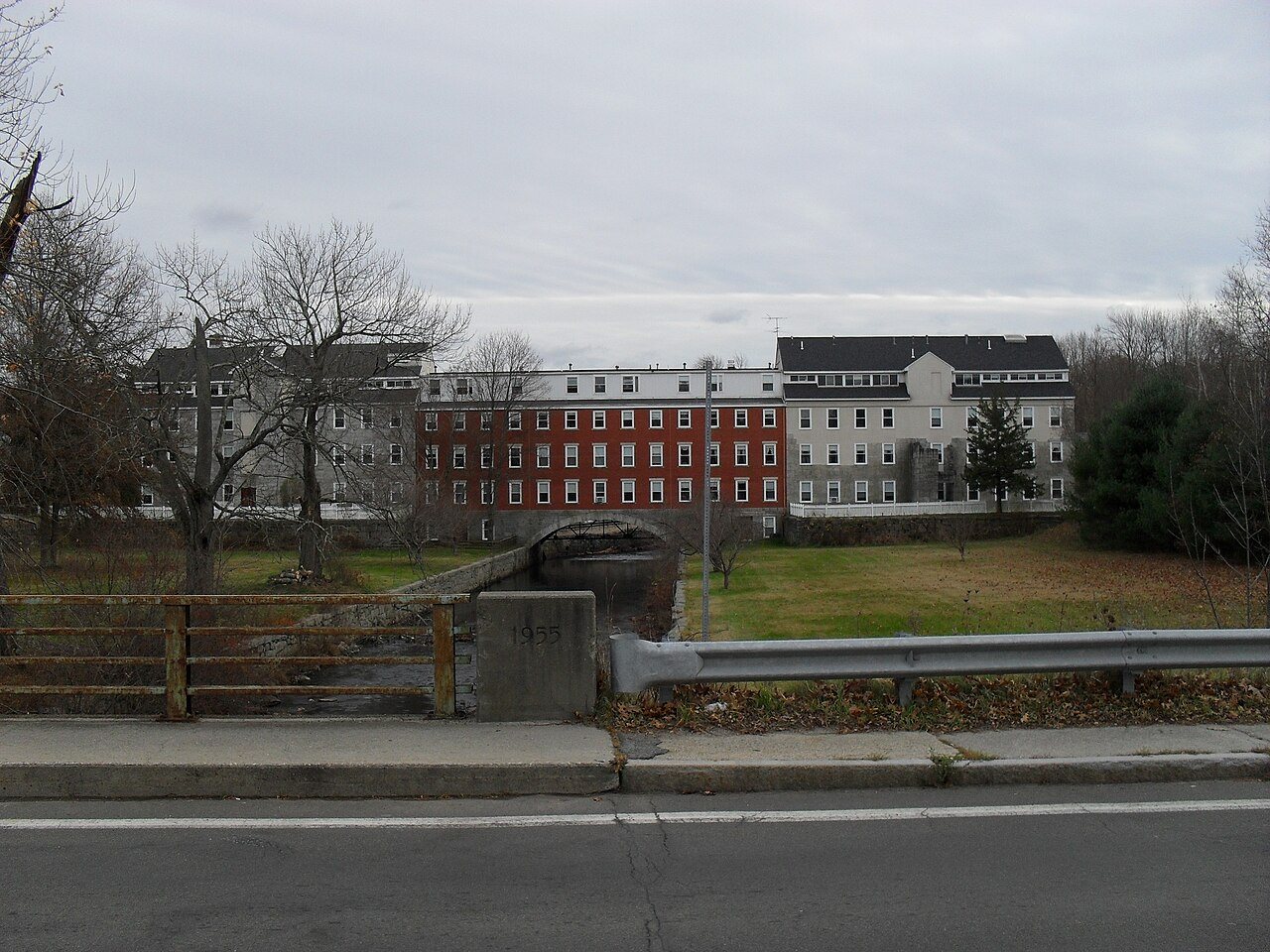
364 years in pictures
Census counts: 1,308 in 1790, 14,162 in 2020. The archive holds 18 old photos and papers going back to 1749 and 8 maps from 1886 on.
51 places on the National Register of Historic Places.
- 1662Uxbridge is settled
Each edition grades its towns against each other only.

For most people who can afford it, yes. Uxbridge grades B overall, 148th of 282 graded towns in Massachusetts. It has 28 miles of trail. The median household earns $125K and it reports less crime per resident than 83% of U.S. towns. What holds it back is price: homes are expensive, about $540K for a typical one and 5.6 times the Worcester metro’s $96K median household income. History is its standout character grade: an A+, better than 97% of U.S. towns, with 51 places on the National Register. Its National Register listings include Rogerson's Village Historic District and Friends Meetinghouse. Uxbridge’s average trip to work is 37 minutes, above both Massachusetts’ towns (30 minutes) and U.S. towns (25 minutes). Among 283 Massachusetts towns, just 5 have a lower share of renters spending 30% or more of income on rent than Uxbridge.
Where Uxbridge beats most towns.
Census counts: 1,308 in 1790, 14,162 in 2020. The archive holds 18 old photos and papers going back to 1749 and 8 maps from 1886 on.
51 places on the National Register of Historic Places.
Each subject compared with towns across the country (schools within Massachusetts), ordered by how far Uxbridge is from typical.
How TownRatings grades towns →
Museums, parks, gardens and other places to visit around Uxbridge. Close and well known come first.
Big draw10 mi LakeLake Chaubunagungamaug
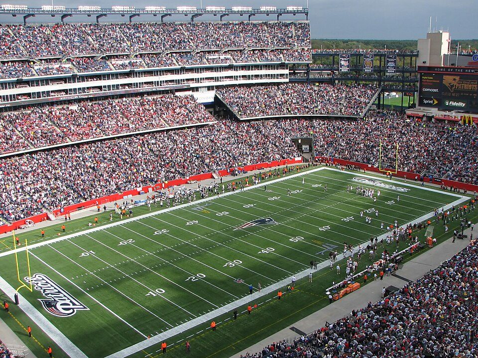
Big draw20 mi Stadium & arenaGillette Stadium
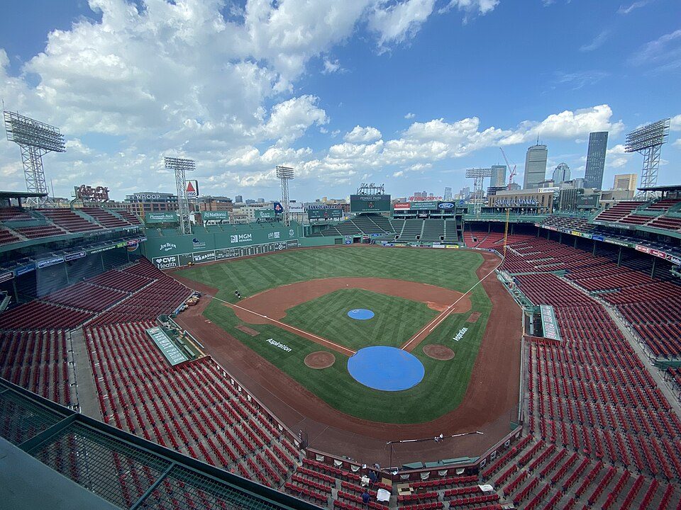
Big draw34 mi Stadium & arenaFenway Park
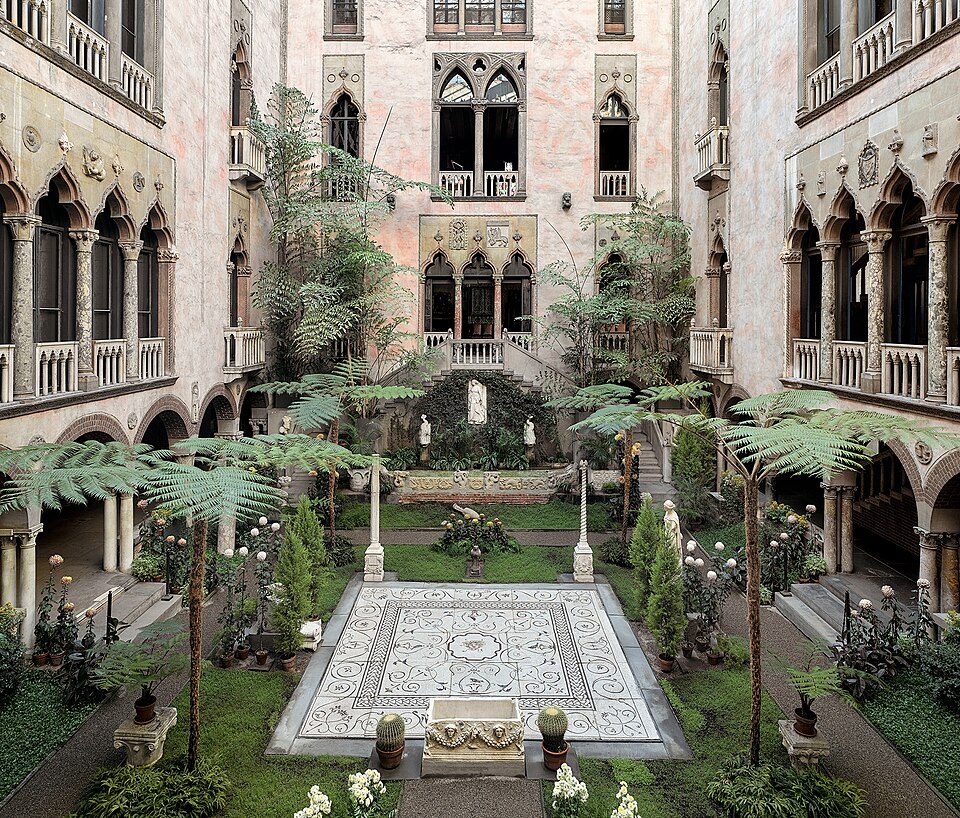
Big draw34 mi MuseumIsabella Stewart Gardner Museum
35 mi MuseumUSS Massachusetts
35 mi Ancient siteHMS EndeavourLake Chaubunagungamaug: Bree from Worcester, MA, USA, CC BY-SA 2.0 · Gillette Stadium: Bernard Gagnon, CC BY-SA 3.0 · Fenway Park: Gatorfan252525, CC BY-SA 4.0 · Isabella Stewart Gardner Museum: Sean Dungan, CC BY-SA 4.0 · USS Massachusetts: USN, Public domain · HMS Endeavour: Samuel Atkins (c.1760-1810), Public domain
Who provides power, water and the rest in Uxbridge, and how to reach them.
EPA SDWIS (Oct 9, 2026) · HIFLD + EIA-861 2025 · Census 2020 ZCTAs · NCES 2024–25 · registration: vote.gov, updated Nov 18, 2024.
Ordered by what stands out in Uxbridge.
Uxbridge sees little violent crime and is healthy by national standards but behind most towns in Massachusetts; it also has commutes longer than most of Massachusetts.
Violent crime is rare: 12 reported in 2025, 0.8 per 1,000 residents.
Uxbridge’s property crime rate is 3.7 per 1,000 residents.
| Uxbridge | Massachusetts towns | U.S. towns | |
|---|---|---|---|
| Property crimes per 1,000 (2025) | 3.7 per 1,000 residents | 4.9 | 9.9 |
| Violent crimes per 1,000 (2025) | 0.8 per 1,000 residents | 1.5 | 1.6 |
FBI crime data, 2025 · crimes reported to police
Its public schools are run by the Uxbridge school district. Two of its 5 schools are below, each with why it’s listed. The largest public high school is Uxbridge High, with 590 students.
| School | Level | Students | Letter |
|---|---|---|---|
| Taft Early Learning CenterLargest public elementary schoolGrades PK–3 | Grades PK–3 | 526 | B− |
| Uxbridge HighLargest public high schoolGrades 8–12 | Grades 8–12 | 590 | B− |
NCES · EDFacts · graded within MA on state tests and graduation
Within Massachusetts it is less healthy than 69% of the 279 graded towns: Massachusetts sets a high bar. Against the 5,091 U.S. towns with household incomes like Uxbridge’s, it is less healthy than 51%: its national edge comes with its incomes.
Uxbridge beats the Massachusetts average on 7 of 32 CDC measures and trails it on 2. 19% of Uxbridge adults binge drink.
| Uxbridge | Massachusetts towns | U.S. towns | |
|---|---|---|---|
| Binge drink (CDC PLACES) | 19% | 17% | 16% |
| Depression (CDC PLACES) | 27% | 24% | 23% |
| Obesity (CDC PLACES) | 32% | 28% | 35% |
| Sleep under 7 hours (CDC PLACES) | 32% | 33% | 36% |
| What stands out | Uxbridge | MA |
|---|---|---|
| Fewer uninsured adults | 3.7% | 5.2% |
| Fewer older adults who have lost all their teeth | 8.7% | 11.9% |
| More adults who have had cancer | 9.6% | 8.5% |
CDC PLACES 2025 · modeled estimates for adults · CMS · HRSA
The average commute for its 6,463 working residents takes 36.7 minutes, against 29.1 across Massachusetts. Jobs based here grew from 2,599 in 2013 to 3,840.
Most working residents leave Uxbridge for work: only 9% work in town. Since 2013, Uxbridge has added 1,241 jobs, to 3,840 in 2023. 3.6% of residents live below the poverty line in Uxbridge.
| Uxbridge | Massachusetts towns | U.S. towns | |
|---|---|---|---|
| Median household income | $125,000 | $120,000 | $80,000 |
| Below the poverty line | 3.6% | 6% | 9.6% |
| Work from home | 16% | 18% | 11% |
Census LEHD 2023 · ACS
Expected storm and flood damage is lower than in 68% of U.S. communities. Since 1979, 17 flood insurance claims have been paid out in Uxbridge.
FEMA flood insurance claims · FEMA National Risk Index · OpenFEMA
Uxbridge has chilly, snowy winters and pleasant summers, with plenty of rain. July afternoons reach 83°, January nights drop to 18° and about 48 inches of snow falls in a winter.
NOAA U.S. Climate Normals, 1991–2020
The trail density in Uxbridge is 0.9 miles per square mile. The biggest place to walk is West Hill Park, 198 acres with 3 miles of trail.
| Biggest places to walk | Trails | Acres |
|---|---|---|
| 1. Blackstone River and Canal Heritage State Park | 7.6 mi | 431 |
| 2. West Hill Park | 3 mi | 198 |
| 3. Cormier Woods | 2.9 mi | 140 |
Trails & parks © OpenStreetMap contributors · Conserved land: USGS PAD-US
The typical Uxbridge home is worth about $540,000, up 2.7% in a year, 18% below the Massachusetts typical home.
| Uxbridge | Massachusetts towns | U.S. towns | |
|---|---|---|---|
| Median rent | $1,555 a month | $1,683 a month | $1,185 a month |
| Households that own their home | 80% | 79% | 73% |
Zillow Home Value Index · Redfin Data Center
No broad age group is more than 4 points off the Massachusetts average. Uxbridge has grown 4.3% since 2020, to 14,783 residents in the Census Bureau’s 2025 estimate. 38% of adults 25 and older have a bachelor’s degree or more, vs 47% across Massachusetts.
| Uxbridge | Massachusetts towns | U.S. towns | |
|---|---|---|---|
| Bachelor’s degree or more, 25+ | 38% | 47% | 29% |
| Under 18 | 20% | 20% | 22% |
| Aged 65 or older | 17% | 19% | 18% |
| Median age | 41.7 years | 43.4 years | 40.5 years |
50% women, 50% men
That’s an even split within the survey’s margin of ±2.9 points. Across Massachusetts, 51.1% of residents are women.
| Uxbridge | MA | U.S. | |
|---|---|---|---|
| Under 10 | 10.8% | 10.2% | 11.6% |
| 10 to 17 | 8.6% | 9.2% | 10.3% |
| 18 to 24 | 8.4% | 9.8% | 9.1% |
| 25 to 34 | 13% | 14% | 13.7% |
| 35 to 44 | 13% | 13% | 13.2% |
| 45 to 54 | 12.7% | 12.3% | 12.2% |
| 55 to 64 | 16.3% | 13.6% | 12.7% |
| 65 to 74 | 10.1% | 10.5% | 10.2% |
| 75 and older | 6.9% | 7.4% | 7% |
| No diploma | 5.2% | 8.6% | 10.4% |
| High school | 27.5% | 22.6% | 26% |
| Some college | 17% | 14.1% | 19.1% |
| Associate’s | 12.3% | 7.5% | 8.8% |
| Bachelor’s | 25.7% | 25.5% | 21.6% |
| Graduate | 12.3% | 21.8% | 14.1% |
Census population estimates, 2025 · U.S. Census Bureau · ACS 2020-2024 5-year estimates
4 within 15 miles of the center of Uxbridge
About 4 of every 100 Uxbridge residents are enrolled in college, against 8 across Massachusetts.
Where Uxbridge’s working residents go each day. Line width shows the share.
Census LEHD 2023
51 places in Uxbridge on the National Register of Historic Places.
18 notable people were born in Uxbridge.


Town in Massachusetts, United States
Uxbridge, a town in Worcester County, Massachusetts, was incorporated in 1727 from a part of Mendon, and named for the Earl of Uxbridge. The town is located 36 mi (58 km) southwest of Boston and 15 mi (24 km) south-southeast of Worcester. The historical society says Uxbridge is the "Heart of The Blackstone Valley" and a “Cradle of the Industrial Revolution". Uxbridge, an early Textile center in the American Industrial Revolution, became a rural hub in the abolition movement. Uxbridge has a credible claim as an early incubator of the American woolen industry. Sachems of the Nipmuc deeded land to 17th-century settlers. Uxbridge history claims a first colonial woman voter, Lydia Taft, and Mass…
From Wikipedia, licensed CC BY-SA 4.0 · facts via Wikidata (CC0)
5 towns share a border with Uxbridge.
| Town | MA rank | Overall | Cost | Safety | Schools | Health |
|---|---|---|---|---|---|---|
| Uxbridge | #148 | B | C− | A− | C | A− |
| Douglas | #116 | B+ | C | A− | C+ | A |
| Northbridge | #188 | B− | C | A− | C | B+ |
| Sutton | #73 | A | C+ | A− | B | A |
| Millville | #132 | B+ | C | A+ | C+ | B+ |
| Whitinsville | — | — | — | — | — | — |
Whitinsville isn’t graded (fewer than 1,000 residents, or not enough data). Compare Uxbridge with a neighbor →
Short answers, built from the data on this page.
For most people who can afford it, yes. Uxbridge grades B overall, better than 65% of U.S. towns and #148 of 282 in Massachusetts. It grades A− for health, A− for safety and C for schools. Cost of living is its weak spot, with a C−.
18 notable people were born here, including Jeannine Oppewall and Tyler Burton.