Guest, Sign inJoin

Post to Southbridge Town

We’ll email a one-tap link to publish your post. No password, and nothing is public until you click it.
Already a member? Sign in
Southbridge Town HallPhoto: Marcbela (Marc N. Belanger) · Public domain
A+History
History · Southbridge Town

Southbridge Town dates to 1730, and 33% of its homes were built before 1940

More historic than 98% of U.S. towns · #43 of 283 in Massachusetts. What drives it

84 places in town are on the National Register, among them ten historic districts with 120 buildings between them. Below: 1 old photo or paper, maps from 1887 on, and the census since 1850.

1730founded
84on the National Register
33%homes built before 1940
1old photo or paper
14famous people
From Southbridge Town’s archive · credits on each photo
Quick answers

How Southbridge Town began

When was Southbridge Town founded?

1730

Southbridge Town dates its founding to 1730 (Wikidata). The census first counted it in 1850.

First census: 2,824 in 18502020 census: 17,740296 years

How historic is Southbridge Town?

A+

More historic than 98% of U.S. towns, on its age, its old homes and the National Register.

What drives the grade ↓
Founding year: Wikidata. First post office: 1823.The full story ↓
History grade

What drives Southbridge Town’s History grade

On its age, its old homes and the National Register, Southbridge Town is more historic than 98% of U.S. towns, #43 of 283 in Massachusetts. All 3 inputs are above most U.S. towns; its age ranks highest and its National Register listings lowest.

A+
HistoryA character grade: shown, never part of Southbridge Town’s overall grade.
All U.S. towns we grade (21,289)Ahead of 98%
NewerOlder
Massachusetts towns of 2,500+ (283)Ahead of 85%

Massachusetts towns list more on the Register than most of the country (a typical Massachusetts town has 46.0 per 10,000 residents, the U.S. 2.4), so Southbridge Town’s 122 sits above most of its state (67% of Massachusetts towns have fewer) while its 218 historic buildings outnumber those of 94% of U.S. towns.

NoteThe founding year comes from Wikidata alone; no second source gives 1730.
How sure. Graded on any two of the three inputs instead, the letter would range from A to A+. The pre-1940 share is a Census survey estimate (±3.5 points).

Founding year: Wikidata (other dates in Quick answers). Homes: Census ACS 2020–24. National Register: National Park Service, May 2026 list; each listing counted once (boundary changes and added documentation belong to their listing), and a historic district counts its contributing buildings. How TownRatings grades history →

What stands out about Southbridge Town’s past

Read from the archive, the National Register and the record. The page puts what stands out first.

★ What stands out · On the National Register

84 historic places in Southbridge Town

The country’s official list of buildings and places worth saving.

places listed
84
National Historic Landmarks
0
none yet
historic buildings protected
218
each building in a district counts
first listed
1987
Southbridge Town Hall
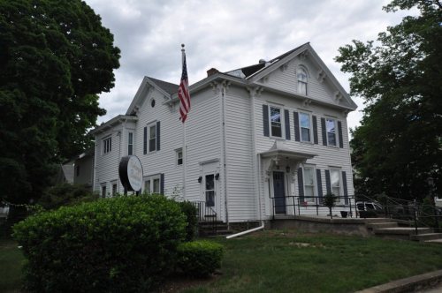
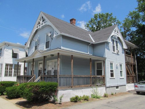
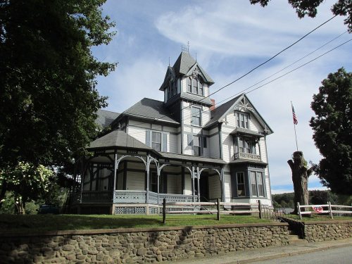
Southbridge Town Hall, built 1888A. Kinney House, built 1865Academie Brochu, built 1899Albert H. Wheeler House, built 1896Alden-Delahanty Block, built 1878Alexis Boyer House, built 1888Alpha M. Cheney House, built 1881Ammidown-Harding Farmhouse, built 1796Ashland Mill Tenement, built 1835Bacon-Morse Historic DistrictBeechwood, built 1868Building at 25-27 River StreetBuilding at 29-31 River StreetBuilding at 38-42 Worcester StreetBuilding at 52 Main Street, built 1915Central Mills Historic DistrictChamberlain-Bordeau HouseChapin Block, built 1888Cheney, J. M., Rental House, built 1890Clarke-Glover FarmhouseCliff Cottage, built 1855Comins-Wall HouseCongregational ChurchDani and Soldani Cabinet Makers and Wood Workers FactoryDennison School HouseDunbar-Vinton HouseDurfee, Henry E., FarmhouseE. B. Cummings House, built 1875E. M. Phillips HouseE. Merritt Cole HouseElm Street Fire HouseEugene Tapin HouseEvangelical Free Church, built 1869George B. and Ruth D. Wells HouseGeorge H. Hartwell HouseGeorge Sumner HouseGlobe Village Fire HouseGlover Street Historic DistrictH. C. Wells Double HouseH. Morse HouseHamilton Mill Brick HouseHamilton Mill-West Street Factory HousingHamilton Millwright-Agent's HouseHamilton Woolen Company Historic DistrictHigh-School Streets Historic DistrictHodgson, William, Two-Family HouseHouse at 18 Walnut StreetHouse at 3 Dean StreetHouse at 34 Benefit StreetHouse at 59-63 Crystal StreetHouse at 64 Main StreetHouse at 70-72 Main StreetHouse at 91 Coombs StreetJ. J. Oakes HouseJames Gleason CottageJohn M. Wells HouseJudson-Litchfield HouseLaCroix-Mosher HouseLaRochelle, Napoleon, Two-Family HouseLorenzo R. Stone HouseMaple Street Historic DistrictMcKinstry, William, FarmhouseMrs. R. Marcy HouseNew York, New Haven & Hartford Passenger DepotNotre Dame Catholic Church, built 1916Plimpton, Simon, FarmhouseSacred Heart Church Historic District, built 1908Samuel C. Hartwell HouseSmith-Lyon FarmhouseSt. George's Greek Orthodox ChurchSt. Peter's Roman Catholic Church-St. Mary's School, built 1853Stephen Richard HouseSylvester Dresser HouseTheodore Harrington HouseTiffany-Leonard HouseTwinehurst American Optical Company NeighborhoodUpper Chapin Street Historic DistrictVinton-Boardman FarmhouseVinton-Torrey HouseWilliam E. Alden House, built 1885William McKinstry Jr. HouseWindsor Court Historic DistrictAmerican Optical Company Historic DistrictMary E. Wells School, built 1916
BuildingsDistricts

Architectural styles listings

Greek Revival23
Italianate11
Colonial Revival10
Federal9
Queen Anne8
Victorian5
All 84 listings
Ashland Mill TenementBuilding · listed 1989Bacon-Morse Historic DistrictDistrict · listed 1989BeechwoodBuilding · listed 1989Building at 25-27 River StreetBuilding · listed 1989Building at 29-31 River StreetBuilding · listed 1989Building at 38-42 Worcester StreetBuilding · listed 1989Building at 52 Main StreetBuilding · listed 1989Central Mills Historic DistrictDistrict · listed 1989Chamberlain-Bordeau HouseBuilding · listed 1989Chapin BlockBuilding · listed 1989Cheney, J. M., Rental HouseBuilding · listed 1989Clarke-Glover FarmhouseBuilding · listed 1989Cliff CottageBuilding · listed 1989Comins-Wall HouseBuilding · listed 1989Congregational ChurchBuilding · listed 1989Dani and Soldani Cabinet Makers and Wood Workers FactoryBuilding · listed 1989Dennison School HouseBuilding · listed 1989Dunbar-Vinton HouseBuilding · listed 1989Durfee, Henry E., FarmhouseBuilding · listed 1989E. B. Cummings HouseBuilding · listed 1989E. M. Phillips HouseBuilding · listed 1989E. Merritt Cole HouseBuilding · listed 1989Elm Street Fire HouseBuilding · listed 1989Eugene Tapin HouseBuilding · listed 1989Evangelical Free ChurchBuilding · listed 1989George B. and Ruth D. Wells HouseBuilding · listed 1989George H. Hartwell HouseBuilding · listed 1989George Sumner HouseBuilding · listed 1989Globe Village Fire HouseBuilding · listed 1989Glover Street Historic DistrictDistrict · listed 1989H. C. Wells Double HouseBuilding · listed 1989H. Morse HouseBuilding · listed 1989Hamilton Mill Brick HouseBuilding · listed 1989Hamilton Mill-West Street Factory HousingBuilding · listed 1989Hamilton Millwright-Agent's HouseBuilding · listed 1989Hamilton Woolen Company Historic DistrictDistrict · listed 1989High-School Streets Historic DistrictDistrict · listed 1989Hodgson, William, Two-Family HouseBuilding · listed 1989House at 18 Walnut StreetBuilding · listed 1989House at 3 Dean StreetBuilding · listed 1989House at 34 Benefit StreetBuilding · listed 1989House at 59-63 Crystal StreetBuilding · listed 1989House at 64 Main StreetBuilding · listed 1989House at 70-72 Main StreetBuilding · listed 1989House at 91 Coombs StreetBuilding · listed 1989J. J. Oakes HouseBuilding · listed 1989James Gleason CottageBuilding · listed 1989John M. Wells HouseBuilding · listed 1989Judson-Litchfield HouseBuilding · listed 1989LaCroix-Mosher HouseBuilding · listed 1989LaRochelle, Napoleon, Two-Family HouseBuilding · listed 1989Lorenzo R. Stone HouseBuilding · listed 1989Maple Street Historic DistrictDistrict · listed 1989McKinstry, William, FarmhouseBuilding · listed 1989Mrs. R. Marcy HouseBuilding · listed 1989New York, New Haven & Hartford Passenger DepotBuilding · listed 1989Notre Dame Catholic ChurchBuilding · listed 1989Plimpton, Simon, FarmhouseBuilding · listed 1989Sacred Heart Church Historic DistrictDistrict · listed 1989Samuel C. Hartwell HouseBuilding · listed 1989Smith-Lyon FarmhouseBuilding · listed 1989St. George's Greek Orthodox ChurchBuilding · listed 1989St. Peter's Roman Catholic Church-St. Mary's SchoolBuilding · listed 1989Stephen Richard HouseBuilding · listed 1989Sylvester Dresser HouseBuilding · listed 1989Theodore Harrington HouseBuilding · listed 1989Tiffany-Leonard HouseBuilding · listed 1989Twinehurst American Optical Company NeighborhoodDistrict · listed 1989Upper Chapin Street Historic DistrictDistrict · listed 1989Vinton-Boardman FarmhouseBuilding · listed 1989Vinton-Torrey HouseBuilding · listed 1989William E. Alden HouseBuilding · listed 1989William McKinstry Jr. HouseBuilding · listed 1989Windsor Court Historic DistrictDistrict · listed 1989American Optical Company Historic DistrictDistrict · listed 2023Mary E. Wells SchoolBuilding · listed 2023

National Park Service, National Register of Historic Places. Photos from Wikimedia Commons, credited on each place’s page.

Help out

Start Southbridge Town’s collection

The first neighbors to add old photos shape how Southbridge Town’s history is told.

Decades since 1900 with photos
00s10s20s30s40s50s60s70s80s90s
0 of 10 decades. The empty ones are waiting for someone’s album.
On the map

Southbridge Town on the map, 1887 to 1982

Every edition of the U.S. Geological Survey’s map of Southbridge Town. Tap a year, or press play to watch the town change.

Southbridge Town on the 1887 USGS mapSouthbridge Town on the 1890 USGS mapSouthbridge Town on the 1915 USGS mapSouthbridge Town on the 1921 USGS mapSouthbridge Town on the 1952 USGS mapSouthbridge Town on the 1967 USGS mapSouthbridge Town on the 1979 USGS mapSouthbridge Town on the 1982 USGS map1887Brookfield sheet · 1:62,500

U.S. Geological Survey historical topographic maps (public domain), via Esri’s collection of the scans. The red ring marks the center of Southbridge Town.

The story

How Southbridge Town came to be

From Wikipedia’s history of Southbridge Town.

Read it all →

The area was initially inhabited by the Nipmuck and Mohegan tribes, with the Quinebaug River dividing their territories. As early as 1638, John Winthrop Jr. purchased Tantiusques, a tract for mining "lead" centered at what is now Leadmine Road in Sturbridge (it was thought at the time that where there was lead, there should be silver nearby). In fact the mineral deposit was graphite which the Winthrops commercialized employing Nipmuck miners.

Text from Wikipedia, licensed CC BY-SA 4.0.

Timeline

Southbridge Town, 1730 to 1986

Woven from the archive, old maps, post office records, the National Register and the people born here.

  1. 18th century
  2. 1730
    FoundingSouthbridge Town is established
  3. 1786Born hereWilliam L. Marcy is born here
  4. 19th century
  5. 1823Post officeThe Southbridge post office opens
  6. 1851Post officeThe Globe Village post office opens
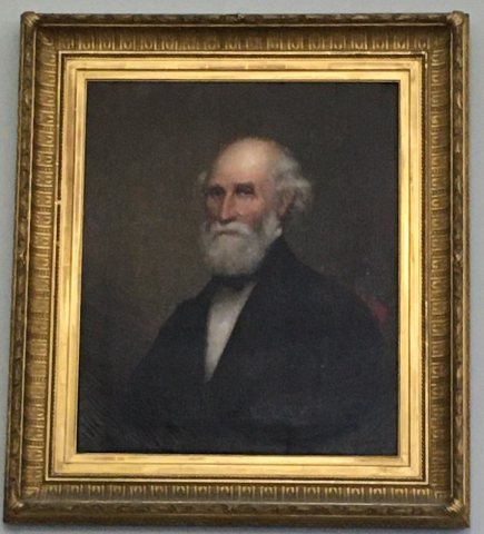
  7. 1860In the archive“Manning Leonard.” ca. 1860
  8. 1865BuiltA. Kinney House is built
  9. 1886Born hereFrancis Harper is born here
  10. 1887On the mapFirst mapped by the U.S. Geological Survey
  11. 1888BuiltSouthbridge Town Hall is built
  12. 1896BuiltAlbert H. Wheeler House is built
  13. 1899BuiltAcademie Brochu is built
  14. 20th century
  15. 1906Post officeThe Globe Village post office closes
  16. 1918Born hereGeorge Constantine is born here
  17. 1986Born hereKenny Dykstra is born here
By decade

Southbridge Town, decade by decade

One decade in the archive so far: the 1860s. Scroll each row; tap a photo for its story.

Then & now

Stand where they stood

No then-and-now pairs yet. Take a photo from the same spot as an old one and they appear here side by side.

“Manning Leonard.” ca. 1860
Retake this view“Manning Leonard.” ca. 1860, c. 1860

Find the spot, match the angle, and add your photo. It becomes the first then-and-now pair on Southbridge Town’s page.

Retake this view · +15
People over time

Southbridge Town, census by census

02,0004,0006,0008,00010,00012,00014,00016,00018,0001850190019502000Peak: 17,816

Between 2,824 and 17,816 people in every census since 1850.

18 censuses, 1850–2020.

U.S. Census Bureau decennial counts, from the census table on Southbridge Town’s Wikipedia page.

Famous people

14 famous people were born in Southbridge Town

Writers, athletes, leaders and more, ranked by how widely they’re known.

See all →
Places that used to be

Lost post offices, old corners, places now gone and burying grounds

Another post office, Globe Village, opened and closed inside today’s town.

Southbridge
1823–today
Globe Village
1851–1906
18201920today
Hamlets and corners on the map
Globe VillageSandersdaleSouthbridge
Gone or out of use
Hamilton Milllocale
4cemeteries and burying grounds inside Southbridge Town
New Notre DameOak RidgeSaint GeorgeSaint Marys

US Post Offices dataset (Blevins & Helbock, CC0). Places and cemeteries from the USGS Geographic Names Information System (2021).

Stories next door

History across the town line

Each neighbor’s History grade, on the same three inputs.

Questions about Southbridge Town’s history

What year was Southbridge Town founded?

In 1730, according to Wikidata. Southbridge Town’s post office opened in 1823, and the census of 1850 counted 2,824 people here.

How does Southbridge Town rank for history?

Southbridge Town is more historic than 98% of U.S. towns, #43 of 283 in Massachusetts. The History grade combines the town’s founding era, the share of homes built before 1940 and its National Register listings. It’s a character grade, so it isn’t part of the overall grade. How it works.

What is on the National Register in Southbridge Town?

84 listings: 73 buildings, among them the Southbridge Town Hall (listed 1987, the first), and 11 historic districts with 120 contributing buildings. 218 historic buildings in all.

How old are the homes in Southbridge Town?

33% of Southbridge Town’s homes were built before 1940 (Census estimate, ±3.5 points), against a typical 21% for a Massachusetts town; the median home was built in 1956.

Memory lane

What the archives can’t tell you, neighbors can.

Town Square →
Start a conversation
Sources

Where this page comes from

Founding dates: Wikidata, Wikipedia, the U.S. post office records of Blevins & Helbock (CC0) and the Census. Homes by year built: Census ACS 2020–24. National Register of Historic Places: National Park Service (list of May 22, 2026). Old photos, postcards and papers: Wikimedia Commons, the Library of Congress and other public archives, credited on each item’s page. Maps: U.S. Geological Survey historical topographic maps (via Esri) and Sanborn fire-insurance maps (Library of Congress). History text and census tables: Wikipedia (CC BY-SA 4.0). Places that used to be: USGS Geographic Names Information System (2021).

From Wikimedia Commons (1), Wikidata (5), the National Register of Historic Places (84), Wikipedia, Wikidata and Wikipedia for famous people, U.S. Geological Survey historical maps, U.S. Census counts (via Wikipedia), the US Post Offices dataset (Blevins & Helbock) and the USGS Geographic Names Information System. Archive images are copied here with their credits and licenses, shown on each photo’s page. Refreshed monthly.