Guest, Sign inJoin

Post to Pittsfield

We’ll email a one-tap link to publish your post. No password, and nothing is public until you click it.
Already a member? Sign in
A+History
History · Pittsfield

Pittsfield dates to 1752, and 38% of its homes were built before 1940

More historic than 96% of U.S. towns · #70 of 283 in Massachusetts. What drives it

23 places in town are on the National Register, among them 2 National Historic Landmarks and five historic districts with 106 buildings between them. Below: 8 old photos and papers, maps from 1884 on, and the census since 1790.

1752founded
23on the National Register
38%homes built before 1940
8old photos & papers
52famous people
From Pittsfield’s archive · credits on each photo
Quick answers

How Pittsfield began

When was Pittsfield founded?

1752

Pittsfield dates its founding to 1752 (Wikidata). It appears in the first U.S. census, 1790.

First census: 1,992 in 17902020 census: 43,927274 years

How historic is Pittsfield?

A+

More historic than 96% of U.S. towns, on its age, its old homes and the National Register.

What drives the grade ↓
Founding year: Wikidata. First post office: 1794.The full story ↓
History grade

What drives Pittsfield’s History grade

On its age, its old homes and the National Register, Pittsfield is more historic than 96% of U.S. towns, #70 of 283 in Massachusetts. All 3 inputs are above most U.S. towns; its age ranks highest and its National Register listings lowest.

A+
HistoryA character grade: shown, never part of Pittsfield’s overall grade.
All U.S. towns we grade (21,289)Ahead of 96%
NewerOlder
Massachusetts towns of 2,500+ (283)Ahead of 76%

Massachusetts towns list more on the Register than most of the country (a typical Massachusetts town has 46.0 per 10,000 residents, the U.S. 2.4), so Pittsfield’s 32.7 sits near the middle of its state (41% of Massachusetts towns have fewer) while its 142 historic buildings outnumber those of 91% of U.S. towns.

How sure. Graded on any two of the three inputs instead, the letter would range from A to A+. The pre-1940 share (±2.7 points) is firm at this size. Two sources give 1752.

Founding year: Wikidata (other dates in Quick answers). Homes: Census ACS 2020–24. National Register: National Park Service, May 2026 list; each listing counted once (boundary changes and added documentation belong to their listing), and a historic district counts its contributing buildings. How TownRatings grades history →

What stands out about Pittsfield’s past

Read from the archive, the National Register and the record. The page puts what stands out first.

★ What stands out · On the National Register

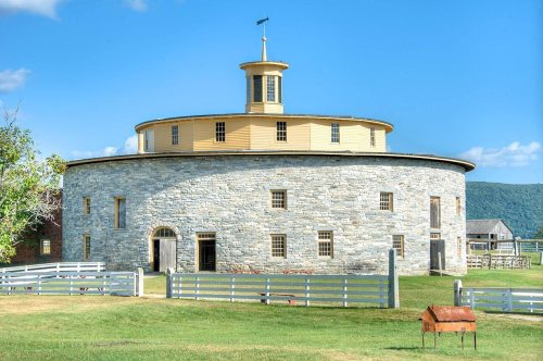
23 listings protect 142 historic buildings

The country’s official list of buildings and places worth saving. 2 are National Historic Landmarks, the highest tier. Boundary changes and added documentation are counted with their listing.

places listed
23
National Historic Landmarks
2
Herman Melville House
historic buildings protected
142
each building in a district counts
first listed
1966
Herman Melville House
All 23 listings

National Park Service, National Register of Historic Places. Photos from Wikimedia Commons, credited on each place’s page.

Places that used to be

Lost post offices, old corners, places now gone and burying grounds

Pittsfield’s post office has been open since 1794. Four other post offices opened and closed inside today’s town.

Pittsfield
1794–today
Stearnsville
1833–1842
West Pittsfield
1844–1903
Coltsville
1862–1886
Pontoosuc
1883–1908
17901910today
Hamlets and corners on the map
Adams JunctionBarkervilleCamp Marion WhiteCamp MerrillCamp StevensonCamp SumnerCamp WitawentinColtsvilleLakeview TerraceLakewoodPontoosucStearnsvilleThe BouldersVictory HillWest PittsfieldYankee Orchards
Gone or out of use
Briggs SchoolschoolCentral Annex SchoolschoolCrane SchoolschoolDawes SchoolschoolHubbard SchoolschoolLower Barkerville Post Officepost officeNorth Junior High SchoolschoolPontoosuc SchoolschoolRedfield SchoolschoolSaint Marys SchoolschoolSouth Junior High SchoolschoolTucker Schoolschool
5cemeteries and burying grounds inside Pittsfield
East PartKnesses IsraelLove of PeacePittsfieldSaint Josephs

US Post Offices dataset (Blevins & Helbock, CC0). Places and cemeteries from the USGS Geographic Names Information System (2021).

On the map

Pittsfield on the map, 1886 to 1997

Every edition of the U.S. Geological Survey’s map of Pittsfield. Tap a year, or press play to watch the town change.

Pittsfield on the 1886 USGS mapPittsfield on the 1893 USGS mapPittsfield on the 1944 USGS mapPittsfield on the 1959 USGS mapPittsfield on the 1973 USGS mapPittsfield on the 1988 USGS mapPittsfield on the 1997 USGS map1886Becket sheet · 1:62,500

U.S. Geological Survey historical topographic maps (public domain), via Esri’s collection of the scans. The red ring marks the center of Pittsfield.

The story

How Pittsfield came to be

From Wikipedia’s history of Pittsfield.

Read it all →

The Mohicans, an Algonquian people, inhabited the area that would later come to comprise Pittsfield until the early 18th century, when the population was greatly reduced by war and disease brought by European Colonists. Many migrated westward or were subjugated to live on the fringes of their land.

Text from Wikipedia, licensed CC BY-SA 4.0.

From the old history books

What they wrote about Pittsfield in 1916

Passages that mention Pittsfield, cut from the printed page as they were published.

Mr. Hibbard's inaugural address was attuned to the same chord of courageous hopefulness which had vibrated throughout Judge Barker's farewell to the town. Said the mayor: "The record of the town of Pittsfield, just closed, is secure, the record of the City of Pittsfield is yet to be made. A record …
The history of Pittsfield, Massachusetts, from the year 1876 to the year 19161916 · page 76Read the page →
Read the text

Mr. Hibbard's inaugural address was attuned to the same chord of courageous hopefulness which had vibrated throughout Judge Barker's farewell to the town. Said the mayor: "The record of the town of Pittsfield, just closed, is secure, the record of the City of Pittsfield is yet to be made. A record as distinguished and brilliant we are not justified in expecting, but a record no less honorable is possible, if we will but carry into the new system of local self-government the spirit of the old; if our public servants

Text read by machine from the scan; it may contain errors.
Pittsfield Journal Co., 311 Pittsfield Kindergarten Association, 225 Pittsfield Manufacturing Co., 252 Pittsfield National Bank, 261 Pittsfield Publishing Co., 312 Pittsfield Shakers, 94 Pittsfield Sun, 303
The history of Pittsfield, Massachusetts, from the year 1876 to the year 19161916 · page 385Read the page →
Read the text

Pittsfield Journal Co., 311 Pittsfield Kindergarten Association, 225 Pittsfield Manufacturing Co., 252 Pittsfield National Bank, 261 Pittsfield Publishing Co., 312 Pittsfield Shakers, 94 Pittsfield Sun, 303

Text read by machine from the scan; it may contain errors.

Scans and text from the Internet Archive. Books published in 1930 or earlier, which are in the public domain.

Timeline

Pittsfield, 1752 to 1903

Woven from the archive, old maps, post office records, the National Register and the people born here.

  1. 18th century
  2. 1752
    FoundingPittsfield is established
  3. 1780BuiltHerman Melville House is built
  4. 1782Born hereWilliam Miller is born here
  5. 1788In the archive1788 Berkshire Chronicle Pittsfield, Massachusetts July3
  6. 1794Post officeThe Pittsfield post office opens
  7. 19th century
  8. 1807In the archiveRecto Berkshire Bank 10 dollars 1807
  9. 1810BuiltPark Square Historic District is built
  10. 1832BuiltOld Town Hall is built
  11. 1833Post officeThe Stearnsville post office opens
  12. 1840In the archiveUS 1864 Pittfield MA Maplewood Seminary Advertising cover
  13. 1842Post officeThe Stearnsville post office closes
  14. 1844Post officeThe West Pittsfield post office opens
  15. 1860In the archivePittsfield (Massachusetts)
  16. 1872In the archive[Allen Library for Thomas Allen
  17. 1886On the mapFirst mapped by the U.S. Geological Survey
  18. 1890In the archiveUS 1892 Pittsfied MA Agricultural Society Advertising Cover
  19. 1895BuiltOld Central Fire Station is built
  20. 20th century
  21. 1903Post officeThe West Pittsfield post office closes
By decade

Pittsfield, decade by decade

6 decades in the archive, from the 1780s to the 1890s. Scroll each row; tap a photo for its story.

Every building

Pittsfield, building by building, 1884–1905

Fire insurance maps drew every building, what it was made of and what it was used for, so insurers could price the risk of fire. Pick a year, then a sheet.

Pittsfield fire insurance map, 1884, sheet 11884Sheet 1 of 8
Edition
BrickWoodStone

Sanborn Map Company, via the Library of Congress. Editions published in 1930 or earlier, which are in the public domain.

Then & now

Stand where they stood

No then-and-now pairs yet. Take a photo from the same spot as an old one and they appear here side by side.

US 1864 Pittfield MA Maplewood Seminary Advertising cover
Retake this viewUS 1864 Pittfield MA Maplewood Seminary Advertising cover, 1840s

Find the spot, match the angle, and add your photo. It becomes the first then-and-now pair on Pittsfield’s page.

Retake this view · +15
People over time

Pittsfield, census by census

05,00010,00015,00020,00025,00030,00035,00040,00045,00050,00055,00060,00018001850190019502000Peak: 57,879

Between 1,992 and 57,879 people in every census since 1790.

24 censuses, 1790–2020.

U.S. Census Bureau decennial counts, from the census table on Pittsfield’s Wikipedia page.

Famous people

52 famous people were born in Pittsfield

Writers, athletes, leaders and more, ranked by how widely they’re known.

See all →
Help out

Finish Pittsfield’s story

Most archives stop around 1920. The photos from after that are in family albums, not libraries.

Decades since 1900 with photos
00s10s20s30s40s50s60s70s80s90s
0 of 10 decades. The empty ones are waiting for someone’s album.
Stories next door

History across the town line

Each neighbor’s History grade, on the same three inputs.

Questions about Pittsfield’s history

What year was Pittsfield founded?

In 1752, according to Wikidata. Pittsfield’s post office opened in 1794, and the first U.S. census counted 1,992 people here in 1790.

How does Pittsfield rank for history?

Pittsfield is more historic than 96% of U.S. towns, #70 of 283 in Massachusetts. The History grade combines the town’s founding era, the share of homes built before 1940 and its National Register listings. It’s a character grade, so it isn’t part of the overall grade. How it works.

What is on the National Register in Pittsfield?

23 listings, 2 of them National Historic Landmarks: 16 buildings, among them the Herman Melville House (a National Historic Landmark since 1962), 5 historic districts with 106 contributing buildings, and 2 sites. 142 historic buildings in all.

How old are the homes in Pittsfield?

38% of Pittsfield’s homes were built before 1940 (Census estimate, ±2.7 points), against a typical 21% for a Massachusetts town; the median home was built in 1950.

Memory lane

What the archives can’t tell you, neighbors can.

Town Square →
Start a conversation
Sources

Where this page comes from

Founding dates: Wikidata, Wikipedia, the U.S. post office records of Blevins & Helbock (CC0) and the Census. Homes by year built: Census ACS 2020–24. National Register of Historic Places: National Park Service (list of May 22, 2026). Old photos, postcards and papers: Wikimedia Commons, the Library of Congress and other public archives, credited on each item’s page. Maps: U.S. Geological Survey historical topographic maps (via Esri) and Sanborn fire-insurance maps (Library of Congress). History text and census tables: Wikipedia (CC BY-SA 4.0). Places that used to be: USGS Geographic Names Information System (2021).

From Wikimedia Commons (7), the Library of Congress (1), Wikidata (4), the National Register of Historic Places (23), Wikipedia, Wikidata and Wikipedia for famous people, U.S. Geological Survey historical maps, U.S. Census counts (via Wikipedia), the US Post Offices dataset (Blevins & Helbock), the USGS Geographic Names Information System, Sanborn fire insurance maps (Library of Congress) and old county and town histories (Internet Archive). Archive images are copied here with their credits and licenses, shown on each photo’s page. Refreshed monthly.