Hancock’s post office opened in 1815, and 1 of its places is on the National Register
Most of Hancock was built recently: 8% of its homes predate 1940 and the median home dates from 1989. Its Register listing is the Hancock Town Hall. Below: 6 old photos and papers from 1865 on and old-book passages.
Hancock was first settled in 1762 as the Plantation of Jericho. The town was officially incorporated in 1776, and renamed for John Hancock.
Hancock is one of only three towns in Massachusetts whose local telephone service was not provided by the former Bell System (instead it is part of the Taconic Telephone Corporation, every one of whose other exchanges is situated in neighboring New York). The other two such towns are Richmond, also in Berkshire County, and Granby, in Hampshire County.
Passages that mention Hancock, cut from the printed page as they were published.
The history of Pittsfield, (Berkshire County,) Massachusetts ... comp. and written, under the general direction of a committee1869 · page 516Read the page →
Read the text
tridgefield (now Peru and Hinsdale) and Dalton, to the east line of Pittsfield, where it connected with Unkamet street. By an act of 1798, the line was extended from the west boundary of Pittsfield, across the town of Hancock — a distance of two and a half miles — to the New York border. In the year 1800, Simon Larned and J. C. Williams of Pittsfield, and Ezra Starkweather of Worthington, a committee of this corporation, represented to the legislature that it had
Text read by machine from the scan; it may contain errors.
The history of Pittsfield, (Berkshire County,) Massachusetts ... comp. and written, under the general direction of a committee1869 · page 514Read the page →
Read the text
On the water-privilege next below the factory built by Daniel • Stearns in 1810, there was, in 1823, an old oil-mill ; but in that year, the privilege was bought by the Pittsfield and Hancock Shakers, who erected a dam, and in the following year a wooden grist-mill, forty feet by thirty, two stories high, and containing two run of stones. The Shakers intended it for their own special convenience, but the excellence of their work soon gained it favor, which continued to increase until, in 1867, it was necessary to
Text read by machine from the scan; it may contain errors.
Scans and text from the Internet Archive. Books published in 1930 or earlier, which are in the public domain.
By decade
Hancock, decade by decade
3 decades in the archive, from the 1860s to the 1930s. Scroll each row; tap a photo for its story.
Nothing in the archives for these yearsWeddings on Main Street, storms, parades, school pictures, the old store. If it’s in your family album, it belongs here.
Founding dates: Wikidata, Wikipedia, the U.S. post office records of Blevins & Helbock (CC0) and the Census. Homes by year built: Census ACS 2020–24. National Register of Historic Places: National Park Service (list of May 22, 2026). Old photos, postcards and papers: Wikimedia Commons, the Library of Congress and other public archives, credited on each item’s page. Maps: U.S. Geological Survey historical topographic maps (via Esri) and Sanborn fire-insurance maps (Library of Congress). History text and census tables: Wikipedia (CC BY-SA 4.0). Places that used to be: USGS Geographic Names Information System (2021). How TownRatings grades history →
From Wikimedia Commons (2), the Library of Congress (4), the National Register of Historic Places (1), Wikipedia, Wikidata and Wikipedia for famous people, the US Post Offices dataset (Blevins & Helbock), the USGS Geographic Names Information System and old county and town histories (Internet Archive). Archive images are copied here with their credits and licenses, shown on each photo’s page. Refreshed monthly.


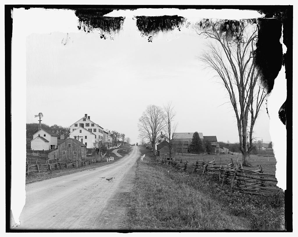


 1906
 1906
 1906
