Lanesborough dates to 1753, and 16% of its homes were built before 1940
More historic than 81% of U.S. towns · #221 of 283 in Massachusetts. What drives it
1 place in town is on the National Register, among them a historic district with 4 buildings. Below: 5 old photos and papers, maps from 1886 on, and the census since 1790.
Founding year: Wikidata; Wikipedia’s history section gives the same year. First post office: 1801.The full story ↓
History grade
What drives Lanesborough’s History grade
On its age, its old homes and the National Register, Lanesborough is more historic than 81% of U.S. towns, #221 of 283 in Massachusetts. Its age holds the grade up; its National Register listings pull it down.
A−
HistoryA character grade: shown, never part of Lanesborough’s overall grade.
Massachusetts towns list more on the Register than most of the country (a typical Massachusetts town has 46.0 per 10,000 residents, the U.S. 2.4), so Lanesborough’s 13.2 sits below most of its state (30% of Massachusetts towns have fewer) while its 4 historic buildings outnumber those of 68% of U.S. towns.
How sure. Graded on any two of the three inputs instead, the letter would range from B to A. The pre-1940 share is a Census survey estimate (±6.2 points). Two sources give 1753.
Founding year: Wikidata (other dates in Quick answers). Homes: Census ACS 2020–24. National Register: National Park Service, May 2026 list; each listing counted once (boundary changes and added documentation belong to their listing), and a historic district counts its contributing buildings. How TownRatings grades history →
What stands out about Lanesborough’s past
Read from the archive, the National Register and the record. The page puts what stands out first.
One of the first Berkshire communities to be settled, Lanesborough was originally known as "New Framingham", carved from part of Northern Berkshire Township #6. Lanesborough was first settled in 1753 and was officially incorporated on January 21, 1765. It was renamed Lanesborough, for the Countess of Lanesborough, a friend of Governor Francis Bernard, who incorporated the town. The town grew with small industry in the early 19th century, most of which settled along Town Brook. Berkshire Pleasure Park was a major attraction at the turn of the 20th century. It was one of the trolley parks along what is now Route 8 on the eastern side of town.
Passages that mention Lanesborough, cut from the printed page as they were published.
History of town of Lanesborough, Massachusetts, 1741-19051905 · page 16Read the page →
Read the text
In 1803 the Eev. Amos Pardee was settled in Lanesborough, where he remained 16 years. In after years he acted as missionary in' New York State, dying in 1819. During his rectorship tlic ]iresent rectory was built, William, Joel, and Ephraim Bradley being the principal donors. In 1809 the lot of land cioiinected with the rectory was enlarged tO' the present dimensions by the gift of William Bradley. Tlicre was a former rectory standing near the present horse-sheds on the south side of the
Text read by machine from the scan; it may contain errors.
The history of Pittsfield (Berkshire County), Massachusetts1869 · page 428Read the page →
Read the text
In the fall of 1784, a spirited movement was entered upon for what was doubtless the object of the Barnes petition, — alternate courts at Great Barrington and Lanesborough ; but the project met little favor. The people, however, were so ill content, that the legislature submitted the matter again to a county convention, which assembled at Lenox, Sept. 28, sixteen towns being represented. This convention adjourned, after appointing Woodbridge Little of Pittsfield, Timothy Edwards of Stockbridge, and William
Text read by machine from the scan; it may contain errors.
History of town of Lanesborough, Massachusetts, 1741-19051905 · page 74Read the page →
Read the text
Fifty years ago tlio military enthusiasm in Lanesborough was Tery great. The war closed with Great Britain in 1815, with \ictory to our banners. The military organizations were kept np by law, the country feeling the importance of ever beijig ready to meet the troops of Johnnie Bull. In our own commonwealth, all able bodied men between the ages of 18 and 45 were required to be entered upon the military roll and were subject to military duty. There were two companies in Lanesborough,
Text read by machine from the scan; it may contain errors.
The history of Pittsfield (Berkshire County), Massachusetts1869 · page 23Read the page →
Read the text
having planted New Framingham, Shoon-keek-moon-keek was, in accordance with the common fate of Indian names, soon lost in Framingham Pond. The plantation developing into the town of Lanesborough : then came Lanesborough Pond ; although by the matter-of-fact people of Pittsfield, who always took their bearings from their meeting-house, it was often styled the North, as other sheets of water were called East, West, and South Ponds.
Text read by machine from the scan; it may contain errors.
Scans and text from the Internet Archive. Books published in 1930 or earlier, which are in the public domain.
Timeline
Lanesborough, 1753 to 1980
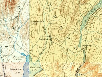
Woven from the archive, old maps, post office records, the National Register and the people born here.
Nothing in the archives for these yearsWeddings on Main Street, storms, parades, school pictures, the old store. If it’s in your family album, it belongs here.
In 1753, according to Wikidata and Wikipedia’s history of the town. Lanesborough’s post office opened in 1801, and the first U.S. census counted 2,142 people here in 1790.
How does Lanesborough rank for history?
Lanesborough is more historic than 81% of U.S. towns, #221 of 283 in Massachusetts. The History grade combines the town’s founding era, the share of homes built before 1940 and its National Register listings. It’s a character grade, so it isn’t part of the overall grade. How it works.
What is on the National Register in Lanesborough?
One place: the Pettibone Farm (listed 1991).
How old are the homes in Lanesborough?
16% of Lanesborough’s homes were built before 1940 (Census estimate, ±6.2 points), against a typical 21% for a Massachusetts town; the median home was built in 1965.
Founding dates: Wikidata, Wikipedia, the U.S. post office records of Blevins & Helbock (CC0) and the Census. Homes by year built: Census ACS 2020–24. National Register of Historic Places: National Park Service (list of May 22, 2026). Old photos, postcards and papers: Wikimedia Commons, the Library of Congress and other public archives, credited on each item’s page. Maps: U.S. Geological Survey historical topographic maps (via Esri) and Sanborn fire-insurance maps (Library of Congress). History text and census tables: Wikipedia (CC BY-SA 4.0). Places that used to be: USGS Geographic Names Information System (2021).
From Wikimedia Commons (11), the Library of Congress (1), the National Register of Historic Places (1), Wikipedia, Wikidata and Wikipedia for famous people, U.S. Geological Survey historical maps, U.S. Census counts (via Wikipedia), the US Post Offices dataset (Blevins & Helbock), the USGS Geographic Names Information System and old county and town histories (Internet Archive). Archive images are copied here with their credits and licenses, shown on each photo’s page. Refreshed monthly.


![In 1803 the Eev. Amos Pardee was settled in Lanesborough, where he remained 16 years. In after years he acted as missionary in' New York State, dying in 1819. During his rectorship tlic ]iresent rectory was built, William, Joel, and Ephraim Bradley being the principal donors. In 1809 the lot of lan…](https://images.townratings.com/story/23911/bk-091c706d85ffe32c-l.jpg)




 1906
 1937
 1937
 2010
 2010
 2009
 2009
 2008
 2004
 2004
