Newbury dates to 1635, and 33% of its homes were built before 1940
More historic than 96% of U.S. towns · #74 of 283 in Massachusetts. What drives it
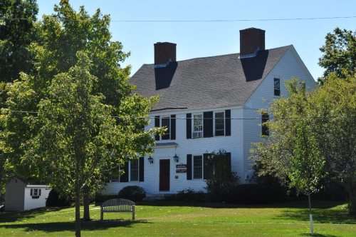
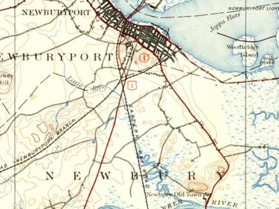
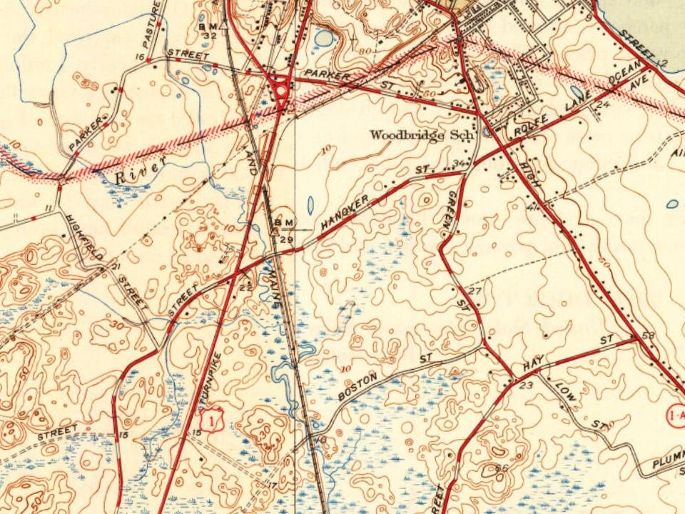
7 places in town are on the National Register, among them the Spencer-Pierce-Little House, a National Historic Landmark, and a historic district with 27 buildings. Below: 11 old photos and papers, maps from 1932 on, and the census since 1790.
Founding year: Wikidata. First post office: 1826.The full story ↓
History grade
What drives Newbury’s History grade
On its age, its old homes and the National Register, Newbury is more historic than 96% of U.S. towns, #74 of 283 in Massachusetts. All 3 inputs are above most U.S. towns; its age ranks highest and its National Register listings lowest.
A+
HistoryA character grade: shown, never part of Newbury’s overall grade.
Massachusetts towns list more on the Register than most of the country (a typical Massachusetts town has 46.0 per 10,000 residents, the U.S. 2.4), so Newbury’s 60.5 sits near the middle of its state (54% of Massachusetts towns have fewer) while its 41 historic buildings outnumber those of 84% of U.S. towns.
NoteThe founding year comes from Wikidata alone; no second source gives 1635.
How sure. Graded on any two of the three inputs instead, the letter would range from A to A+. The pre-1940 share is a Census survey estimate (±10.6 points).
Founding year: Wikidata (other dates in Quick answers). Homes: Census ACS 2020–24. National Register: National Park Service, May 2026 list; each listing counted once (boundary changes and added documentation belong to their listing), and a historic district counts its contributing buildings. How TownRatings grades history →
What stands out about Newbury’s past
Read from the archive, the National Register and the record. The page puts what stands out first.
Native Americans lived along the Merrimack River for thousands of years prior to European colonization of the Americas. At the time of contact, Pennacook or Pentucket controlled territory north of the Merrimack, while Agawam and Naumkeag controlled territory southeast and southwest of the river respectively. The original name for the land that would become Newbury may have been Quascancunquen meaning "waterfall," referring to the falls in Byfield where Central Street crosses the Parker River, and was likely part of the territory of Agawam sachem Masconomet at the time of contact. No formal agreements between the original inhabitants of Newbury and English colonists would be made until more than a generation had passed from settlement and the effects of virgin soil epidemics had significantly decreased native populations in the area.
Here, — though the exact location of the house is unknown,— when the town of Newbury was in its infancy, a little hamlet lying in its woodlands, with the rough, lonely roads stretching out in various directions, uniting it with neighbor settlements, lived Edward Rawson, gentleman ; town clerk of Newbury from 1638 to 1650, and afterwards a man prominent in the affairs of the Massachusetts Bay colony.
Text read by machine from the scan; it may contain errors.
The descendants of Nathaniel Clarke and his wife Elizabeth Somerby of Newbury, Massachusetts. A history of ten generations, 1642-19021902 · page 248Read the page →
Read the text
The children were i. Elizabeth' b. 5 Nov. 1743, bapt. 6 Nov., living in 1783, m. in Newbury, 23 July, 1765 (int. 29 June, 1765), Stephen Pettingell, Jr., of Newbury. She m. secondly, in Newbury, 5 May, 1772 (int. 8 April, 1772), Michael Smith. The
Text read by machine from the scan; it may contain errors.
The descendants of Nathaniel Clarke and his wife Elizabeth Somerby of Newbury, Massachusetts. A history of ten generations, 1642-19021902 · page 271Read the page →
Read the text
From the Newbury records it further appears that the Rev. John preached in Newbury, as on 20 November, 1695, the town referred to the selectmen the question of settling with him. He was then of Exeter and wished to be paid for his services in Newbury.
Text read by machine from the scan; it may contain errors.
Scans and text from the Internet Archive. Books published in 1930 or earlier, which are in the public domain.
By decade
Newbury, decade by decade
5 decades in the archive, from the 1830s to the 1930s. Scroll each row; tap a photo for its story.
Nothing in the archives for these yearsWeddings on Main Street, storms, parades, school pictures, the old store. If it’s in your family album, it belongs here.
In 1635, according to Wikidata. Newbury’s post office opened in 1826, and the first U.S. census counted 3,972 people here in 1790.
How does Newbury rank for history?
Newbury is more historic than 96% of U.S. towns, #74 of 283 in Massachusetts. The History grade combines the town’s founding era, the share of homes built before 1940 and its National Register listings. It’s a character grade, so it isn’t part of the overall grade. How it works.
What is on the National Register in Newbury?
7 listings: 4 buildings, among them the Spencer-Pierce-Little House (a National Historic Landmark since 1968), 1 historic district, the Newbury Historic District, with 27 contributing buildings, and 2 structures. 41 historic buildings in all.
How old are the homes in Newbury?
33% of Newbury’s homes were built before 1940 (Census estimate, ±10.6 points), against a typical 21% for a Massachusetts town; the median home was built in 1963.
Founding dates: Wikidata, Wikipedia, the U.S. post office records of Blevins & Helbock (CC0) and the Census. Homes by year built: Census ACS 2020–24. National Register of Historic Places: National Park Service (list of May 22, 2026). Old photos, postcards and papers: Wikimedia Commons, the Library of Congress and other public archives, credited on each item’s page. Maps: U.S. Geological Survey historical topographic maps (via Esri) and Sanborn fire-insurance maps (Library of Congress). History text and census tables: Wikipedia (CC BY-SA 4.0). Places that used to be: USGS Geographic Names Information System (2021).
From Wikimedia Commons (6), the Library of Congress (5), Wikidata (1), the National Register of Historic Places (7), Wikipedia, Wikidata and Wikipedia for famous people, U.S. Geological Survey historical maps, U.S. Census counts (via Wikipedia), the US Post Offices dataset (Blevins & Helbock), the USGS Geographic Names Information System and old county and town histories (Internet Archive). Archive images are copied here with their credits and licenses, shown on each photo’s page. Refreshed monthly.




 1832
 1832
 1900
 1901–1907
 c. 1907
 1911



 ★ Landmark