Founding year: Wikidata. First post office: 1806.The full story ↓
History grade
What drives Rowley’s History grade
On its age, its old homes and the National Register, Rowley is more historic than 86% of U.S. towns, #178 of 283 in Massachusetts. Its age holds the grade up; its National Register listings pull it down.
A
HistoryA character grade: shown, never part of Rowley’s overall grade.
Massachusetts towns list more on the Register than most of the country (a typical Massachusetts town has 46.0 per 10,000 residents, the U.S. 2.4), so Rowley’s 9.6 sits below most of its state (27% of Massachusetts towns have fewer) while its 6 historic buildings outnumber those of 72% of U.S. towns.
NoteThe founding year comes from Wikidata alone; no second source gives 1638.
How sure. Graded on any two of the three inputs instead, the letter would range from B+ to A. The pre-1940 share is a Census survey estimate (±5.7 points).
Founding year: Wikidata (other dates in Quick answers). Homes: Census ACS 2020–24. National Register: National Park Service, May 2026 list; each listing counted once (boundary changes and added documentation belong to their listing), and a historic district counts its contributing buildings. How TownRatings grades history →
What stands out about Rowley’s past
Read from the archive, the National Register and the record. The page puts what stands out first.
The area was inhabited by the Agawam people under sachem Masconomet. Although the area that would become Rowley was colonized by English settlers starting in 1639, it was not until 1700 that the town would pay Masoconomet's heirs nine pounds for a quitclaim deed.
Passages that mention Rowley, cut from the printed page as they were published.
History of the town of Rindge, New Hampshire, from the date of the Rowley Canada or Massachusetts charter, to the present time, 1736-1874, with a genealogical register of the Rindge families1875 · page 25Read the page →
Read the text
In the expedition referred to, the town of Rowley furnished one captain, one lieutenant, and thirty non-commissioned officers and privates. The lieutenant was Abel Platts, whose appointment as ensign of the Rowley foot was dated July 15, 1(389. Subsequently he received from the town of Rowley thirteen pounds, one shilling, and two pence for services in Canada. He was the grandfather of Abel Platts, of Rindge. Deacon Ezekiel Jewett was paid
Text read by machine from the scan; it may contain errors.
History of Essex County, Massachusetts, with biographical sketches of many of its pioneers and prominent men1888 · page 809Read the page →
Read the text
These owners of lands in Rowley were under the old grant. The new grant was made not long after. It will be recalled that in 1681, a request came to Rowley from Bradford, for an enlargement of their territory, and perhaps after many appeals, the town of Rowley, April 7, 1699, appointed a committee, " to meet with the Bradford Committee, when there may be a convenient opportunity, to settle thelinebetween
Text read by machine from the scan; it may contain errors.
History of the town of Rindge, New Hampshire, from the date of the Rowley Canada or Massachusetts charter, to the present time, 1736-1874, with a genealogical register of the Rindge families1875 · page 571Read the page →
Read the text
The record of the Jewett family in this country commences with the settlement of Rowley, Mass. In 1638, about sixty families, led by Rev. Ezekiel Rogers, eminent in the annals of New England, came from Yorkshire, England, and by them the town of Rowley was planted early in the following year. Among these emigrants were the brothers Maximillian and Joseph Jewett, men of good estate, from Bradford, Yorkshire, England. From them the multitude of Jewetts in this country are descended, among whom are included many persons of distinction in
Text read by machine from the scan; it may contain errors.
History of Essex County, Massachusetts, with biographical sketches of many of its pioneers and prominent men1888 · page 819Read the page →
Read the text
At this date, 1733, the line between Byfield and this parish was settled "with Leonard Harriman 's widow and David pearsons to belong to the west parish of Rowley, and so Jedediah pearsons' Land to belong to Byfield." " Dea. Searl was chosen to go down to the Generall Court, to see what may be gotten of the town rents." December, 1735, the same was chosen to receive the money that the parish is to have of the
Text read by machine from the scan; it may contain errors.
Scans and text from the Internet Archive. Books published in 1930 or earlier, which are in the public domain.
By decade
Rowley, decade by decade
3 decades in the archive, from the 1930s to the 1980s. Scroll each row; tap a photo for its story.
Nothing in the archives for these yearsWeddings on Main Street, storms, parades, school pictures, the old store. If it’s in your family album, it belongs here.
Nothing in the archives for these yearsWeddings on Main Street, storms, parades, school pictures, the old store. If it’s in your family album, it belongs here.
In 1638, according to Wikidata. Rowley’s post office opened in 1806, and the first U.S. census counted 1,772 people here in 1790.
How does Rowley rank for history?
Rowley is more historic than 86% of U.S. towns, #178 of 283 in Massachusetts. The History grade combines the town’s founding era, the share of homes built before 1940 and its National Register listings. It’s a character grade, so it isn’t part of the overall grade. How it works.
What is on the National Register in Rowley?
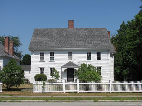
4 listings: 4 buildings, among them the Chaplin-Clarke House (listed 1979, the first). 6 historic buildings in all.
How old are the homes in Rowley?
23% of Rowley’s homes were built before 1940 (Census estimate, ±5.7 points), against a typical 21% for a Massachusetts town; the median home was built in 1975.
Founding dates: Wikidata, Wikipedia, the U.S. post office records of Blevins & Helbock (CC0) and the Census. Homes by year built: Census ACS 2020–24. National Register of Historic Places: National Park Service (list of May 22, 2026). Old photos, postcards and papers: Wikimedia Commons, the Library of Congress and other public archives, credited on each item’s page. Maps: U.S. Geological Survey historical topographic maps (via Esri) and Sanborn fire-insurance maps (Library of Congress). History text and census tables: Wikipedia (CC BY-SA 4.0). Places that used to be: USGS Geographic Names Information System (2021).
From Wikimedia Commons (5), Wikidata (1), the National Register of Historic Places (4), Wikipedia, U.S. Geological Survey historical maps, U.S. Census counts (via Wikipedia), the US Post Offices dataset (Blevins & Helbock), the USGS Geographic Names Information System and old county and town histories (Internet Archive). Archive images are copied here with their credits and licenses, shown on each photo’s page. Refreshed monthly.




 1940
 2006