Lexington dates to 1640, and 21% of its homes were built before 1940
More historic than 91% of U.S. towns · #135 of 283 in Massachusetts. What drives it
18 places in town are on the National Register, among them 3 National Historic Landmarks and two historic districts with 110 buildings between them. Below: 16 old photos and papers, maps from 1887 on, and the census since 1790.
Founding year: Wikidata. First post office: 1812.The full story ↓
History grade
What drives Lexington’s History grade
On its age, its old homes and the National Register, Lexington is more historic than 91% of U.S. towns, #135 of 283 in Massachusetts. All 3 inputs are above most U.S. towns; its age ranks highest and its National Register listings lowest.
A
HistoryA character grade: shown, never part of Lexington’s overall grade.
Massachusetts towns list more on the Register than most of the country (a typical Massachusetts town has 46.0 per 10,000 residents, the U.S. 2.4), so Lexington’s 37.0 sits near the middle of its state (43% of Massachusetts towns have fewer) while its 127 historic buildings outnumber those of 91% of U.S. towns.
NoteThe founding year comes from Wikidata alone; no second source gives 1640.
How sure. Graded on any two of the three inputs instead, the letter would range from A− to A. The pre-1940 share (±2.4 points) is firm at this size.
Founding year: Wikidata (other dates in Quick answers). Homes: Census ACS 2020–24. National Register: National Park Service, May 2026 list; each listing counted once (boundary changes and added documentation belong to their listing), and a historic district counts its contributing buildings. How TownRatings grades history →
What stands out about Lexington’s past
Read from the archive, the National Register and the record. The page puts what stands out first.
Native Americans inhabited the area that would become Lexington for thousands of years prior to European colonization of the Americas, as attested by a woodland-era archaeological site near Loring Hill south of the town center. At the time of European contact, the area may have been a border region between Naumkeag or Pawtucket to the northeast, Massachusett to the south, and Nipmuc to the west, though the land was eventually purchased from the Naumkeag. The contact period introduced a number of European infectious diseases which would decimate native populations in virgin soil epidemics, leaving the area largely uncontested upon the arrival of large groups of English settlers in the Puritan Great Migration. In 1639, the Massachusetts General Court purchased the land that would become present-day Lexington, then within the boundaries of Cambridge, from the Naumkeag Squaw Sachem of Misti…
Passages that mention Lexington, cut from the printed page as they were published.
History of the town of Lexington, Middlesex County, Massachusetts, from its first settlement to 18681913Read the page →
Read the text
southerly side of Francis Whitmore's house, towards the town of Cambridge." The same description was used when the precinct was erected into a town in 1713, and the above line remains still the boundary between Lexington and Arlington. Francis Whitmore, however, did not reside in this house at the date of the incorporation of the town, as he had then been dead for several years. It is believed also that he never lived there, although he owned the house, which was probably occupied then or later by
Text read by machine from the scan; it may contain errors.
History of the battle of Lexington1825 · page 39Read the page →
Read the text
I, Asigzan Harrineron, one of the representatives to the General Court from the town of Lexington, on oath do testify, that, in April, 1775, I lived about a mile and a quarter below the meeting-house in Lexington. After hearing the firing, on the morning of the 19th, and not getting any certain information whether the British had killed any of our men, I went up to the meeting-house, soon after the regulars had marched off for
Text read by machine from the scan; it may contain errors.
History of the town of Lexington, Middlesex County, Massachusetts, from its first settlement to 18681913Read the page →
Read the text
He lived successively in Lexington, Watertown, Lexington and Lincoln; this was partly on account of his changing his reisdence, and partly from alterations of town lines, which annexed a part of Lexington to Lincoln. When he became an inhabitant of Lexington is not known, but he was taxed in 1729 and had a seat assigned him in the meeting-house in 1731. He was chosen one of the committee to provide for schools in 1743, and also filled the office of constable, assessor and selectman.
Text read by machine from the scan; it may contain errors.
History of the battle of Lexington1825 · page 38Read the page →
Read the text
I, Natnan Muwrorz, of Lexington, in the county of Middlesex and state of Massachusetts, do testify and say, that I was enrolled as a soldier in the company commanded by Capt. John Parker of said Lexington, in the year 1775 ; and, knowing that several British officers went up the road towards Concord in the evening of the 18th of April of said year, I, with Benjamin -Tidd, at the request of my captain, went to Bedford in the evening, and notified the inhabitants through the town, to the great road at Merriam’s Corner, so called, in Concord, and then returned to Lexington.
Text read by machine from the scan; it may contain errors.
Scans and text from the Internet Archive. Books published in 1930 or earlier, which are in the public domain.
By decade
Lexington, decade by decade
5 decades in the archive, from the 1780s to the 1900s. Scroll each row; tap a photo for its story.
Nothing in the archives for these yearsWeddings on Main Street, storms, parades, school pictures, the old store. If it’s in your family album, it belongs here.
Every edition of the U.S. Geological Survey’s map of Lexington. Tap a year, or press play to watch the town change.
1893Boston sheet · 1:62,500
U.S. Geological Survey historical topographic maps (public domain), via Esri’s collection of the scans. The red ring marks the center of Lexington.
Every building
Lexington, building by building, 1887–1927
Fire insurance maps drew every building, what it was made of and what it was used for, so insurers could price the risk of fire. Pick a year, then a sheet.
In 1640, according to Wikidata. Lexington’s post office opened in 1812, and the first U.S. census counted 941 people here in 1790.
How does Lexington rank for history?
Lexington is more historic than 91% of U.S. towns, #135 of 283 in Massachusetts. The History grade combines the town’s founding era, the share of homes built before 1940 and its National Register listings. It’s a character grade, so it isn’t part of the overall grade. How it works.
What is on the National Register in Lexington?
18 listings, 3 of them National Historic Landmarks: 14 buildings, among them the Buckman Tavern (a National Historic Landmark since 1975), 2 historic districts, the Peacock Farm Historic District and the Six Moon Hill Historic District, with 110 contributing buildings, and 1 site. 127 historic buildings in all.
How old are the homes in Lexington?
21% of Lexington’s homes were built before 1940 (Census estimate, ±2.4 points), against a typical 21% for a Massachusetts town; the median home was built in 1965.
Founding dates: Wikidata, Wikipedia, the U.S. post office records of Blevins & Helbock (CC0) and the Census. Homes by year built: Census ACS 2020–24. National Register of Historic Places: National Park Service (list of May 22, 2026). Old photos, postcards and papers: Wikimedia Commons, the Library of Congress and other public archives, credited on each item’s page. Maps: U.S. Geological Survey historical topographic maps (via Esri) and Sanborn fire-insurance maps (Library of Congress). History text and census tables: Wikipedia (CC BY-SA 4.0). Places that used to be: USGS Geographic Names Information System (2021).
From Wikimedia Commons (6), the Library of Congress (10), Wikidata (8), the National Register of Historic Places (18), Wikipedia, Wikidata and Wikipedia for famous people, U.S. Geological Survey historical maps, U.S. Census counts (via Wikipedia), the US Post Offices dataset (Blevins & Helbock), the USGS Geographic Names Information System, Sanborn fire insurance maps (Library of Congress) and old county and town histories (Internet Archive). Archive images are copied here with their credits and licenses, shown on each photo’s page. Refreshed monthly.


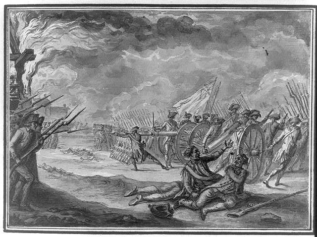

 ★ Landmark
 ★ Landmark
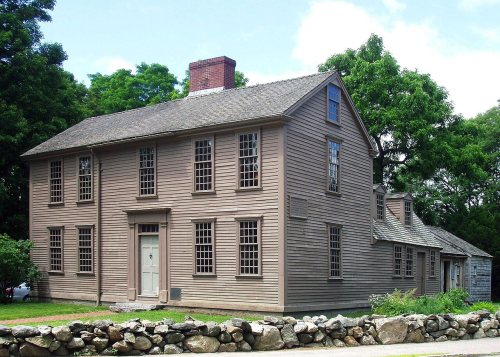 ★ Landmark





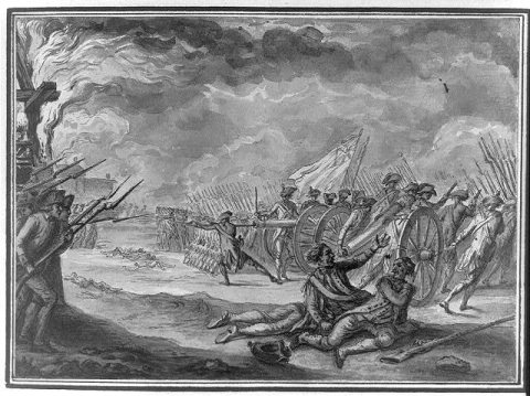 1784
 1890
 1890
 1890
 1895
 1898
 1898
 1898
 1898
 1898
 1900


