Lenox dates to 1750, and 30% of its homes were built before 1940
Among the most historic 1% of U.S. towns · #26 of 283 in Massachusetts. What drives it
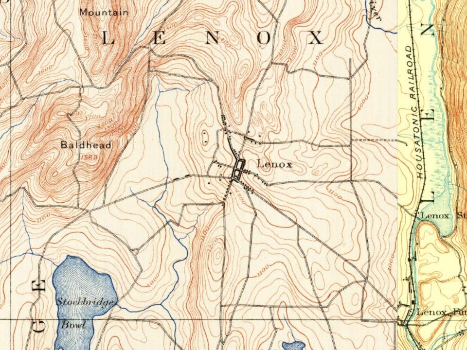
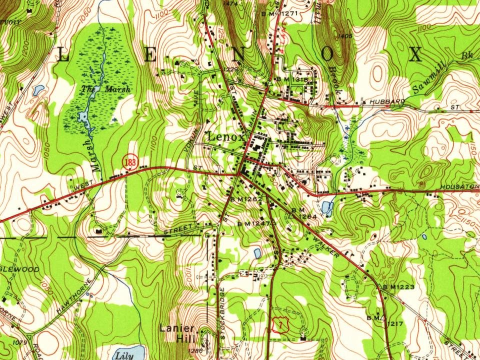
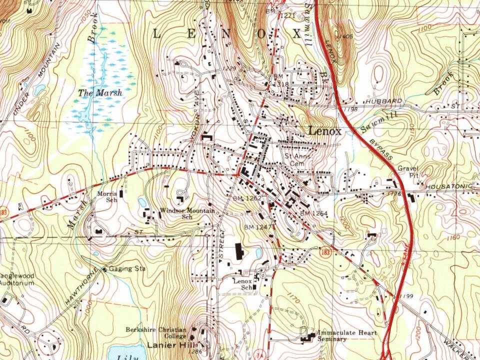
10 places in town are on the National Register, among them the Mount, The, a National Historic Landmark, and two historic districts with 281 buildings between them. Below: 11 old photos and papers, maps from 1888 on, and the census since 1790.
Founding year: Wikidata. First post office: 1800.The full story ↓
History grade
What drives Lenox’s History grade
On its age, its old homes and the National Register, Lenox is among the most historic 1% of U.S. towns, #26 of 283 in Massachusetts. All 3 inputs are above most U.S. towns; its age ranks highest and its share of homes from before 1940 lowest.
A+
HistoryA character grade: shown, never part of Lenox’s overall grade.
Massachusetts towns list more on the Register than most of the country (a typical Massachusetts town has 46.0 per 10,000 residents, the U.S. 2.4), so Lenox’s 579 sits above most of its state (93% of Massachusetts towns have fewer) while its 294 historic buildings outnumber those of 95% of U.S. towns.
How sure. Graded on any two of the three inputs instead, the letter would still be A+. The pre-1940 share is a Census survey estimate (±8.1 points). Two sources give 1750.
Founding year: Wikidata (other dates in Quick answers). Homes: Census ACS 2020–24. National Register: National Park Service, May 2026 list; each listing counted once (boundary changes and added documentation belong to their listing), and a historic district counts its contributing buildings. How TownRatings grades history →
What stands out about Lenox’s past
Read from the archive, the National Register and the record. The page puts what stands out first.
The area was inhabited by Mahicans, Native American Algonquian speakers who largely lived along the Hudson and Housatonic Rivers. Hostilities during the French and Indian Wars discouraged settlement by European colonial settlers until 1750, when Jonathan and Sarah Hinsdale from Hartford, Connecticut, established a small inn and general store. The Province of Massachusetts Bay thereupon auctioned large tracts of land for 10 townships in Berkshire County, set off in 1761 from Hampshire County.
Passages that mention Lenox, cut from the printed page as they were published.
The history of Pittsfield, (Berkshire County,) Massachusetts ... comp. and written, under the general direction of a committee1869 · page 536Read the page →
Read the text
present a joint petition to the legislatures of New York and Massachusetts, for the incorporation of a railroad from Hudson to West Stockbridge, and— there dividing— through Richmond to Pittsfield, and, through Stockbridge and Lee, to Lenox Furnace. On" the 12th of February, the Pittsfield delegation to the West Stockbridge convention, reported to a meeting of their constituents ; which strongly approved the action taken, and appointed the following committee of Vigilance and Correspondence — a name
Text read by machine from the scan; it may contain errors.
The history of Pittsfield, (Berkshire County,) Massachusetts ... comp. and written, under the general direction of a committee1869 · page 450Read the page →
Read the text
"The Episcopal Eeligious Society of Lenox, Pittsfield, Lee and Stockbridge," which was incorporated in 1806, seems to have become extinct, so far as its Pittsfield members were concerned, on the removal of Henry Van Schaack to Kinderhook. An attempt to establish an Episcopal parish during the political troubles of the First Parish failed ; and no further efforts to that end were made until the year 1830. Hon. Edward A. Newton was, however, known to be a devoted member of the Protestant
Text read by machine from the scan; it may contain errors.
History of Great Barrington, (Berkshire County,) Massachusetts1882 · page 280Read the page →
Read the text
Great Barrington on the last Tuesday of April and first Tuesday of September annually." Thus Great Barrington became the county seat, and so remained until the removal of the courts to Lenox in 1787. The first session of the court for the county was held at the old meeting-house in Great Barrington, on the first Tuesday of September, 1761, the town having, by special vote, granted the use of the house for that
Text read by machine from the scan; it may contain errors.
Scans and text from the Internet Archive. Books published in 1930 or earlier, which are in the public domain.
Timeline
Lenox, 1750 to 1984
Woven from the archive, old maps, post office records, the National Register and the people born here.
Nothing in the archives for these yearsWeddings on Main Street, storms, parades, school pictures, the old store. If it’s in your family album, it belongs here.
Fire insurance maps drew every building, what it was made of and what it was used for, so insurers could price the risk of fire. Pick a year, then a sheet.
In 1750, according to Wikidata. Lenox’s post office opened in 1800, and the first U.S. census counted 1,160 people here in 1790.
How does Lenox rank for history?
Lenox is among the most historic 1% of U.S. towns, #26 of 283 in Massachusetts. The History grade combines the town’s founding era, the share of homes built before 1940 and its National Register listings. It’s a character grade, so it isn’t part of the overall grade. How it works.
What is on the National Register in Lenox?
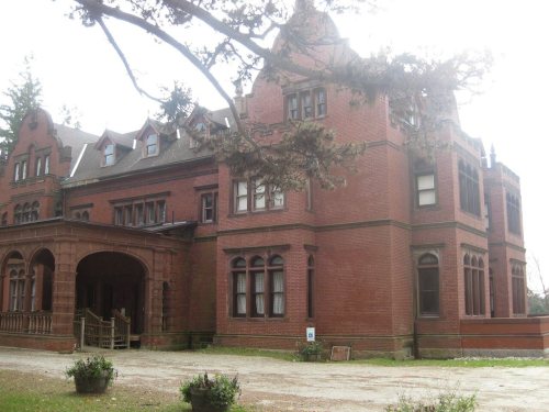
10 listings: 8 buildings, among them the Mount, The (a National Historic Landmark since 1971), and 2 historic districts, the Ventfort Hall and the Lenox Village Historic District, with 281 contributing buildings. 294 historic buildings in all.
How old are the homes in Lenox?
30% of Lenox’s homes were built before 1940 (Census estimate, ±8.1 points), against a typical 21% for a Massachusetts town; the median home was built in 1966.
Founding dates: Wikidata, Wikipedia, the U.S. post office records of Blevins & Helbock (CC0) and the Census. Homes by year built: Census ACS 2020–24. National Register of Historic Places: National Park Service (list of May 22, 2026). Old photos, postcards and papers: Wikimedia Commons, the Library of Congress and other public archives, credited on each item’s page. Maps: U.S. Geological Survey historical topographic maps (via Esri) and Sanborn fire-insurance maps (Library of Congress). History text and census tables: Wikipedia (CC BY-SA 4.0). Places that used to be: USGS Geographic Names Information System (2021).
From Wikimedia Commons (11), Wikidata (1), the National Register of Historic Places (10), Wikipedia, Wikidata and Wikipedia for famous people, U.S. Geological Survey historical maps, U.S. Census counts (via Wikipedia), the US Post Offices dataset (Blevins & Helbock), the USGS Geographic Names Information System, Sanborn fire insurance maps (Library of Congress) and old county and town histories (Internet Archive). Archive images are copied here with their credits and licenses, shown on each photo’s page. Refreshed monthly.





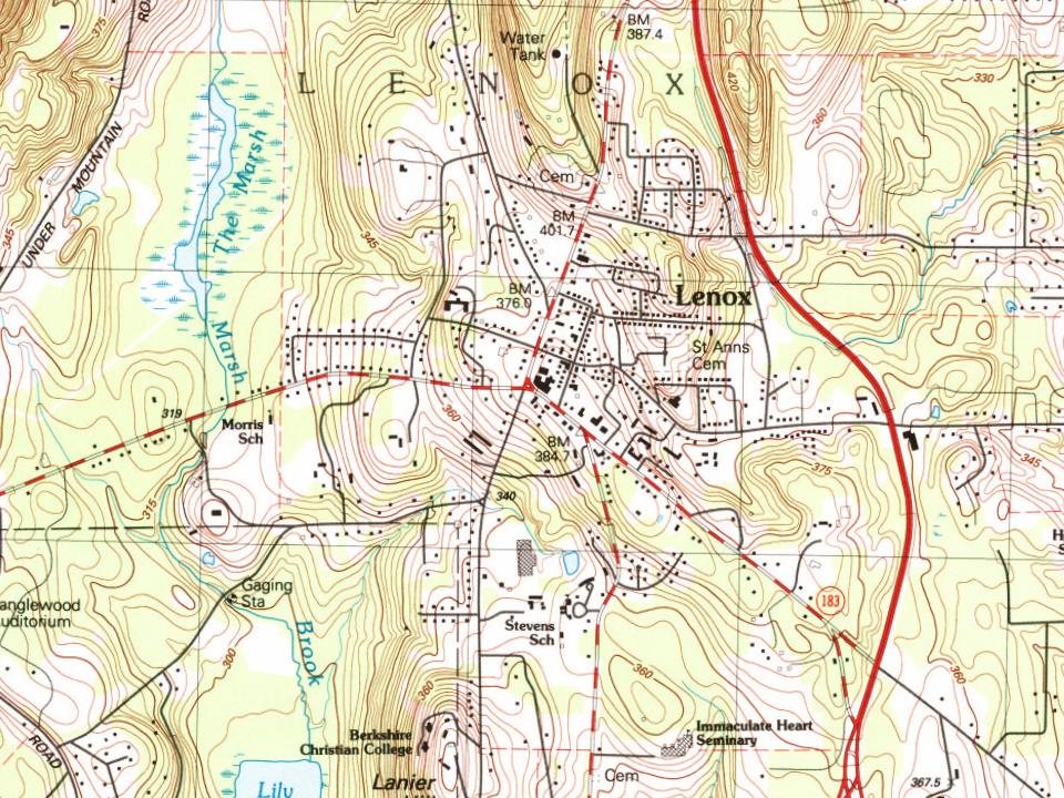


 1898
 1898
 1898
 1898
 1898
 1898
 1898
 1898
 1898
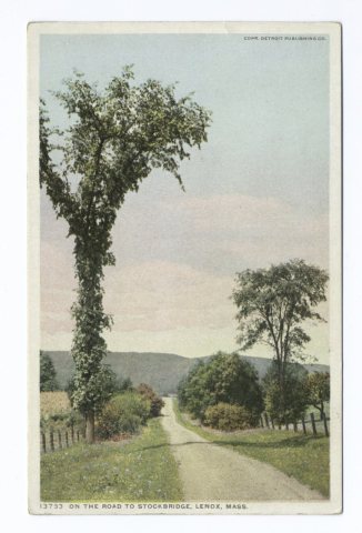 1898

