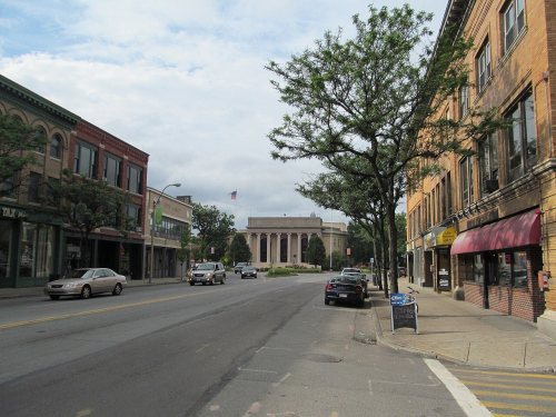
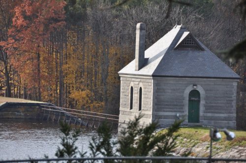
Framingham dates to 1650, and 17% of its homes were built before 1940
More historic than 87% of U.S. towns · #165 of 283 in Massachusetts. What drives it
16 places in town are on the National Register, among them five historic districts with 152 buildings between them. Below: 2 old photos and papers, maps from 1886 on, and the census since 1790.
Founding year: Wikidata. First post office: 1810.The full story ↓
History grade
What drives Framingham’s History grade
On its age, its old homes and the National Register, Framingham is more historic than 87% of U.S. towns, #165 of 283 in Massachusetts. All 3 inputs are above most U.S. towns; its age ranks highest and its share of homes from before 1940 lowest.
A
HistoryA character grade: shown, never part of Framingham’s overall grade.
Massachusetts towns list more on the Register than most of the country (a typical Massachusetts town has 46.0 per 10,000 residents, the U.S. 2.4), so Framingham’s 22.5 sits near the middle of its state (37% of Massachusetts towns have fewer) while its 163 historic buildings outnumber those of 92% of U.S. towns.
NoteThe founding year comes from Wikidata alone; no second source gives 1650.
How sure. Graded on any two of the three inputs instead, the letter would range from B+ to A. The pre-1940 share (±2.0 points) is firm at this size.
Founding year: Wikidata (other dates in Quick answers). Homes: Census ACS 2020–24. National Register: National Park Service, May 2026 list; each listing counted once (boundary changes and added documentation belong to their listing), and a historic district counts its contributing buildings. How TownRatings grades history →
What stands out about Framingham’s past
Read from the archive, the National Register and the record. The page puts what stands out first.
Prior to English settlement, the region around Framingham was inhabited by the indigenous Nipmuc. They lived in encampments established alongside the Washakamaug ("eel fishing place") or what is today called Farm Pond. The Nipmuc Indians used game management techniques through the hunting of deer and beaver, fishing in ponds and streams, as well as established growing areas for the Three Sisters (squash, corn, beans) in the nearby hills. The ancient Indian trail later known as the Old Connecticut Path also ran through this area. During the initial period of colonization of the region by Puritan settlers, the Nipmuc suffered a rapid decline in population due to the introduction of foreign infectious diseases to which they had no immunity and violence related to their raiding settlements. Many of the Nipmuc people were forced into praying towns including nearby Natick.
Passages that mention Framingham, cut from the printed page as they were published.
History of Framingham, Massachusetts, early known as Danforth's Farms, 1640-18801887 · page 136Read the page →
Read the text
July 4, a petition signed by Thomas Drury, David Rice, Thomas Walker, John Pratt, John How, and Joseph Pratt, in behalf of the rest living at Rice's End, was presented to the Court, praying that they may be laid to Framingham. And the next day an order was passed as follows: "Ordered, that the Petitioners, and other the Farmes lying betwixt the northerly end of Cochitawick Pond and the line of Framingham be laid and annexed to the town of Framingham, and enjoy all immunities and privileges with the other the inhabi-
Text read by machine from the scan; it may contain errors.
History of Framingham, Massachusetts1887 · page 138Read the page →
Read the text
Danforth Esq. as well by purchase as by Court grant at the time of settling of Sherborn in May 1679, '^"^ excepted in the Court's confirmation of the Township of Sherborn, be and belong unto Framingham : And That the inhabitants of said Town of Framingham do convene and assemble at their meeting house on the first Tuesday in August next, and then and there make choice of selectmen and other town officers, to serve until March next, at which time the law appoints the choice of Town Officers.
Text read by machine from the scan; it may contain errors.
History of Framingham, Massachusetts1887 · page 139Read the page →
Read the text
Sherborn levied a tax on the families living on Sherborn Row, in the spring or summer of 1700, and in the fall proceeded to collect the same by legal process. Framingham interfered, as the following town action shows: " At a town meeting held Dec. 10, 1700, Voted, that as we apprehend that Sherborn sessors have rated part of our town of Framingham, that we the inhabitants do engage to defend them; and those of our grieved neighbors do engage to bear an equal proportion as to all charges that may arise upon a suit at law. Chose
Text read by machine from the scan; it may contain errors.
History of Framingham, Massachusetts, early known as Danforth's Farms, 1640-18801887 · page 139Read the page →
Read the text
Sherborn levied a tax on the families living on Sherborn Row, in the spring or summer of 1700, and in the fall proceeded to collect the same by legal process. Framingham interfered, as the following town action shows: " At a town meeting held Dec. 10, 1700, Voted, that as we apprehend that Sherborn sessors have rated part of our town of Framingham, that we the inhabitants do engage to defend them; and those of our grieved neighbors do engage to bear an equal proportion as to all charges that may arise upon a suit at law. Chose
Text read by machine from the scan; it may contain errors.
Scans and text from the Internet Archive. Books published in 1930 or earlier, which are in the public domain.
By decade
Framingham, decade by decade
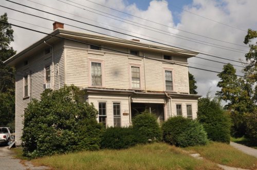
One decade in the archive so far: the 1850s. Scroll each row; tap a photo for its story.
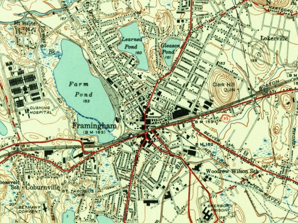
Fire insurance maps drew every building, what it was made of and what it was used for, so insurers could price the risk of fire. Pick a year, then a sheet.
In 1650, according to Wikidata. Framingham’s post office opened in 1810, and the first U.S. census counted 1,598 people here in 1790.
How does Framingham rank for history?
Framingham is more historic than 87% of U.S. towns, #165 of 283 in Massachusetts. The History grade combines the town’s founding era, the share of homes built before 1940 and its National Register listings. It’s a character grade, so it isn’t part of the overall grade. How it works.
What is on the National Register in Framingham?
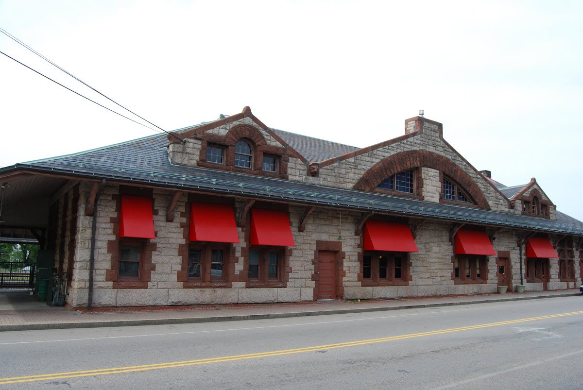
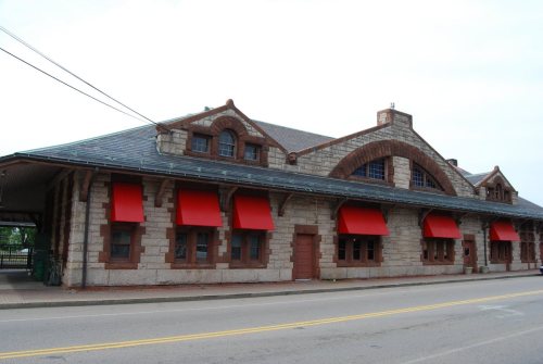
16 listings: 7 buildings, among them the Framingham Railroad Station (listed 1975, the first), 5 historic districts with 152 contributing buildings, and 4 structures. 163 historic buildings in all.
How old are the homes in Framingham?
17% of Framingham’s homes were built before 1940 (Census estimate, ±2.0 points), against a typical 21% for a Massachusetts town; the median home was built in 1966.
Founding dates: Wikidata, Wikipedia, the U.S. post office records of Blevins & Helbock (CC0) and the Census. Homes by year built: Census ACS 2020–24. National Register of Historic Places: National Park Service (list of May 22, 2026). Old photos, postcards and papers: Wikimedia Commons, the Library of Congress and other public archives, credited on each item’s page. Maps: U.S. Geological Survey historical topographic maps (via Esri) and Sanborn fire-insurance maps (Library of Congress). History text and census tables: Wikipedia (CC BY-SA 4.0). Places that used to be: USGS Geographic Names Information System (2021).
From Wikimedia Commons (2), Wikidata (4), the National Register of Historic Places (16), Wikipedia, Wikidata and Wikipedia for famous people, U.S. Geological Survey historical maps, U.S. Census counts (via Wikipedia), the US Post Offices dataset (Blevins & Helbock), the USGS Geographic Names Information System, Sanborn fire insurance maps (Library of Congress) and old county and town histories (Internet Archive). Archive images are copied here with their credits and licenses, shown on each photo’s page. Refreshed monthly.








 1854