Concord dates to 1635, and 23% of its homes were built before 1940
More historic than 94% of U.S. towns · #105 of 283 in Massachusetts. What drives it
26 places in town are on the National Register, among them 6 National Historic Landmarks and four historic districts with 93 buildings between them. Below: 1 old photo or paper, maps from 1886 on, and the census since 1790.
Founding year: Wikidata; Wikipedia’s history section gives the same year. First post office: 1795.The full story ↓
History grade
What drives Concord’s History grade
On its age, its old homes and the National Register, Concord is more historic than 94% of U.S. towns, #105 of 283 in Massachusetts. All 3 inputs are above most U.S. towns; its age ranks highest and its National Register listings lowest.
A
HistoryA character grade: shown, never part of Concord’s overall grade.
Massachusetts towns list more on the Register than most of the country (a typical Massachusetts town has 46.0 per 10,000 residents, the U.S. 2.4), so Concord’s 70.2 sits near the middle of its state (58% of Massachusetts towns have fewer) while its 128 historic buildings outnumber those of 91% of U.S. towns.
How sure. Graded on any two of the three inputs instead, the letter would range from A− to A. The pre-1940 share is a Census survey estimate (±3.3 points). Two sources give 1635.
Founding year: Wikidata (other dates in Quick answers). Homes: Census ACS 2020–24. National Register: National Park Service, May 2026 list; each listing counted once (boundary changes and added documentation belong to their listing), and a historic district counts its contributing buildings. How TownRatings grades history →
What stands out about Concord’s past
Read from the archive, the National Register and the record. The page puts what stands out first.
The country’s official list of buildings and places worth saving. 6 are National Historic Landmarks, the highest tier. Boundary changes and added documentation are counted with their listing.
Lost post offices, old corners, places now gone and burying grounds
Concord’s post office has been open since 1795. Five other post offices opened and closed inside today’s town.
Concord
1795–today
Westvale
1870–1903
Nashoba
1876–1925
Warnerville
1876–1891
Concord Junction
1891–1928
West Concord
1928–1970
17901910today
Hamlets and corners on the map
Meriams CornerNine Acre CornerPlainWest Concord
Gone or out of use
Concord JunctionlocaleDamon MilllocaleJohn Buttrick House Post Officepost officeMiddlesex JunctionlocaleParkman TavernbuildingThe Brooks SchoolschoolWarnerville Post Officepost officeWestvale Post Officepost officeWright Tavernbuilding
4cemeteries and burying grounds inside Concord
Grave of British SoldiersOld HillSaint BernardsSleepy Hollow
US Post Offices dataset (Blevins & Helbock, CC0). Places and cemeteries from the USGS Geographic Names Information System (2021).
The area which became the town of Concord was originally known as "Musketaquid", situated at the confluence of the Sudbury and Assabet rivers. The name was an Algonquian word for "grassy plain", fitting the area's low-lying marshes and kettle holes. Native Americans had cultivated corn crops there; the rivers were rich with fish and the land was lush and arable. The area was largely depopulated in 1633 by an epidemic of smallpox, a disease likely to have been introduced to the New World by European explorers and settlers.
Passages that mention Concord, cut from the printed page as they were published.
The story of a Concord Farm and its owners1883 · page 24Read the page →
Read the text
24 The Story of a Concord Farm either side who was not, either of Concord origin or else a settler of the town. In person he was well nigh of gigantic proportions, standing an inch or two over six feet, and weighing more than 250 pounds.
Text read by machine from the scan; it may contain errors.
Scans and text from the Internet Archive. Books published in 1930 or earlier, which are in the public domain.
By decade
Concord, decade by decade
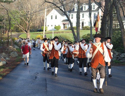
One decade in the archive so far: the 1770s. Scroll each row; tap a photo for its story.
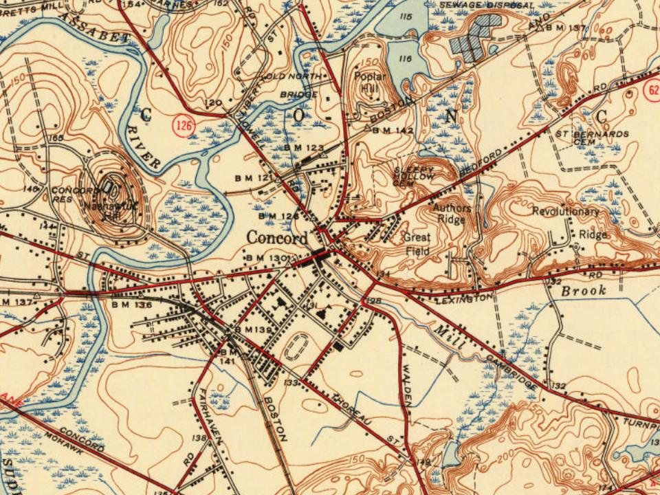
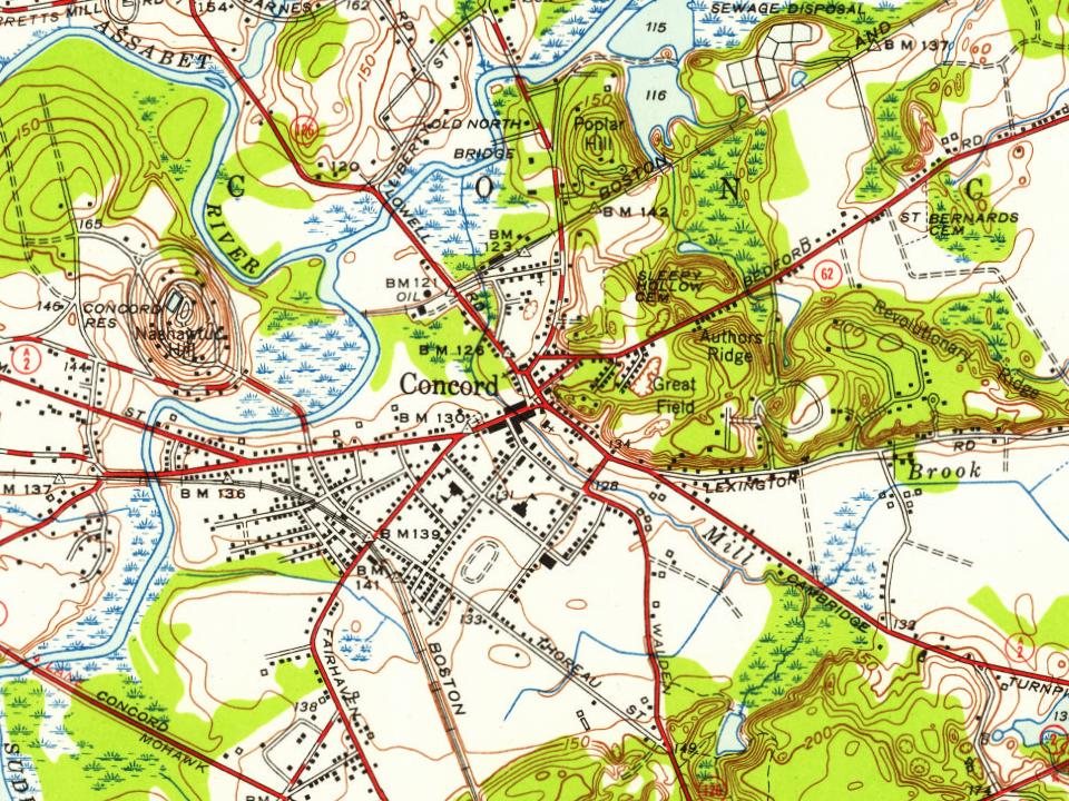
Every edition of the U.S. Geological Survey’s map of Concord. Tap a year, or press play to watch the town change.
1886Framingham sheet · 1:62,500
U.S. Geological Survey historical topographic maps (public domain), via Esri’s collection of the scans. The red ring marks the center of Concord.
Every building
Concord, building by building, 1887–1918
Fire insurance maps drew every building, what it was made of and what it was used for, so insurers could price the risk of fire. Pick a year, then a sheet.
1887Sheet 1 of 1
Edition
Sheets
BrickWoodStone
Sanborn Map Company, via the Library of Congress. Editions published in 1930 or earlier, which are in the public domain.
People over time
Concord, census by census
Grew from 1,590 people in 1790 to 18,491 in 2020, more than tenfold.
19 censuses, 1790–2020.
U.S. Census Bureau decennial counts, from the census table on Concord’s Wikipedia page.
Famous people
57 famous people were born in Concord
Writers, athletes, leaders and more, ranked by how widely they’re known.
In 1635, according to Wikidata and Wikipedia’s history of the town. Concord’s post office opened in 1795, and the first U.S. census counted 1,590 people here in 1790.
How does Concord rank for history?
Concord is more historic than 94% of U.S. towns, #105 of 283 in Massachusetts. The History grade combines the town’s founding era, the share of homes built before 1940 and its National Register listings. It’s a character grade, so it isn’t part of the overall grade. How it works.
What is on the National Register in Concord?
26 listings, 6 of them National Historic Landmarks: 21 buildings, among them the Old Manse (a National Historic Landmark since 1962), 4 historic districts with 93 contributing buildings, 1 site, and 1 structure. 128 historic buildings in all.
How old are the homes in Concord?
23% of Concord’s homes were built before 1940 (Census estimate, ±3.3 points), against a typical 21% for a Massachusetts town; the median home was built in 1969.
Founding dates: Wikidata, Wikipedia, the U.S. post office records of Blevins & Helbock (CC0) and the Census. Homes by year built: Census ACS 2020–24. National Register of Historic Places: National Park Service (list of May 22, 2026). Old photos, postcards and papers: Wikimedia Commons, the Library of Congress and other public archives, credited on each item’s page. Maps: U.S. Geological Survey historical topographic maps (via Esri) and Sanborn fire-insurance maps (Library of Congress). History text and census tables: Wikipedia (CC BY-SA 4.0). Places that used to be: USGS Geographic Names Information System (2021).
From Wikimedia Commons (1), Wikidata (11), the National Register of Historic Places (27), Wikipedia, Wikidata and Wikipedia for famous people, U.S. Geological Survey historical maps, U.S. Census counts (via Wikipedia), the US Post Offices dataset (Blevins & Helbock), the USGS Geographic Names Information System, Sanborn fire insurance maps (Library of Congress) and old county and town histories (Internet Archive). Archive images are copied here with their credits and licenses, shown on each photo’s page. Refreshed monthly.


 ★ Landmark
 ★ Landmark
 ★ Landmark
 ★ Landmark
 ★ Landmark
 ★ Landmark