Mendon dates to 1660, and 5 of its places are on the National Register
More historic than 89% of U.S. towns · #155 of 283 in Massachusetts. What drives it
Most of Mendon was built recently: 9% of its homes predate 1940 and the median home dates from 1985. 5 places in town are on the National Register, among them two historic districts with 201 buildings between them. Below: 5 old photos and papers, maps from 1886 on, and the census since 1790.
Founding year: Wikidata; Wikipedia’s history section gives the same year. First post office: 1794.The full story ↓
History grade
What drives Mendon’s History grade
On its age, its old homes and the National Register, Mendon is more historic than 89% of U.S. towns, #155 of 283 in Massachusetts. Its age holds the grade up; its share of homes from before 1940 pulls it down.
A
HistoryA character grade: shown, never part of Mendon’s overall grade.
Massachusetts towns list more on the Register than most of the country (a typical Massachusetts town has 46.0 per 10,000 residents, the U.S. 2.4), so Mendon’s 327 sits above most of its state (86% of Massachusetts towns have fewer) while its 207 historic buildings outnumber those of 93% of U.S. towns.
How sure. Graded on any two of the three inputs instead, the letter would range from A− to A+. The pre-1940 share is a Census survey estimate (±5.5 points). Two sources give 1660.
Founding year: Wikidata (other dates in Quick answers). Homes: Census ACS 2020–24. National Register: National Park Service, May 2026 list; each listing counted once (boundary changes and added documentation belong to their listing), and a historic district counts its contributing buildings. How TownRatings grades history →
What stands out about Mendon’s past
Read from the archive, the National Register and the record. The page puts what stands out first.
Native Americans inhabited the Mendon area for thousands of years prior to European colonization of the Americas. At the time of contact, Nipmuc people inhabited the area that would become Mendon, and Nipmuc Pond is named for them. Nipmuc Regional High School was named after this lake. Nipmuc means "small pond place" or "people of the fresh waters". The Nipmuc name does not refer to a specific village or tribe, but to natives that inhabited almost all of central Massachusetts. Over 500 Nipmuc live today in Massachusetts, and there are two nearby reservations at Grafton and Webster. The Nipmuc had a written language, tools, a graphite mine at Sturbridge, and well-developed agriculture, including maize (a variant of corn), beans and squash.
Passages that mention Mendon, cut from the printed page as they were published.
History of Worcester County, Massachusetts1889 · page 1263Read the page →
Read the text
And Be it further Enacted that the Inhabitants of said Town of Milford shall be held to pay their Proportionable part of all Town, County and State Taxes that are already raised, or granted, to be assessed on the Inhabitants of said Town of Mendon, or that shall be granted to be assessed on said Town of Mendon during the present Sitting of the Great and General Court, and be held to repair & Build one-half of the Bridges and mend and repair one-half the Roads on which they are bounded lying in the Town of Mendon forever.
Text read by machine from the scan; it may contain errors.
History of Worcester County, Massachusetts1889 · page 1262Read the page →
Read the text
The petition of sundry inhabitants of the town of Mendon in said Province hereunto subscribing, Humbly sheweth ; That the said Town of Mendon, in answer to a petition of sundry iuhabitants on the Easterly side of Mill River in said Town, did, at their meeting on September the 22, 1741, vote their consent That the lauds in said Township lying on the Easterly side of Mill River to the County road by Sheffield's Mill, then bounding on said road to Bellingham and bounding on Bellingham, Holliston and Hopkinton, with all the lands and inhabit-
Text read by machine from the scan; it may contain errors.
Historic homes and institutions and genealogical and personal memoirs of Worcester county, Massachusetts, with a history of Worcester society of antiquity1907 · page 395Read the page →
Read the text
mariner and he probably followed the sea in his early life. In a deed of Rowley property he calls Joseph Tainer his father-in-law. He bought fifteen acres of land in Mendon, March 7, 1723, and about that time settled in Mendon. He bought land again in 1731 and at various times in Mendon and what was later called Upton. He was living in Mendon, August 9, 1735. April i, 1748, he sold
Text read by machine from the scan; it may contain errors.
Scans and text from the Internet Archive. Books published in 1930 or earlier, which are in the public domain.
By decade
Mendon, decade by decade
4 decades in the archive, from the 1720s to the 1890s. Scroll each row; tap a photo for its story.
Nothing in the archives for these yearsWeddings on Main Street, storms, parades, school pictures, the old store. If it’s in your family album, it belongs here.
In 1660, according to Wikidata and Wikipedia’s history of the town. Mendon’s post office opened in 1794, and the first U.S. census counted 1,555 people here in 1790.
How does Mendon rank for history?
Mendon is more historic than 89% of U.S. towns, #155 of 283 in Massachusetts. The History grade combines the town’s founding era, the share of homes built before 1940 and its National Register listings. It’s a character grade, so it isn’t part of the overall grade. How it works.
What is on the National Register in Mendon?
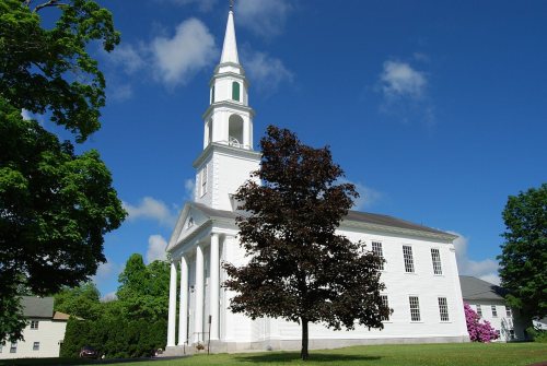
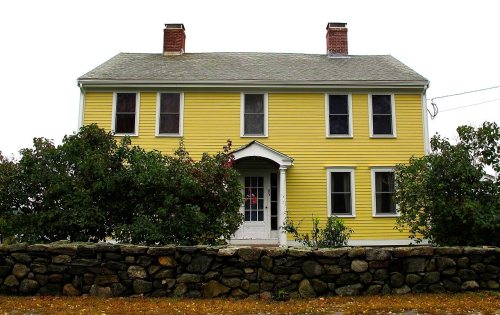
5 listings: 3 buildings, among them the Richard Sayles House (listed 1983, the first), and 2 historic districts, the Mendon Center Historic District and the North Avenue Rural Historic District, with 201 contributing buildings. 207 historic buildings in all.
How old are the homes in Mendon?
9% of Mendon’s homes were built before 1940 (Census estimate, ±5.5 points), against a typical 21% for a Massachusetts town; the median home was built in 1985.
Founding dates: Wikidata, Wikipedia, the U.S. post office records of Blevins & Helbock (CC0) and the Census. Homes by year built: Census ACS 2020–24. National Register of Historic Places: National Park Service (list of May 22, 2026). Old photos, postcards and papers: Wikimedia Commons, the Library of Congress and other public archives, credited on each item’s page. Maps: U.S. Geological Survey historical topographic maps (via Esri) and Sanborn fire-insurance maps (Library of Congress). History text and census tables: Wikipedia (CC BY-SA 4.0). Places that used to be: USGS Geographic Names Information System (2021).
From Wikimedia Commons (5), Wikidata (1), the National Register of Historic Places (5), Wikipedia, Wikidata and Wikipedia for famous people, U.S. Geological Survey historical maps, U.S. Census counts (via Wikipedia), the US Post Offices dataset (Blevins & Helbock), the USGS Geographic Names Information System and old county and town histories (Internet Archive). Archive images are copied here with their credits and licenses, shown on each photo’s page. Refreshed monthly.




 1831


