Zionsville dates to 1852, and 5 of its places are on the National Register
More historic than 44% of U.S. towns · #406 of 593 in Indiana. What drives it
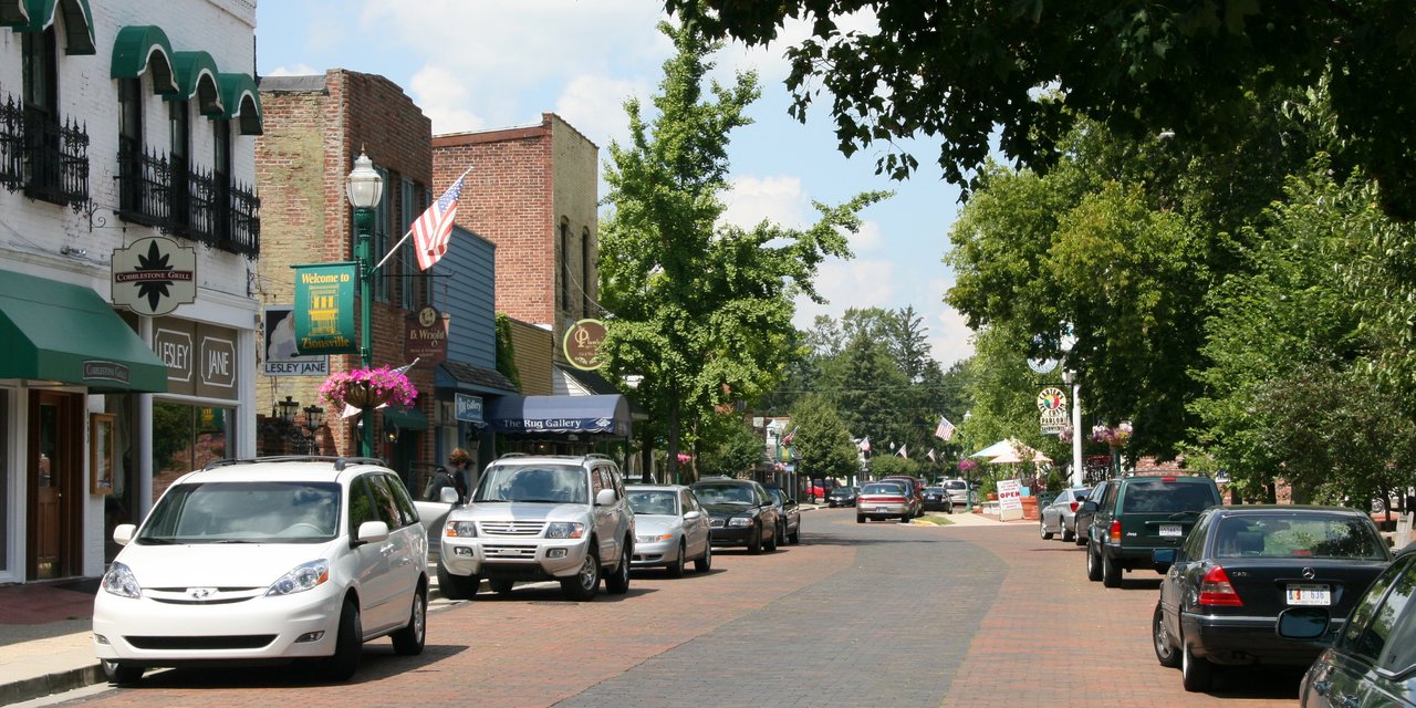
Most of Zionsville was built recently: 4% of its homes predate 1940 and the median home dates from 1999. 5 places in town are on the National Register, among them three historic districts with 51 buildings between them. Below: maps from 1895 on and the census since 1860.
Founding year: Wikidata; Wikipedia’s history section gives the same year. First post office: 1832. Name: Wikipedia, licensed CC BY-SA 4.0.The full story ↓
History grade
What drives Zionsville’s History grade
On its age, its old homes and the National Register, Zionsville is more historic than 44% of U.S. towns, #406 of 593 in Indiana. Its National Register listings hold the grade up; its share of homes from before 1940 pulls it down.
C+
HistoryA character grade: shown, never part of Zionsville’s overall grade.
Indiana towns list more on the Register than most of the country (a typical Indiana town has 7.9 per 10,000 residents, the U.S. 2.4), so Zionsville’s 16.5 sits above most of its state (66% of Indiana towns have fewer) while its 53 historic buildings outnumber those of 85% of U.S. towns.
How sure. Graded on any two of the three inputs instead, the letter would range from C− to B. The pre-1940 share (±1.1 points) is firm at this size. Two sources give 1852.
Founding year: Wikidata (other dates in Quick answers). Homes: Census ACS 2020–24. National Register: National Park Service, May 2026 list; each listing counted once (boundary changes and added documentation belong to their listing), and a historic district counts its contributing buildings. How TownRatings grades history →
What stands out about Zionsville’s past
Read from the archive, the National Register and the record. The page puts what stands out first.
Zionsville was laid out in 1852 when the railroad was extended to that point. It was named for William Zion, a pioneer settler.
Abraham Lincoln made a whistle-stop speech in Zionsville in 1861 when traveling to his inauguration. Later, after his assassination in 1865, the train carrying Lincoln's body passed through Zionsville on its circuitous route to his final rest in Springfield, Illinois.
Town Hall (Castle Hall) was listed on the National Register of Historic Places in 1983.
Passages that mention Zionsville, cut from the printed page as they were published.
History of Boone County, Indiana1914 · page 429Read the page →
Read the text
Zionsville is located in Eagle township in the southeast part of Boone county, on the banks of Eagle creek, just below the junction of Big and Little Eagle creeks. It was organized and laid out in 1852, on the completion of the Indianapolis, Cincinnati and LaFayette railroad now known as the Big Four and belonging to the New York system. It was named in honor of William Zion of Lebanon. It is about half way between Indianapolis and Lebanon.
Text read by machine from the scan; it may contain errors.
History of Boone County, Indiana1914 · page 323Read the page →
Read the text
trusts was never questioned. He was the father of Wes Lane, a former cashier of the First National Bank. Amelia Zion, the last survivor of the class, was the wife of William Zion, after whom the neighboring town of Zionsville was named. She died a number of years ago full of honors and years, and her death was regretted by all who knew her. For some reason the mission did not flourish and there was no more preaching by ordained ministers until October, 1836, when Rev. Ancil Beach happened to discover the vacancy on the skirmish line while on his way to conference and stopped off
Text read by machine from the scan; it may contain errors.
Scans and text from the Internet Archive. Books published in 1930 or earlier, which are in the public domain.
Timeline
Zionsville, 1832 to 1992
Woven from the archive, old maps, post office records, the National Register and the people born here.
Every edition of the U.S. Geological Survey’s map of Zionsville. Tap a year, or press play to watch the town change.
1953Zionsville sheet · 1:24,000
U.S. Geological Survey historical topographic maps (public domain), via Esri’s collection of the scans. The red ring marks the center of Zionsville.
Every building
Zionsville, building by building, 1895–1922
Fire insurance maps drew every building, what it was made of and what it was used for, so insurers could price the risk of fire. Pick a year, then a sheet.
1895Sheet 1 of 1
Edition
Sheets
BrickWoodStone
Sanborn Map Company, via the Library of Congress. Editions published in 1930 or earlier, which are in the public domain.
People over time
Zionsville, census by census
Grew from 365 people in 1860 to 30,603 in 2020, more than tenfold.
17 censuses, 1860–2020.
U.S. Census Bureau decennial counts, from the census table on Zionsville’s Wikipedia page.
Famous people
9 famous people were born in Zionsville
Writers, athletes, leaders and more, ranked by how widely they’re known.
In 1852, according to Wikidata and Wikipedia’s history of the town. Zionsville’s post office opened in 1832, and the census of 1860 counted 365 people here.
How does Zionsville rank for history?
Zionsville is more historic than 44% of U.S. towns, #406 of 593 in Indiana. The History grade combines the town’s founding era, the share of homes built before 1940 and its National Register listings. It’s a character grade, so it isn’t part of the overall grade. How it works.
What is on the National Register in Zionsville?
5 listings: 2 buildings, among them the Town Hall (Castle Hall) (listed 1983, the first), and 3 historic districts, the Brock, Pryor Farmstead, the Traders Point Hunt Rural Historic District and the Maplelawn Farmstead, with 51 contributing buildings. 53 historic buildings in all.
How old are the homes in Zionsville?
4% of Zionsville’s homes were built before 1940 (Census estimate, ±1.1 points), against a typical 14% for an Indiana town; the median home was built in 1999.
Founding dates: Wikidata, Wikipedia, the U.S. post office records of Blevins & Helbock (CC0) and the Census. Homes by year built: Census ACS 2020–24. National Register of Historic Places: National Park Service (list of May 22, 2026). Old photos, postcards and papers: Wikimedia Commons, the Library of Congress and other public archives, credited on each item’s page. Maps: U.S. Geological Survey historical topographic maps (via Esri) and Sanborn fire-insurance maps (Library of Congress). History text and census tables: Wikipedia (CC BY-SA 4.0). Places that used to be: USGS Geographic Names Information System (2021).
From Wikimedia Commons (3), the National Register of Historic Places (5), Wikipedia, Wikidata and Wikipedia for famous people, U.S. Geological Survey historical maps, U.S. Census counts (via Wikipedia), the US Post Offices dataset (Blevins & Helbock), the USGS Geographic Names Information System, Sanborn fire insurance maps (Library of Congress) and old county and town histories (Internet Archive). Archive images are copied here with their credits and licenses, shown on each photo’s page. Refreshed monthly.


 2019
 2012
 2011


