Indianapolis has 261 places on the National Register, 8 of them National Historic Landmarks
More historic than 89% of U.S. towns · #157 of 593 in Indiana State. What drives it
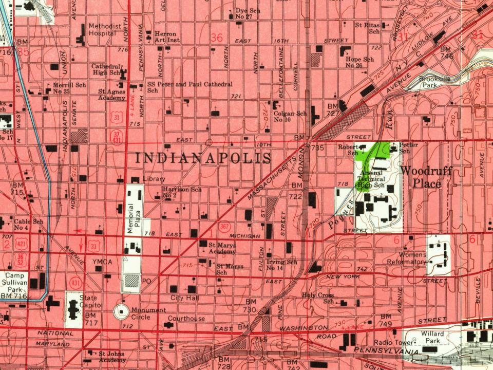
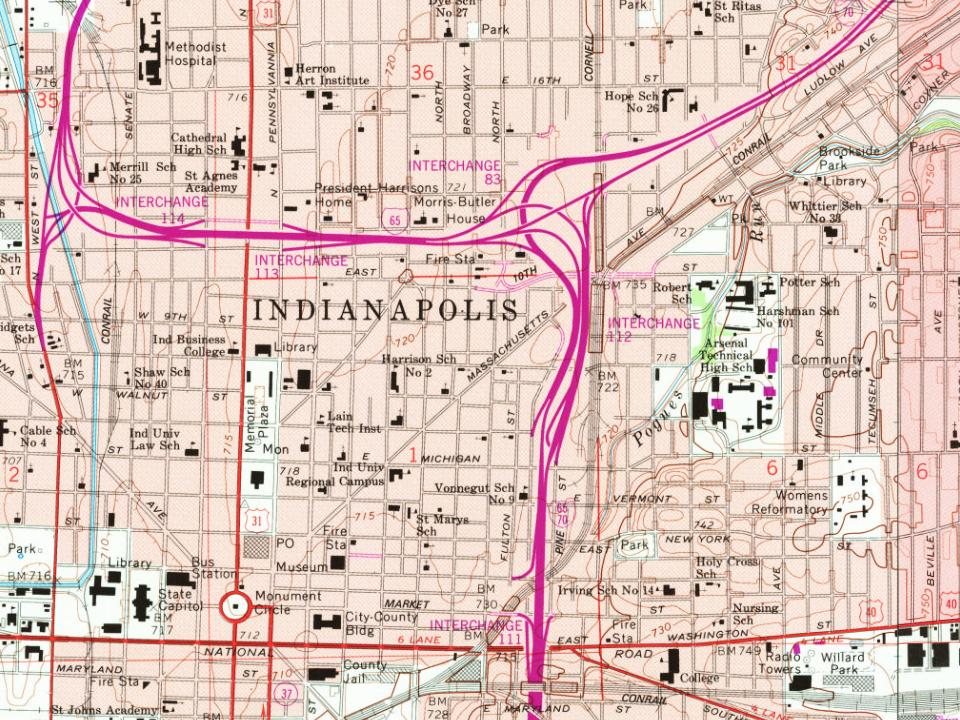
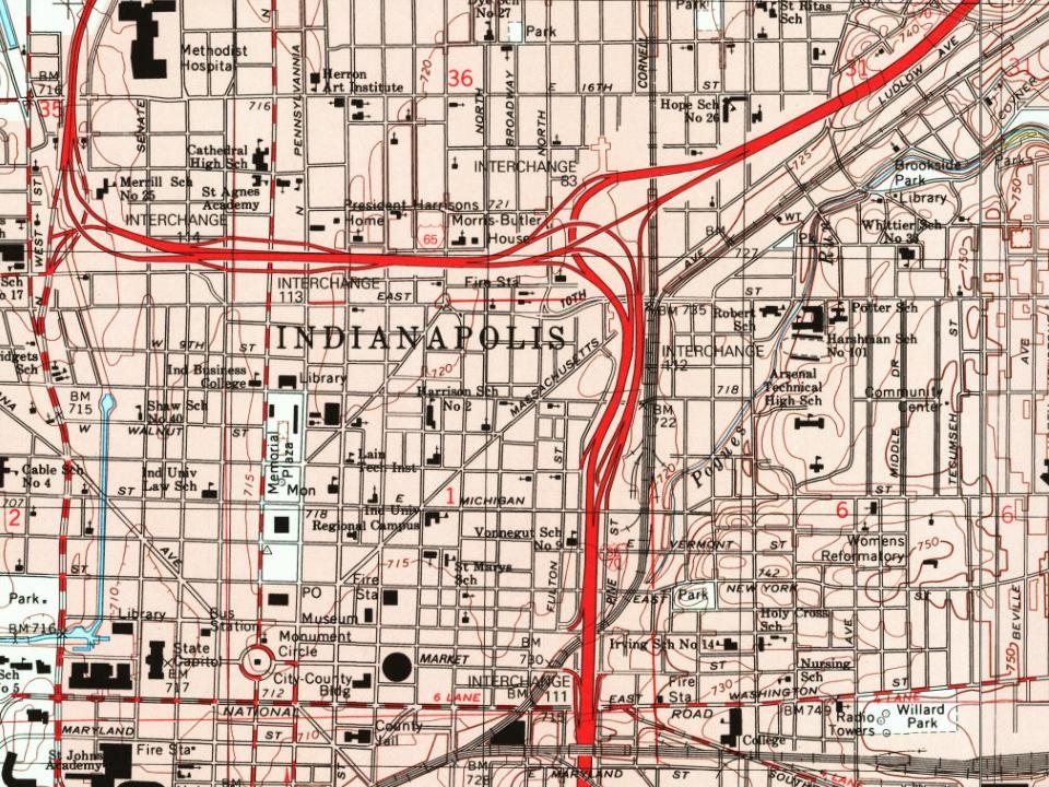
Dated to 1821 (Wikidata and Wikipedia’s history), with 16% of its homes built before 1940 and 59 historic districts holding 12,517 contributing buildings. Below: 37 old photos and papers, maps from 1948 on, the census since 1840, and every listing on the Register.
Founding year: Wikidata; Wikipedia’s history section gives the same year. First post office: 1822.The full story ↓
History grade
What drives Indianapolis’ History grade
On its age, its old homes and the National Register, Indianapolis is more historic than 89% of U.S. towns, #157 of 593 in Indiana State. All 3 inputs are above most U.S. towns; its National Register listings ranks highest and its share of homes from before 1940 lowest.
A
HistoryA character grade: shown, never part of Indianapolis’ overall grade.
Among the 400 U.S. cities of 100,000 or more, Indianapolis ranks #73 on History.
Indiana State towns list more on the Register than most of the country (a typical Indiana State town has 7.9 per 10,000 residents, the U.S. 2.4), so Indianapolis’ 140 sits above most of its state (84% of Indiana State towns have fewer) while its 12,517 historic buildings outnumber those of 100% of U.S. towns.
How sure. Graded on any two of the three inputs instead, the letter would range from B+ to A. The pre-1940 share (±0.4 points) is firm at this size. Two sources give 1821.
Founding year: Wikidata (other dates in Quick answers). Homes: Census ACS 2020–24. National Register: National Park Service, May 2026 list; each listing counted once (boundary changes and added documentation belong to their listing), and a historic district counts its contributing buildings. How TownRatings grades history →
What stands out about Indianapolis’ past
Read from the archive, the National Register and the record. The page puts what stands out first.
Nothing in the archives for these yearsWeddings on Main Street, storms, parades, school pictures, the old store. If it’s in your family album, it belongs here.
In 1816, the year Indiana gained statehood, U.S. Congress designated four sections of land in central Indiana as the future seat of state government, contingent on tribal removal. Under the Treaty of St. Mary's (1818), the Delaware and Miami nations relinquished title to these designated lands, with agreement to vacate by 1821. This tract of land, which was called the New Purchase, included the site selected for the new state capital in 1820. The indigenous people of the land prior to systematic removal are the Miami Nation of Indiana (Miami Nation of Oklahoma) and Indianapolis makes up part of Cession 99; the primary treaty between the indigenous population and the United States was the Treaty of St. Mary's in 1818.
Passages that mention Indianapolis, cut from the printed page as they were published.
Commemorative biographical record of prominent1908 · page 235Read the page →
Read the text
Richardson : "Whereas there have been certain differences between Joel F. Richardson and the Indianapolis, Cincinnati & Lafayette Railroad Company, growing out of what is known as the 'elevator contract,' also the Indianapolis & Vincennes Railroad, as to which suits are now pending, and whereas said parties have set-
Text read by machine from the scan; it may contain errors.
Commemorative biographical record of prominent1908 · page 57Read the page →
Read the text
Air. Culley took an interest in municipal affairs from the time of his settlement in the town of Indianapolis, which was incorporated as a city in 1838. In 1841, upon the resignation of William Sullivan, he was honored with election as President of the Council, although he had lived in the city but five years. Such early and decided recognition of his abilities
Text read by machine from the scan; it may contain errors.
History of Indianapolis and Marion County, Indiana1884 · page 620Read the page →
Read the text
ing their anticipation realized, and the college moved to and located within the town. A more extended accouut of this institution is given in the history of the city of Indianapolis. The first merchant in Irvington was William Furrey. After him were the following : William H.
Text read by machine from the scan; it may contain errors.
Scans and text from the Internet Archive. Books published in 1930 or earlier, which are in the public domain.
Timeline
Indianapolis, 1821 to 1968
Woven from the archive, old maps, post office records, the National Register and the people born here.
In 1821, according to Wikidata and Wikipedia’s history of the town. Indianapolis’ post office opened in 1822, and the census of 1840 counted 2,695 people here.
How does Indianapolis rank for history?
Indianapolis is more historic than 89% of U.S. towns, #157 of 593 in Indiana State. The History grade combines the town’s founding era, the share of homes built before 1940 and its National Register listings. It’s a character grade, so it isn’t part of the overall grade. How it works.
What is on the National Register in Indianapolis?
261 listings, 8 of them National Historic Landmarks: 1 building, among them the Our Savior Lutheran Church (listed 2018, the first). 12,517 historic buildings in all.
How old are the homes in Indianapolis?
16% of Indianapolis’ homes were built before 1940 (Census estimate), against a typical 14% for an Indiana State town; the median home was built in 1972.
Founding dates: Wikidata, Wikipedia, the U.S. post office records of Blevins & Helbock (CC0) and the Census. Homes by year built: Census ACS 2020–24. National Register of Historic Places: National Park Service (list of May 22, 2026). Old photos, postcards and papers: Wikimedia Commons, the Library of Congress and other public archives, credited on each item’s page. Maps: U.S. Geological Survey historical topographic maps (via Esri) and Sanborn fire-insurance maps (Library of Congress). History text and census tables: Wikipedia (CC BY-SA 4.0). Places that used to be: USGS Geographic Names Information System (2021).
From Wikimedia Commons (33), the Library of Congress (4), Wikidata (5), the National Register of Historic Places (1), Wikipedia, Wikidata and Wikipedia for famous people, U.S. Geological Survey historical maps, U.S. Census counts (via Wikipedia) and old county and town histories (Internet Archive). Archive images are copied here with their credits and licenses, shown on each photo’s page. Refreshed monthly.


 1854
 1854
 1860
 1880
 1897–1924
 1898
 1898
 1898
 1898
 1898
 1898
 1898
 1904
 1907
 1908
 1908
 1908
 1908
 1908
 1908
 1908
 1908
 1908
 1908
 1908
 1908
 1908
 1908
 1908
 1908
 1908
 1908
 1908
 1908
 1908
 1908
 1909