12% of Wayne Township’s homes were built before 1940
More historic than 81% of U.S. towns · #221 of 593 in Indiana. What drives it
13 places in town are on the National Register, among them two historic districts with 344 buildings between them. Below: 1 old photo or paper, maps from 1953 on, and the census since 1890.
On its age, its old homes and the National Register, Wayne Township is more historic than 81% of U.S. towns, #221 of 593 in Indiana. All 2 inputs are above most U.S. towns; its National Register listings ranks highest and its share of homes from before 1940 lowest.
A−
HistoryA character grade: shown, never part of Wayne Township’s overall grade.
Among the 400 U.S. cities of 100,000 or more, Wayne Township ranks #116 on History.
Indiana towns list more on the Register than most of the country (a typical Indiana town has 7.9 per 10,000 residents, the U.S. 2.4), so Wayne Township’s 45.0 sits above most of its state (73% of Indiana towns have fewer) while its 668 historic buildings outnumber those of 98% of U.S. towns.
How sure. Graded on two of the three inputs, so a change in either one moves the letter more than it would with three. The pre-1940 share (±1.1 points) is firm at this size.
Founding year: our sources. Homes: Census ACS 2020–24. National Register: National Park Service, May 2026 list; each listing counted once (boundary changes and added documentation belong to their listing), and a historic district counts its contributing buildings. How TownRatings grades history →
What stands out about Wayne Township’s past
Read from the archive, the National Register and the record. The page puts what stands out first.
National Park Service, National Register of Historic Places. Photos from Wikimedia Commons, credited on each place’s page.
Places that used to be
Lost post offices, old corners, places now gone and burying grounds
Seven other post offices opened and closed inside today’s town.
Bridgeport
1832–1958
Mount Jackson
1832–1898
Sunnyside
1869–1878
Sabine
1870–1899
Maywood
1873–1955
Ben Davis
1877–1906
Flackville
1888–1902
18301930today
Hamlets and corners on the map
Ben DavisBridgeportBrooklyn HeightsChapel HillDrexel GardensFairview StationFarleys AdditionFlackvilleGlendaleKeystone ManorLynhurstMaywoodMickleyvilleMount JacksonSterling HeightsTremontWestwood
Gone or out of use
Central State HospitalhospitalClermont AirportairportFlackville School Number 100schoolKentucky Avenue MinemineSabine Post Officepost officeSchool Number 52schoolStout FieldairportSunnyside Post Officepost office
6cemeteries and burying grounds inside Wayne Township
BridgeportFloral ParkMount JacksonOld UnionWest Ridge ParkWest Union
US Post Offices dataset (Blevins & Helbock, CC0). Places and cemeteries from the USGS Geographic Names Information System (2021).
Help out
Start Wayne Township’s collection
The first neighbors to add old photos shape how Wayne Township’s history is told.
Decades since 1900 with photos
00s10s20s30s40s50s60s70s80s90s
1 of 10 decades. The empty ones are waiting for someone’s album.
Wikipedia doesn’t have a history of Wayne Township yet. The photos, dates and memories neighbors add here are how it gets written.
Wayne Township is one of nine townships in Marion County, Indiana. As of the 2010 census, its population was 136,828. The school district is Metropolitan School District of Wayne Township.
Between the 2010 and 2020 censuses its population grew from 136,828 to 148,444 (+8%).
Intro from Wikipedia. Population: U.S. Census Bureau.
Timeline
Wayne Township, 1832 to 1971
Woven from the archive, old maps, post office records, the National Register and the people born here.
Nothing in the archives for these yearsWeddings on Main Street, storms, parades, school pictures, the old store. If it’s in your family album, it belongs here.
Every edition of the U.S. Geological Survey’s map of Wayne Township. Tap a year, or press play to watch the town change.
1953Clermont sheet · 1:24,000
U.S. Geological Survey historical topographic maps (public domain), via Esri’s collection of the scans. The red ring marks the center of Wayne Township.
Then & now
Stand where they stood
No then-and-now pairs yet. Take a photo from the same spot as an old one and they appear here side by side.
Retake this viewSundown Haven Motel, 6 miles west of downtown Indianapolis on U. S. Rt. 40 (85587), c. 1930
Find the spot, match the angle, and add your photo. It becomes the first then-and-now pair on Wayne Township’s page.
Wayne Township is more historic than 81% of U.S. towns, #221 of 593 in Indiana. The History grade combines the town’s founding era, the share of homes built before 1940 and its National Register listings. It’s a character grade, so it isn’t part of the overall grade. How it works.
What is on the National Register in Wayne Township?
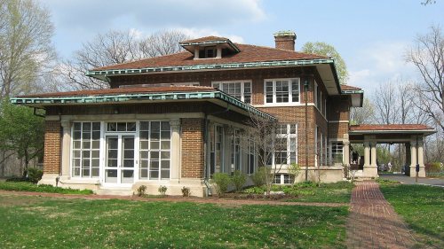
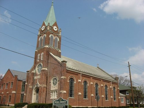
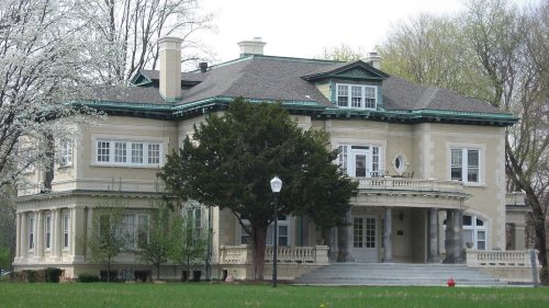
13 listings: 8 buildings, among them the Allison Mansion (listed 1970, the first), 2 historic districts, the Haughville Historic District and the Indianapolis Veterans Administration Hospital, with 344 contributing buildings, and 1 site. 668 historic buildings in all.
How old are the homes in Wayne Township?
12% of Wayne Township’s homes were built before 1940 (Census estimate, ±1.1 points), against a typical 14% for an Indiana town; the median home was built in 1969.
Founding dates: Wikidata, Wikipedia, the U.S. post office records of Blevins & Helbock (CC0) and the Census. Homes by year built: Census ACS 2020–24. National Register of Historic Places: National Park Service (list of May 22, 2026). Old photos, postcards and papers: Wikimedia Commons, the Library of Congress and other public archives, credited on each item’s page. Maps: U.S. Geological Survey historical topographic maps (via Esri) and Sanborn fire-insurance maps (Library of Congress). History text and census tables: Wikipedia (CC BY-SA 4.0). Places that used to be: USGS Geographic Names Information System (2021).
From Wikimedia Commons (6), the National Register of Historic Places (11), Wikidata and Wikipedia for famous people, U.S. Geological Survey historical maps, U.S. Census counts (via Wikipedia), the US Post Offices dataset (Blevins & Helbock) and the USGS Geographic Names Information System. Archive images are copied here with their credits and licenses, shown on each photo’s page. Refreshed monthly.





 2025
 2020
 2018
 2018
 2014


