Hammond’s post office opened in 1873, and 30% of its homes were built before 1940
More historic than 82% of U.S. towns · #216 of 593 in Indiana. What drives it
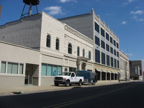
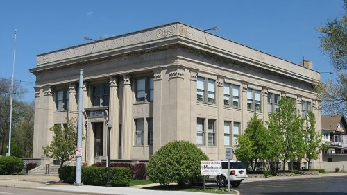
15 places in town are on the National Register, among them nine historic districts with 521 buildings between them. Below: maps from 1886 on and the census since 1880.
The Hammond post office opened in 1873, the earliest record of the town by name. Wikidata gives 1884. Three smaller post offices, Gibson's Station (1857), Gibson (1882) and Hessville (1886), opened inside today’s city and later closed.
First census: 699 in 18802020 census: 77,879153 years
How historic is Hammond?
A−
More historic than 82% of U.S. towns, on its age, its old homes and the National Register.
Founding year: the first Hammond post office (Blevins & Helbock, CC0). Wikidata: 1884.The full story ↓
History grade
What drives Hammond’s History grade
On its age, its old homes and the National Register, Hammond is more historic than 82% of U.S. towns, #216 of 593 in Indiana. Its National Register listings hold the grade up; its age pulls it down.
A−
HistoryA character grade: shown, never part of Hammond’s overall grade.
Indiana towns list more on the Register than most of the country (a typical Indiana town has 7.9 per 10,000 residents, the U.S. 2.4), so Hammond’s 72.3 sits above most of its state (79% of Indiana towns have fewer) while its 555 historic buildings outnumber those of 97% of U.S. towns.
How sure. Graded on any two of the three inputs instead, the letter would range from B to A. The pre-1940 share (±2.0 points) is firm at this size. The founding year is the first post office, not a stated founding date; Wikidata’s 1884 falls in the same era, so the grade doesn’t depend on which one is used.
Founding year: the first post office (other dates in Quick answers). Homes: Census ACS 2020–24. National Register: National Park Service, May 2026 list; each listing counted once (boundary changes and added documentation belong to their listing), and a historic district counts its contributing buildings. How TownRatings grades history →
What stands out about Hammond’s past
Read from the archive, the National Register and the record. The page puts what stands out first.
National Park Service, National Register of Historic Places. Photos from Wikimedia Commons, credited on each place’s page.
Places that used to be
Lost post offices, old corners, places now gone and burying grounds
Hammond’s post office has been open since 1873. Three other post offices opened and closed inside today’s town.
Gibson's Station
1857–1882
Hammond
1873–today
Gibson
1882–1912
Hessville
1886–1927
18501940today
Hamlets and corners on the map
Bonfiglio's Mobile Home ParkGibsonHessvilleOsbornParagon Mobile Home ParkRobertsdaleSheffield EstatesWoodmar
Gone or out of use
Bethel Baptist ChurchchurchChrist United Methodist ChurchchurchChurch of ChristchurchE B Hayward Branch Hammond Public LibrarybuildingHoward Branch Hammond Public LibrarybuildingLighthouse TabernaclechurchPorter SchoolschoolRiverside Elementary SchoolschoolSaint Josephs SchoolschoolSaint Paul's Episcopal ChurchchurchSaint Paul's Evangelical Lutheran ChurchchurchSouth Side Christian ChurchchurchWashington Schoolschool
9cemeteries and burying grounds inside Hammond
ConcordiaElmwoodHessvilleHoly GhostOak HillSaint John - Saint Joseph CatholicSaint MarysSaint MichaelsSaint Nicholas
US Post Offices dataset (Blevins & Helbock, CC0). Places and cemeteries from the USGS Geographic Names Information System (2021).
Help out
Start Hammond’s collection
The first neighbors to add old photos shape how Hammond’s history is told.
Decades since 1900 with photos
00s10s20s30s40s50s60s70s80s90s
0 of 10 decades. The empty ones are waiting for someone’s album.
The first European-descended residents arrived around 1847 to settle on land between the Grand and Little Calumet Rivers, on the south end of Lake Michigan. Those first residents were German immigrant farmers looking for land and opportunity. Before that time, the area was a crossroad for Indian tribes, explorers, stagecoach lines, and supply lines to the West. Convenient location and abundant fresh water from Lake Michigan led to the beginning of Hammond's industrialization in 1869 with the George H. Hammond Company meat-packing plant following merchants and farmers to the area. Hammond was incorporated on April 21, 1884, and was named after the Detroit butcher.
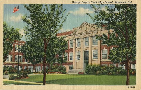
Passages that mention Hammond, cut from the printed page as they were published.
Centennial souvenir history of Gouverneur, Rossie, Fowler, Hammond, Edwards, De Kalb1905 · page 92Read the page →
Read the text
said Russell, voted to grant the request of Benjamin Pike, in behalf of the inhabitants of that part of Russell called Somerville that they be set off from Russell and annexed to Gouverneur.” The part so set off embraced the townships numbered 1, 2 and 7. Hammond, Killarney and Somerville of tract number 3. That is the present towns of Fowler, Rossie and part of Hammond.
Text read by machine from the scan; it may contain errors.
Centennial souvenir history of Gouverneur, Rossie, Fowler, Hammond, Edwards, De Kalb1905 · page 101Read the page →
Read the text
railroad was completed from Watertown to Potsdam, crossing the town at Keenes, Avhere a station was established, there had been two lines of stage coaches, running via Antwerp, Somerville and Gouverneur north, the other from Antwerp to Ogdensburg by OxBow, Hammond, Rossie and Morristown. Before the advent of the railroad, all produce was hauled to Albany or Troy. In 1818 an element entered the town, destined to have a great influence in shaping its moral and industrial growth. In that year, came Robert Ormiston, (portrait accompanying). William Faichney,
Text read by machine from the scan; it may contain errors.
Scans and text from the Internet Archive. Books published in 1930 or earlier, which are in the public domain.
Timeline
Hammond, 1857 to 1960
Woven from the archive, old maps, post office records, the National Register and the people born here.
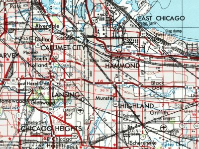
Every edition of the U.S. Geological Survey’s map of Hammond. Tap a year, or press play to watch the town change.
1953Chicago sheet · 1:250,000
U.S. Geological Survey historical topographic maps (public domain), via Esri’s collection of the scans. The red ring marks the center of Hammond.
Every building
Hammond, building by building, 1886–1915
Fire insurance maps drew every building, what it was made of and what it was used for, so insurers could price the risk of fire. Pick a year, then a sheet.
The Hammond post office opened in 1873, the earliest record of the town by name (U.S. post office records). Wikidata gives 1884.
How does Hammond rank for history?
Hammond is more historic than 82% of U.S. towns, #216 of 593 in Indiana. The History grade combines the town’s founding era, the share of homes built before 1940 and its National Register listings. It’s a character grade, so it isn’t part of the overall grade. How it works.
What is on the National Register in Hammond?
15 listings: 6 buildings, among them the State Bank of Hammond Building (listed 1984, the first), and 9 historic districts with 521 contributing buildings. 555 historic buildings in all.
How old are the homes in Hammond?
30% of Hammond’s homes were built before 1940 (Census estimate, ±2.0 points), against a typical 14% for an Indiana town; the median home was built in 1952.
Founding dates: Wikidata, Wikipedia, the U.S. post office records of Blevins & Helbock (CC0) and the Census. Homes by year built: Census ACS 2020–24. National Register of Historic Places: National Park Service (list of May 22, 2026). Old photos, postcards and papers: Wikimedia Commons, the Library of Congress and other public archives, credited on each item’s page. Maps: U.S. Geological Survey historical topographic maps (via Esri) and Sanborn fire-insurance maps (Library of Congress). History text and census tables: Wikipedia (CC BY-SA 4.0). Places that used to be: USGS Geographic Names Information System (2021).
From Wikimedia Commons (12), the National Register of Historic Places (15), Wikipedia, Wikidata and Wikipedia for famous people, U.S. Geological Survey historical maps, U.S. Census counts (via Wikipedia), the US Post Offices dataset (Blevins & Helbock), the USGS Geographic Names Information System, Sanborn fire insurance maps (Library of Congress) and old county and town histories (Internet Archive). Archive images are copied here with their credits and licenses, shown on each photo’s page. Refreshed monthly.







 2006
 2006
 2006
 2006
 2006
 2006
 2006
 2006
 2006
 2006
 2006
 2006


