Wilmette’s post office opened in 1870, and 29% of its homes were built before 1940
More historic than 85% of U.S. towns · #124 of 768 in Illinois. What drives it
14 places in town are on the National Register, among them four historic districts with 959 buildings between them. Below: 11 old photos and papers, maps from 1899 on, and the census since 1880.
The Wilmette post office opened in 1870, the earliest record of the town by name. Wikidata gives 1872. Two smaller post offices, Gross Point (1846) and Gross Point (1857), opened inside today’s town and later closed.
First census: 419 in 18802020 census: 28,170156 years
How historic is Wilmette?
A
More historic than 85% of U.S. towns, on its age, its old homes and the National Register.
Founding year: the first Wilmette post office (Blevins & Helbock, CC0). Wikidata: 1872.The full story ↓
History grade
What drives Wilmette’s History grade
On its age, its old homes and the National Register, Wilmette is more historic than 85% of U.S. towns, #124 of 768 in Illinois. Its National Register listings hold the grade up; its age pulls it down.
A
HistoryA character grade: shown, never part of Wilmette’s overall grade.
Few Illinois towns list much on the Register (a typical Illinois town has 0.5 per 10,000 residents, the U.S. 2.4), so Wilmette’s 352 sits above most of its state (98% of Illinois towns have fewer) while its 969 historic buildings outnumber those of 99% of U.S. towns.
How sure. Graded on any two of the three inputs instead, the letter would range from B to A+. The pre-1940 share (±2.7 points) is firm at this size. The founding year is the first post office, not a stated founding date; Wikidata’s 1872 falls in the same era, so the grade doesn’t depend on which one is used.
Founding year: the first post office (other dates in Quick answers). Homes: Census ACS 2020–24. National Register: National Park Service, May 2026 list; each listing counted once (boundary changes and added documentation belong to their listing), and a historic district counts its contributing buildings. How TownRatings grades history →
What stands out about Wilmette’s past
Read from the archive, the National Register and the record. The page puts what stands out first.
Wilmette was a forested area with high bluffs along its lakeshore. Before European settlement, members of the Potawatomi tribe lived in the area that would later become Wilmette. Native Americans were forced out of the area by treaties in the 1820s and 1830s.
The village is named in honor of Archange and Antoine Ouilmette.
Passages that mention Wilmette, cut from the printed page as they were published.
History of Cook County, Illinois. From the earliest period to the present time1884 · page 447Read the page →
Read the text
W. It. K. up to 18«7. when he wont to what is now the village of Wilmette, ami in connection with Alexander MeDaniels and Henry A. Dingee laid out trie town of Wilmette In 1808 he engaged in the dairy business and followed it up to the fall of 18*2. In November, 1SSI. he bought out Mr. Vnllmer in the grocery business ami has carried it on ever since, taking into partnership his son George, the firm being S. V. Kline & Son. He was Assessor for seven years for the town of Evans-
Text read by machine from the scan; it may contain errors.
History of Cook County, Illinois. From the earliest period to the present time1884 · page 467Read the page →
Read the text
Dingee, and others, laid out the present town of W dinette. They built and carried on t he first pickle manufactory in Cook County at Wilmette. In 1870 the copartnership between him and Mr. Dingee was dissolved, since which time Mr. Westerfield has been engaged in civil engineering. He has been largely interested in the improvement of Wilmette for years, and was the first Minor of the town, ne has l>een school trustee and has held all the minor offices of that town, and is now both
Text read by machine from the scan; it may contain errors.
Should the present intention of the citizens of Wilmette and of the Sanitary District of Chicago to create and maintain a public park at this place on the lake front, built by spoil excavated from the Drainage Canal now in progress of construction, be carried out, it is respectfully suggested that the Evanston Historical Society or the citizens of Wilmette, or both, erect at, or near the foot of Lake Avenue, on the former site of the cabin, a suitable monument bear-
Text read by machine from the scan; it may contain errors.
Scans and text from the Internet Archive. Books published in 1930 or earlier, which are in the public domain.
Timeline
Wilmette, 1846 to 1988
Woven from the archive, old maps, post office records, the National Register and the people born here.
Nothing in the archives for these yearsWeddings on Main Street, storms, parades, school pictures, the old store. If it’s in your family album, it belongs here.
The Wilmette post office opened in 1870, the earliest record of the town by name (U.S. post office records). Wikidata gives 1872.
How does Wilmette rank for history?
Wilmette is more historic than 85% of U.S. towns, #124 of 768 in Illinois. The History grade combines the town’s founding era, the share of homes built before 1940 and its National Register listings. It’s a character grade, so it isn’t part of the overall grade. How it works.
What is on the National Register in Wilmette?
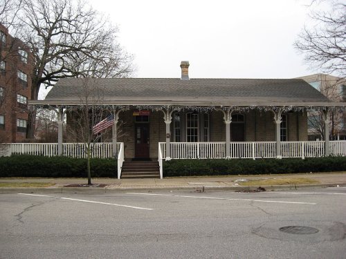
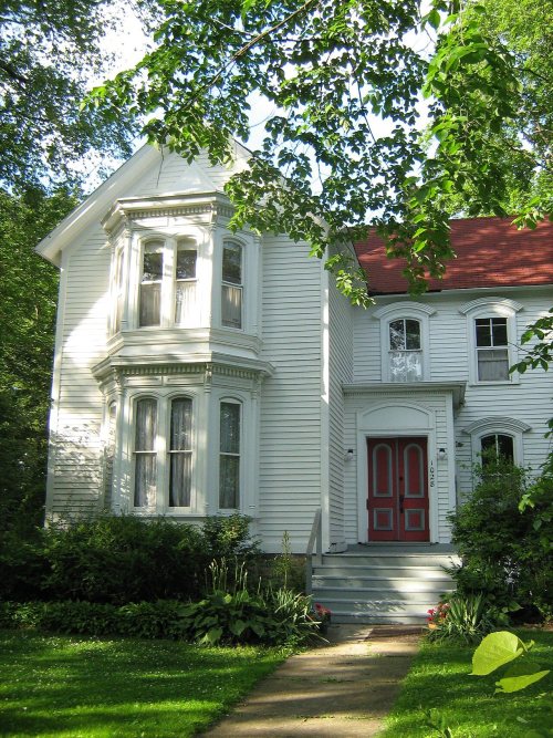
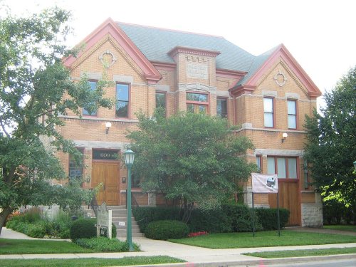
14 listings: 10 buildings, among them the Frank J. Baker House (listed 1974, the first), and 4 historic districts with 959 contributing buildings. 969 historic buildings in all.
How old are the homes in Wilmette?
29% of Wilmette’s homes were built before 1940 (Census estimate, ±2.7 points), against a typical 11% for an Illinois town; the median home was built in 1957.
Founding dates: Wikidata, Wikipedia, the U.S. post office records of Blevins & Helbock (CC0) and the Census. Homes by year built: Census ACS 2020–24. National Register of Historic Places: National Park Service (list of May 22, 2026). Old photos, postcards and papers: Wikimedia Commons, the Library of Congress and other public archives, credited on each item’s page. Maps: U.S. Geological Survey historical topographic maps (via Esri) and Sanborn fire-insurance maps (Library of Congress). History text and census tables: Wikipedia (CC BY-SA 4.0). Places that used to be: USGS Geographic Names Information System (2021).
From Wikimedia Commons (11), Wikidata (1), the National Register of Historic Places (14), Wikipedia, Wikidata and Wikipedia for famous people, U.S. Geological Survey historical maps, U.S. Census counts (via Wikipedia), the US Post Offices dataset (Blevins & Helbock), the USGS Geographic Names Information System and old county and town histories (Internet Archive). Archive images are copied here with their credits and licenses, shown on each photo’s page. Refreshed monthly.








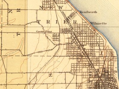


 1900
 1933
 1933
 1933
 1933
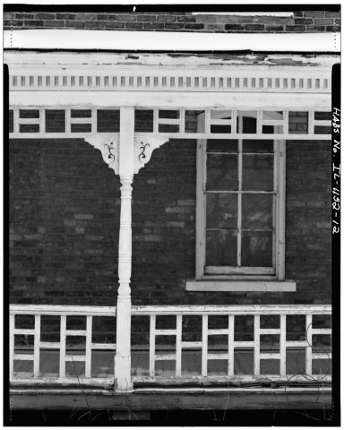 1933
 1933