Nothing in the archives for these yearsWeddings on Main Street, storms, parades, school pictures, the old store. If it’s in your family album, it belongs here.
Paris was established in 1826 on land donated by Samuel Vance to be the county seat, and was incorporated as a village in 1849. The town most likely received its name from the word "Paris" carved into a jack oak tree in the middle of what became the town and not after France's capital.
Paris's history includes the service of two brothers, Walter Booth and Newton Booth, as its mayors in the mid-1850s. Newton Booth later moved west to California, where he served as governor and a U.S. senator.
Passages that mention Paris Township, cut from the printed page as they were published.
The History of Edgar County, Illinois, containing a history of the county--its cities, towns, &c.1879Read the page →
Read the text
The territory embraced in Paris Township was a part of the Kickapoo hunting-grounds for years after settlements were made on the east side of the old Indian boundary line. The lands west of this line were not bought from the Indians until 1822, and were then surveyed and placed in the market. But that part of the county lying east of the line referred to, was purchased by Gen. Harrison in 1809, as noted in the county history, and offered for sale at Vincennes as early as 1816. Hence, settlements were made in the eastern part of the county several years before a white man ventured thus far West.
Text read by machine from the scan; it may contain errors.
The History of Edgar County, Illinois1879 · page 303Read the page →
Read the text
The territory embraced in Paris Township was a part of the Kickapoo hunting-grounds for years after settlements were made on the east side of the old Indian boundary line. The lands west of this line were not bought from the Indians until 1822, and were then surveyed and placed in the market. But that part of the county lying east of the line referred to, was purchased by Gen. Harrison in 1809, as noted in the county history, and offered for sale at Vincennes as early as 1816. Hence, settlements were made in the eastern part of the county several years before a white man ventured thus far West.
Text read by machine from the scan; it may contain errors.
The history of Edgar County, Illinois1879 · page 303Read the page →
Read the text
The territory embraced in Paris Township was a part of the Kickapoo hunting-grounds for years after settlements were made on the east side of the old Indian boundary line. The lands west of this line were not bought from the Indians until 1822, and were then surveyed and placed in the market. But that part of the county lying east of the line referred to, was purchased by Gen. Harrison in 1809, as noted in the county history, and offered for sale at Vincennes as early as 1816. Hence, settlements were made in the eastern part of the county several years before a white man ventured thus far West.
Text read by machine from the scan; it may contain errors.
The History of Edgar County, Illinois, containing a history of the county--its cities, towns, &c.1879Read the page →
Read the text
The railroads and other highways of Paris Township are so fully given in the general county history that we could say but little additional in this place without useless repetition. Much time and labor have been spent on the wagonroads running through the township, and they will favorably compare with any roads, perhaps, in the State. The railroads intersecting the town are the Indianapolis & St. Louis, the Paris & Danville, and the Illinois Midland, all of which have been fully described in another chapter.
Text read by machine from the scan; it may contain errors.
Scans and text from the Internet Archive. Books published in 1930 or earlier, which are in the public domain.
On the map
Paris Township on the map, 1947 to 1966
Every edition of the U.S. Geological Survey’s map of Paris Township. Tap a year, or press play to watch the town change.
1947Paris sheet · 1:62,500
U.S. Geological Survey historical topographic maps (public domain), via Esri’s collection of the scans. The red ring marks the center of Paris Township.
Then & now
Stand where they stood
No then-and-now pairs yet. Take a photo from the same spot as an old one and they appear here side by side.
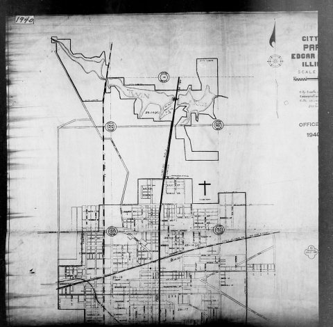
Retake this view1940 Census Enumeration District Maps - Illinois - Edgar County - Paris - ED 23-14, ED 23-15, ED 23-16A, ED 23-16B, ED …, 1880
Find the spot, match the angle, and add your photo. It becomes the first then-and-now pair on Paris Township’s page.
Between 1,930 and 9,971 people in every census since 1860.
17 censuses, 1860–2020.
U.S. Census Bureau decennial counts, from the census table on Paris Township’s Wikipedia page.
Places that used to be
Old corners, places now gone and burying grounds
Old hamlets and crossroads still carry their names on the map.
Hamlets and corners on the map
Harris
Gone or out of use
Kimble SchoolschoolMaple Grove SchoolschoolNorth Union SchoolschoolParis AirportairportPlum Grove SchoolschoolStewart AirportairportSugar Creek SchoolschoolSulphur Springs SchoolschoolTurner Schoolschool
2cemeteries and burying grounds inside Paris Township
ConkeyRedmon
Places and cemeteries from the USGS Geographic Names Information System (2021).
Help out
Finish Paris Township’s story
Most archives stop around 1920. The photos from after that are in family albums, not libraries.
Decades since 1900 with photos
00s10s20s30s40s50s60s70s80s90s
2 of 10 decades. The empty ones are waiting for someone’s album.
Founding dates: Wikidata, Wikipedia, the U.S. post office records of Blevins & Helbock (CC0) and the Census. Homes by year built: Census ACS 2020–24. National Register of Historic Places: National Park Service (list of May 22, 2026). Old photos, postcards and papers: Wikimedia Commons, the Library of Congress and other public archives, credited on each item’s page. Maps: U.S. Geological Survey historical topographic maps (via Esri) and Sanborn fire-insurance maps (Library of Congress). History text and census tables: Wikipedia (CC BY-SA 4.0). Places that used to be: USGS Geographic Names Information System (2021). How TownRatings grades history →
From Wikimedia Commons (12), Wikipedia, U.S. Geological Survey historical maps, U.S. Census counts (via Wikipedia), the USGS Geographic Names Information System and old county and town histories (Internet Archive). Archive images are copied here with their credits and licenses, shown on each photo’s page. Refreshed monthly.


 1870
 1870
 1870
 1870
 1880
 1880
 1880
 1880
 1880
 1912
 1933
 1933


