From Chillicothe’s archive · credits on each photo
Quick answers
How Chillicothe began
When was Chillicothe founded?
1841
The Chillicothe post office opened in 1841, the earliest record of the town by name. Another post office, North Chillicothe (1892), opened inside today’s city and later closed.
First census: 663 in 18602020 census: 6,128185 years
How historic is Chillicothe?
A−
More historic than 79% of U.S. towns, on its age, its old homes and the National Register.
Founding year: the first Chillicothe post office (Blevins & Helbock, CC0).The full story ↓
History grade
What drives Chillicothe’s History grade
On its age, its old homes and the National Register, Chillicothe is more historic than 79% of U.S. towns, #185 of 768 in Illinois. All 3 inputs are above most U.S. towns; its age ranks highest and its National Register listings lowest.
A−
HistoryA character grade: shown, never part of Chillicothe’s overall grade.
Few Illinois towns list much on the Register (a typical Illinois town has 0.5 per 10,000 residents, the U.S. 2.4), so Chillicothe’s 1.7 sits above most of its state (66% of Illinois towns have fewer) while its 1 listings outnumber those of 51% of U.S. towns.
How sure. Graded on any two of the three inputs instead, the letter would range from B+ to A−. The pre-1940 share is a Census survey estimate (±6.6 points). The founding year is the first post office, not a stated founding date.
Founding year: the first post office (other dates in Quick answers). Homes: Census ACS 2020–24. National Register: National Park Service, May 2026 list; each listing counted once (boundary changes and added documentation belong to their listing), and a historic district counts its contributing buildings. How TownRatings grades history →
What stands out about Chillicothe’s past
Read from the archive, the National Register and the record. The page puts what stands out first.
Nothing in the archives for these yearsWeddings on Main Street, storms, parades, school pictures, the old store. If it’s in your family album, it belongs here.
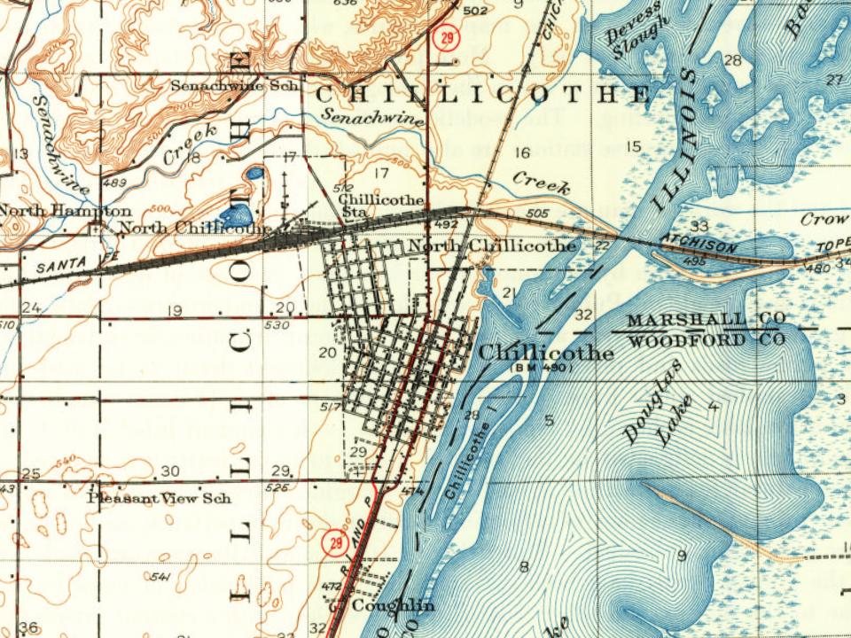
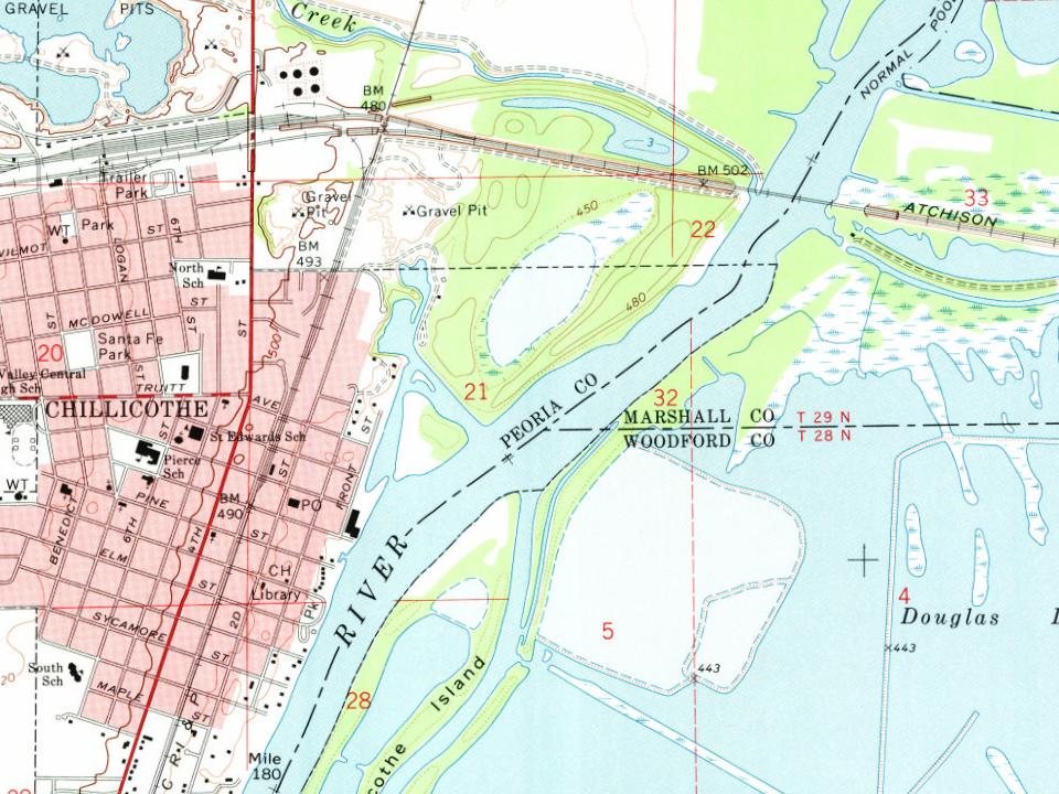
Every edition of the U.S. Geological Survey’s map of Chillicothe. Tap a year, or press play to watch the town change.
1893Metamora sheet · 1:62,500
U.S. Geological Survey historical topographic maps (public domain), via Esri’s collection of the scans. The red ring marks the center of Chillicothe.
Every building
Chillicothe, building by building, 1893–1913
Fire insurance maps drew every building, what it was made of and what it was used for, so insurers could price the risk of fire. Pick a year, then a sheet.
The name Chillicothe comes from the name of the Chalahgawtha sect of the Shawnee nation.
Along with Peoria, Chillicothe grew due to river traffic and quickly became a stop for barge and railroad traffic traveling to and from Chicago and St. Louis.
In the late 1800s, the Atchison, Topeka and Santa Fe Railway was building its mainline from Chicago to Kansas City and selected Chillicothe as its crossing point of the Illinois River. The railroad quickly became an establishment in Chillicothe as a crew change point and a notable stop in Central Illinois. Chillicothe today still remains a key point on the Southern Transcon route between Chicago and Los Angeles with high frequency intermodal freight trains moving through daily.
Passages that mention Chillicothe, cut from the printed page as they were published.
The History of Peoria County, Illinois. Containing a history of the Northwest--history of Illinois--history of the county, its early settlement, growth, development, resources, etc., etc. ..1880 · page 762Read the page →
Read the text
Dec. 16, 1830, Barbara A. Reed, a native of Middletown, Delaware Co., N. Y., born Sept. 15, 181 1, and in the Summer of 1832 moved on to the present site of the town of Chillicothe, being the first resident within its bounds. There he remained till April, 1836, and in the same Summer came to his present farm, where he has since resided. His farm consists of 240 acres in Marshall Co., and 160 acres in Peoria Co. A great
Text read by machine from the scan; it may contain errors.
The History of Peoria County, Illinois. Containing a history of the Northwest--history of Illinois--history of the county, its early settlement, growth, development, resources, etc., etc. ..1880 · page 55Read the page →
Read the text
It then improved rapidly, having in 1818 a population of upward of 9,000. Chillicothe was laid out in 1796, and in 1818 had a pojuilation of 2,600. Columbus, the present capital, was laid out early in the year 1812, and in 1818 contained about 1,500 inhabitants. Cleveland was laid out in 1796, and about the same time a number of settlements were made along the Miami. Until the legislature met in Columbus, in December, 1816, Cincinnati and Chillicothe had alternately enjoyed the distinction of being both the Territorial and State capitals. In 181-t the first State-house, a plain brick building, was erected at Columbus, the permanent seat of the State Government. In February, 1852,
Text read by machine from the scan; it may contain errors.
Scans and text from the Internet Archive. Books published in 1930 or earlier, which are in the public domain.
Timeline
Chillicothe, 1841 to 1997
Woven from the archive, old maps, post office records, the National Register and the people born here.
The Chillicothe post office opened in 1841, the earliest record of the town by name (U.S. post office records).
How does Chillicothe rank for history?
Chillicothe is more historic than 79% of U.S. towns, #185 of 768 in Illinois. The History grade combines the town’s founding era, the share of homes built before 1940 and its National Register listings. It’s a character grade, so it isn’t part of the overall grade. How it works.
What is on the National Register in Chillicothe?
One place: the Peoria Automobile Club (listed 1995).
How old are the homes in Chillicothe?
20% of Chillicothe’s homes were built before 1940 (Census estimate, ±6.6 points), against a typical 11% for an Illinois town; the median home was built in 1964.
Founding dates: Wikidata, Wikipedia, the U.S. post office records of Blevins & Helbock (CC0) and the Census. Homes by year built: Census ACS 2020–24. National Register of Historic Places: National Park Service (list of May 22, 2026). Old photos, postcards and papers: Wikimedia Commons, the Library of Congress and other public archives, credited on each item’s page. Maps: U.S. Geological Survey historical topographic maps (via Esri) and Sanborn fire-insurance maps (Library of Congress). History text and census tables: Wikipedia (CC BY-SA 4.0). Places that used to be: USGS Geographic Names Information System (2021).
From Wikimedia Commons (10), the Library of Congress (20), the National Register of Historic Places (1), Wikipedia, Wikidata and Wikipedia for famous people, U.S. Geological Survey historical maps, U.S. Census counts (via Wikipedia), the US Post Offices dataset (Blevins & Helbock), the USGS Geographic Names Information System, Sanborn fire insurance maps (Library of Congress) and old county and town histories (Internet Archive). Archive images are copied here with their credits and licenses, shown on each photo’s page. Refreshed monthly.


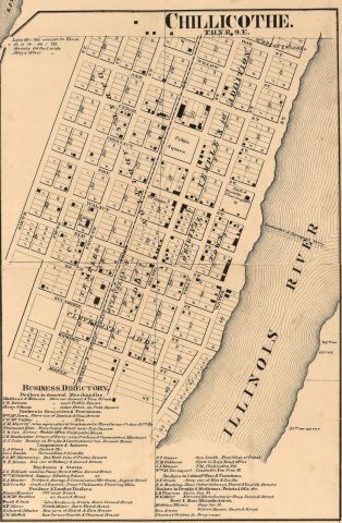 1861
 1911
 1916
 1943
 1943
 1943
 1943
 1943
 1943
 1943
 1943
 1943
 1943
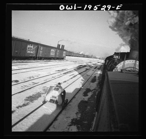 1943
 1943
 1943
 1943
 1943
 1943
 1943
 1943
 1989
 1997
 1997
 2012
 2012
 2012
 2012
 2006
 2005