Chicago Heights’ post office opened in 1891, and 16% of its homes were built before 1940
More historic than 56% of U.S. towns · #358 of 768 in Illinois. What drives it
Its Register listings are the Bloom Township High School and the Flat Iron Building. Below: 8 old photos and papers, maps from 1929 on, and the census since 1900.
From Chicago Heights’ archive · credits on each photo
Quick answers
How Chicago Heights began
When was Chicago Heights founded?
1891
The Chicago Heights post office opened in 1891, the earliest record of the town by name. Wikidata gives 1893. Two smaller post offices, Thorn Grove (1849) and Bloom (1850), opened inside today’s city and later closed.
First census: 5,100 in 19002020 census: 27,480135 years
How historic is Chicago Heights?
B
More historic than 56% of U.S. towns, on its age, its old homes and the National Register.
Founding year: the first Chicago Heights post office (Blevins & Helbock, CC0). Wikidata: 1893.The full story ↓
History grade
What drives Chicago Heights’ History grade
On its age, its old homes and the National Register, Chicago Heights is more historic than 56% of U.S. towns, #358 of 768 in Illinois. Its share of homes from before 1940 holds the grade up; its age pulls it down.
B
HistoryA character grade: shown, never part of Chicago Heights’ overall grade.
Few Illinois towns list much on the Register (a typical Illinois town has 0.5 per 10,000 residents, the U.S. 2.4), so Chicago Heights’ 0.7 sits near the middle of its state (61% of Illinois towns have fewer) while its 2 listings outnumber those of 60% of U.S. towns.
How sure. Graded on any two of the three inputs instead, the letter would range from C+ to B+. The pre-1940 share is a Census survey estimate (±3.1 points). The founding year is the first post office, not a stated founding date; Wikidata’s 1893 falls in the same era, so the grade doesn’t depend on which one is used.
Founding year: the first post office (other dates in Quick answers). Homes: Census ACS 2020–24. National Register: National Park Service, May 2026 list; each listing counted once (boundary changes and added documentation belong to their listing), and a historic district counts its contributing buildings. How TownRatings grades history →
What stands out about Chicago Heights’ past
Read from the archive, the National Register and the record. The page puts what stands out first.
The first recorded settlement by non-native Americans of the area that would become Chicago Heights occurred in 1833 when Absalom Wells built a cabin on the ridge above Thorn Creek. By the 1840s, a small rural community known as Thorn Grove had been formed, centered around a Presbyterian church.
In the 1890s, a group of Chicago developers led by Charles Wacker formed the Chicago Heights Land Association to create an outer-ring industrial suburb of Chicago. They convinced many businesses to construct factories in the new development, including Inland Steel, the Owens-Illinois Glass Company, and the Ludowici Roofing Tile Company, among many others.
Passages that mention Chicago Heights, cut from the printed page as they were published.
History of Cook County, Illinois1909 · page 351Read the page →
Read the text
Printing company. William H. Freeman is its editor. The Chicago Heights Star, official newspaper of the city of Chicago Heights, is published weekly at 86 Illinois street, by W. E. Williams. It is in its eighth volume. A city directory of Chicago Heights has been published annually since 1900. The postoffice at Chicago Heights is ably managed by William J. McEldowney, postmaster, with Charles F. Kargis as assistant postmaster. The local delivery work is so extensive as to employ
Text read by machine from the scan; it may contain errors.
History of Cook County, Illinois1909 · page 345Read the page →
Read the text
line of the northeast quarter of section 29-35-14 for a distance of 1,131.2 feet to the point of beginning; the territory described above by metes and bounds being included within blocks 218 and 219 and a part of Euclid avenue and Main street, in Chicago Heights, 111. "§2. That the territory annexed shall be known and legally described as blocks 218 and 219 in the first annexation to the village of Chicago Heights, which is a subdivision in T. 35 N., R.
Text read by machine from the scan; it may contain errors.
Scans and text from the Internet Archive. Books published in 1930 or earlier, which are in the public domain.
Timeline
Chicago Heights, 1849 to 1989
Woven from the archive, old maps, post office records, the National Register and the people born here.
Nothing in the archives for these yearsWeddings on Main Street, storms, parades, school pictures, the old store. If it’s in your family album, it belongs here.
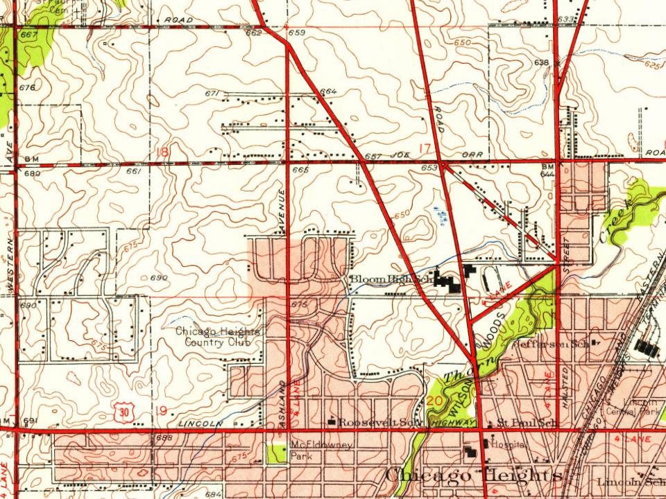
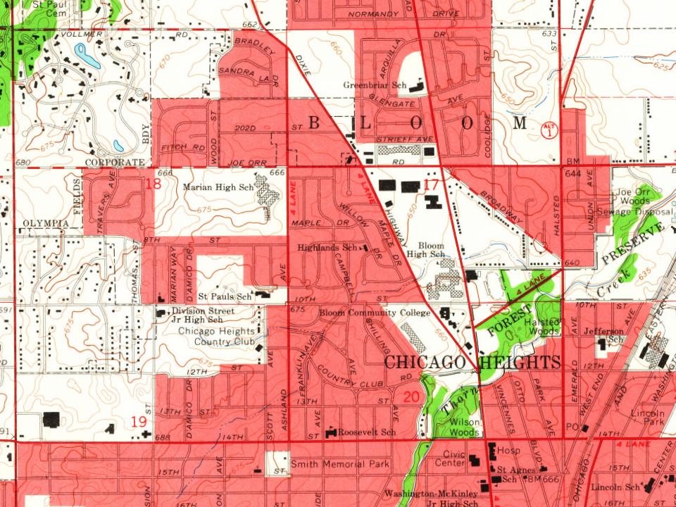
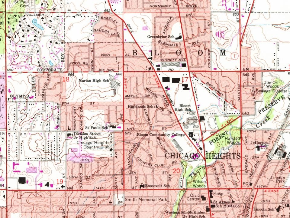
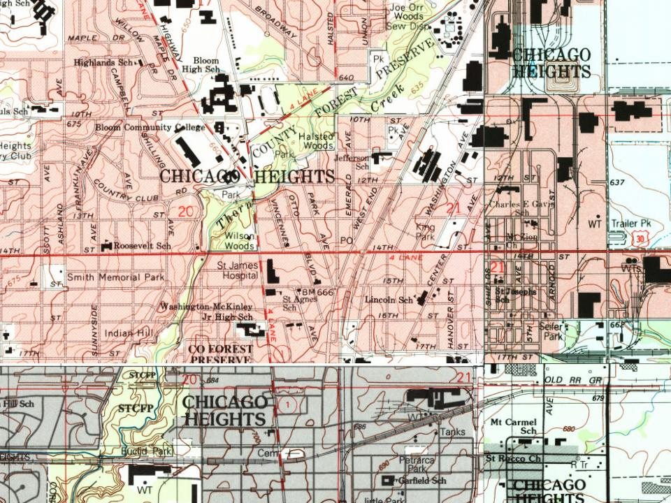
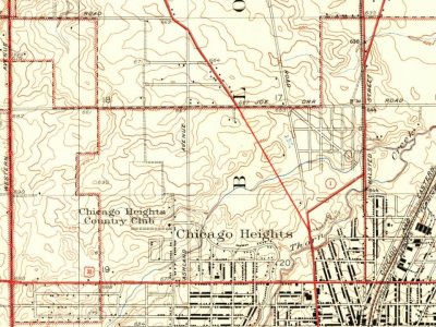
Every edition of the U.S. Geological Survey’s map of Chicago Heights. Tap a year, or press play to watch the town change.
1929Harvey sheet · 1:24,000
U.S. Geological Survey historical topographic maps (public domain), via Esri’s collection of the scans. The red ring marks the center of Chicago Heights.
Then & now
Stand where they stood
No then-and-now pairs yet. Take a photo from the same spot as an old one and they appear here side by side.
Retake this viewChicago Heights, Ill. from Lawrence Captive Airship, c. 1908
Find the spot, match the angle, and add your photo. It becomes the first then-and-now pair on Chicago Heights’ page.
The Chicago Heights post office opened in 1891, the earliest record of the town by name (U.S. post office records). Wikidata gives 1893.
How does Chicago Heights rank for history?
Chicago Heights is more historic than 56% of U.S. towns, #358 of 768 in Illinois. The History grade combines the town’s founding era, the share of homes built before 1940 and its National Register listings. It’s a character grade, so it isn’t part of the overall grade. How it works.
What is on the National Register in Chicago Heights?
Two places: the Bloom Township High School (listed 1982) and the Flat Iron Building (2003).
How old are the homes in Chicago Heights?
16% of Chicago Heights’ homes were built before 1940 (Census estimate, ±3.1 points), against a typical 11% for an Illinois town; the median home was built in 1959.
Founding dates: Wikidata, Wikipedia, the U.S. post office records of Blevins & Helbock (CC0) and the Census. Homes by year built: Census ACS 2020–24. National Register of Historic Places: National Park Service (list of May 22, 2026). Old photos, postcards and papers: Wikimedia Commons, the Library of Congress and other public archives, credited on each item’s page. Maps: U.S. Geological Survey historical topographic maps (via Esri) and Sanborn fire-insurance maps (Library of Congress). History text and census tables: Wikipedia (CC BY-SA 4.0). Places that used to be: USGS Geographic Names Information System (2021).
From Wikimedia Commons (19), the Library of Congress (1), the National Register of Historic Places (2), Wikipedia, Wikidata and Wikipedia for famous people, U.S. Geological Survey historical maps, U.S. Census counts (via Wikipedia), the US Post Offices dataset (Blevins & Helbock), the USGS Geographic Names Information System and old county and town histories (Internet Archive). Archive images are copied here with their credits and licenses, shown on each photo’s page. Refreshed monthly.




 1908
 Date?
 Date?
 2022
 2021
 2016
 2013
 2012
 2012
 2010
 2010
 2009
 2006
 2003
 2003