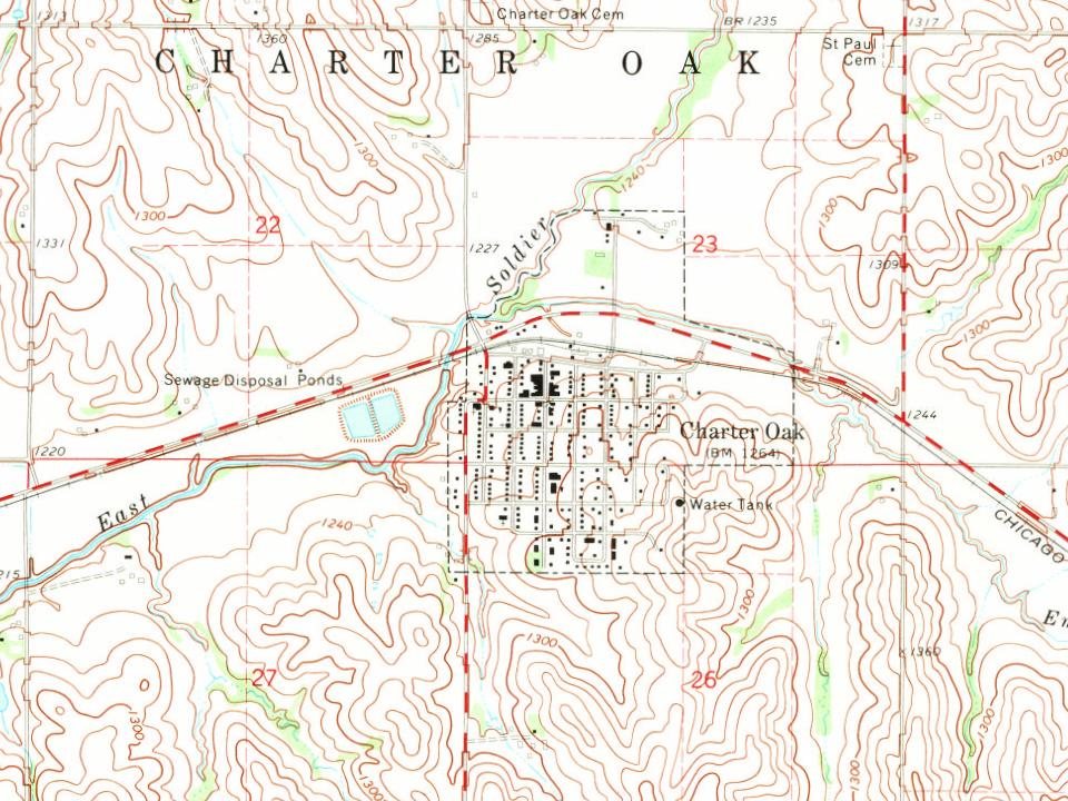
Charter Oak was first mentioned in newspapers August 13, 1869. The town Post Office was established May 4, 1876. The Chicago, Milwaukee & St. Paul Railway was completed in February 1887, bringing the train through town twice daily as it hauled postage and freight from Manilla to Sioux City. Articles of Incorporation were filed for the town of Charter Oak February 14, 1891.
Charter Oak was a busy community with many businesses to employ community members. The first school was built in 1889, as the community grew the school became too small. The current school building was built in 1916. In 1929 the first street was paved.
Peaked at 776 in 1940; 535 people lived here in 2020.
14 censuses, 1890–2020.
U.S. Census Bureau decennial counts, from the census table on Charter Oak’s Wikipedia page.
From the old history books
What they wrote about Charter Oak in 1911
Passages that mention Charter Oak, cut from the printed page as they were published.
History of Crawford County, Iowa, a record of settlement, organization, progress and achievement1911 · page 603Read the page →
Read the text
at Denison, to sell the property and secure a site in the town upon which to build a church. Accordingly the land was sold and three lots were purchased at Charter Oak, and a neat little church was erected at a cost of twenty-five hundred dollars. Father Lenihan was the first priest to celebrate mass, this event taking place in one of the public school houses south of Charter Oak. As soon as the new church was completed the present pastor at Denison, Rev. M. Farrelly, was given charge of the congregation. He continued until 1896, when Rev. M.
Text read by machine from the scan; it may contain errors.
History of Crawford County, Iowa, a record of settlement, organization, progress and achievement1911 · page 602Read the page →
Read the text
The history of St. Boniface parish dates from early in the '80s, when a few Catholic .settlers began the organization of a center for religious services and secured a tract of forty acres about five miles northeast of the present town of Charter Oak. In 1886, however, the town having shown evidences of prosperity and permanency, it was decided through advice of Rev. B. C. Lenihan, then pastor
Text read by machine from the scan; it may contain errors.
Scans and text from the Internet Archive. Books published in 1930 or earlier, which are in the public domain.
Timeline
Charter Oak, 1876 to 1971
Woven from the archive, old maps, post office records, the National Register and the people born here.
Founding dates: Wikidata, Wikipedia, the U.S. post office records of Blevins & Helbock (CC0) and the Census. Homes by year built: Census ACS 2020–24. National Register of Historic Places: National Park Service (list of May 22, 2026). Old photos, postcards and papers: Wikimedia Commons, the Library of Congress and other public archives, credited on each item’s page. Maps: U.S. Geological Survey historical topographic maps (via Esri) and Sanborn fire-insurance maps (Library of Congress). History text and census tables: Wikipedia (CC BY-SA 4.0). Places that used to be: USGS Geographic Names Information System (2021). How TownRatings grades history →
From Wikimedia Commons (5), Wikipedia, U.S. Geological Survey historical maps, U.S. Census counts (via Wikipedia), the US Post Offices dataset (Blevins & Helbock), the USGS Geographic Names Information System and old county and town histories (Internet Archive). Archive images are copied here with their credits and licenses, shown on each photo’s page. Refreshed monthly.


 2021
 2011
 2011
 2008
 2004