Stamford dates to 1641, and 14% of its homes were built before 1940
More historic than 89% of U.S. towns · #53 of 155 in Connecticut. What drives it
33 places in town are on the National Register, among them the First Presbyterian Church, a National Historic Landmark, and five historic districts with 1,123 buildings between them. Below: 5 old photos and papers, maps from 1884 on, and the census since 1880.
Founding year: Wikidata. First post office: 1776.The full story ↓
History grade
What drives Stamford’s History grade
On its age, its old homes and the National Register, Stamford is more historic than 89% of U.S. towns, #53 of 155 in Connecticut. All 3 inputs are above most U.S. towns; its age ranks highest and its share of homes from before 1940 lowest.
A
HistoryA character grade: shown, never part of Stamford’s overall grade.
Among the 400 U.S. cities of 100,000 or more, Stamford ranks #74 on History.
Connecticut towns list more on the Register than most of the country (a typical Connecticut town has 73.3 per 10,000 residents, the U.S. 2.4), so Stamford’s 84.9 sits near the middle of its state (51% of Connecticut towns have fewer) while its 1,164 historic buildings outnumber those of 99% of U.S. towns.
NoteThe founding year comes from Wikidata alone; no second source gives 1641.
How sure. Graded on any two of the three inputs instead, the letter would range from B+ to A. The pre-1940 share (±1.3 points) is firm at this size.
Founding year: Wikidata (other dates in Quick answers). Homes: Census ACS 2020–24. National Register: National Park Service, May 2026 list; each listing counted once (boundary changes and added documentation belong to their listing), and a historic district counts its contributing buildings. How TownRatings grades history →
What stands out about Stamford’s past
Read from the archive, the National Register and the record. The page puts what stands out first.
The country’s official list of buildings and places worth saving. One is a National Historic Landmark, the highest tier. Boundary changes and added documentation are counted with their listing.
Stamford was known as Rippowam by the Siwanoy Native American inhabitants of the region, and the very first European settlers in the area also called it that. The present name is after the town of Stamford, Lincolnshire, England. The deed to Stamford was signed on July 1, 1640, between Captain Turner of the New Haven Colony and Chief Ponus. By the 18th century, one of the town's primary industries was merchandising by water, which was possible due to Stamford's proximity to New York.
In 1692, Stamford was home to a less famous witch trial than the well-known Salem witch trials, which also occurred in 1692. The accusations were less fanatical and on a smaller scale, but they also grew to prominence through gossip and hysterics.
Passages that mention Stamford, cut from the printed page as they were published.
History of Stamford, Connecticut1868 · page 250Read the page →
Read the text
"It having been represented to this assembly that Isaac Qaintard of Stamford, in the County of Fairfield, Capt. of the 2nd military company, in the town of Stamford, in the 9th regt. in this colony, and Fyler Dibble of said Stamford, Otipt, of the first military company of Stamford, in said regiment, at said Stamford, in January last, in contempt of the authority in this colony, did attempt and endeavor to prevent the introduction of certain barrels of gun powder into this colony for the government's use, agreeably to the orders and directions of legal authority, which conduct is inconsist-
Text read by machine from the scan; it may contain errors.
History of Stamford, Connecticut1868 · page 50Read the page →
Read the text
under the jurisdiction of New Haven, and respecting the Colony School. Tlie court, rather curtly, gave him to understand that " whatever liberties or privileges our laws do allow them, that they should have." He then desires a special court in Stamford for the settlement of these questions. In 1663, he is sworn a constable for the town of Stamford in the general court of Connecticut, and in 1665, '7, and '9 he represented the town in the General Assembly. He married, here, Martha, widow of John
Text read by machine from the scan; it may contain errors.
There are a few incidents, most human In their character, which will serve to lengthen the perspective of the history of the town of Stamford, and perchance, reveal something of the fundarnental things that lie below the surface and link Stamford folk with the larger life of America. Remembering that the settlers of Stamford came through the doorway of WatertOAvn, Mass., there are three paragraphs from the pages of
Text read by machine from the scan; it may contain errors.
He was not the only Loyalist In this category. There were others from Stamford and the neighborhood and many from other towns who sought homes under the British flag In Nova Scotia, New Brunswick and elsewhere in Canada. In 1783 the town of Stamford
Text read by machine from the scan; it may contain errors.
Scans and text from the Internet Archive. Books published in 1930 or earlier, which are in the public domain.
By decade
Stamford, decade by decade
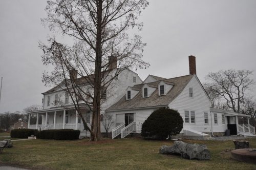
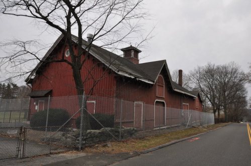
3 decades in the archive, from the 1860s to the 1880s. Scroll each row; tap a photo for its story.
Nothing in the archives for these yearsWeddings on Main Street, storms, parades, school pictures, the old store. If it’s in your family album, it belongs here.
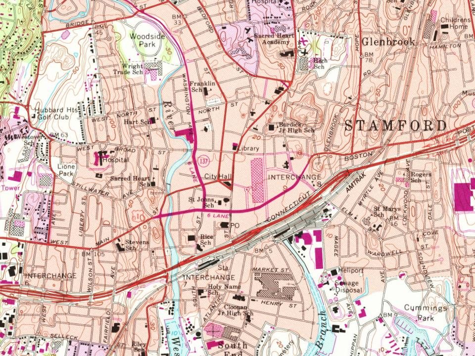
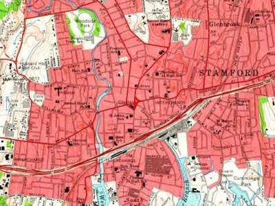
Every edition of the U.S. Geological Survey’s map of Stamford. Tap a year, or press play to watch the town change.
1960Stamford sheet · 1:24,000
U.S. Geological Survey historical topographic maps (public domain), via Esri’s collection of the scans. The red ring marks the center of Stamford.
Every building
Stamford, building by building, 1884–1901
Fire insurance maps drew every building, what it was made of and what it was used for, so insurers could price the risk of fire. Pick a year, then a sheet.
Doctor Barnes SanitariumhospitalEnniston ParkparkLow and Heywood Schoolschool
21cemeteries and burying grounds inside Stamford
Agudath SholomBelltown Cemetery No 1Belltown Cemetery No 2Beth - elBoultonEdwin R LockwoodEmmanuel ChapelFairfield Memorial ParkHigh RidgeHunting Ridge Cemetery No 1Long Ridge UnionNewfieldNorth StamfordNorthfieldOldPotters FieldRoxburySaint Andrews and Saint JohnsScofieldtown - LockwoodWestoverWoodland
See all 21
Agudath Sholom Cemetery · Belltown Cemetery No 1 · Belltown Cemetery No 2 · Beth - el Cemetery · Boulton Cemetery · Edwin R Lockwood Cemetery · Emmanuel Chapel Cemetery · Fairfield Memorial Park · High Ridge Cemetery · Hunting Ridge Cemetery No 1 · Long Ridge Union Cemetery · Newfield Cemetery · North Stamford Cemetery · Northfield Cemetery · Old Burying Ground · Potters Field · Roxbury Cemetery · Saint Andrews and Saint Johns Cemetery · Scofieldtown - Lockwood Cemetery · Westover Cemetery · Woodland Cemetery
US Post Offices dataset (Blevins & Helbock, CC0). Places and cemeteries from the USGS Geographic Names Information System (2021).
Help out
Finish Stamford’s story
Most archives stop around 1920. The photos from after that are in family albums, not libraries.
Decades since 1900 with photos
00s10s20s30s40s50s60s70s80s90s
0 of 10 decades. The empty ones are waiting for someone’s album.
In 1641, according to Wikidata. Stamford’s post office opened in 1776, and the census of 1880 counted 2,540 people here.
How does Stamford rank for history?
Stamford is more historic than 89% of U.S. towns, #53 of 155 in Connecticut. The History grade combines the town’s founding era, the share of homes built before 1940 and its National Register listings. It’s a character grade, so it isn’t part of the overall grade. How it works.
What is on the National Register in Stamford?
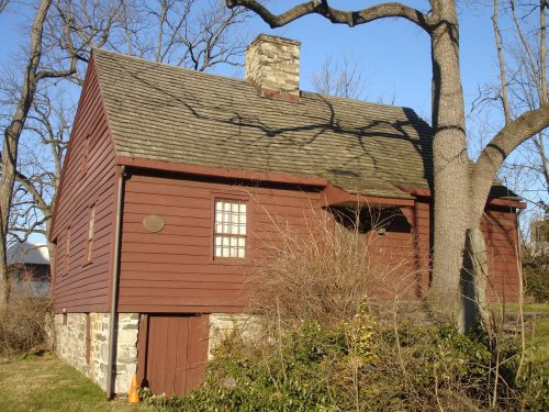
33 listings: 26 buildings, among them the First Presbyterian Church (a National Historic Landmark since 2021) and the Hoyt-Barnum House (listed 1969, the first), 5 historic districts with 1,123 contributing buildings, and 2 structures. 1,164 historic buildings in all.
How old are the homes in Stamford?
14% of Stamford’s homes were built before 1940 (Census estimate, ±1.3 points), against a typical 15% for a Connecticut town; the median home was built in 1973.
Founding dates: Wikidata, Wikipedia, the U.S. post office records of Blevins & Helbock (CC0) and the Census. Homes by year built: Census ACS 2020–24. National Register of Historic Places: National Park Service (list of May 22, 2026). Old photos, postcards and papers: Wikimedia Commons, the Library of Congress and other public archives, credited on each item’s page. Maps: U.S. Geological Survey historical topographic maps (via Esri) and Sanborn fire-insurance maps (Library of Congress). History text and census tables: Wikipedia (CC BY-SA 4.0). Places that used to be: USGS Geographic Names Information System (2021).
From Wikimedia Commons (5), Wikidata (1), the National Register of Historic Places (33), Wikipedia, Wikidata and Wikipedia for famous people, U.S. Geological Survey historical maps, U.S. Census counts (via Wikipedia), the US Post Offices dataset (Blevins & Helbock), the USGS Geographic Names Information System, Sanborn fire insurance maps (Library of Congress) and old county and town histories (Internet Archive). Archive images are copied here with their credits and licenses, shown on each photo’s page. Refreshed monthly.


 ★ Landmark









 1867
 1883