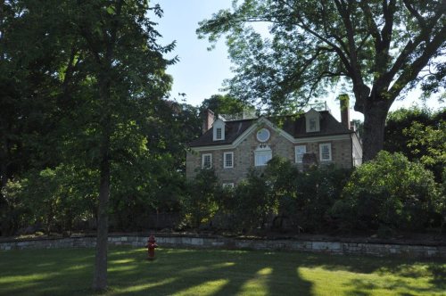
287 years in pictures
Census counts: 2,573 in 1820, 2,680 in 2020. The archive holds 6 old photos and papers going back to 1798 and 2 maps from 1892 on.
7 places on the National Register of Historic Places.
- 1739Sharon is settled
Each edition grades its towns against each other only.

Sharon grades C overall, ranked 125th of 151 in Connecticut, with clear strengths and some subjects that lag. Residents are healthier than 92% of U.S. towns on CDC estimates and it has 65 miles of trail and 36% conserved land. On the other side, the typical home is worth about $591K, 6.3 years of the Torrington area’s $94K median household income. History is its standout character grade: an A+, better than 100% of U.S. towns, with 7 places on the National Register. 37% of the land in Sharon is conserved, above both Connecticut’s towns (14%) and U.S. towns (4.3%). Housatonic State Forest, at 4,165 acres with 25.9 miles of trail, is the biggest park or preserve. On history, just 4 of Connecticut’s 175 towns do better.
Where Sharon beats most towns.
Census counts: 2,573 in 1820, 2,680 in 2020. The archive holds 6 old photos and papers going back to 1798 and 2 maps from 1892 on.
7 places on the National Register of Historic Places.
Each subject compared with towns across the country (schools within Connecticut), ordered by how far Sharon is from typical.
How TownRatings grades towns →
Who provides power, water and the rest in Sharon, and how to reach them.
EPA SDWIS (Oct 9, 2026) · HIFLD + EIA-861 2025 · Census 2020 ZCTAs · NCES 2024–25 · registration: vote.gov, updated Sep 30, 2026.
Ordered by what stands out in Sharon.
Sharon gets more snow than almost anywhere else in Connecticut, is a second-home town and keeps more of its land conserved than most of Connecticut.
Within Connecticut it is healthier than 64% of the 154 graded towns: Connecticut sets a high bar.
27% of Sharon adults feel lonely, where Connecticut’s towns sit at 31% and U.S. towns at 33%. 12% of adults report frequent mental distress in Sharon. Sharon beats the Connecticut average on 16 of 32 CDC measures and trails it on 4.
| Sharon | Connecticut towns | U.S. towns | |
|---|---|---|---|
| Feel lonely (CDC PLACES) | 27% | 31% | 33% |
| Frequent mental distress (CDC PLACES) | 12% | 15% | 17% |
| Sleep under 7 hours (CDC PLACES) | 29% | 34% | 36% |
| Obesity (CDC PLACES) | 26% | 30% | 35% |
| What stands out | Sharon | CT |
|---|---|---|
| Fewer adults facing food insecurity | 6.9% | 14.9% |
| Fewer adults facing housing insecurity | 5.9% | 12.5% |
| More adults who have had cancer | 13.2% | 8.5% |
CDC PLACES 2025 · modeled estimates for adults · CMS · HRSA
Each of its 3 graded neighbors has a higher School Grade than its C+, Salisbury highest at B+.
Its public schools are run by the Sharon School District. Its one school is below.
| School | Level | Students | Letter |
|---|---|---|---|
| Sharon Center SchoolLargest public elementary schoolGrades PK–8 | Grades PK–8 | 97 | B |
NCES · EDFacts · graded within CT on state tests and graduation
Its 13,830 conserved acres are a larger share of the town than in 97% of Connecticut towns.
65 miles of trail in 20 parks and preserves. Sharon’s trail density is 1.1 miles per square mile.
| Biggest places to walk | Trails | Acres |
|---|---|---|
| 1. Housatonic State Forest | 25.9 mi | 4,165 |
| 2. Appalachian Trail Scenic Open Space | 5.7 mi | 787 |
| 3. Sharon Audubon Center | 4.1 mi | 1,024 |
Trails & parks © OpenStreetMap contributors · Conserved land: USGS PAD-US
The Norfolk 2 Sw weather station, 14 miles away, records that 75 inches of snow fall in a normal winter, the highest of 353 Connecticut places with climate records. The Norfolk 2 Sw weather station, 14 miles away, records that about 1 days a year reach 90°, fewer than in 97% of U.S. towns.
The July high in Sharon is 81°F. Sharon has cold, snowy winters and pleasant summers, with plenty of rain.
NOAA U.S. Climate Normals, 1991–2020
Most working residents leave Sharon for work: only 18% work in town. Jobs based in Sharon grew to 1,085 in 2023, 125 more than in 2013. 11% of Sharon residents live below the poverty line.
| Sharon | Connecticut towns | U.S. towns | |
|---|---|---|---|
| Working residents who work in town | 18% | 11% | 8% |
| Average trip to work | 30 minutes | 27 minutes | 25 minutes |
| Below the poverty line | 11% | 5.8% | 9.6% |
| Median household income | $101,000 | $109,000 | $80,000 |
Census LEHD 2023 · ACS
Expected storm and flood damage is higher than in 58% of U.S. communities. Since 1982, 5 flood insurance claims have been paid out in Sharon.
FEMA flood insurance claims · FEMA National Risk Index · OpenFEMA
At 6.3 years of the Torrington area’s $94K median household income, the typical home costs more against local pay than in 83% of Connecticut towns; that ratio is one input to its D for cost of living.
Zillow Home Value Index · Redfin Data Center
Museums, parks, gardens and other places to visit around Sharon. Close and well known come first.
24 mi National Historic SiteHome of Franklin D. Roosevelt National Historic Site102K visitors a year
25 mi LakeCandlewood Lake
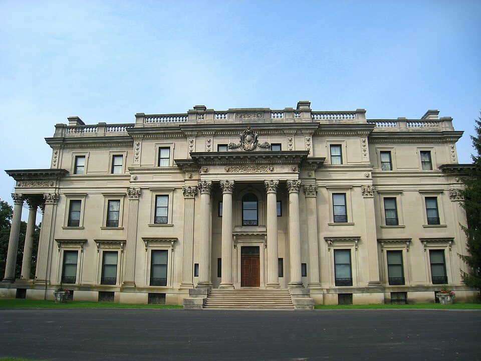
26 mi National Historic SiteVanderbilt Mansion National Historic Site295K visitors a year
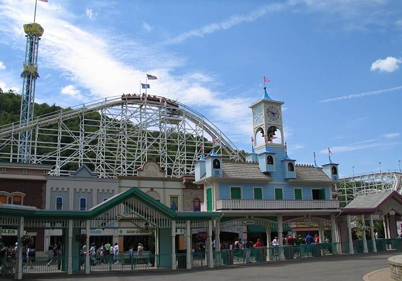
31 mi Theme parkLake Compounce
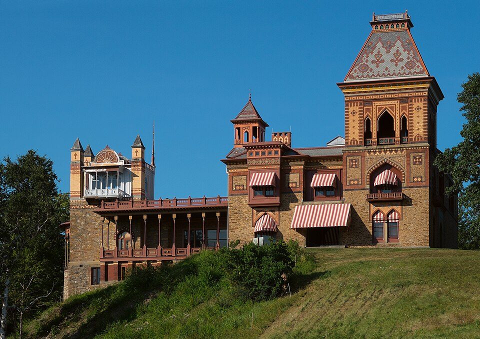
32 mi MuseumOlana State Historic Site
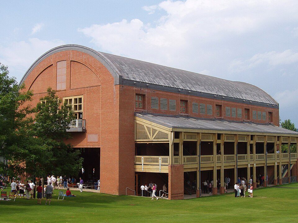
35 mi TheatreTanglewoodHome of Franklin D. Roosevelt National Historic Site: Crunch, CC BY-SA 4.0 · Candlewood Lake: Carol M. Highsmith, Public domain · Vanderbilt Mansion National Historic Site: Daderot, Public domain · Lake Compounce: Wildcat1 at English Wikipedia, Public domain · Olana State Historic Site: Netniks, CC BY-SA 4.0 · Tanglewood: Daderot., CC BY-SA 3.0
None within 15 miles of Sharon; the nearest are
About 4 of every 100 Sharon residents are enrolled in college, against 7 across Connecticut.
7 places in Sharon on the National Register of Historic Places.
14 notable people were born in Sharon.


Town in Connecticut, United States
Sharon is a town in Litchfield County, Connecticut, United States, in the northwest corner of the state. At the time of the 2020 census, the town had a total population of 2,680. The town is part of the Northwest Hills Planning Region. The ZIP Code for Sharon is 06069. The urban center of the town is the Sharon census-designated place, with a population of 729 at the 2010 census.
From Wikipedia, licensed CC BY-SA 4.0 · facts via Wikidata (CC0)
7 towns share a border with Sharon.
| Town | CT rank | Overall | Cost | Safety | Schools | Health |
|---|---|---|---|---|---|---|
| Sharon | #125 | C | D | — | C+ | A |
| Cornwall | — | — | C | — | B | A− |
| West Cornwall | — | — | — | — | — | — |
| Cornwall Bridge | — | — | — | — | — | — |
| Salisbury | #77 | B | D | — | B+ | A |
| Kent | #23 | A | B | — | B+ | A |
Cornwall has fewer than 2,500 residents, so it gets subject grades but no overall grade. Sharon, Cornwall, Salisbury and Kent report no FBI crime data of their own. West Cornwall and Cornwall Bridge aren’t graded (fewer than 1,000 residents, or not enough data). Compare Sharon with a neighbor →
Short answers, built from the data on this page.
Sharon grades C overall, better than 32% of U.S. towns and #125 of 151 in Connecticut. It grades A for health and C+ for schools. Cost of living is its weak spot, with a D.
Yes. The typical home is worth about $591,000, 32% above the Connecticut typical home. Cost of living, which also weighs rents, property taxes and how many households pay 30% or more of their income for housing, grades D.
14 notable people were born here, including Roswell Rudd and Thomas Kiefer.