Seymour dates to 1850, and 12% of its homes were built before 1940
More historic than 48% of U.S. towns · #152 of 155 in Connecticut. What drives it
3 places in town are on the National Register, among them a historic district with 42 buildings. Below: 10 old photos and papers, maps from 1889 on, and the census since 1850.
Founding year: Wikidata; Wikipedia’s history section gives the same year. First post office: 1812.The full story ↓
History grade
What drives Seymour’s History grade
On its age, its old homes and the National Register, Seymour is more historic than 48% of U.S. towns, #152 of 155 in Connecticut. Its National Register listings hold the grade up; its age pulls it down.
B−
HistoryA character grade: shown, never part of Seymour’s overall grade.
Connecticut towns list more on the Register than most of the country (a typical Connecticut town has 73.3 per 10,000 residents, the U.S. 2.4), so Seymour’s 26.1 sits below most of its state (27% of Connecticut towns have fewer) while its 44 historic buildings outnumber those of 84% of U.S. towns.
How sure. Graded on any two of the three inputs instead, the letter would range from C+ to B. The pre-1940 share is a Census survey estimate (±3.1 points). Two sources give 1850.
Founding year: Wikidata (other dates in Quick answers). Homes: Census ACS 2020–24. National Register: National Park Service, May 2026 list; each listing counted once (boundary changes and added documentation belong to their listing), and a historic district counts its contributing buildings. How TownRatings grades history →
What stands out about Seymour’s past
Read from the archive, the National Register and the record. The page puts what stands out first.
In the late 17th century, the site of present-day Seymour was known as Wesquantuck, a Native American settlement. Then Paugusset and Schaghticoke people created a settlement called Chusetown, named for Chief Joseph Mauwehu (Pequot), nicknamed Chuse.
The area that now encompasses the lands of the town was originally part of the town of Derby, which in turn was a part of Milford. The downtown portion of what is now Seymour was eventually called Humphreysville, named after an American Revolutionary War veteran David Humphreys, aide-de-camp to General George Washington. Humphreys had purchased a factory in what is the downtown portion of the town, which produced scythes and other tools as well as wool products from the sheep he had imported.
Passages that mention Seymour, cut from the printed page as they were published.
History of Seymour, Connecticut, with biographies and genealogies1879 · page 88Read the page →
Read the text
Wednesday of May, A. D., 1832, the said Humphreysville and Salem Turnpike Company was by a resolve of the general assembly, duly incorporated by the name of the "Humphreysville Turnpike Company," with power to cons'. ruct a turnp'ke road from the Palls bridge, so called, then in the tonn of Derby, but now the town of Seymour, to Salem bridge, in the then town of Waterbury. now Naugatuck, and that said turnpike road was afterwards during the said year last mentioned laid out and con.structed by said company, and has ever since been kept open for public travel by
Text read by machine from the scan; it may contain errors.
History of Seymour, Connecticut, with biographies and genealogies1879 · page 81Read the page →
Read the text
Resolved further, That the tirst meeting of said town of Seymour shall be held on the fourth ]\Ionday of June, 1850, at the basement of the Methodist Episcopal Church at Humphreys Ville, in said town of Seymour ; and Lenian Chatfield, Esquire, (and in case of his failure to attend the same, Harris B. Munson, Esquire,) shall be moderator of said meeting; and said meeting shall be warned by setting up a notification of the same on a sigu post hereby established at the east end of the bridge over Naugatuck Iviver, at said Humphreys Ville, and at such other place or places as said persons
Text read by machine from the scan; it may contain errors.
Scans and text from the Internet Archive. Books published in 1930 or earlier, which are in the public domain.
Timeline
Seymour, 1790 to 1913
Woven from the archive, old maps, post office records, the National Register and the people born here.
Nothing in the archives for these yearsWeddings on Main Street, storms, parades, school pictures, the old store. If it’s in your family album, it belongs here.
In 1850, according to Wikidata and Wikipedia’s history of the town. Seymour’s post office opened in 1812, and the census of 1850 counted 1,677 people here.
How does Seymour rank for history?
Seymour is more historic than 48% of U.S. towns, #152 of 155 in Connecticut. The History grade combines the town’s founding era, the share of homes built before 1940 and its National Register listings. It’s a character grade, so it isn’t part of the overall grade. How it works.
What is on the National Register in Seymour?
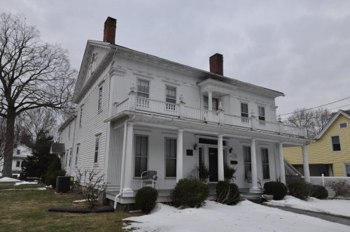
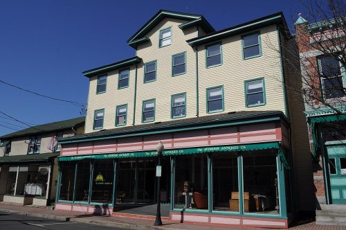
Three places: the Sanford-Humphreys House (listed 1982), the Downtown Seymour Historic District (1983) and the Seymour High School and Annex (1983).
How old are the homes in Seymour?
12% of Seymour’s homes were built before 1940 (Census estimate, ±3.1 points), against a typical 15% for a Connecticut town; the median home was built in 1973.
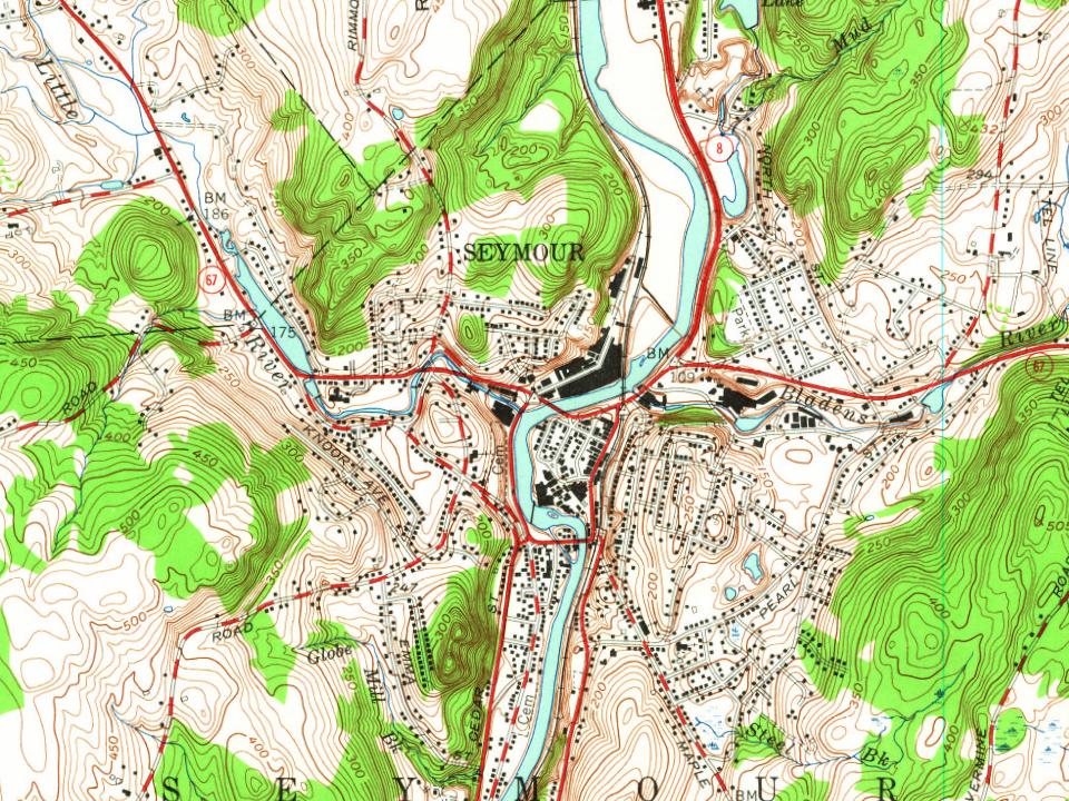
Founding dates: Wikidata, Wikipedia, the U.S. post office records of Blevins & Helbock (CC0) and the Census. Homes by year built: Census ACS 2020–24. National Register of Historic Places: National Park Service (list of May 22, 2026). Old photos, postcards and papers: Wikimedia Commons, the Library of Congress and other public archives, credited on each item’s page. Maps: U.S. Geological Survey historical topographic maps (via Esri) and Sanborn fire-insurance maps (Library of Congress). History text and census tables: Wikipedia (CC BY-SA 4.0). Places that used to be: USGS Geographic Names Information System (2021).
From Wikimedia Commons (13), the Library of Congress (3), Wikidata (2), the National Register of Historic Places (3), Wikipedia, Wikidata and Wikipedia for famous people, U.S. Geological Survey historical maps, U.S. Census counts (via Wikipedia), the US Post Offices dataset (Blevins & Helbock), the USGS Geographic Names Information System and old county and town histories (Internet Archive). Archive images are copied here with their credits and licenses, shown on each photo’s page. Refreshed monthly.






![Resolved further, That the tirst meeting of said town of Seymour shall be held on the fourth ]\Ionday of June, 1850, at the basement of the Methodist Episcopal Church at Humphreys Ville, in said town of Seymour ; and Lenian Chatfield, Esquire, (and in case of his failure to attend the same, Harris …](https://images.townratings.com/story/19561/bk-1124dbc3c6ef5d75-l.jpg)


 1879
 1896
 1906
 1907–1915
 1909
 1913
 2012
 2010
 2008
 2008
 2007
 2006