Guest, Sign inJoin

Post to Norwich

We’ll email a one-tap link to publish your post. No password, and nothing is public until you click it.
Already a member? Sign in
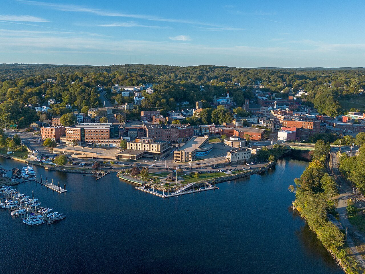
Norwich, Connecticut 2Photo: Hayden Soloviev · CC BY 4.0
BOutdoors
Outdoors in Norwich

14% of Norwich’s land is conserved: 2,465 acres

The biggest trail networks: Mohegan Park (3.9 mi), Taftville Watershed Reserve Land (1.6 mi), Bog Meadow Watershed Reserve Land (1.3 mi). 18 miles of mapped trail cross Norwich, 0.7 per square mile of land. 178 acres are parks and preserves, 4.5 per 1,000 residents.

Ahead of 65% of U.S. towns · #137 of 155 in Connecticut. What drives it

Conserved land
14%
2,465 acres · of 28.1 sq mi of land
Trails
18 mi
0.7 per sq mi of land
Park land
178 ac
4.5 acres per 1,000 residents
Near a park
72%
of residents within ½ mile
Bike routes
0.7 mi
0.7 mi paths
Highest peak
502 ft
Wawecus Hill
Lakes & rivers
23
1 beach · 2 boat launches

What kind of outdoors town is Norwich?

Read from the map. The page puts what stands out first.

Outdoors grade

How much outdoors does Norwich have?

On conserved land, trails, park land and how close residents live to a park, Norwich is ahead of 65% of U.S. towns, #137 of 155 in Connecticut. Conserved land holds the grade up; park acres per resident pull it down.

B
OutdoorsA character grade: shown, never part of Norwich’s overall grade.
All U.S. towns we grade (21,298)Ahead of 65%
LessMore
Connecticut towns of 2,500+ (155)Ahead of 12%

Connecticut towns conserve more land than most (a typical one, 15%; the U.S., 4%), so Norwich’s 14% is ahead of 45% of Connecticut towns, while its trails per square mile lead 13% of them.

How sure. Graded on any three of the four inputs instead, the letter would range from B− to A−. Trails and many small parks come from OpenStreetMap, mapped by volunteers, so coverage varies from town to town; the half mile is a straight line from each census block, so a river or highway in the way isn’t counted against it.

PAD-US, OpenStreetMap (© OpenStreetMap contributors), Census 2025 Gazetteer and 2020 blocks; details in Sources below. How TownRatings grades the outdoors →

The map

Conserved land, trails & bike routes

Tap a number to zoom to a park. Tap a layer to hide it.

1234567
Easements protect land from building but are usually private.© OpenStreetMap contributors · USGS PAD-US
Places to walk

Pick a walk

The longest trail network is Mohegan Park, with 3.9 miles. Directions go to the nearest trailhead or public parking.

Mohegan Park

Managed by City of Norwich
475 acres3.9 mi of trail
Dog rules not recorded
Directionsto the parking lotWebsite ↗

Taftville Watershed Reserve Land

Managed by City of Norwich
220 acres1.6 mi of trail
Dog rules not recorded
Directionsto the parking lot

Bog Meadow Watershed Reserve Land

Managed by City of Norwich
356 acres1.3 mi of trail
Dog rules not recorded
No trailhead mapped yet

Fairview Watershed Reserve Land

Managed by City of Norwich
265 acres1.3 mi of trail
Dog rules not recorded
No trailhead mapped yet

Lowthorpe Meadow Natural Area

Managed by Lowthorpe Association Inc.
20 acres0.6 mi of trail
Dog rules not recorded
No trailhead mapped yet

Rogers Road Open Space

Managed by City of Norwich
130 acres0.5 mi of trail
Dog rules not recorded
No trailhead mapped yet

Estelle Cohn Memorial Dog Park

Managed by City of Norwich
5 acres0.3 mi of trail
Dog rules not recorded
Directionsto the parking lot
All 66 parks & preserves
Mohegan Park475 acres · 3.9 mi of trail · City of Norwich
Directions
Taftville Watershed Reserve Land220 acres · 1.6 mi of trail · City of Norwich
Directions
Bog Meadow Watershed Reserve Land356 acres · 1.3 mi of trail · City of Norwich
Fairview Watershed Reserve Land265 acres · 1.3 mi of trail · City of Norwich
Lowthorpe Meadow Natural Area20 acres · 0.6 mi of trail · Lowthorpe Association Inc.
Rogers Road Open Space130 acres · 0.5 mi of trail · City of Norwich
Estelle Cohn Memorial Dog Park5 acres · 0.3 mi of trail · City of Norwich
Directions
The Marina at American Wharf5 acres · 0.2 mi of trail · City of Norwich
Directions
Crandall Property14 acres · 0.1 mi of trail · City of Norwich
Jennings Field11 acres · 0.1 mi of trail · City of Norwich
R. "Red" McKeon Occum Park5 acres · 0.1 mi of trail · City of Norwich
Sachem Street Open Space2 acres · 0.1 mi of trail · City of Norwich
Directions
Elizabeth Street Park1 acres · 0.1 mi of trail · City of Norwich
Cedar Woods Preserve46 acres · Avalonia Land Conservancy
Hunters Road Open Space27 acres · City of Norwich
Raymond “Cit” Ouellet Park20 acres · City of Norwich
Lawler Lane Open Space19 acres · City of Norwich
Laurel Hill Road Open Space13 acres · State of Connecticut
F. W. Brown Tract10 acres · City of Norwich
Norwich Little League10 acres
Directions
Lucas Park9 acres · City of Norwich
Hamilton Avenue Park8 acres · City of Norwich
Laurel Circle Drive Open Space6 acres · City of Norwich
Howie Dickenman Field5 acres · City of Norwich
Canterbury Turnpike Open Space5 acres · City of Norwich
Washington Street Park5 acres · City of Norwich
Directions
Firemen's Field4 acres · Yantic Fire Engine Co.
Jenkins Field4 acres
Directions
Cranberry Pond Road Open Space4 acres · City of Norwich
Stephen S. Armstrong Tenis Courts4 acres · City of Norwich
Heritage Trail Corridor4 acres · State of Connecticut
Directions
Great Plain Road Open Space3 acres · City of Norwich
Orchard Street Open Space3 acres · City of Norwich
Luis DePina Recreation Fields3 acres · City of Norwich
Upper Dam Heritage Park3 acres · City of Norwich
Directions
Royal Mohegan Burial Ground3 acres
Directions
Howard T. Brown Memorial Park3 acres · City of Norwich
Directions
Hammond Avenue Open Space3 acres · City of Norwich
Taftville Playground3 acres · City of Norwich
Directions
North Main Street Open Space3 acres · City of Norwich
Directions
Fernwood Playground3 acres · City of Norwich
Occum Playground3 acres · City of Norwich
Norwich Avenue Open Space3 acres · City of Norwich
Directions
Franklin Park2 acres · City of Norwich
Directions
Uncas Leap Heritage Park2 acres · City of Norwich
Directions
Stoney Ridge Road Open Space2 acres · City of Norwich
Thamesville Playground2 acres · Thamesville Recreation Association;City of Norwich
Sturtevant Street Open Space2 acres · City of Norwich
Seventh Street Open Space2 acres · City of Norwich
Talman Street Open Space2 acres · City of Norwich
Directions
Brook Street Park1 acres · City of Norwich
White Plains Road Open Space1 acres · City of Norwich
Robert W. Spayne Basketball Courts1 acres · City of Norwich
Kent Street Open Space1 acres · City of Norwich
Directions
Stewart Drive Open Space1 acres · City of Norwich
Columbus Park1 acres · City of Norwich
Directions
Schiller Street Open Space1 acres · City of Norwich
Julian Terrace Open Space1 acres · City of Norwich
Directions
Palmer Street Open Space1 acres · City of Norwich
Greeneville Playground1 acres · City of Norwich
Cherry Hill Road Open Space1 acres · City of Norwich
Julian Street Open Space1 acres · City of Norwich
Trading Cove Association1 acres · Trading Cove Association Inc.
Krodel Road Open Space1 acres · City of Norwich
Monsignor Joseph V. King Memorial Park1 acres · Roman Catholic Archdiocese of Norwich
Balawender Drive Open Space1 acres · City of Norwich
Who protects it

2,465 conserved acres

14% of Norwich’s land. Who manages Norwich’s conserved land, from the USGS Protected Areas Database. Approximate, because parcels can overlap.

Town or city909 ac
Private owners402 ac
Land trusts & nonprofits379 ac
USDA easements (NRCS)160 ac
Other or Unknown Local Government142 ac
Other state land126 ac
State conservation41 ac
Local Other or Unknown · 1,677 acConservation Easement · 389 acForest Stewardship Easement · 379 acLocal Park · 369 acAgricultural Easement · 301 ac
Good to know

Conserved doesn’t always mean open to visitors. 485 acres are conservation easements, usually private land. Public access isn’t recorded for 48 of 70 parcels. The walks above are places people visit.

The biggest protected parcels
Parcel (PAD-US)Managed byAcresPublic access
Unknown
Local Other or Unknown
Not recorded1,904Unknown
Mohegan Park
Local Park
Town or city338Open
Crandall Property & Crouch Pond
Local Other or Unknown
Not recorded14Unknown
The Solomon Lucas Memorial Woods
Local Other or Unknown
Not recorded11Unknown
Hamilton Avenue Playground
Local Park
Town or city5Open
Mechanic St Park
Local Park
Town or city5Open
Upper Falls Park
Local Park
Town or city3Open
Franklin Park
Local Park
Town or city3Open
Fitzgerald Field
Local Recreation Area
Town or city3Open
Washington Street Park
Local Park
Town or city3Open

5 smaller protected places aren’t shown.

Things to do

47 places to go in Norwich

Beaches, playgrounds, peaks, falls and more. Pick a kind.

Peaks in Norwich
Wawecus Hill502 ft elevation
Directions
Ox Hill390 ft elevation
Directions
Jail Hill213 ft elevation
Directions
Laurel Hill210 ft elevation
Directions
Mount Pleasant154 ft elevation
Directions
Fox Hill138 ft elevation
Directions
Crown Hill125 ft elevation
Directions
Long Rock16 ft elevation
Directions
Trails & water

23 lakes & rivers

Biking & sports

0.7 miles of bike routes

Bike lanes are often missing from the map in smaller towns, so that number is likely low.

0.7 mi
off-road bike paths
Courts & fields
17Basketball
15Tennis
6Soccer
5Baseball
3Football
2Softball
1Skate park

Includes school and college facilities, which aren’t always open to the public.

History along the way

34 places on the National Register

The country’s official list of places worth saving (National Park Service). The map also marks 18 historic points from OpenStreetMap: plaques, memorials and old buildings.

History →
Bradford-Huntington HouseBuilding · listed 1970
About it
Carpenter, Joseph, Silversmith ShopBuilding · listed 1970
About it
Converse House and BarnBuilding · listed 1970
About it
Gen. Jedidiah Huntington HouseBuilding · listed 1970
About it
Gov. Samuel Huntington HouseBuilding · listed 1970
About it
Nathaniel Backus HouseBuilding · listed 1970
About it
Carpenter HouseBuilding · listed 1970
About it
Capt. Richard Charlton HouseBuilding · listed 1970
About it
Dr. Philip Turner HouseBuilding · listed 1970
About it
Little Plain Historic DistrictDistrict · listed 1970
About it
East District SchoolBuilding · listed 1970
About it
Dr. Joshua Lathrop HouseBuilding · listed 1970
About it

22 more on the History page.

When to get out

The best walking months in Norwich: May to September

NOAA’s 1991–2020 normals for the town and the daylight at its latitude. Outlined months have long days, highs of 59 to 86 °F and little rain for the place.

JanFebMarAprMayJunJulAugSepOctNovDec
Daylight (h)9.510.511.813.314.515.214.913.812.411.09.89.2
High (°F)374047596978838174635242
Rain (in)3.73.04.44.23.64.13.53.94.24.73.94.5

February is the driest month (3.0 in) and July the warmest (highs of 83 °F). 4.7 inches fall in October, the wettest month. The climate in Norwich →

Next door

Norwich and its neighbors

Tap a town to see its outdoors.

TownConserved
of land
Trail mi
per sq mi
Park acres
per 1,000
Near a park
½ mile
Outdoors
Norwich14%0.7472%B
Montville12%0.52427%B+
Bozrah12%0.35934%B+
Preston8%0.8832%B−
Lisbon3%0.31417%C+
Sprague14%0.915157%A
Franklin26%1.03527%A−
Baltic— not graded: under 1,000 residents or part of its town

The four inputs of the Outdoors grade, from the engine; shares are of land, not water.

Questions about parks and trails in Norwich

Where can I hike in Norwich?

The longest trail networks: Mohegan Park, 3.9 miles; Taftville Watershed Reserve Land, 1.6 miles; Bog Meadow Watershed Reserve Land, 1.3 miles; Fairview Watershed Reserve Land, 1.3 miles. Each one is on the map above, with directions to the nearest trailhead or parking.

How much of Norwich is conserved land?

14% of its land, against a typical 15% for a Connecticut town and 4% nationally (PAD-US). Conserved doesn’t always mean open to visitors: easements are usually private land.

Are dogs allowed on Norwich’s trails?

Mohegan Park and Taftville Watershed Reserve Land don’t have dog rules recorded on the map; check the signs at the trailhead.

Where can I bike in Norwich?

0.7 miles of bike routes are on the map: 0.7 of off-road paths.

Is there public land near Norwich?

7,400 acres of parks and open public land lie inside Norwich or within 10 miles of it (PAD-US), 178 of them inside the city line.

How much outdoors does Norwich have?

Ahead of 65% of U.S. towns on the Outdoors grade, #137 of 155 in Connecticut. The grade combines the share of land that is conserved, miles of mapped trail per square mile of land, park acres per 1,000 residents and the share of residents within a half mile of a park. It’s a character grade, so it isn’t part of the overall grade. How it works.

Trail talk

Conditions, parking and favorite walks from Norwich neighbors.

Town Square →
Share a tip
Sources

Where this page comes from

Conserved and public land: USGS Protected Areas Database of the United States (PAD-US), service updated July 2026. Parks, trails, playgrounds, beaches and other places: OpenStreetMap (© OpenStreetMap contributors, ODbL), map data as of 2026-10-28. Land and water area: Census 2025 Gazetteer. Residents near a park: 2020 Census blocks. National Register: National Park Service. How TownRatings grades the outdoors →