Founding year: the first Jewett City post office (Blevins & Helbock, CC0).
History grade
What drives Jewett City’s History grade
On its age, its old homes and the National Register, Jewett City is more historic than 80% of U.S. towns, #92 of 155 in Connecticut. Its share of homes from before 1940 holds the grade up; its National Register listings pull it down.
A−
HistoryA character grade: shown, never part of Jewett City’s overall grade.
Connecticut towns list more on the Register than most of the country (a typical Connecticut town has 73.3 per 10,000 residents, the U.S. 2.4), so Jewett City’s 8.7 sits below most of its state (10% of Connecticut towns have fewer) while its 3 historic buildings outnumber those of 65% of U.S. towns.
How sure. Graded on any two of the three inputs instead, the letter would range from B to A. The pre-1940 share is a Census survey estimate (±14.6 points). The founding year is the first post office, not a stated founding date.
Founding year: the first post office (other dates in Quick answers). Homes: Census ACS 2020–24. National Register: National Park Service, May 2026 list; each listing counted once (boundary changes and added documentation belong to their listing), and a historic district counts its contributing buildings. How TownRatings grades history →
What stands out about Jewett City’s past
Read from the archive, the National Register and the record. The page puts what stands out first.
Wikipedia doesn’t have a history of Jewett City yet. The photos, dates and memories neighbors add here are how it gets written.
Jewett City is a borough in New London County, Connecticut, United States, in the town of Griswold. The borough is part of the Southeastern Connecticut Planning Region. The population was 3,328 at the 2020 census, down from 3,487 in 2010. The borough was named for Eliezer Jewett, who founded a settlement there in 1771.
Its first post office opened in 1804. Between the 2010 and 2020 censuses its population fell from 3,487 to 3,328 (-5%).
Intro from Wikipedia. Population: U.S. Census Bureau.
From the old history books
What they wrote about Jewett City, 1882–1922
Passages that mention Jewett City, cut from the printed page as they were published.
History of New London county, Connecticut, with biographical sketches of many of its pioneers and prominent men1882 · page 404Read the page →
Read the text
The first settlement in this town was made at Jewett City in 1771 by Eleazer Jewett, from whom the village of Jewett City derived its name. He was a persevering man, of a genial and kindly temperament, happy in doing good, and opening paths of enterprise for the benefit of others without laboring to enrich himself. Beginning with only a small farm and a mill-seat on the Pachaug River, he lived to see
Text read by machine from the scan; it may contain errors.
History of New London county, Connecticut, with biographical sketches of many of its pioneers and prominent men1882 · page 407Read the page →
Read the text
ordained and installed Feb. 14, 1810, and dismissed Sept. 2, 1828. Near the close of his ministry the Second Congregational Church was organized at Jewett City. Twenty members were dismissed from the First Church to form the Second. Thus what was originally one "became two bands."
Text read by machine from the scan; it may contain errors.
A modern history of New London County, Connecticut1922Read the page →
Read the text
In the year 1S83 Mr. Anthony came to Jewett City and entered the Jewett City Savings Bank as a clerk, subsequently advancing through the offices of the bank until upon the death of James O. Sweet, president, in 1913, he was elected his successor. As executive head of the Jewett City Savings Bank, Mr.
Text read by machine from the scan; it may contain errors.
A modern history of New London County, Connecticut1922 · page 137Read the page →
Read the text
Returning to Norwich, Mr. Worth bought an interest in the Jewett City Textile Novelty Company, of Jewett City, accepting the offices of vicepresident and secretary of this concern, and on January i, 1921, became president, also serving as sales manager. This association still continues. The company is engaged in the printing and bleaching of cotton textile goods, largely in novelty fabrics and
Text read by machine from the scan; it may contain errors.
Scans and text from the Internet Archive. Books published in 1930 or earlier, which are in the public domain.
By decade
Jewett City, decade by decade
4 decades in the archive, from the 1880s to the 1970s. Scroll each row; tap a photo for its story.
Nothing in the archives for these yearsWeddings on Main Street, storms, parades, school pictures, the old store. If it’s in your family album, it belongs here.
Nothing in the archives for these yearsWeddings on Main Street, storms, parades, school pictures, the old store. If it’s in your family album, it belongs here.
Fire insurance maps drew every building, what it was made of and what it was used for, so insurers could price the risk of fire. Pick a year, then a sheet.
The Jewett City post office opened in 1804, the earliest record of the town by name (U.S. post office records).
How does Jewett City rank for history?
Jewett City is more historic than 80% of U.S. towns, #92 of 155 in Connecticut. The History grade combines the town’s founding era, the share of homes built before 1940 and its National Register listings. It’s a character grade, so it isn’t part of the overall grade. How it works.
How old are the homes in Jewett City?
37% of Jewett City’s homes were built before 1940 (Census estimate, ±14.6 points), against a typical 15% for a Connecticut town; the median home was built in 1961.
Founding dates: Wikidata, Wikipedia, the U.S. post office records of Blevins & Helbock (CC0) and the Census. Homes by year built: Census ACS 2020–24. National Register of Historic Places: National Park Service (list of May 22, 2026). Old photos, postcards and papers: Wikimedia Commons, the Library of Congress and other public archives, credited on each item’s page. Maps: U.S. Geological Survey historical topographic maps (via Esri) and Sanborn fire-insurance maps (Library of Congress). History text and census tables: Wikipedia (CC BY-SA 4.0). Places that used to be: USGS Geographic Names Information System (2021).
From Wikimedia Commons (18), U.S. Geological Survey historical maps, U.S. Census counts (via Wikipedia), Sanborn fire insurance maps (Library of Congress) and old county and town histories (Internet Archive). Archive images are copied here with their credits and licenses, shown on each photo’s page. Refreshed monthly.
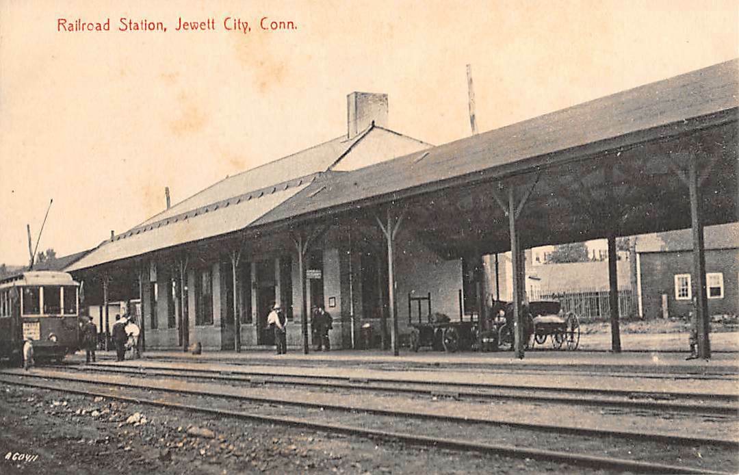


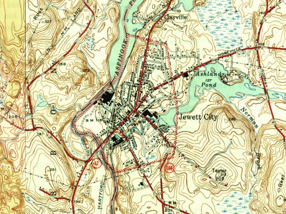


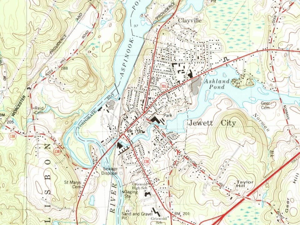




 1889
 1889
 c. 1907
 1908
 c. 1908
 1909
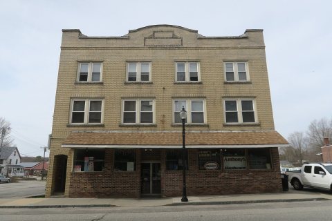 2019
 2018
 2018
 2014
 2012
 2011
 2008
 2005
