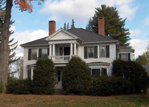
Granby dates to 1723, and 8 of its places are on the National Register
More historic than 85% of U.S. towns · #76 of 155 in Connecticut. What drives it
Most of Granby was built recently: 10% of its homes predate 1940 and the median home dates from 1978. 8 places in town are on the National Register, among them two historic districts with 110 buildings between them. Below: 4 old photos and papers, maps from 1892 on, and the census since 1820.
Founding year: Wikipedia. First post office: 1805.The full story ↓
History grade
What drives Granby’s History grade
On its age, its old homes and the National Register, Granby is more historic than 85% of U.S. towns, #76 of 155 in Connecticut. Its age holds the grade up; its share of homes from before 1940 pulls it down.
A−
HistoryA character grade: shown, never part of Granby’s overall grade.
Connecticut towns list more on the Register than most of the country (a typical Connecticut town has 73.3 per 10,000 residents, the U.S. 2.4), so Granby’s 104 sits near the middle of its state (58% of Connecticut towns have fewer) while its 116 historic buildings outnumber those of 90% of U.S. towns.
NoteThe founding year comes from Wikipedia alone; no second source gives 1723.
How sure. Graded on any two of the three inputs instead, the letter would range from B+ to A. The pre-1940 share is a Census survey estimate (±3.1 points).
Founding year: Wikipedia (other dates in Quick answers). Homes: Census ACS 2020–24. National Register: National Park Service, May 2026 list; each listing counted once (boundary changes and added documentation belong to their listing), and a historic district counts its contributing buildings. How TownRatings grades history →
What stands out about Granby’s past
Read from the archive, the National Register and the record. The page puts what stands out first.
Granby was founded by people who lived in Simsbury and settled as early as 1723. Granby was part of Simsbury until 1786, when it became independent. The name is from Granby, Massachusetts in return, where it was named in honor of John Manners, Marquess of Granby.
Part of Southwick, Massachusetts, known as "the Notch" seceded from Massachusetts in 1774, just before the outbreak of the American Revolutionary War. This territory became part of Granby when it seceded from Simsbury, but was returned to Southwick as part of an 1803–1804 border dispute compromise. (See History of Massachusetts.)
Passages that mention Granby, cut from the printed page as they were published.
A history of Newgate of Connecticut, at Simsbury, now East Granby1860 · page 15Read the page →
Read the text
factured a currency. We have seen it stated that Mr. Higley, the author of these coppers, was an ingenious blacksmith who resided in the town of Granby ; hence the name Granby Coppers; and that with all the notions of utility which he naturally derived from the anvil, he was ambitious of making a little reputation for himself besides. He has certainly left evidence of having been an artist as
Text read by machine from the scan; it may contain errors.
A history of Newgate of Connecticut, at Simsbury, now East Granby1860 · page 15Read the page →
Read the text
factured a currency. We have seen it stated that Mr. Higley, the author of these coppers, was an ingenious blacksmith who resided in the town of Granby ; hence the name Granby Coppers ; and that with all the notions of utility which he naturally derived from the anvil, he was ambitious of making a little reputation for himself besides. He has certainly left evidence of having been an artist as
Text read by machine from the scan; it may contain errors.
History of Simsbury, Granby, and Canton1845 · page 103Read the page →
Read the text
Granby was set off from the north part of Simsbury, and incorporated in 1786. Its extent is about six by nine and a half miles. The soil is of various kinds. The best lands lie in the eastern section of the town and in the valley of Salmon brook. In general, the lands are adapted to the purposes of agriculture, in which business the inhabitants are chiefly engaged. The New Haven and Northampton Canal, which passes through the center of the town, facil-
Text read by machine from the scan; it may contain errors.
History of Simsbury, Granby, and Canton1845 · page 100Read the page →
Read the text
The town was divided into two nearly equal parts when Granby was incorporated in 1786 — the latter town taking the north division. Canton was set off from the west side of Simsbury in 1806 ; and in 1843, the eastern part, from the top of the mountain, was annexed to Bloomfield. The present dimensions of the town are about four by seven miles. Thus has ihis ancient town been curtailed on three sides, and reduced from one of the largest, to one of the
Text read by machine from the scan; it may contain errors.
Scans and text from the Internet Archive. Books published in 1930 or earlier, which are in the public domain.
Timeline
Granby, 1723 to 2010
Woven from the archive, old maps, post office records, the National Register and the people born here.
Nothing in the archives for these yearsWeddings on Main Street, storms, parades, school pictures, the old store. If it’s in your family album, it belongs here.
In 1723, according to Wikipedia’s history of the town. Granby’s post office opened in 1805, and the census of 1820 counted 3,012 people here.
How does Granby rank for history?
Granby is more historic than 85% of U.S. towns, #76 of 155 in Connecticut. The History grade combines the town’s founding era, the share of homes built before 1940 and its National Register listings. It’s a character grade, so it isn’t part of the overall grade. How it works.
What is on the National Register in Granby?
8 listings: 6 buildings, among them the Rowe and Weed Houses (listed 1978, the first), and 2 historic districts, the Granby Center Historic District and the West Granby Historic District, with 110 contributing buildings. 116 historic buildings in all.
How old are the homes in Granby?
10% of Granby’s homes were built before 1940 (Census estimate, ±3.1 points), against a typical 15% for a Connecticut town; the median home was built in 1978.
Founding dates: Wikidata, Wikipedia, the U.S. post office records of Blevins & Helbock (CC0) and the Census. Homes by year built: Census ACS 2020–24. National Register of Historic Places: National Park Service (list of May 22, 2026). Old photos, postcards and papers: Wikimedia Commons, the Library of Congress and other public archives, credited on each item’s page. Maps: U.S. Geological Survey historical topographic maps (via Esri) and Sanborn fire-insurance maps (Library of Congress). History text and census tables: Wikipedia (CC BY-SA 4.0). Places that used to be: USGS Geographic Names Information System (2021).
From Wikimedia Commons (16), the Library of Congress (1), Wikidata (1), the National Register of Historic Places (8), Wikipedia, Wikidata and Wikipedia for famous people, U.S. Geological Survey historical maps, U.S. Census counts (via Wikipedia), the US Post Offices dataset (Blevins & Helbock), the USGS Geographic Names Information System and old county and town histories (Internet Archive). Archive images are copied here with their credits and licenses, shown on each photo’s page. Refreshed monthly.


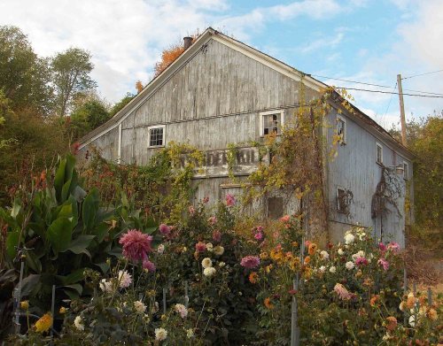


 1869
 2010
 2010
 2010
 2010
 2010
 2010
 2010
 2010
 2010
 2010
 2010
 2010
 2006